Skip to main content
Home
World History Maps
Historical Maps of USA
Historical Maps of Canada
Old School History Maps
Maps +
More Historical Maps of Canada
World
Ancient Greece
Roman Empire
Holy Roman Empire
Europe
Albania
Austria
British Isles
Bulgaria
Croatia
France
Germany
Greece
Hungary
Italy
Netherlands
Poland
Romania
Scandinavia
Serbia
Spain & Portugal
Switzerland
Turkiye
Ukraine
Russia
Caucasus
Middle East & Northern Africa
Asia
Latin America
Canada
U.S.A.
Australia
Map Collections and Atlases
Atlas of Canada
(Natural Resources Canada)
Atlas historique du Canada français
(Maurice Trudel, 1961)
Blank and Outline Maps of North America
(d-maps.com)
Blank and Outline Maps of Canada
(d-maps.com)
Canadian Historical Maps and Prints
(Dalhousie University)
Cartes géographiques historiques de la Nouvelle-France
Historical Atlas of Canada
(Online Learning Project)
Historical Boundaries of Canada
(The Canadian Encyclopedia)
Historical Maps of Canada
(University of Alabama)
Historical Maps of Canada: 1667-1999
(Library and Archives Canada)
Maps, Charts and Architectural Plans Collection
(Library and Archive Canada)
Maps of the Acadian Deportation, Migration, and Resettlement
(Canadian-American Center - Univ. of Maine)
Old Maps of Canada
The Canadian County Atlas Digital Project
(McGill University)
The W. H. Pugsley Collection of Early Canadian Maps
(McGill University)
Aboriginal Maps
(Aboriginal Mapping Network)
First Nations Maps
(Gabriel Dumont Institute)
Hudson’s Bay Company Fur Trade Post Maps
(Hudson’s Bay Company Archives - Govt. of Manitoba)
Stations Network Map / Carte des gares & propriétés
(ViaRail)
Political Maps of the Métis Nation
(Gabriel Dumont Institute)
Old Alberta and Saskatchewan Maps: Online Historical Map Digitization Project
Alberta: Digital Map Collection
(Provincial Archives of Alberta)
Historical Maps of the Prairie Provinces
(University of Alabama)
Historical Maps of Calgary and Alberta
(University of Calgary)
Atlas of Alberta Railways
(University of Alberta)
Historical Maps of British Columbia
(University of Alabama)
Historical Maps Collections: British Columbia & Canada
(University of British Columbia)
Historical Cartographic Collections: British Columbia & Canada
(University of Victoria)
Newfoundland Historical Maps
(Memorial University of Newfoundland)
Newfoundland and Labrador Historical Maps
(Memorial University of Newfoundland)
Historical Maps of Nova Scotia
(Nova Scotia Archives)
Historic Maps of Prince Edward Island
(University of Prince Edward Island)
Atlas of the Maritime Provinces of the Dominion of Canada
(Roe Brothers, 1878, University of P.E.I.)
Illustrated Historical Atlas of the Province of Prince Edward Island
(Meacham, 1880, University of P.E.I.)
Atlas of Province of Prince Edward Island
(Cummins, 1918, University of P.E.I.)
Historical Maps of the Maritime Provinces & Newfoundland
(University of Alabama)
Historical Maps of Ontario (Upper Canada)
The Changing Shape of Ontario
(Ontario Archives)
Ontario Historical County Maps Project
(University of Toronto)
Atlas du Québec
(Gouvernement du Québec)
Atlas of Saskatchewan
(K. I. Fung & others)
Historical Maps of Yukon/Northwest Territories
(University of Alabama)
Yukon: First Nations Traditional Territory Map Data
(Government of Yukon)
Calgary:
City of Calgary Map Gallery
Edmonton:
Historical Map Collection
(City of Edmonton Archives)
Edmonton:
Historical Maps - Centennial 1912-2012
(University of Alberta)
Kingston:
Historical Maps - City of Kingston
London:
London Historic Maps Collection
(University of Western Ontario)
Montreal:
Atlas of the City & Island of Montreal, 1879
(H. W. Hopkins, ed.)
Montreal:
Maps and Plans of the City of Montreal
(Archives de Montréal)
Montreal:
Historical Maps of the Port of Montreal
Niagara
Historical Maps of Niagara
(Brock University)
Ottawa:
Old Maps of Ottawa
(Ottawa’s History and Heritage in Pictures)
Regina:
The Early Years
(City of Regina Archives Map Collection)
Thunder Bay:
Historic Maps
(City of Thunder Bay)
Toronto:
Historical Maps of Toronto
Toronto:
Maps of the City of Toronto from 1792
Toronto:
Atlas of the City of Toronto and Suburbs
(Charles Goad, 1884-1924)
Vancouver:
Maps of the City of Vancouver & Its Hinterland
(City of Vancouver Archives)
Victoria:
Victoria’s Early History: Maps
(University of Victoria)
Winnipeg:
Winnipeg Historical Maps
War of 1812 in Maps
(War of 1812 Bicentennial)
Canada and the First World War
(Canadian War Museum)
The Western Front, 1914-1918 - Canadian Operations
(Veterans Affairs Canada)
The Western Front, 1914-1918 - Canadian Operations
(McMaster University)
Maps
Discovery of North America
(The National Atlas of the United States of America, 1970)
Linguistic and Tribal Distribution of First Nations Groups in Canada, Contact Period
(Gabriel Dumont Institute)
Canada : European Explorations, 1534-1811
(Grolier)
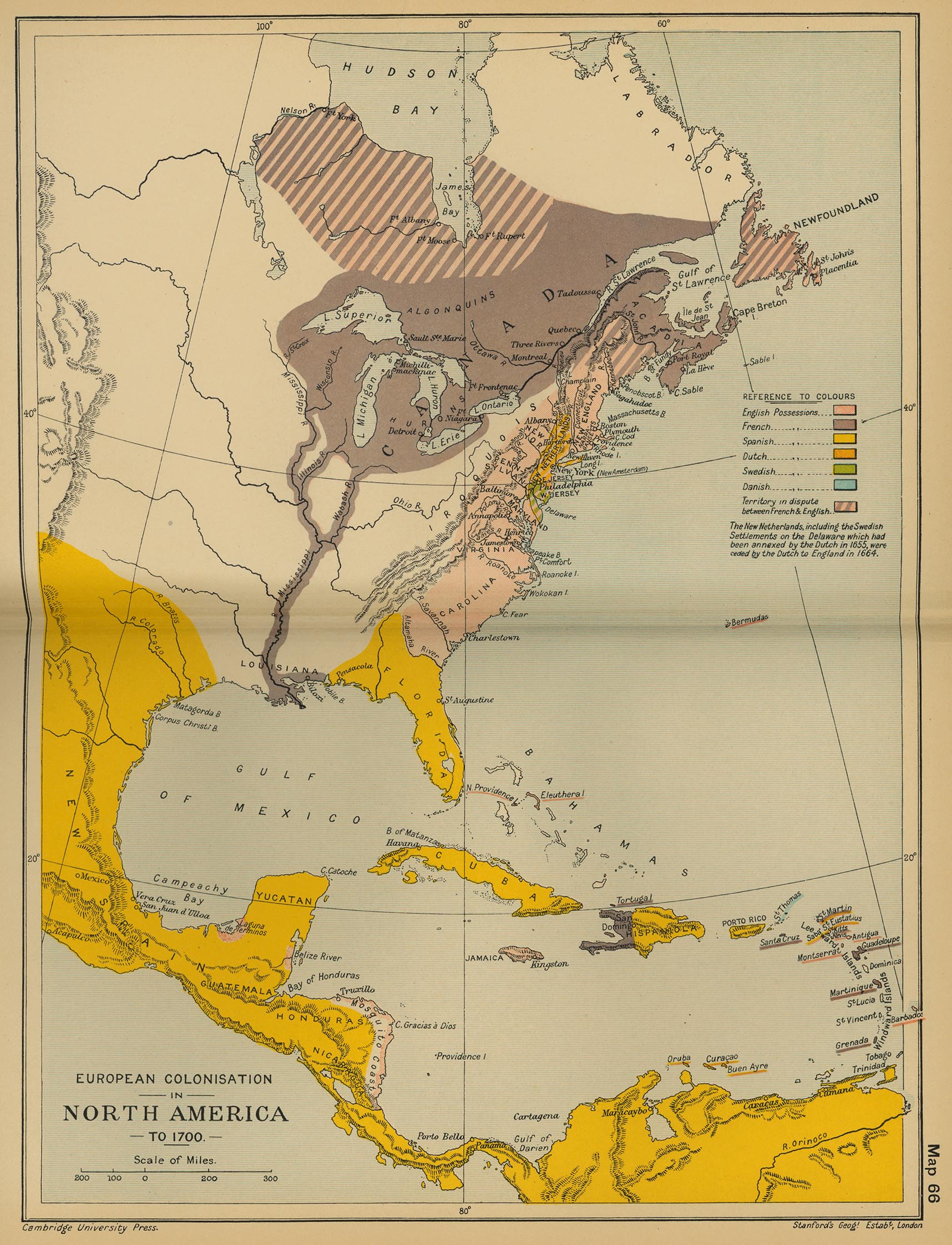
European Colonisation in North America, c. 1700
(Cambridge Modern History Atlas, 1912)
North America
(Droysens Allgemeiner Historischer Handatlas, 1886)
British and French Settlements in North America, 1755
(John Hinton)
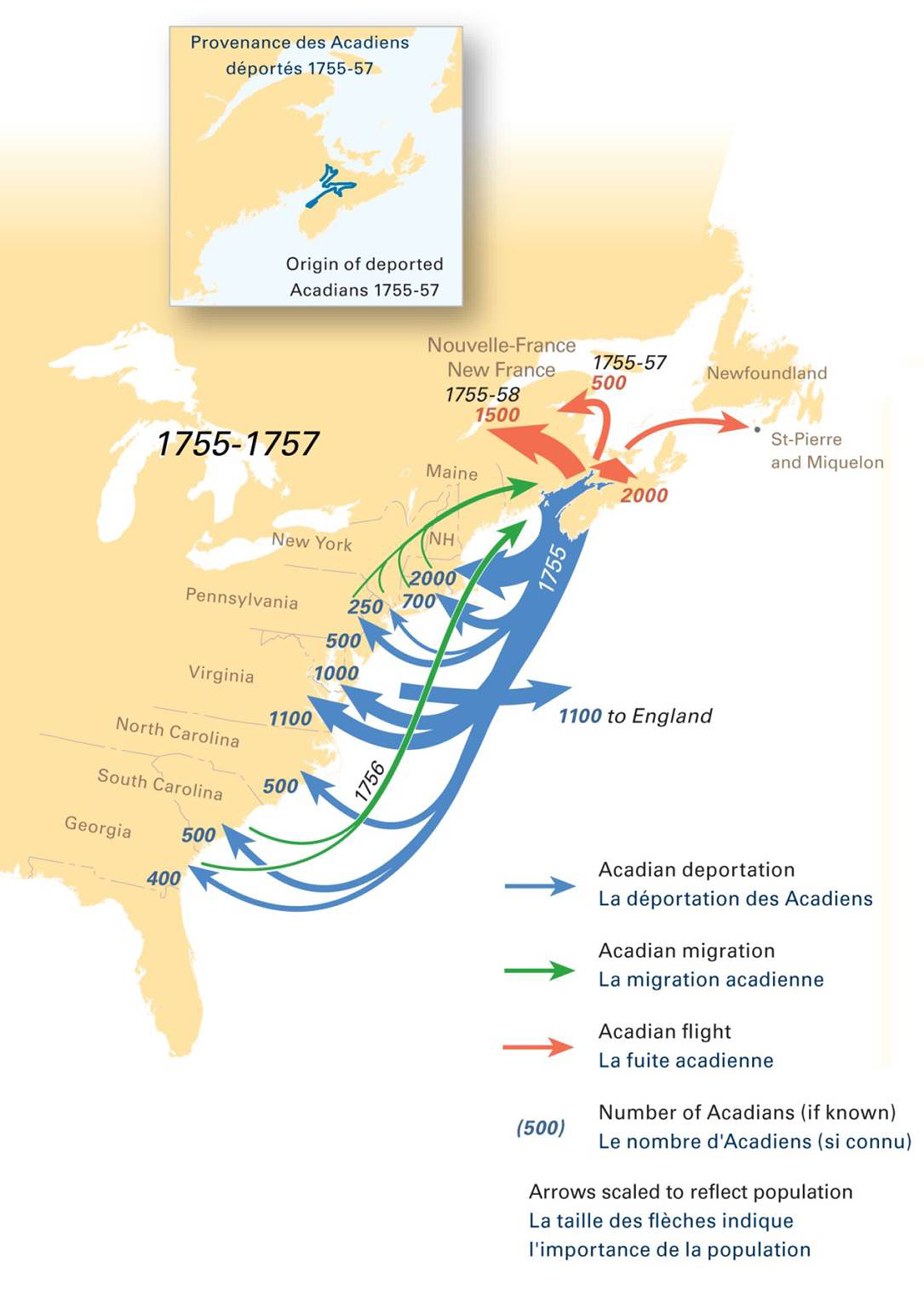
Acadian Deportation, 1755-1757
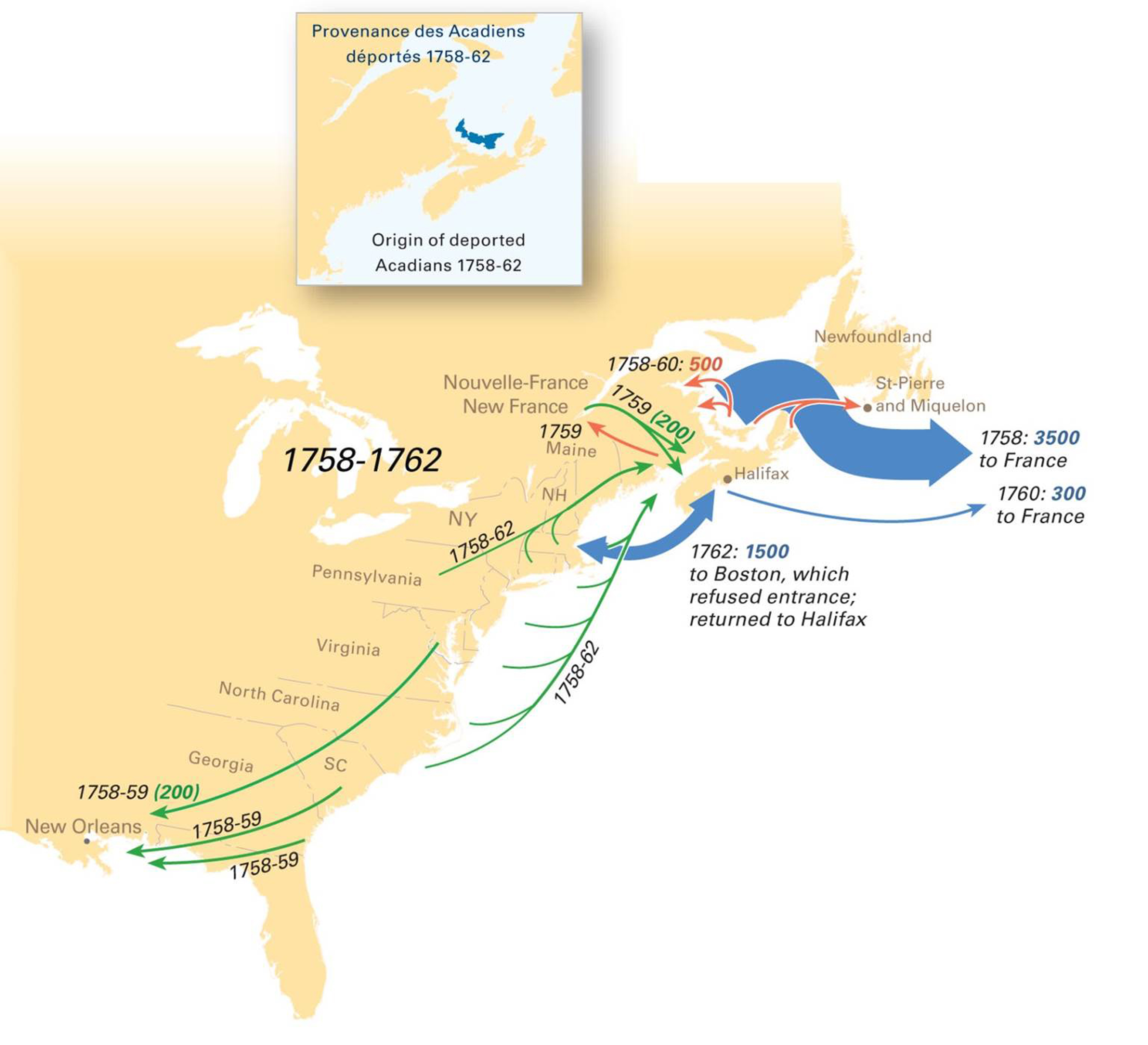
Acadian Deportation, 1758-1762
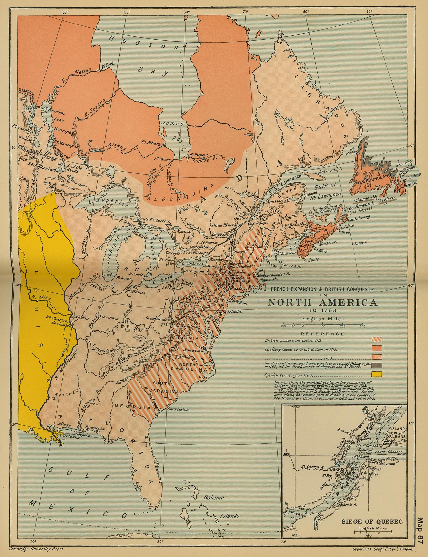
French Expansion and British Conquests in North America, c. 1763
(Cambridge Modern History Atlas, 1912)
North America, c. 1763
(Putzgers Historischer Weltatlas, 1923)
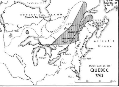
Boundaries of Quebec, 1763
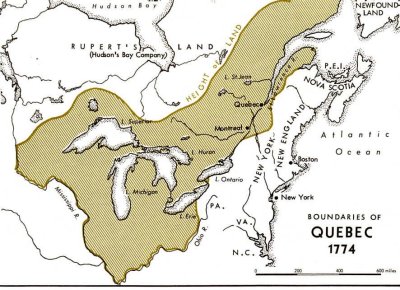
Province of Quebec, 1774
(Encyclopaedia Britannica, 2005)
Boundaries of Quebec, 1774
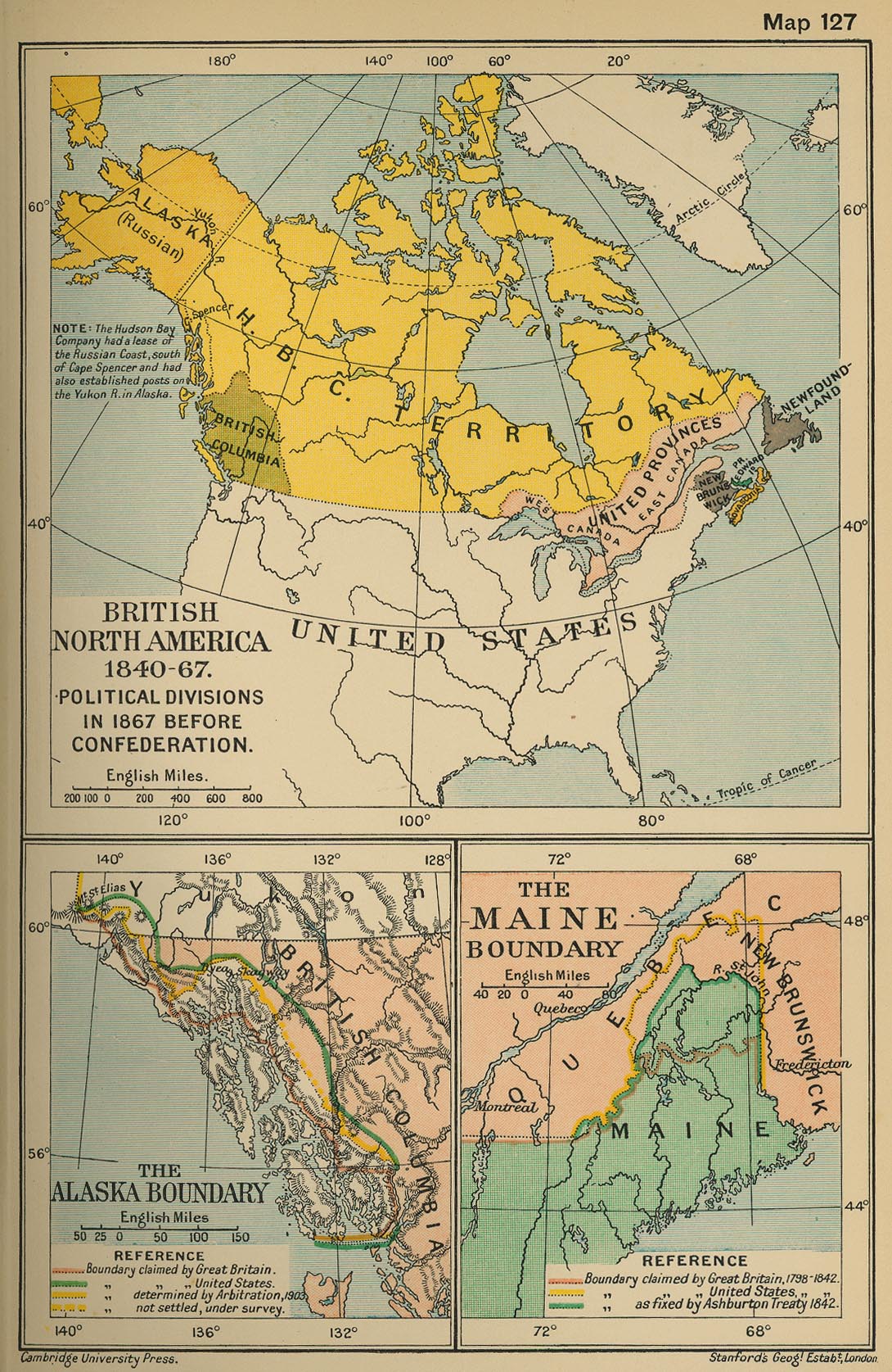
British North America (with the Hudson’s Bay Company Territorial Claims), 1850
British North America 1840-1867; Political division, 1867, before Confederation
(Cambridge Modern Hist. Atlas, 1912)
Dinsmore’s Complete Map of the Railroads & Canals in the United States & Canada, 1856
Canada, 1870
North-West Territories, 1870-1905
(The Canadian Encyclopedia)
Canada, 1873
Dawson’s Map of the Dominion of Canada, 1873
Canada - Map Showing Location of Some of Principal Products, also Railways & Water Routes, 1878
Dominion of Canada, 1898
(W. & A. K. Johnston)
Canada - Map Showing Grand Trunk Pacific Railway, 1903
Canada - Map of the National Transcontinental Railway, 1904
(Canada Dept. of the Interior)
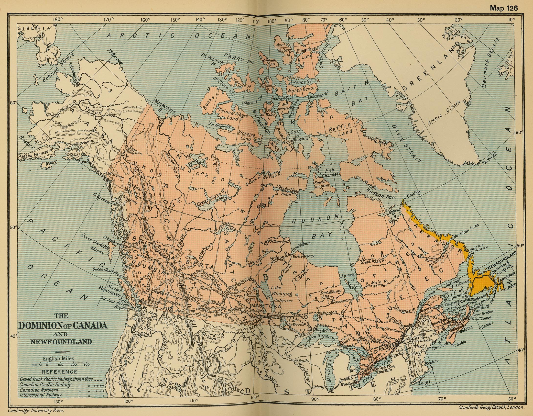
The Dominion of Canada and Newfoundland
(Cambridge Modern History Atlas, 1912)
Dominion of Canada, 1914
(Canada Dept. of the Interior)
Canada’s Participation in the First World War (1914-1918)
(The Canadian Encyclopaedia)
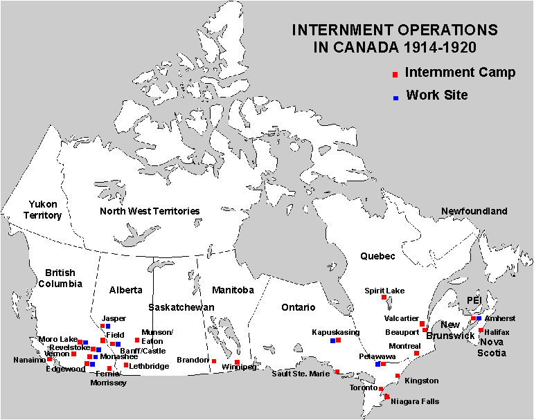
Internment Operations in Canada, 1914-1920
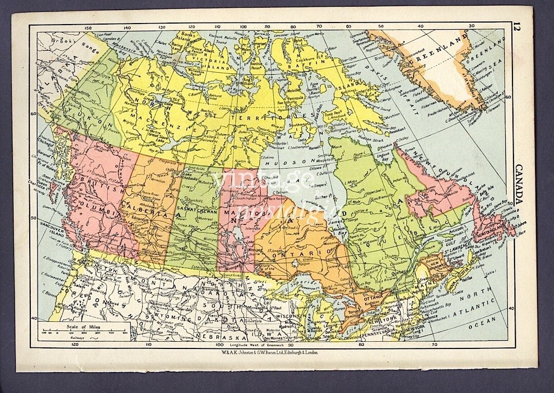
Dominion of Canada, 1920
(Times Survey Atlas of the World, 1920)
Dominion of Canada, 1924
(Canada Dept. of the Interior)
Dominion of Canada - Vegetation & Forest Map, 1930
(Canada Dept. of the Interior)
Canada, 1950
Canada’s Current Marine Protected Areas
(MacLean’s)
Canadian Peacekeeping Map
Canadian Armed Forces Current Operations Map
(Government of Canada)

