Skip to main content
Home
Historical Maps
World History
U.S. History
Canadian History
Canada (English)
Canada (Français)
Old school history maps
Stories on the Map
Armenia
Assyria
Catalonia
Kurdistan
Palestine
Ukraine
Edmaps +
Historical Maps of France
World
Ancient Greece
Roman Empire
Holy Roman Empire
Europe
Albania
Austria
Britain
Bulgaria
Croatia
France
Germany
Greece
Hungary
Italy
Netherlands
Poland
Romania
Scandinavia
Serbia
Spain & Portugal
Switzerland
Türkiye
Ukraine
Russia
Caucasus
Middle East
Asia
Latin America
Canada
U.S.A.
Australia
Map Collections and Atlases
Blank and Outline Maps of France
(d-maps.com)
Atlas des colonies françaises, protectorats et territories sous mandat de la France, 1934
(G. Grandidier)
Atlas historique de la France depuis César jusqu’à nos jours
(Auguste Longnon, 1907)
Cartes de France des années 1950
(IGN)
France: Historical Maps
Collection (Library of Congress)
Historical Maps of France
(American Geographical Society Library Digital Map Collection)
Historical Maps of France
(David Rumsey Map Collection)
L’histoire de France en cartes
(cartesfrance.fr)
La France en cartes
(Gallica - Bibliothèque nationale de France)
Les royaumes francs : l'évolution territoriale, 500-900
(Éditions Ménestrel)
Mapping Gothic France
(Columbia University)
Old Maps of France
(oldmapsonline.org)
Maps
The Frankish Kingdom under the Merovingians
(Droysens Allgemeiner Historischer Handatlas, 1886)
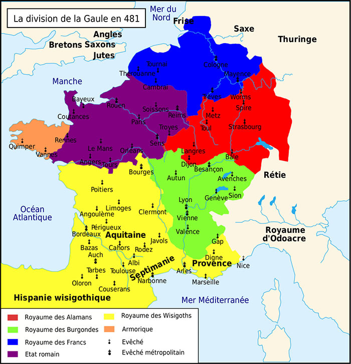
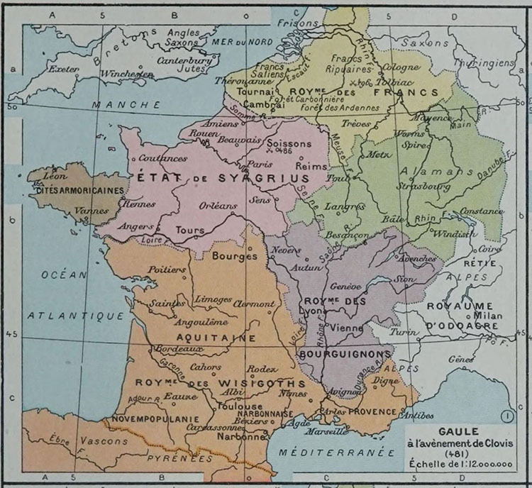
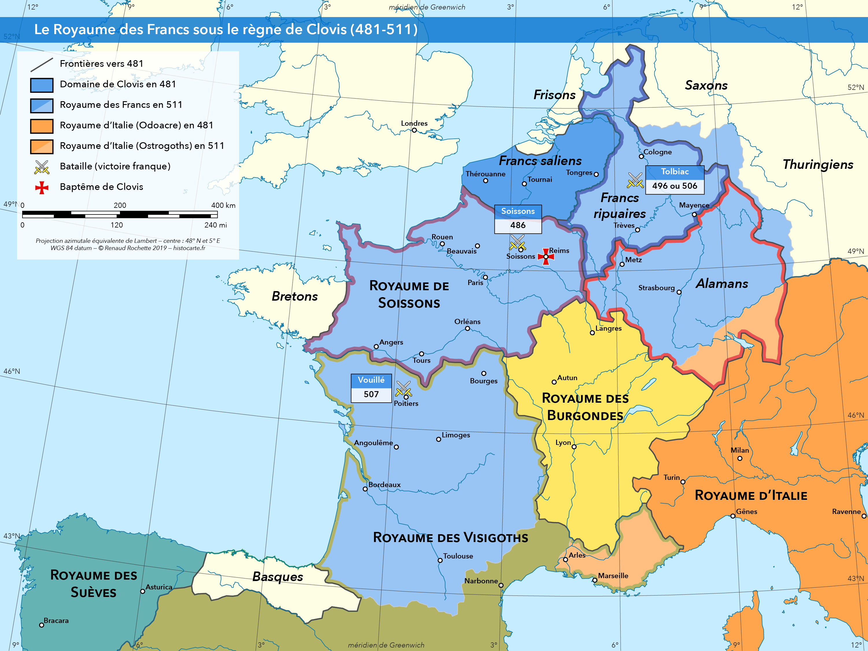
La division de la Gaule en 481
Le royaume des Francs sous le règne de Clovis (481-511)
(Renaud Rochette)
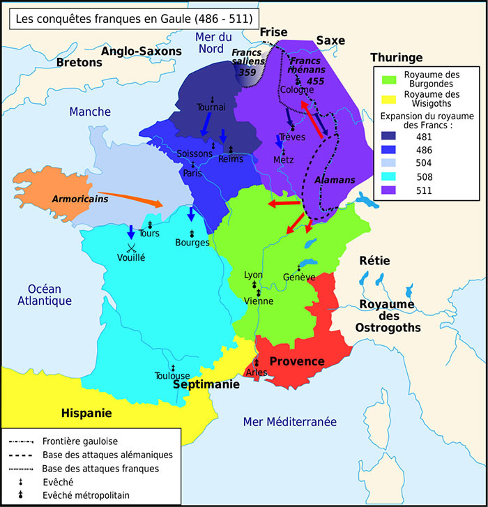
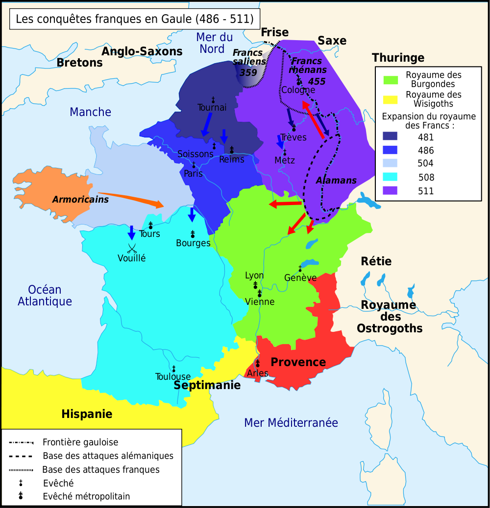
Les conquêtes franques en Gaule (486-511)
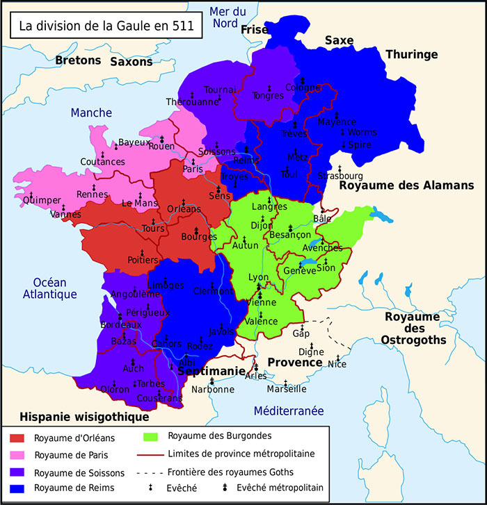
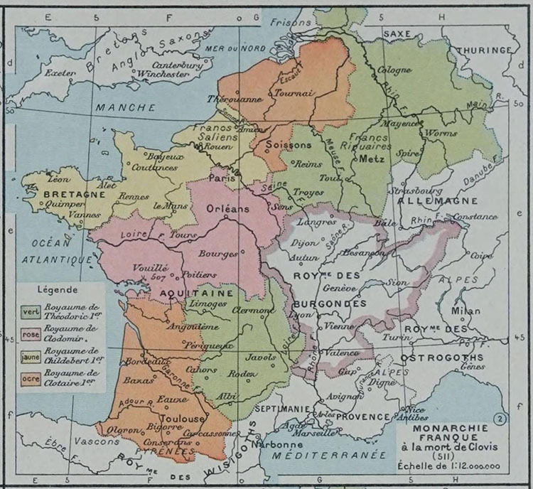
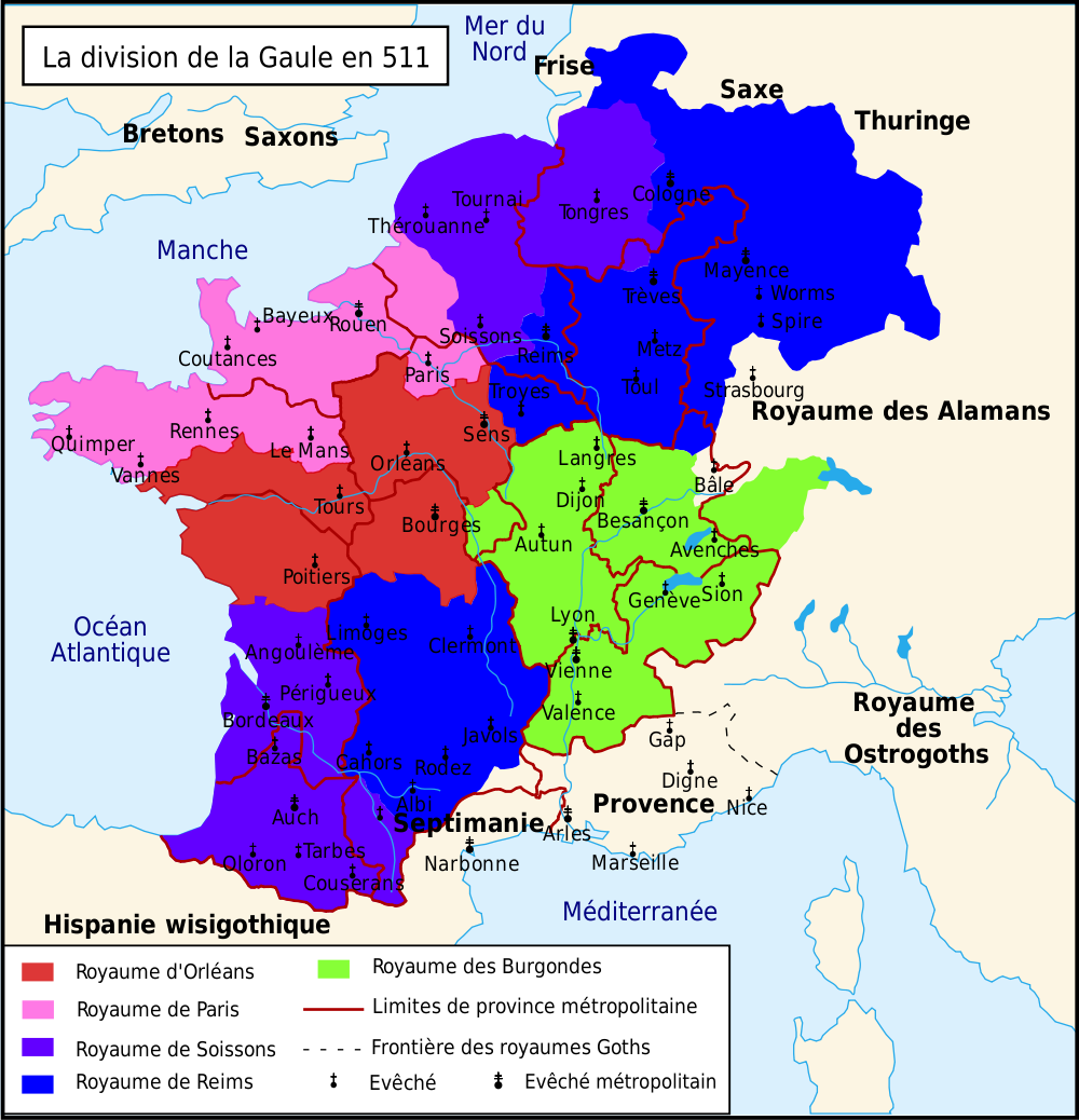
La division de la Gaule en 511
The Frankish Kingdoms in 511
(Wirkd History Encyclopedia)
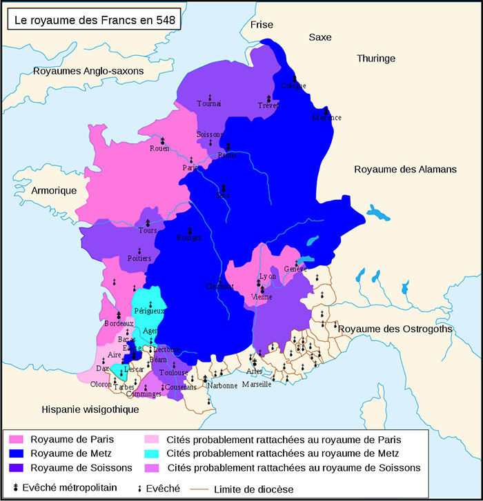
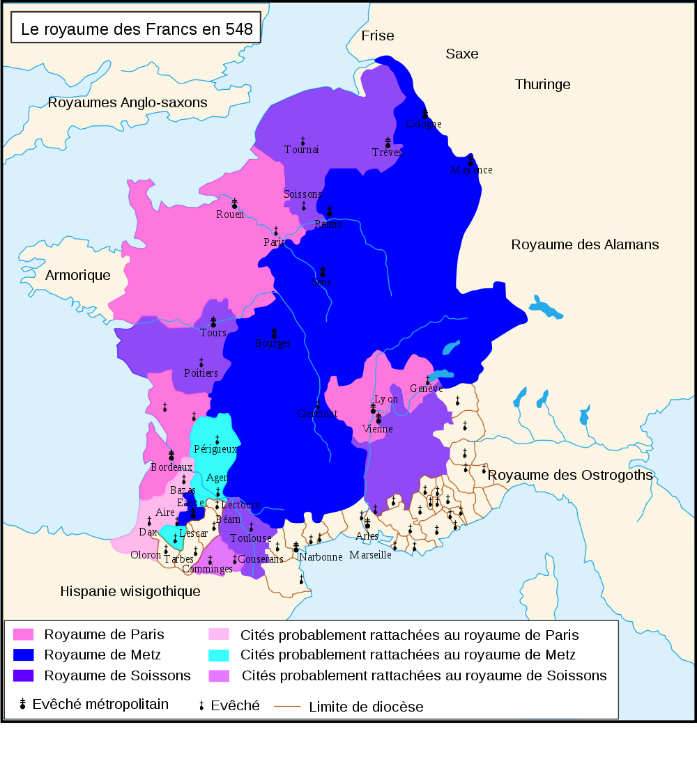
Le royaume des Francs en 548
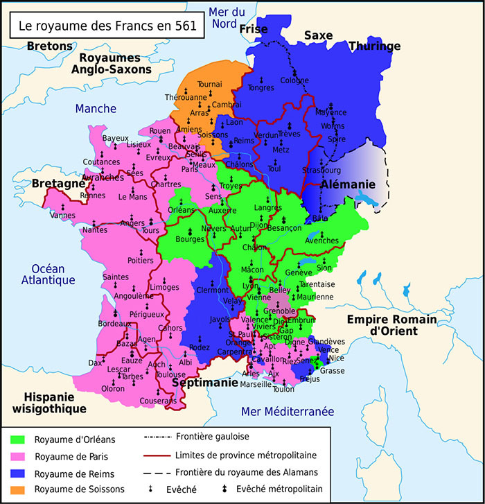
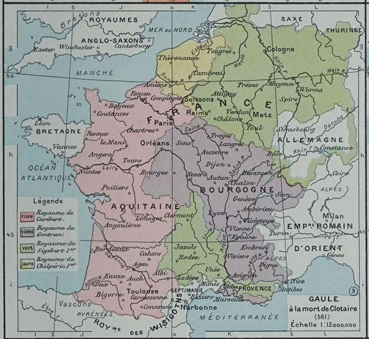
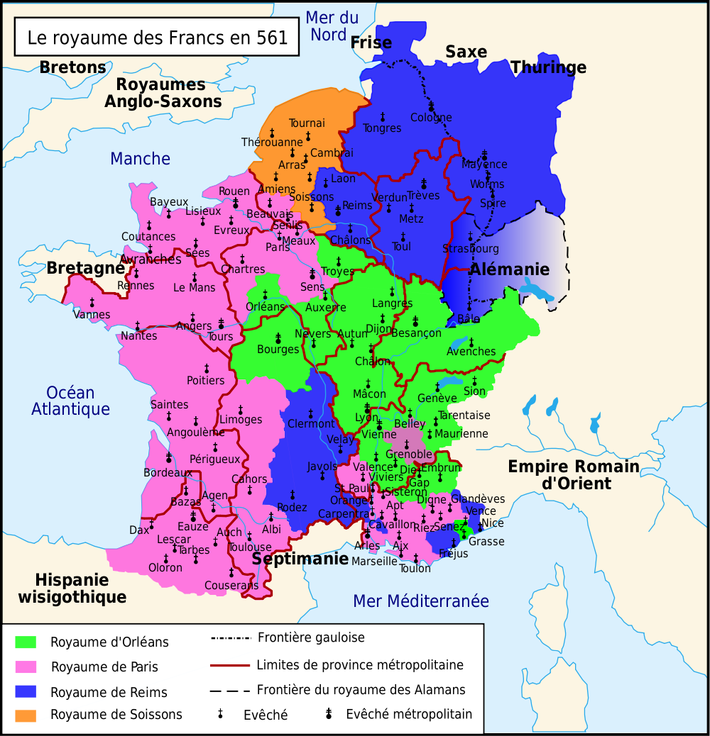
Le royaume des Francs en 561
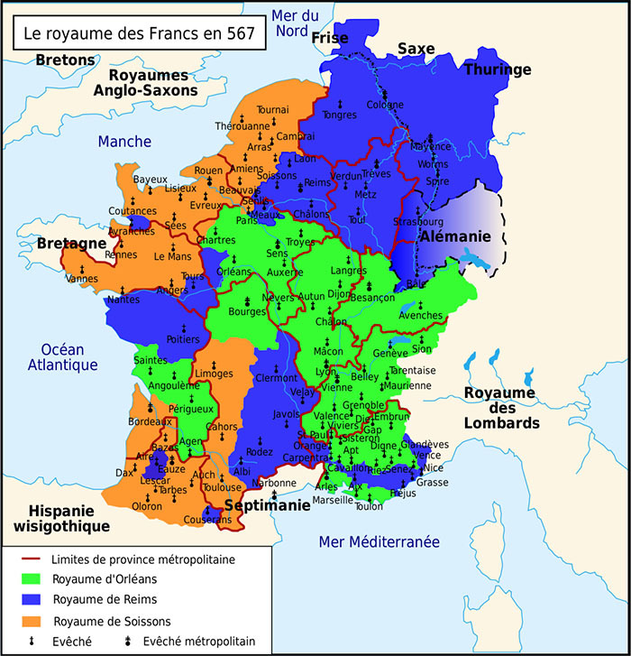
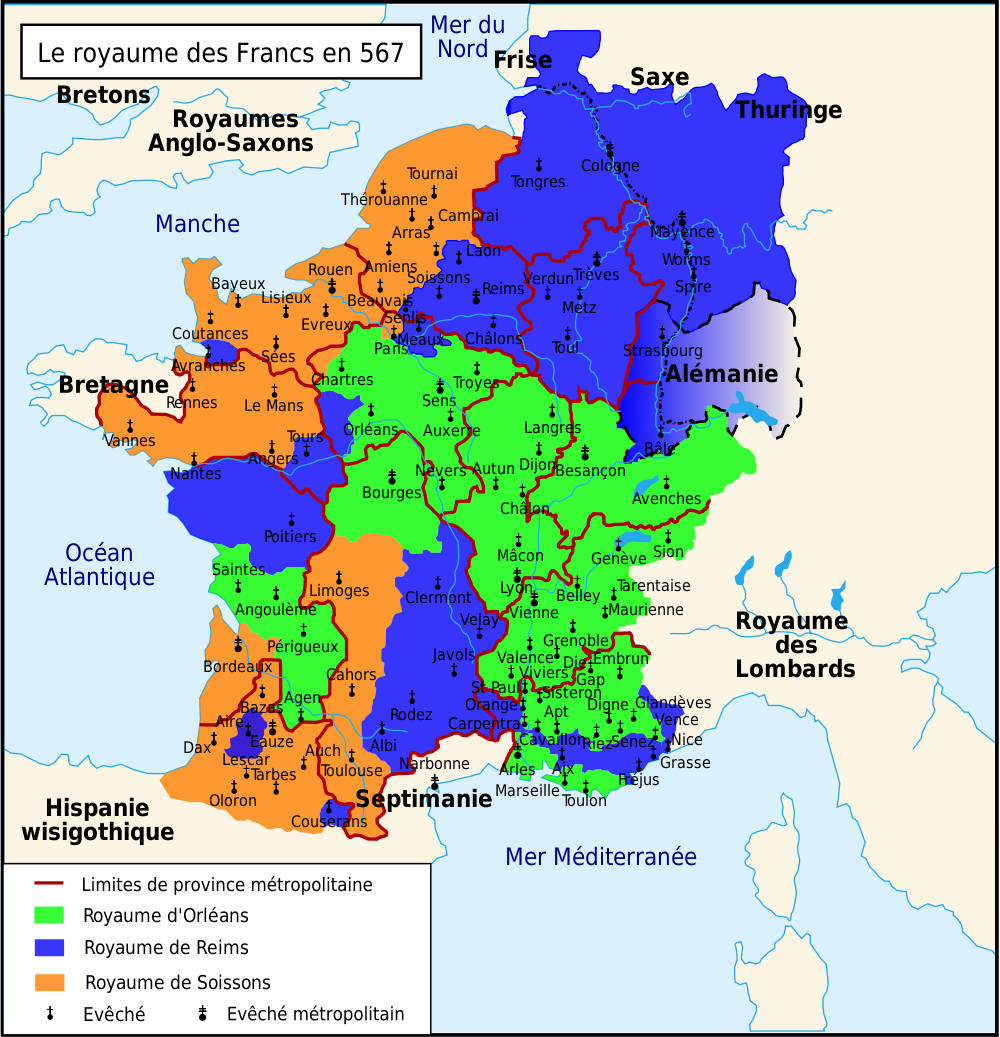
Le royaume des Francs en 567
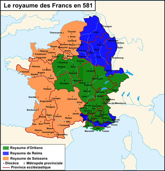
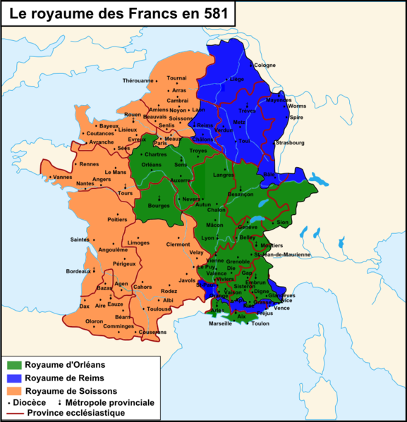
Le royaume des Francs en 581
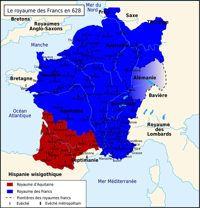
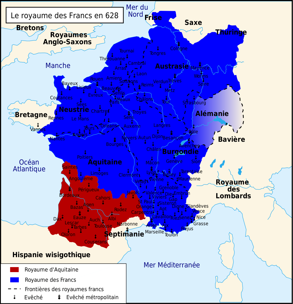
Le royaume des Francs en 628
The Frankish Dominions in Merovingian Times (486-768)
(R. Lane Poole, Historical Atlas of Modern Europe, c.1900)
Central Europe in Carolingian Times
(Droysens Allgemeiner Historischer Handatlas, 1886)
The Frankish Dominions in Carolingian Times (768-900)
(R. Lane Poole, Historical Atlas of Modern Europe, c.1900)
France about 1035
(William Shepherd, Historical Atlas, 1926)
Northern France in 1066
(R. Lane Poole, Historical Atlas..., c.1900)
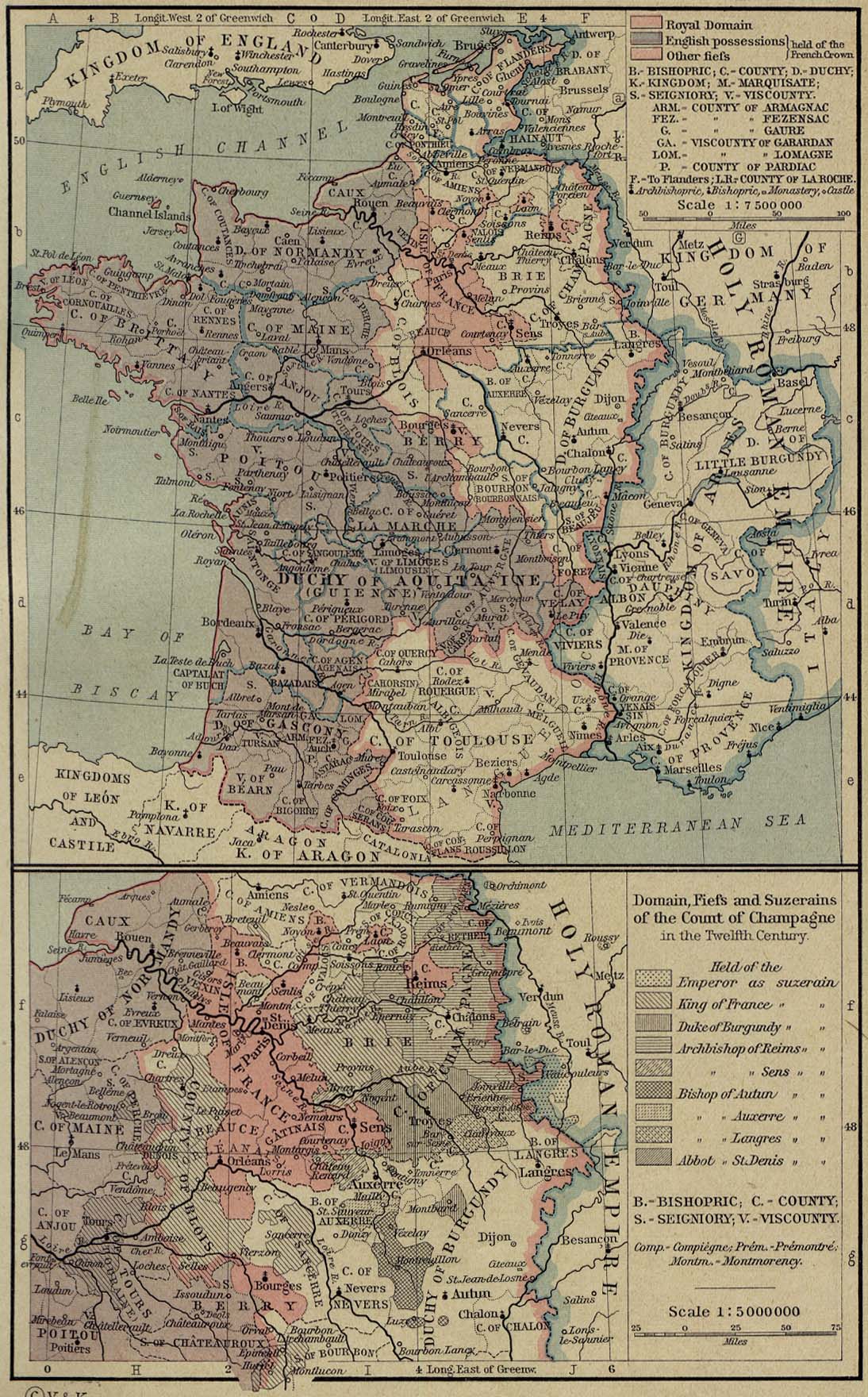
France, Lotharingia, and Burgundy in the Eleventh and Twelfth Centuries
(R. Lane Poole, Historical Atlas..., c.1900)
France in the Twelfth Century. France in the Fourteenth and Fifteenth Centuries
(Droysens..., 1886)
France, 1154-1184
(William Shepherd, Historical Atlas, 1926)
France in the Thirteenth Century
(R. Lane Poole, Historical Atlas of Modern Europe, c.1900)
Gallia Sacra
(R. Lane Poole, Historical Atlas of Modern Europe, c.1900)
France During the Hundred Years' War
(R. Lane Poole, Historical Atlas of Modern Europe, c.1900)
France, 1328
(William Shepherd, Historical Atlas, 1926)
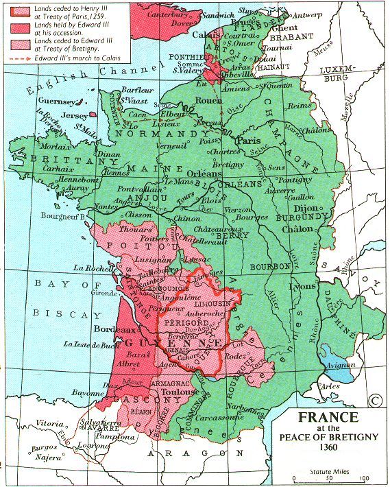
France, 1360
(Muir’s Historical Atlas, 1911)
France at the Death of Charles V, 1380
(Robert Labberton, New Historical Atlas and General History, 1886)
France During the Second English Invasion, 1415-1463
(R. Labberton, New Historical Atlas..., 1886)
France 1429
(Muir’s Historical Atlas, 1911)
France, 1453
(William Shepherd, Historical Atlas, 1911)
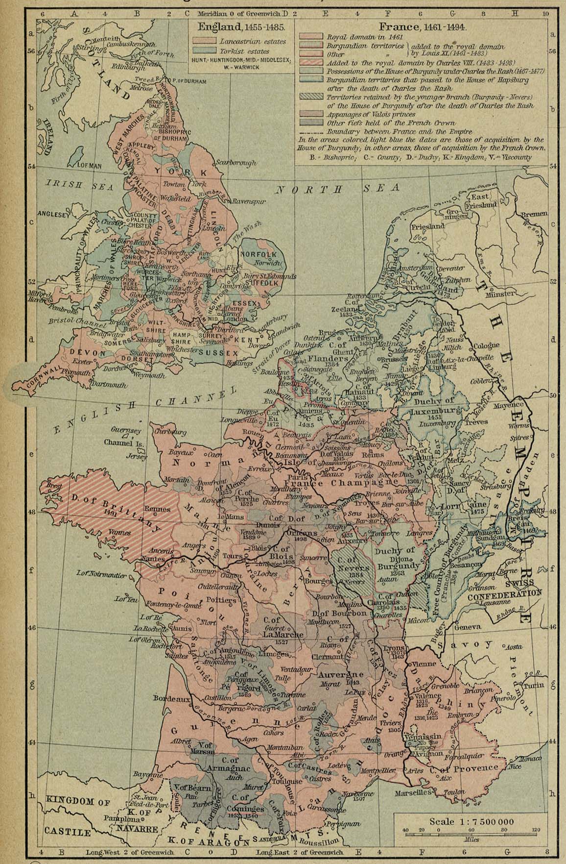
France and England, 1455-1494
(William Shepherd, Historical Atlas, 1926)
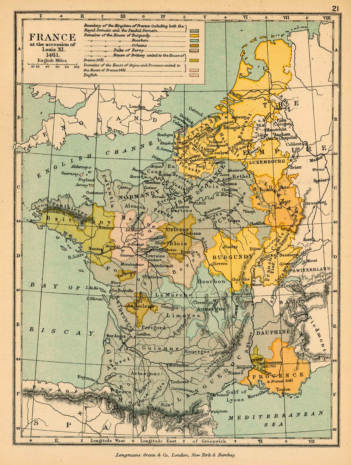
France at the Accession of Louis XI, 1461
(Robert Labberton, New Historical Atlas and General History, 1886)
France at the Accession of Louis XI
(Charles Colbeck, The Public Schools Historical Atlas, 1905)
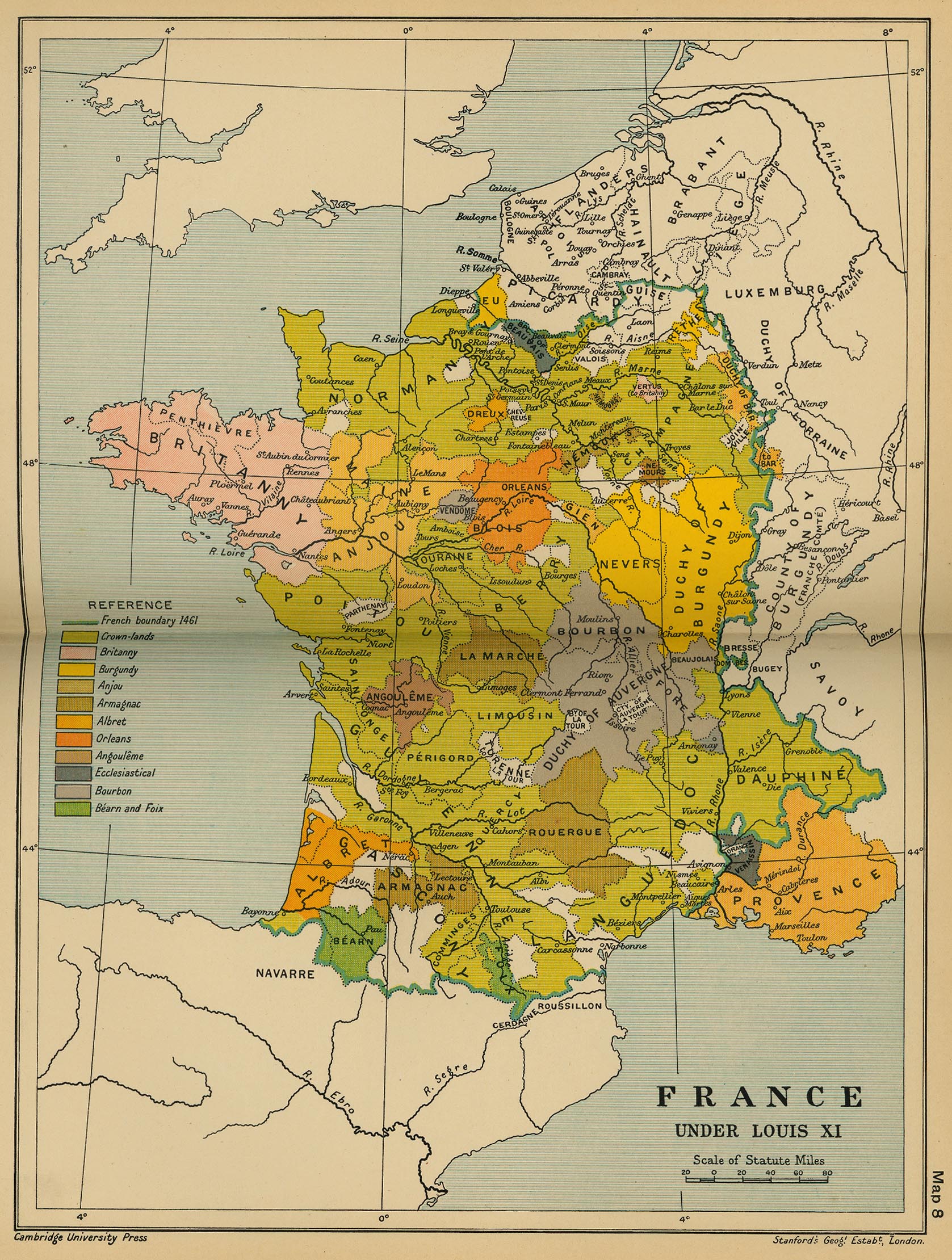
France Under Louis XI
(Cambridge Modern History Atlas, 1912)
France at the Death of Louis XI (1483)
(Robert Labberton, New Historical Atlas and General History, 1886)
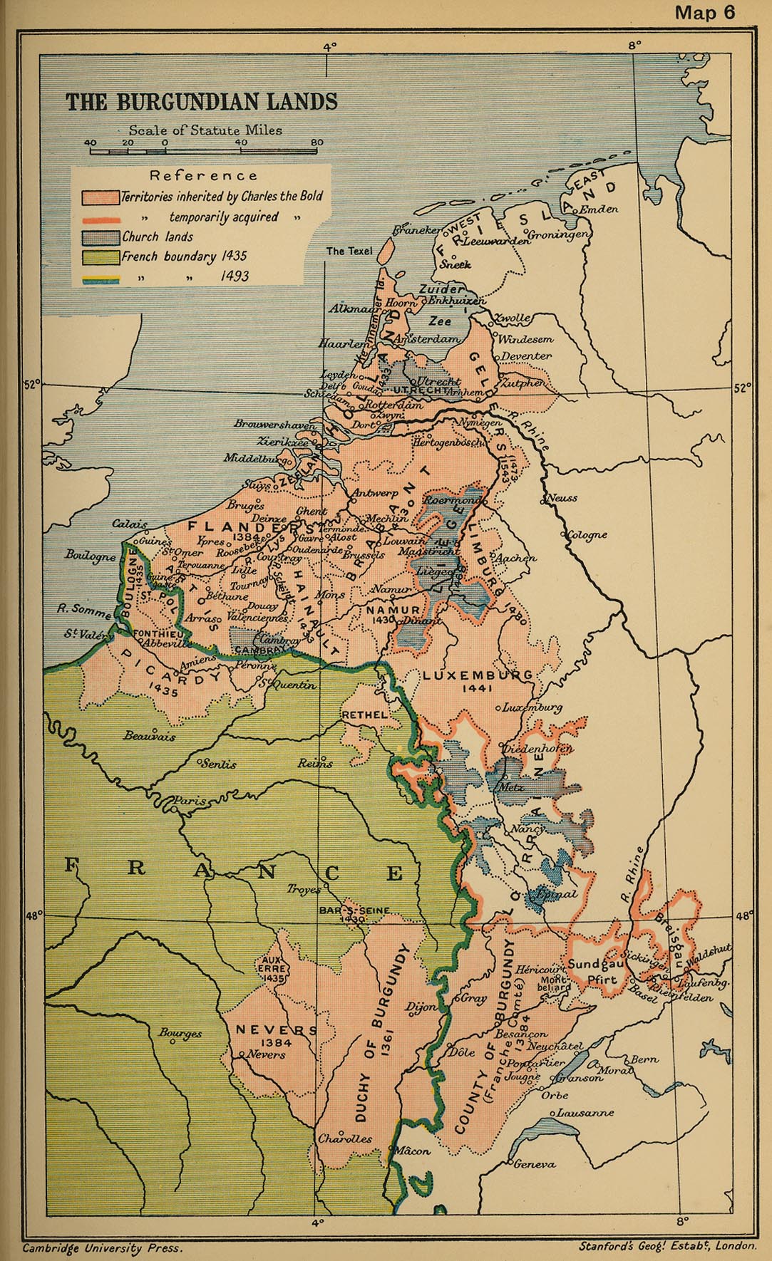
The Burgundian Lands, 1493
(Cambridge Modern History Atlas, 1912)
France, Late 15th Century
(Muir’s Historical Atlas, 1911)
France in the 16th-18th Centuries
(Droysens Allgemeiner Historischer Handatlas, 1886)
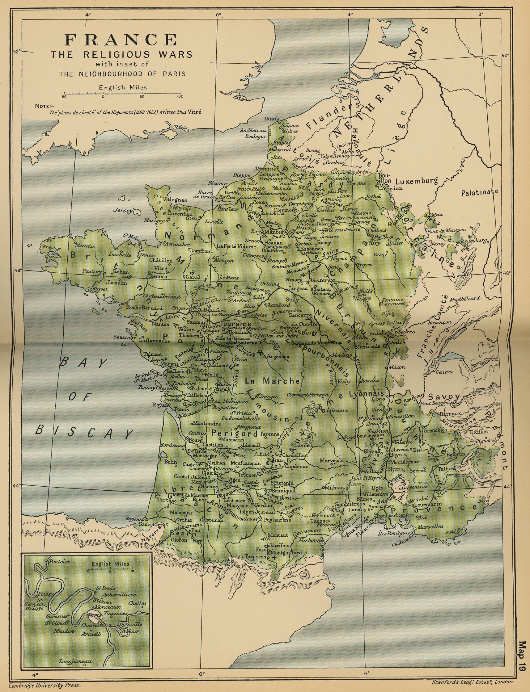
The Religious Wars
(Cambridge Modern History Atlas, 1912)
France under the Ancien Régime, 1600-1790
(Lane Poole, Historical Atlas of Modern Europe, c.1900)
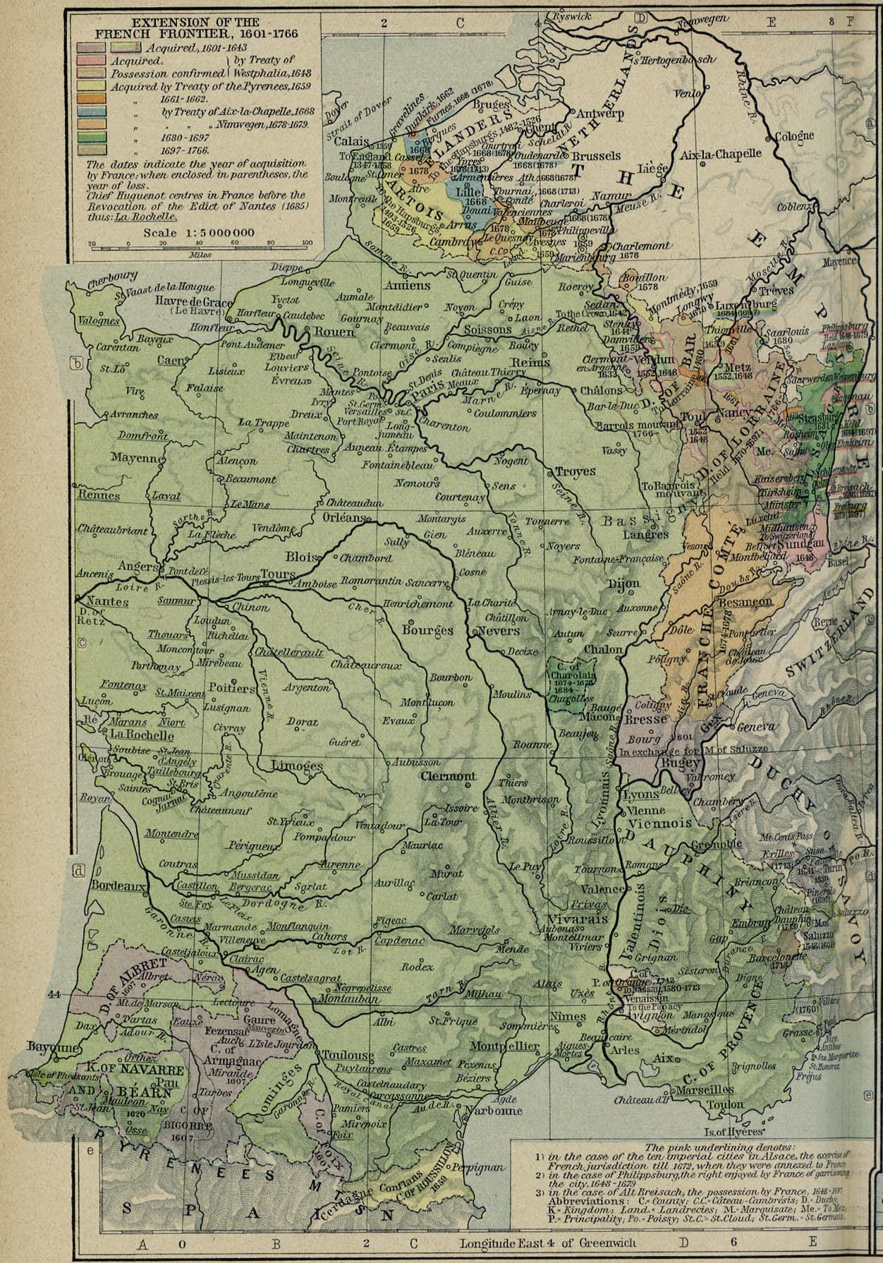
Extension of the French Frontiers, 1601-1766
(William Shepherd, Historical Atlas, 1926)
France, 1618-1648
(J. Bartholomew, A Literary & Historical Atlas of Europe, 1910)
Eastern Frontier of France under Louis XIV, 1643-1715
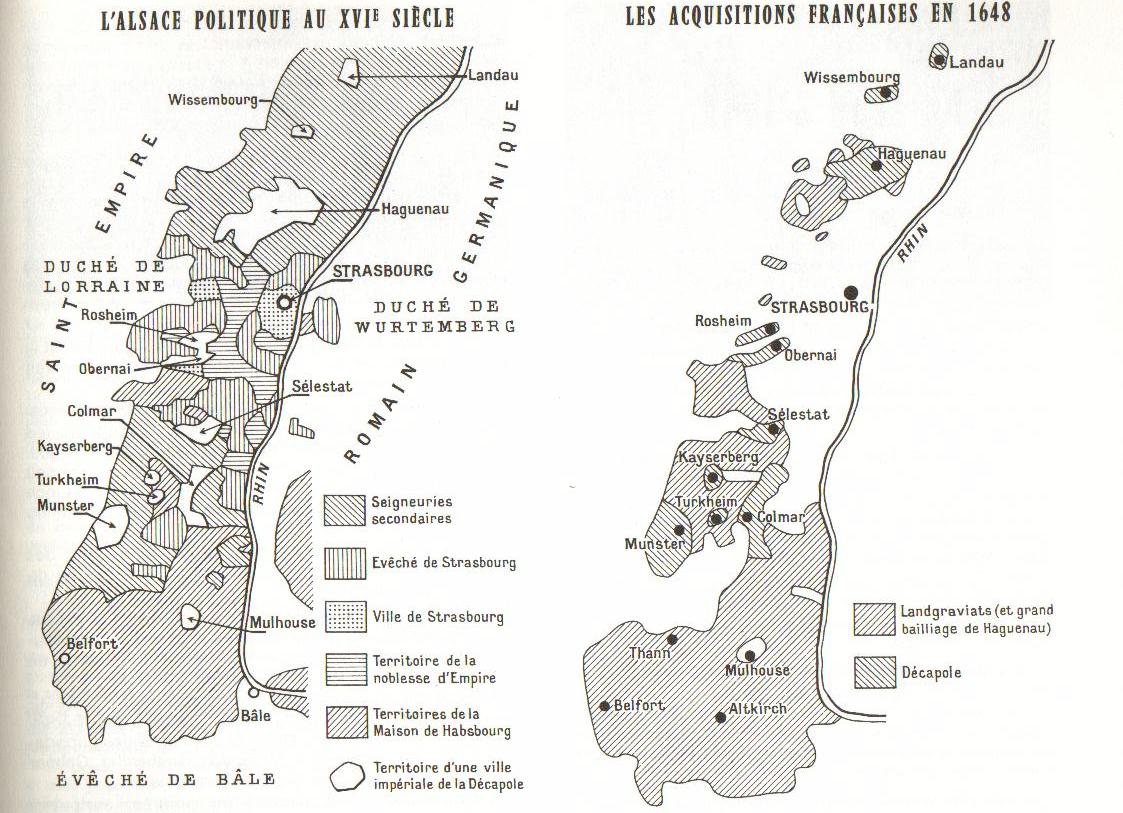
L’Alsace politique au XVIe siècle - Les acquisitions françaises en 1648
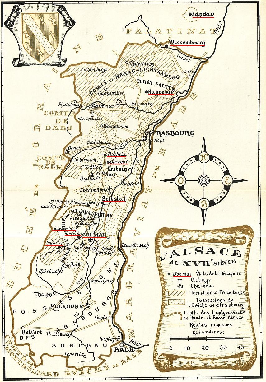
L’Alsace au XVIIe siècle
Alsace-Lorraine from 1648 to 1789
(Droysens Allgemeiner Historischer Handatlas, 1886)
France After the Peace of Aix-la-Chapelle, 1668
(Robert Labberton, New Historical Atlas..., 1886)
France After the Peace of Nijmegen, 1678
(Robert Labberton, New Historical Atlas..., 1886)
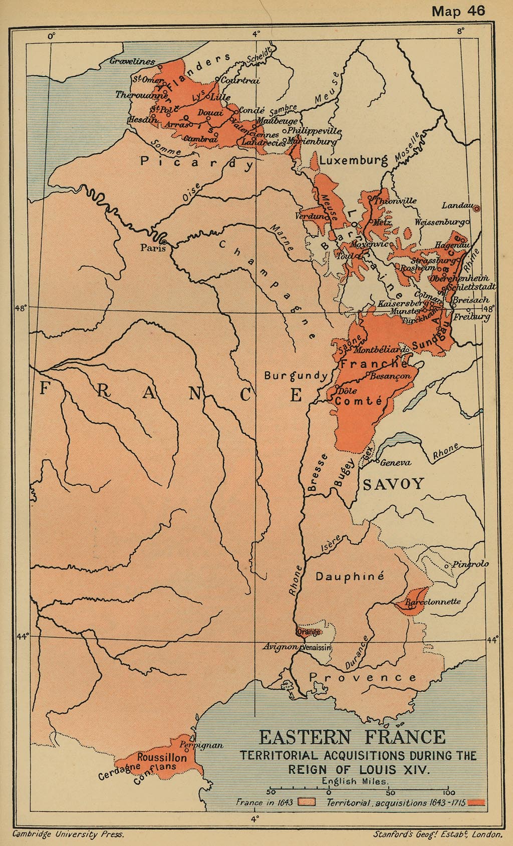
Territorial Acquisitions During the Reign of Louis XIV
(Cambridge Modern History Atlas, 1912)
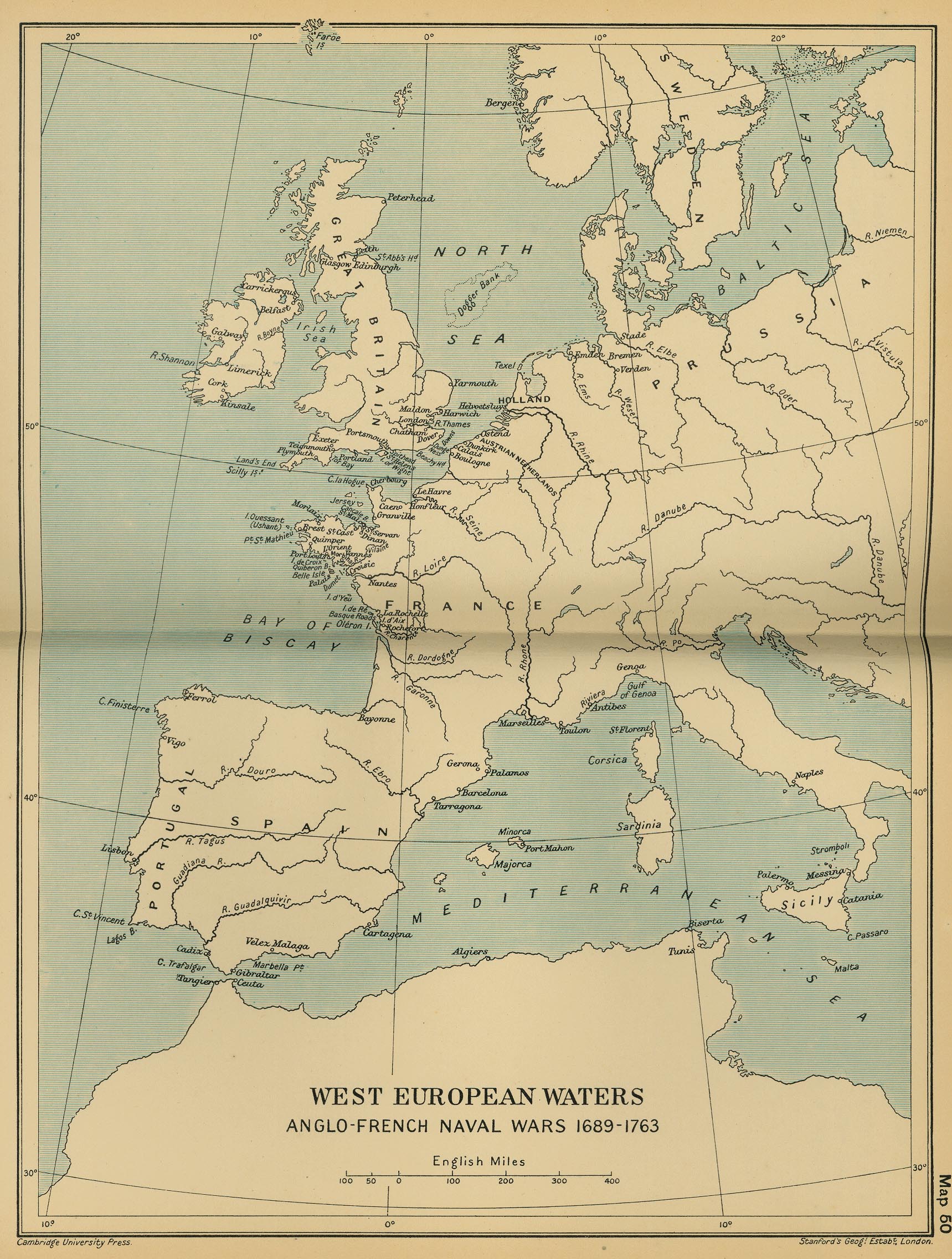
Anglo-French Naval Wars 1689-1763
(Cambridge Modern History Atlas, 1912)
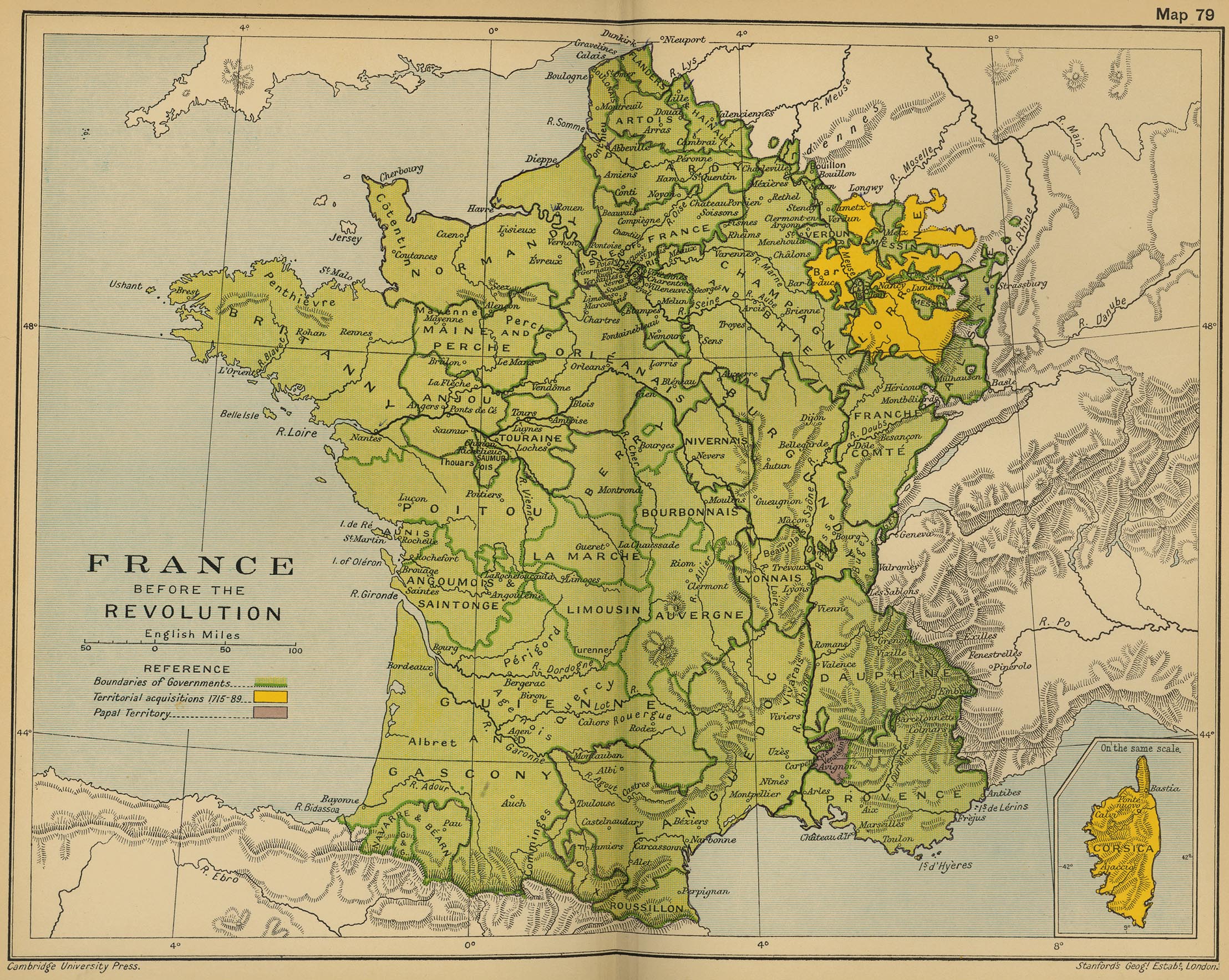
France before the Revolution
(Cambridge Modern History Atlas, 1912)
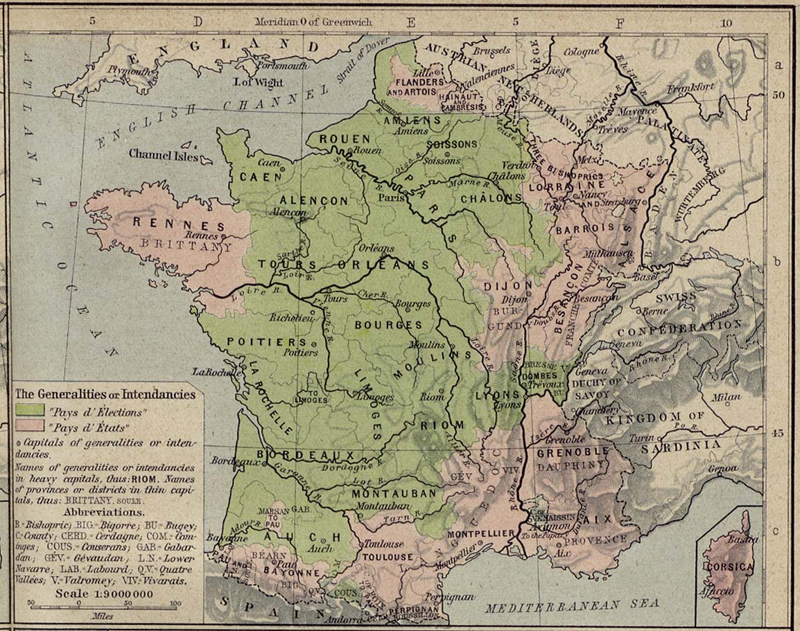
France - The Generalities and Intendancies, 1789
(William Shepherd, Historical Atlas, 1926)
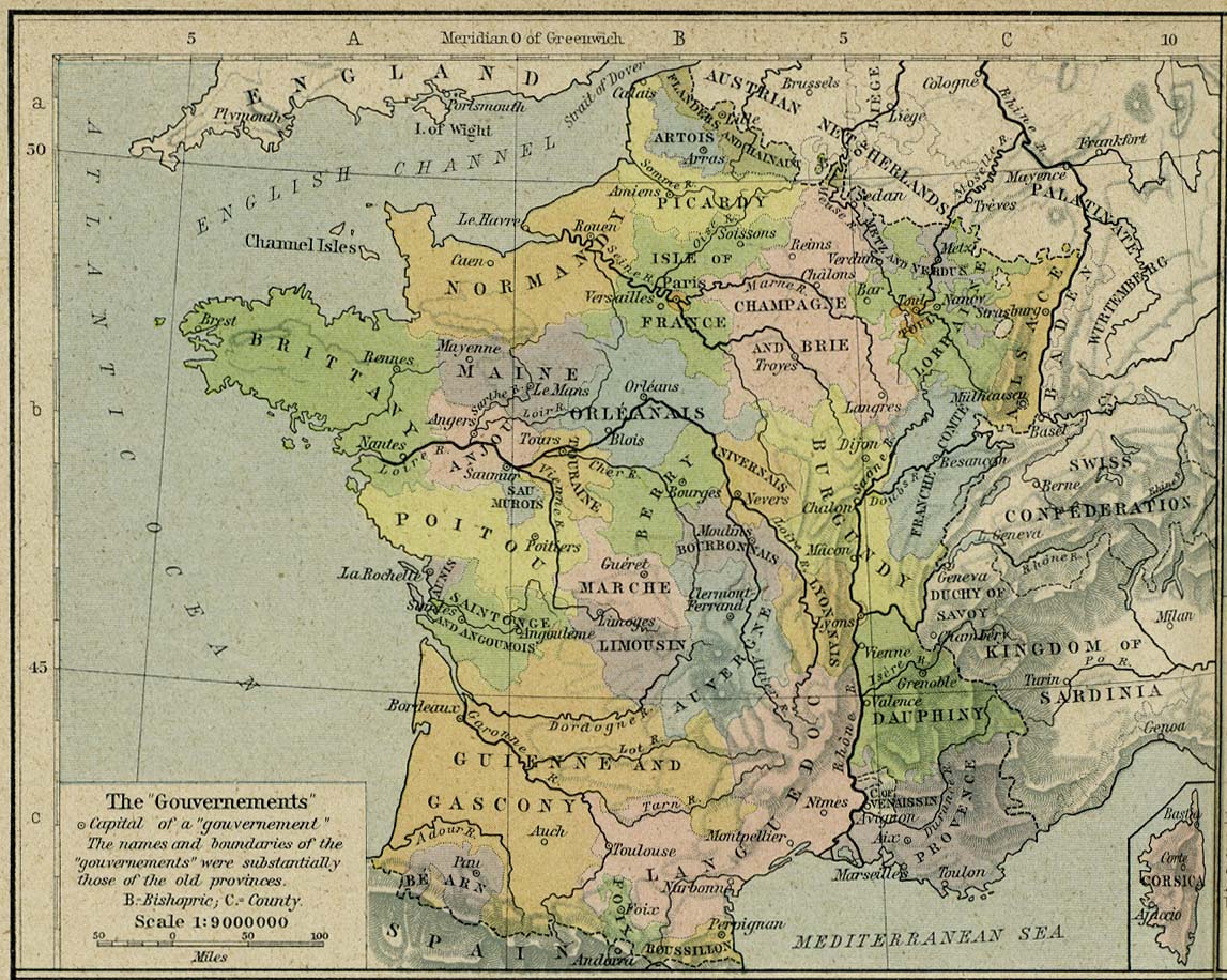
France - The Governments, 1789
(William Shepherd, Historical Atlas, 1926)
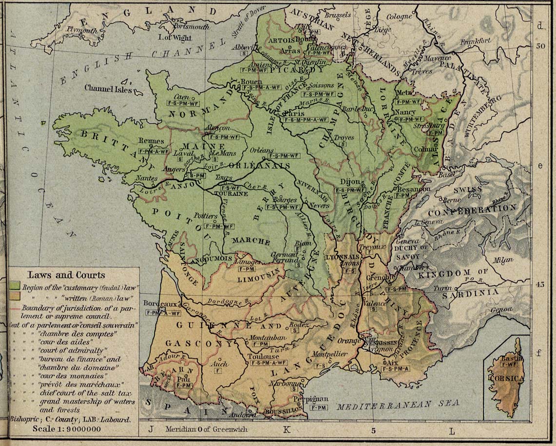
France - Law and Courts, 1789
(William Shepherd, Historical Atlas, 1926)
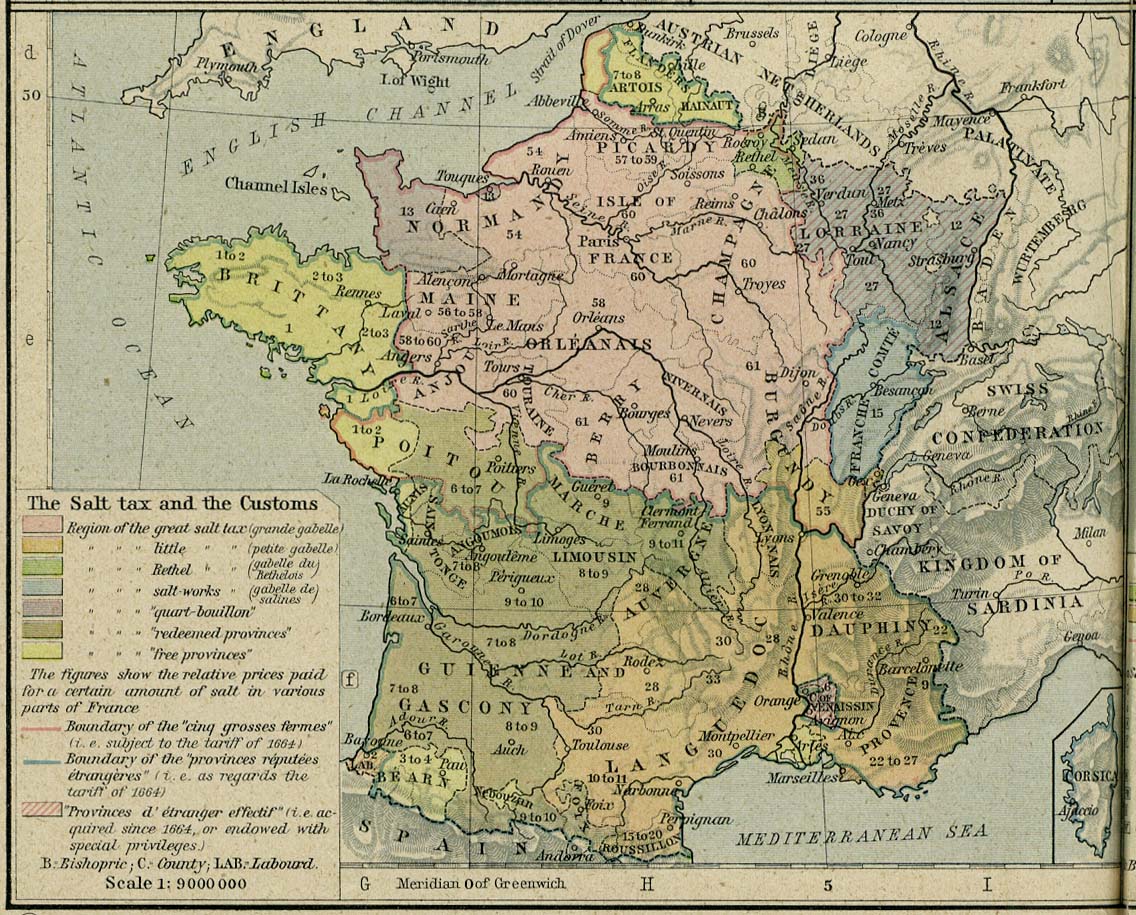
France - The Salt Tax, 1789
(William Shepherd, Historical Atlas, 1926)
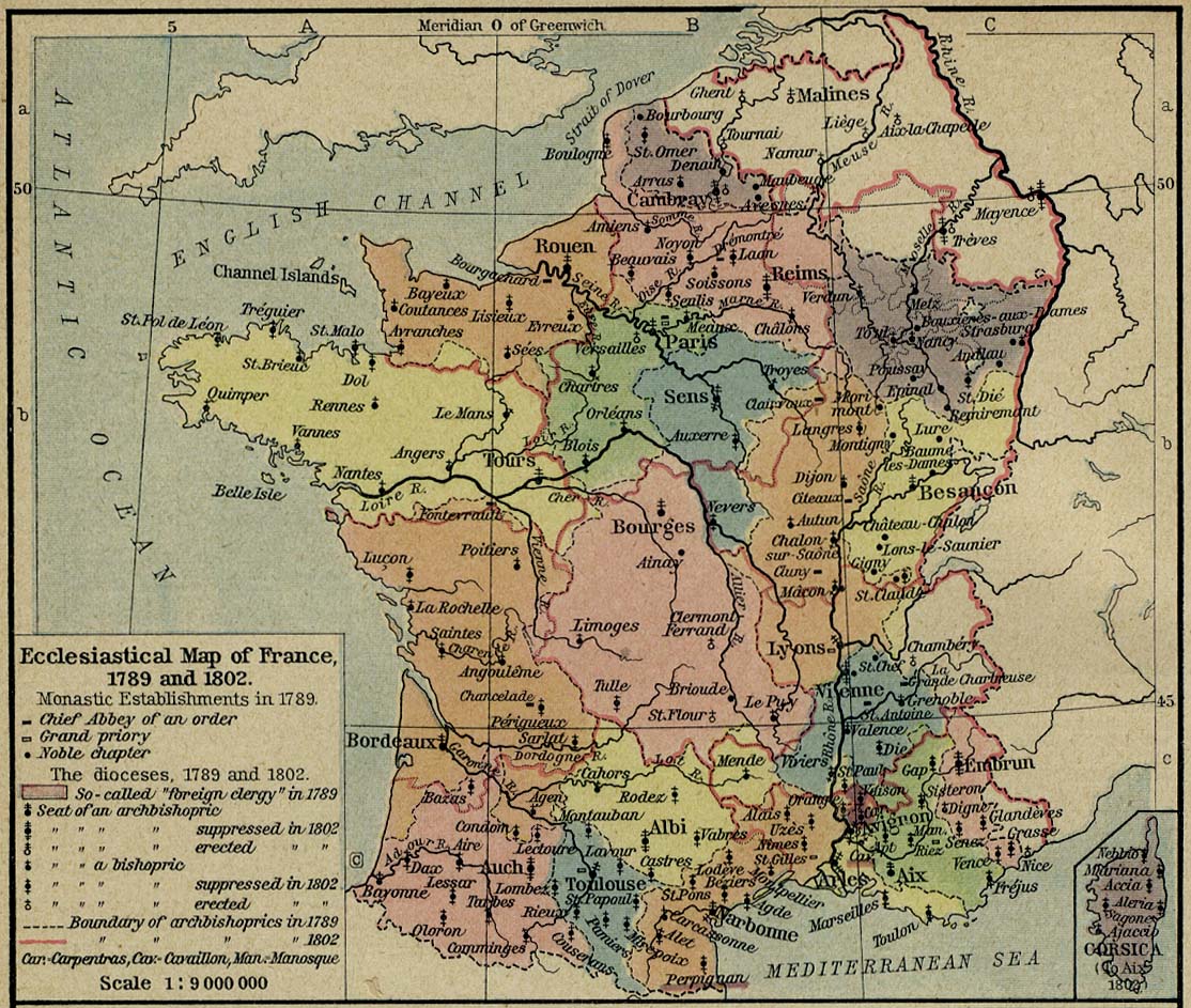
France - Ecclesiastical Map, 1789 and 1802
(William Shepherd, Historical Atlas, 1926)
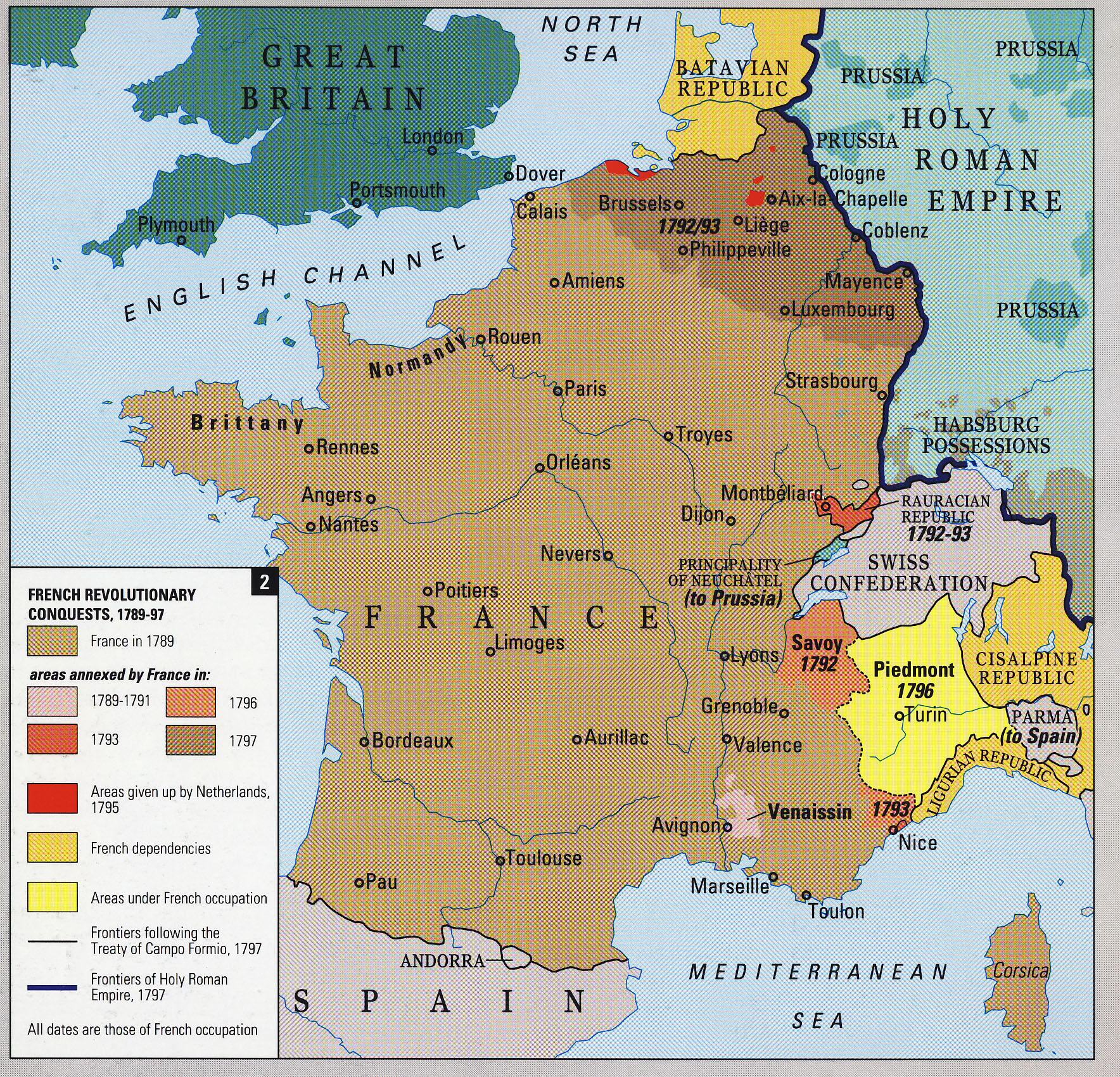
French Revolutionary Conquests, 1789-1797
France, 1791
(William Shepherd, Historical Atlas, 1926)
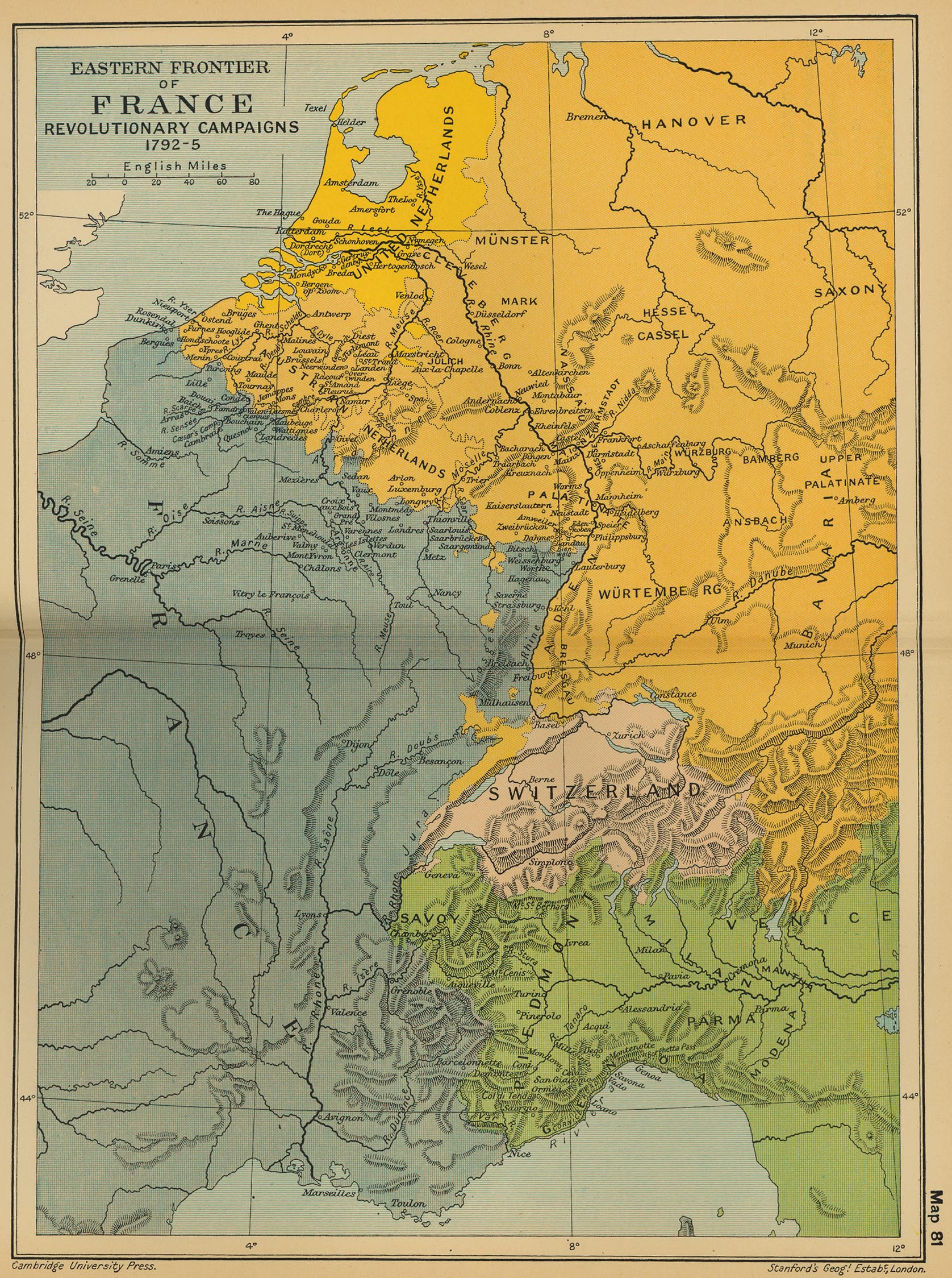
Eastern Frontier of France: Revolutionary Campaigns 1792-1795
(Cambridge Modern History Atlas, 1912)
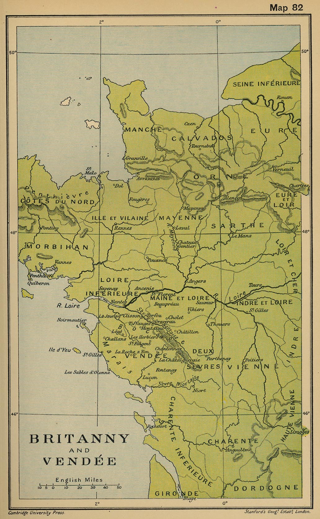
Britanny and Vendee
(Cambridge Modern History Atlas, 1912)
Napoleon’s Reorganisation, 1795-1809
(Droysens Allgemeiner Historischer Handatlas, 1886)
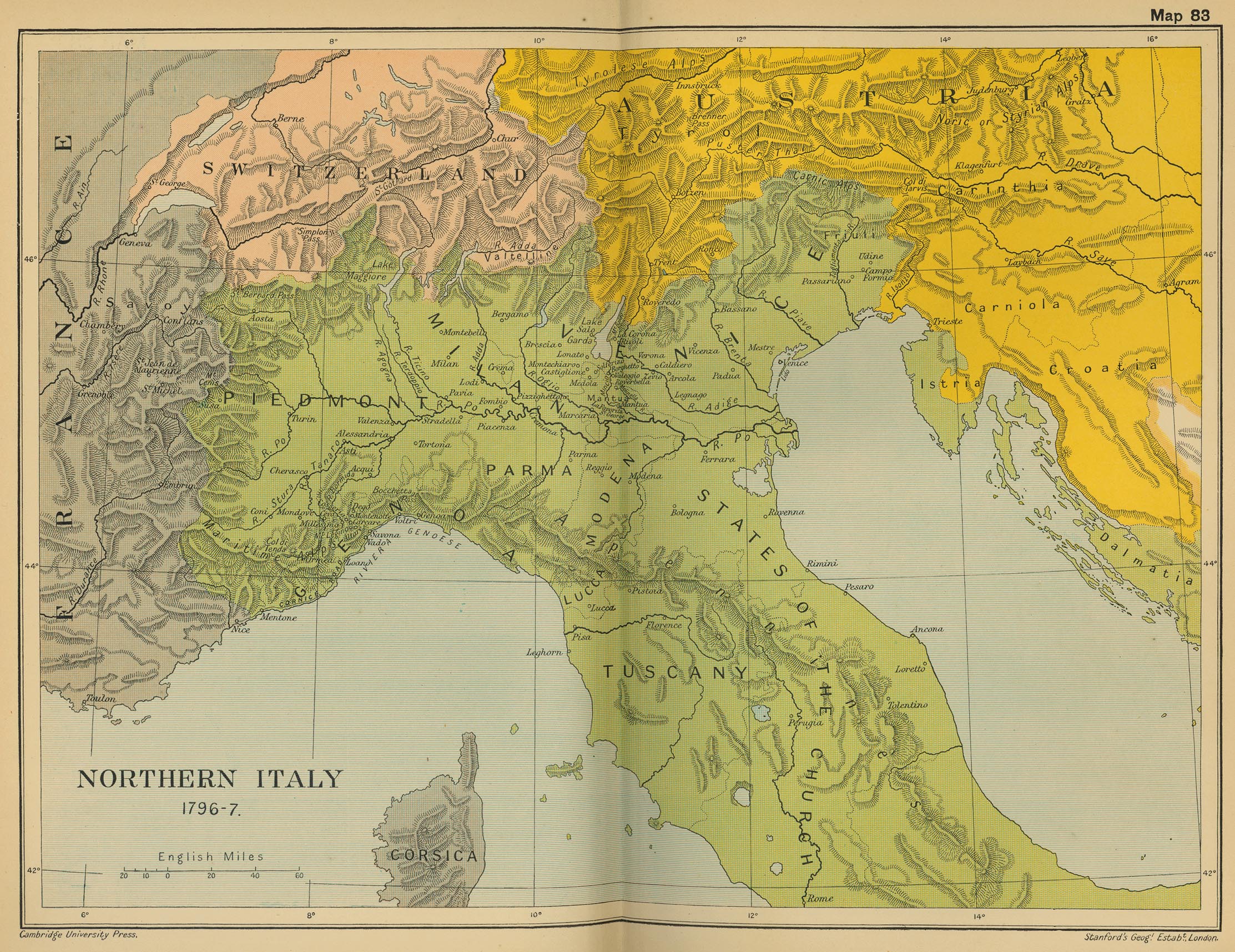
Northern Italy: Bonaparte's Campaign 1796-1797
(Cambridge Modern History Atlas, 1912)
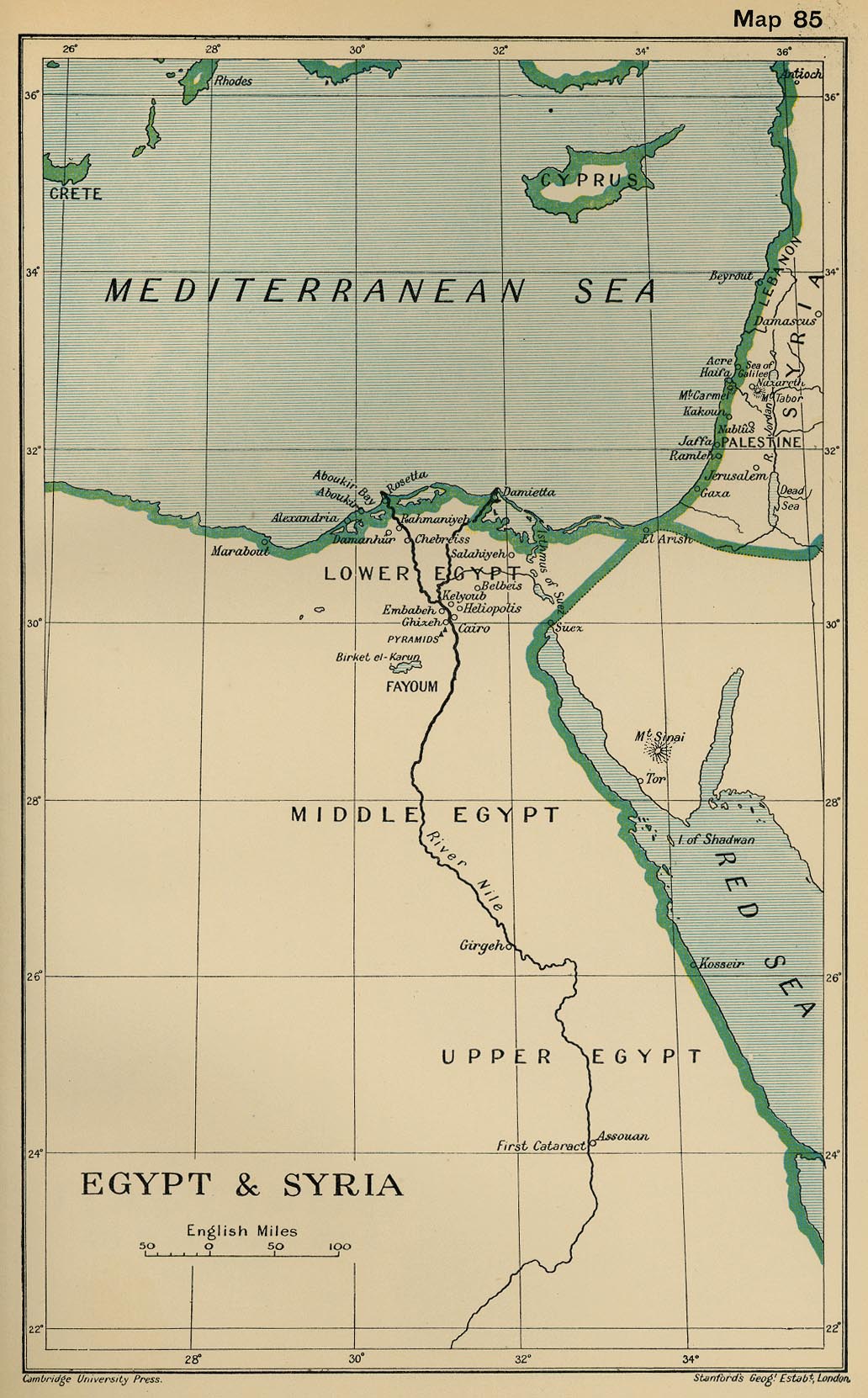
Egypt and Syria
(Cambridge Modern History Atlas, 1912)
Italy in 1799. Theatres of War in Italy
(Droysens Allgemeiner Historischer Handatlas, 1886)
Italy in 1799
(Cambridge Modern History Atlas, 1912)
European Waters: Naval Wars 1792-1815
(Cambridge Modern History Atlas, 1912)
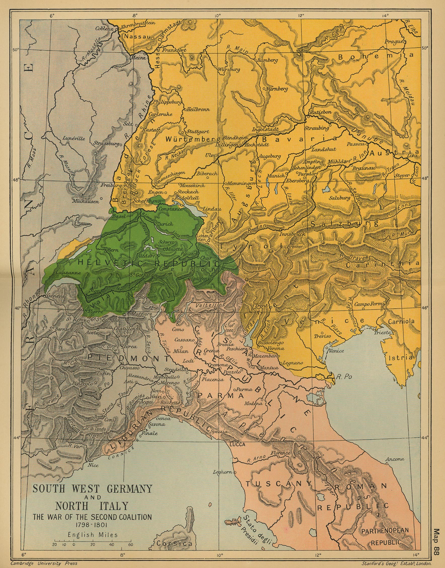
South West Germany and North Italy: The War of the Second Coalition 1798-1801
(Cambridge..., 1912)
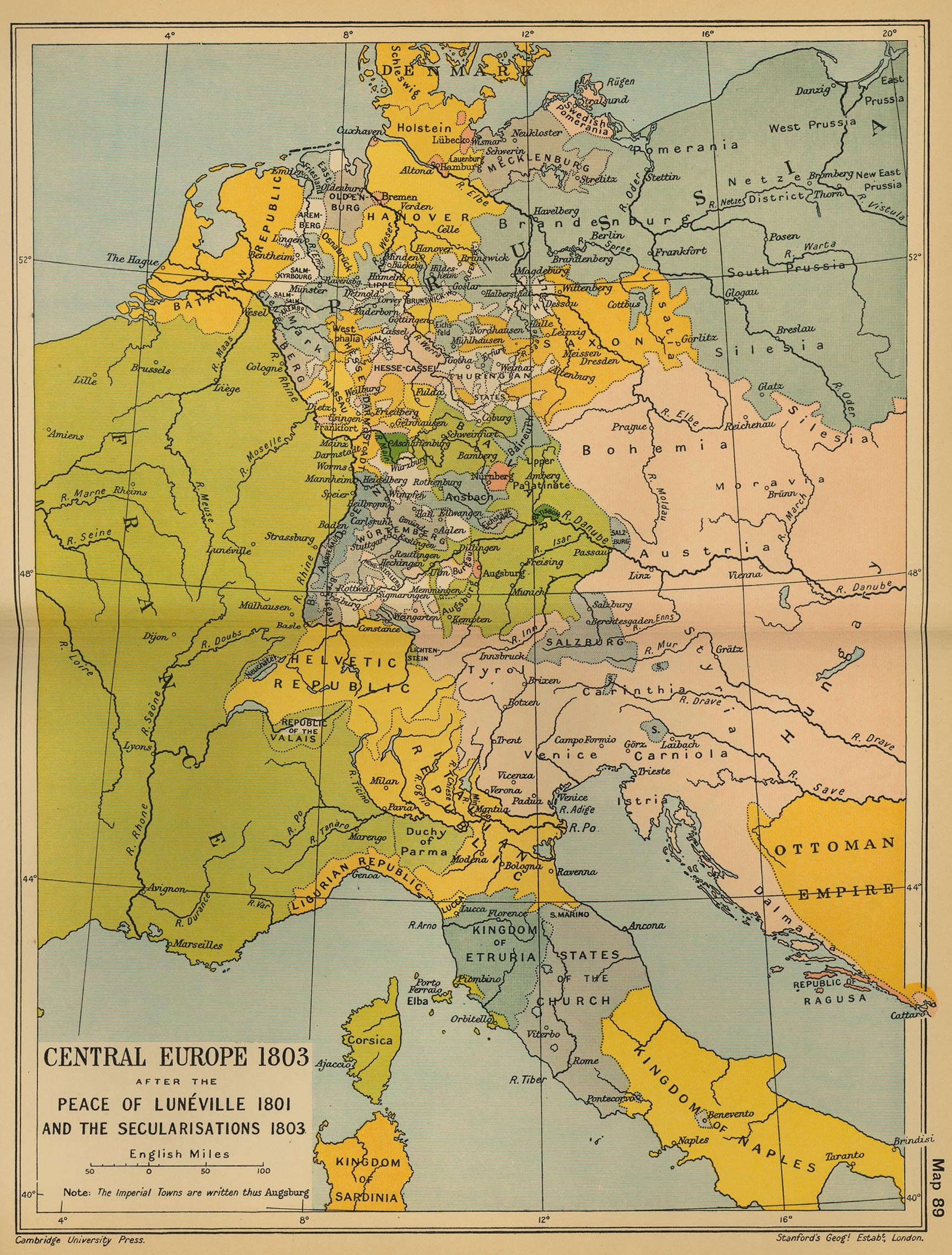
Central Europe, 1803
(Cambridge Modern History Atlas, 1912)
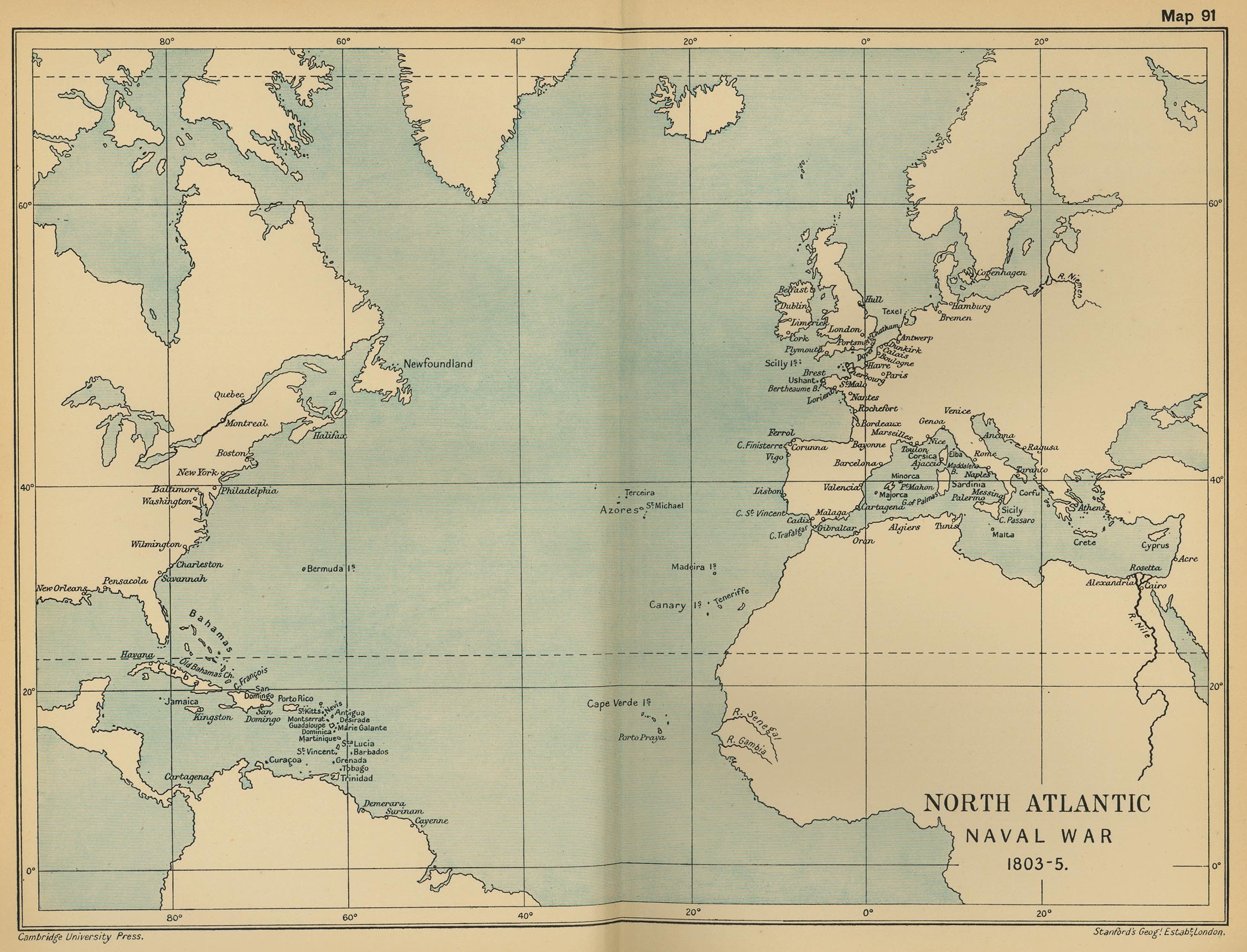
North Atlantic Naval War 1803-1805
(Cambridge Modern History Atlas, 1912)
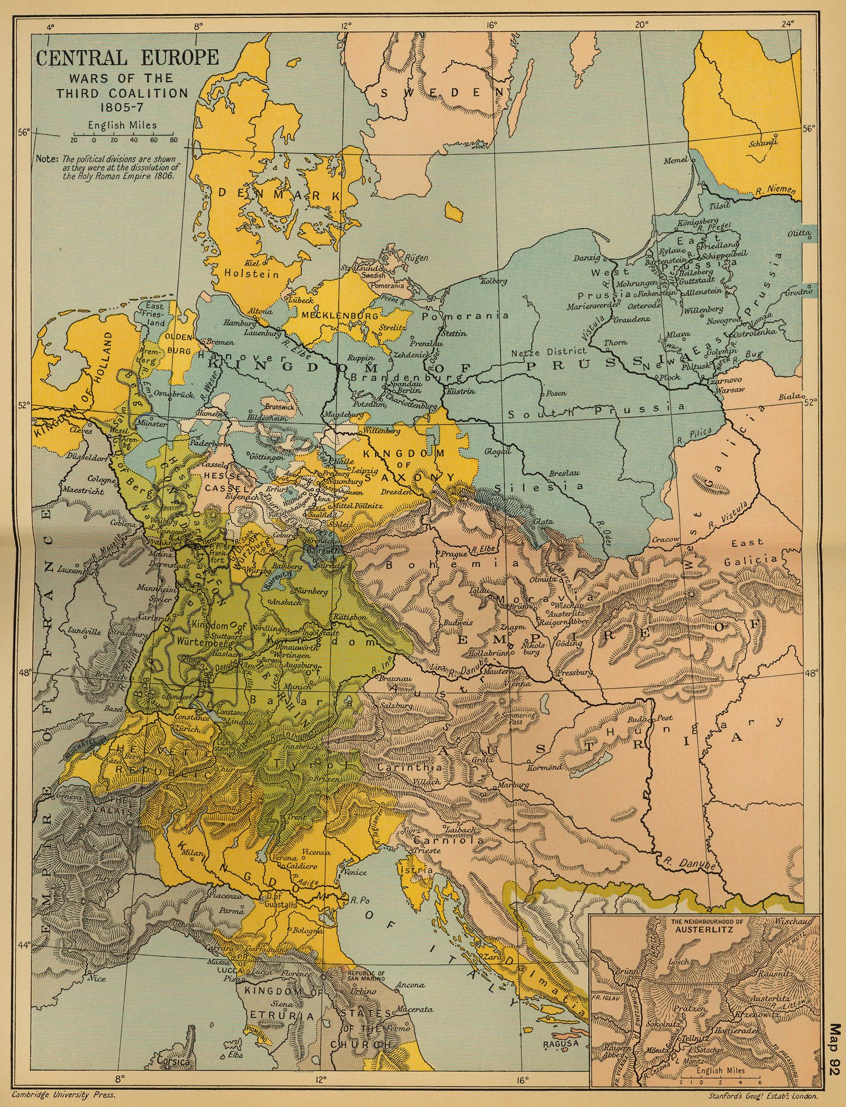
Central Europe: Wars of the Third Coalition, 1805-1807
(Cambridge Modern History Atlas, 1912)
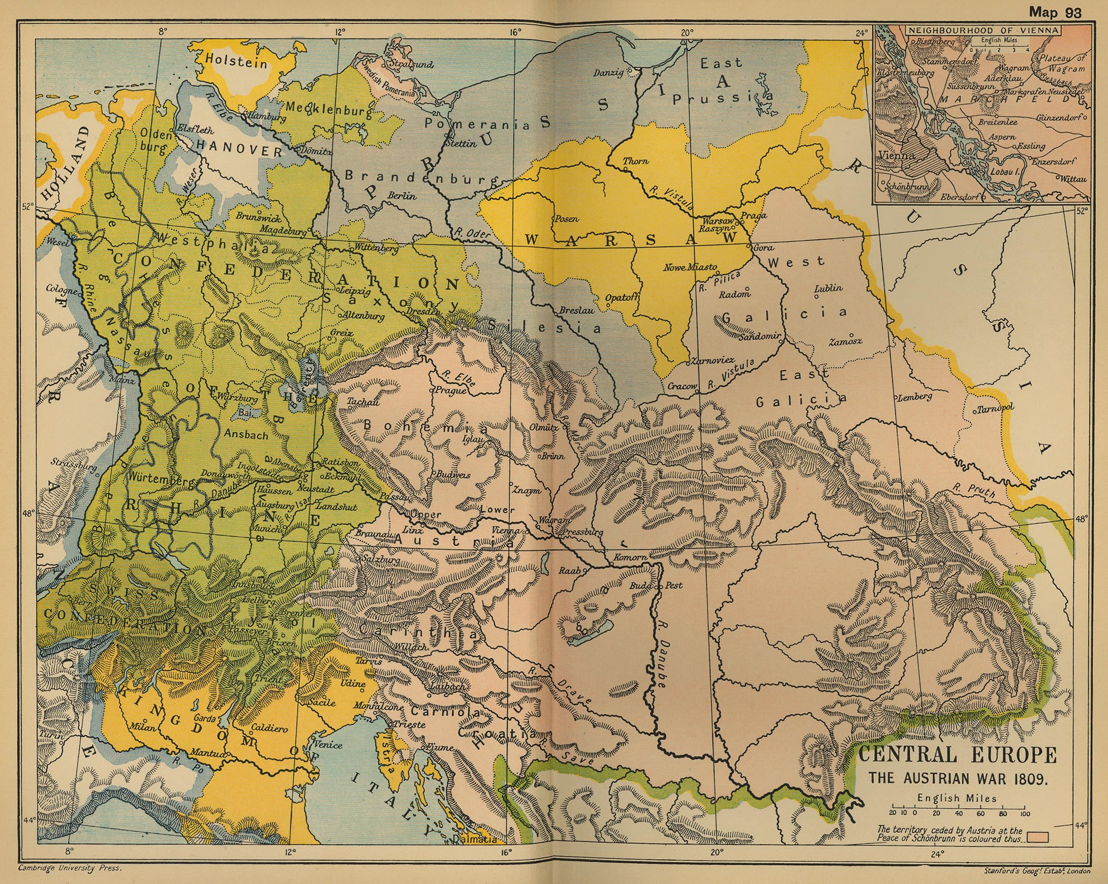
Central Europe: The Austrian War, 1809
(Cambridge Modern History Atlas, 1912)
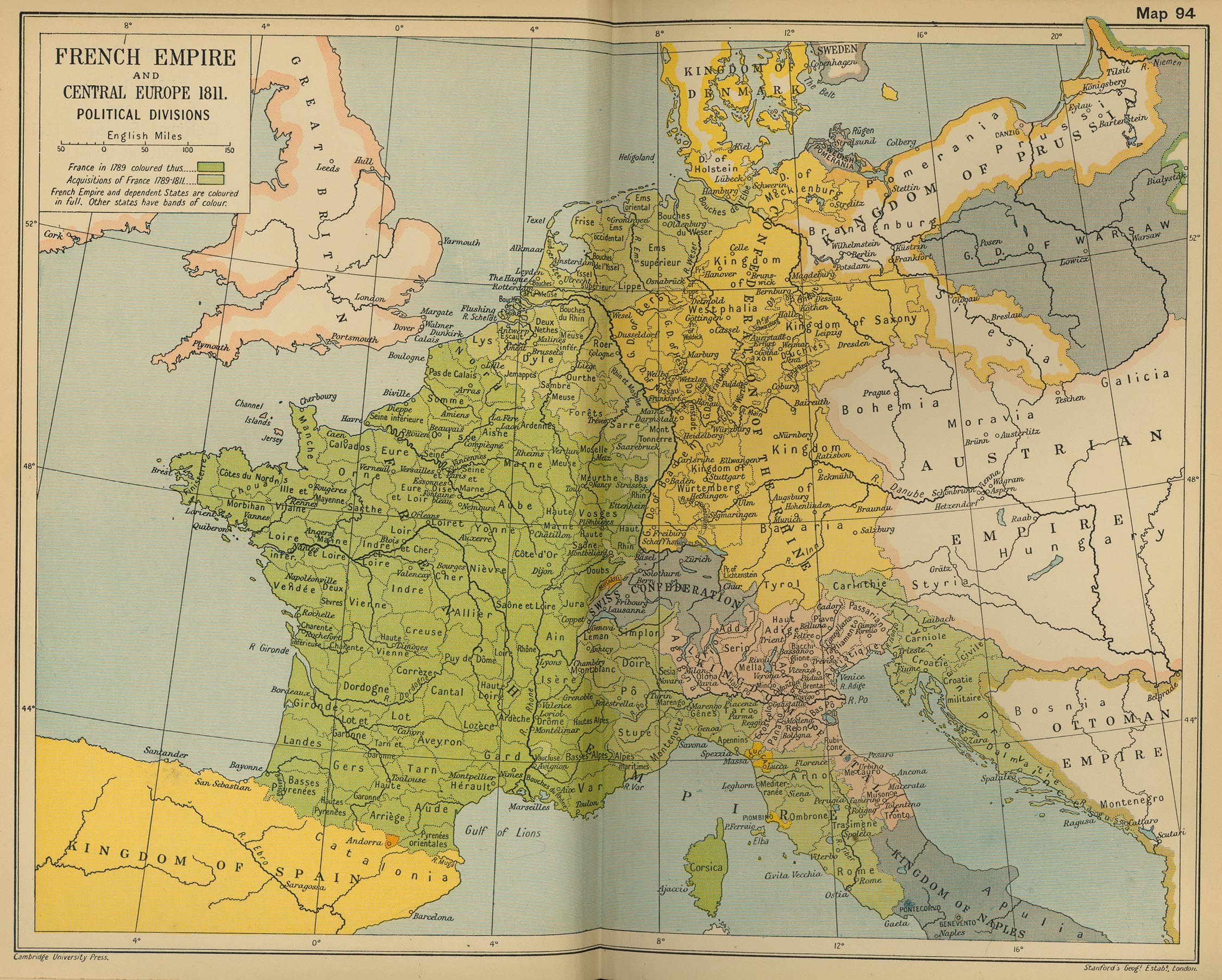
French Empire and Central Europe, 1811
(Cambridge Modern History Atlas, 1912)
Europe at the Time of Napoleon’s Major Reorganisation
(Droysens Allgemeiner Historischer Handatlas, 1886)
L’Empire français en 1811
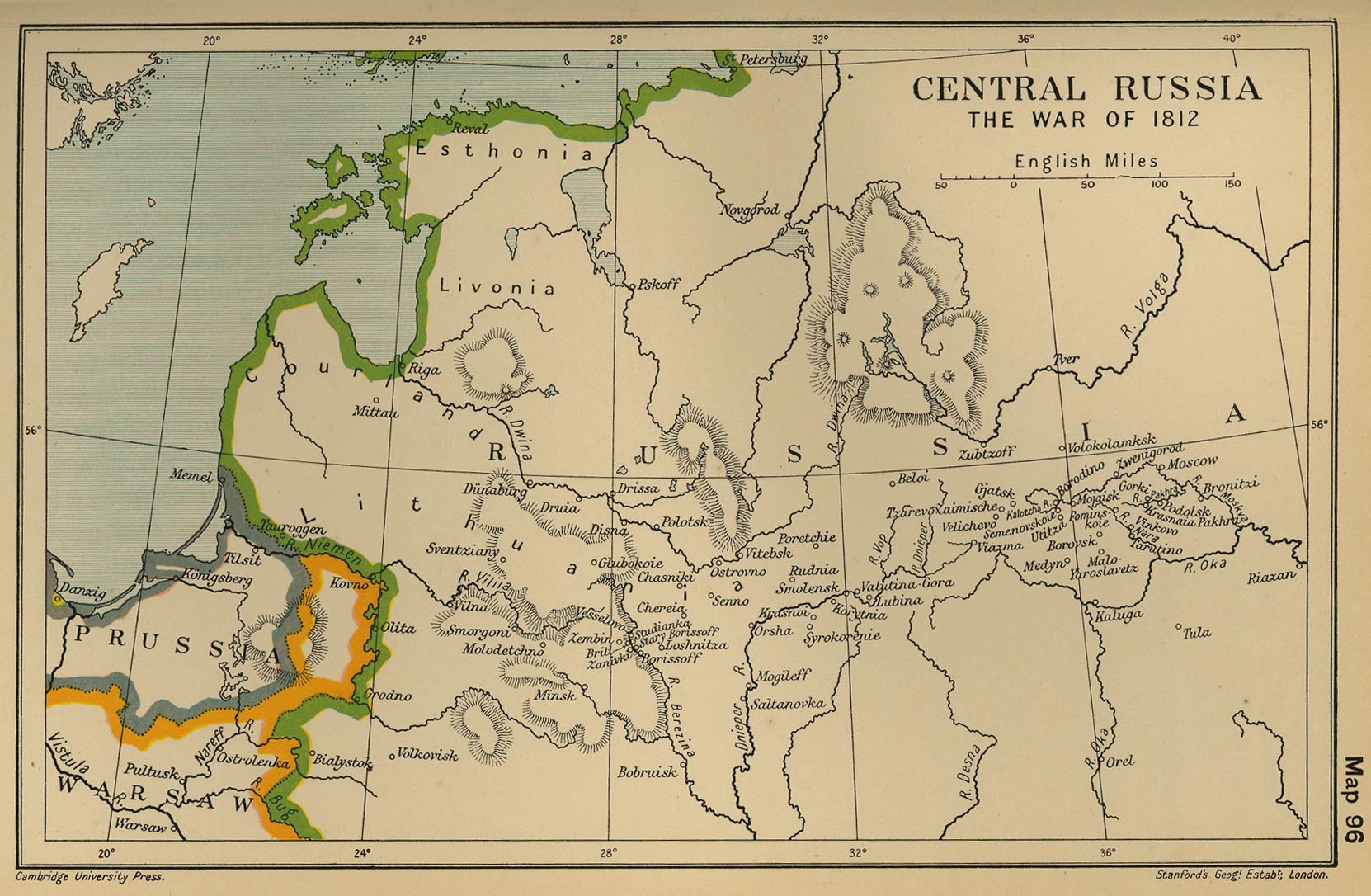
Central Russia: The War of 1812
(Cambridge Modern History Atlas, 1912)
Germany in 1812
(Droysens Allgemeiner Historischer Handatlas, 1886)
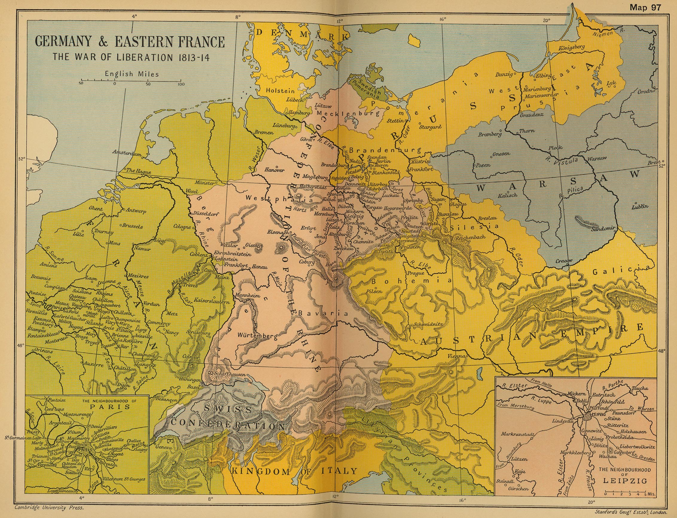
Germany and Eastern France: The War of Liberation 1813-1814
(Cambridge Modern History Atlas, 1912)
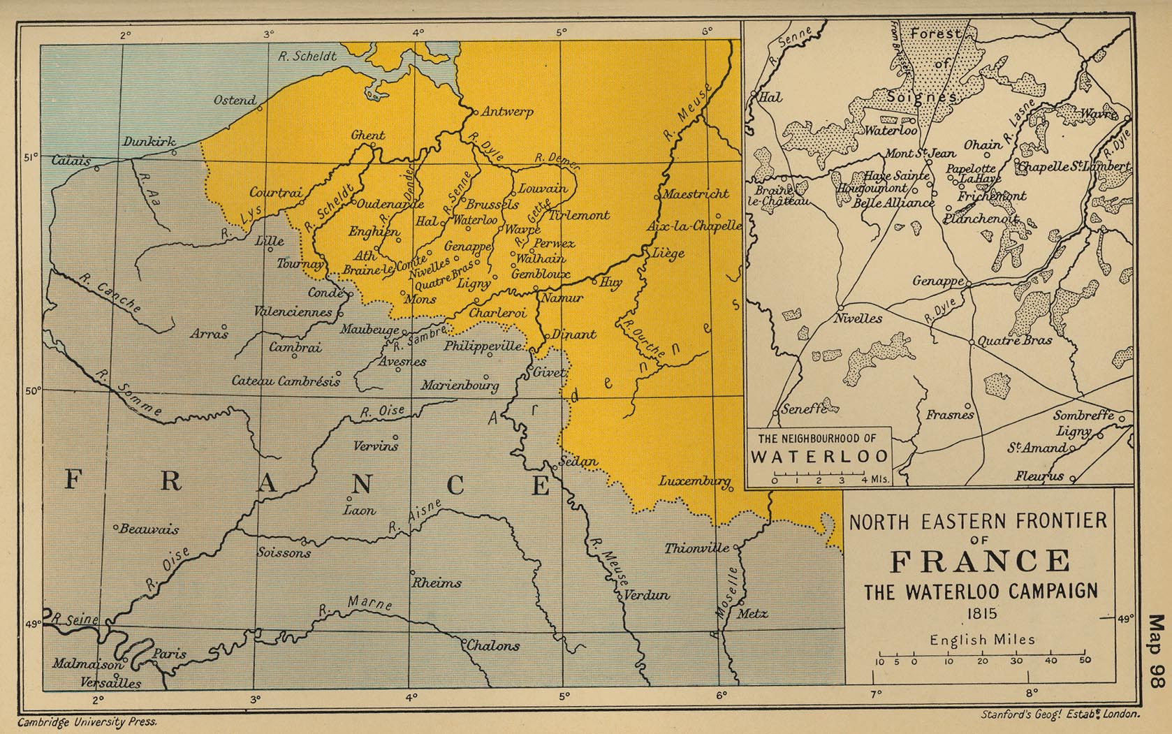
North Eastern Frontier of France: The Waterloo Campaign
(Cambridge Modern History Atlas, 1912)
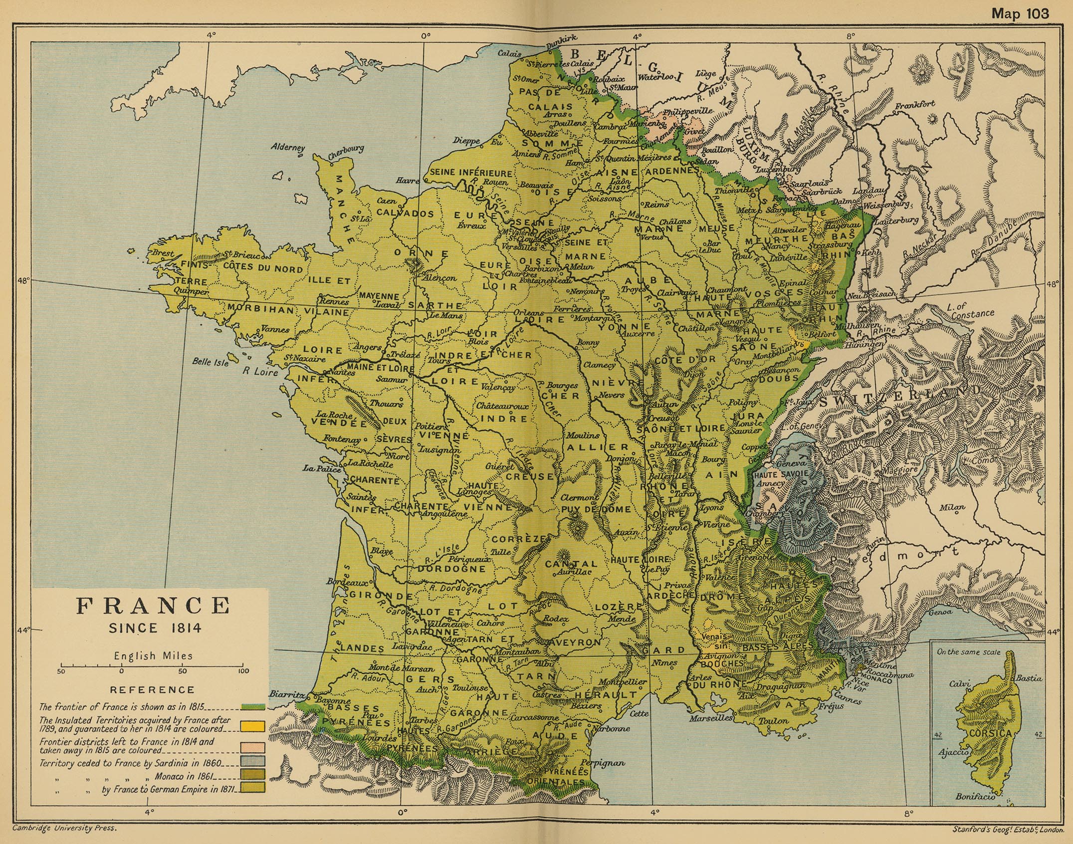
France since 1814
(Cambridge Modern History Atlas, 1912)
France, 1832
(John Dower)
The Franco-Prussian War (1870-1871) a
(Droysens Allgemeiner Historischer Handatlas, 1886)
The Franco-Prussian War (1870-1871) b
(Droysens Allgemeiner Historischer Handatlas, 1886)
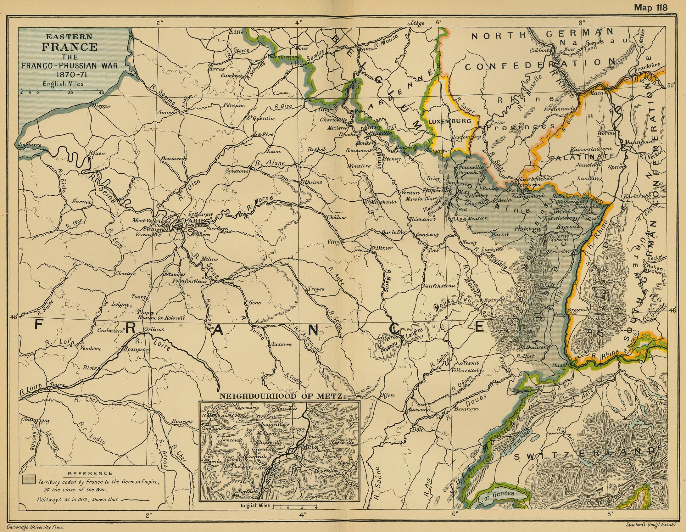
Eastern France: The Franco-Prussian War 1870-1871
(Cambridge Modern History Atlas, 1912)
Territoires cédés à l’Allemagne (1871)
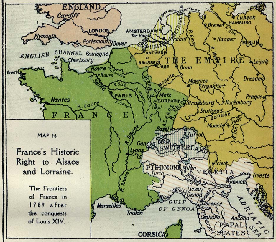
France’s Historic Right to Alsace and Lorraine (The Frontiers of France in 1789 after the Conquests of Louis XIV)
L’Alsace dans les deux guerres mondiales
Le tour de France (Itinéraire d’André et Julien)
Disputed Boundaries of the Rhine Frontier
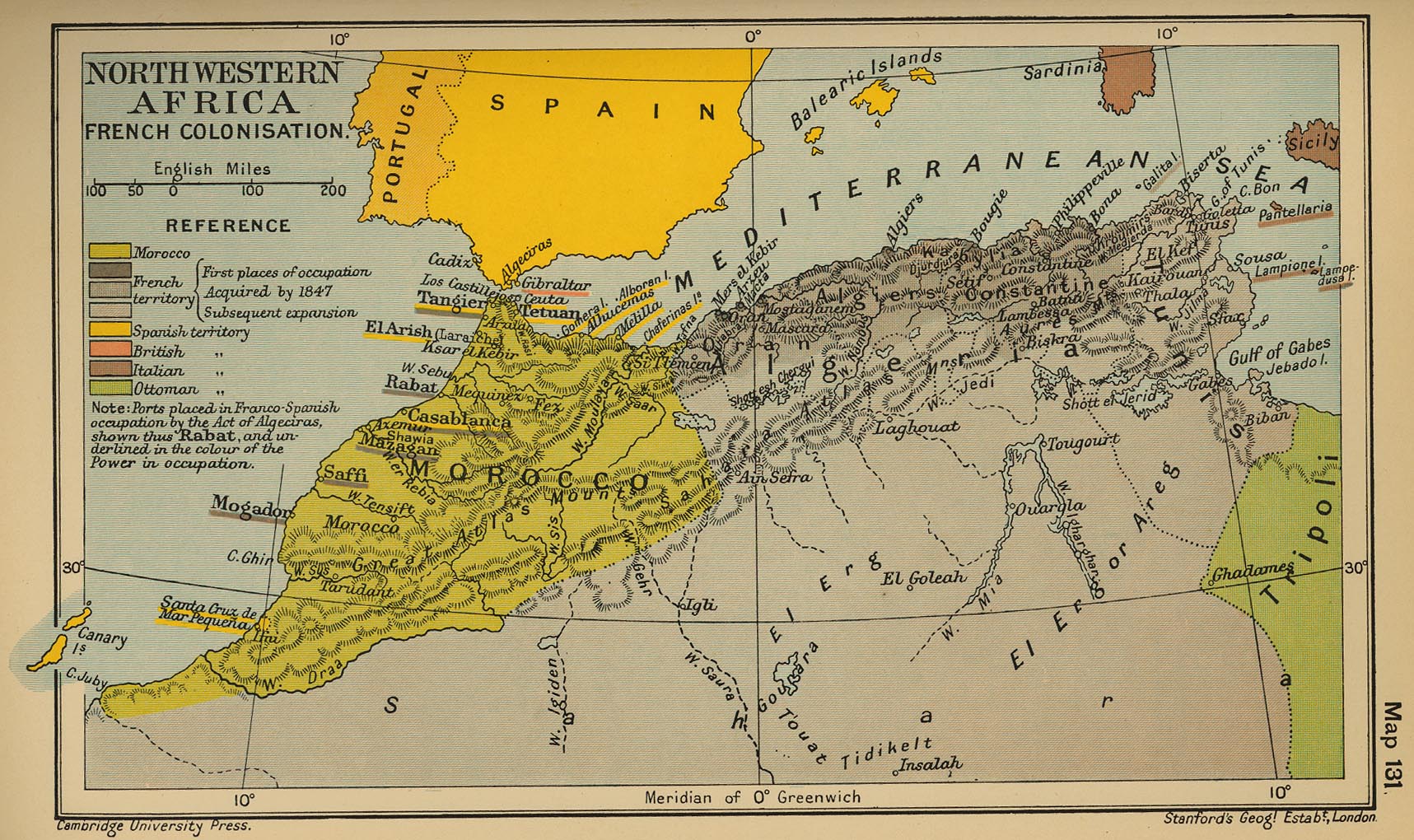
Northwestern Africa French Colonisation
(Cambridge Modern History Atlas, 1912)
Afrique septentrionale française (Afrique du nord), 1922
Afrique du nord, 1934 - cartes physique et politique
La France occupée
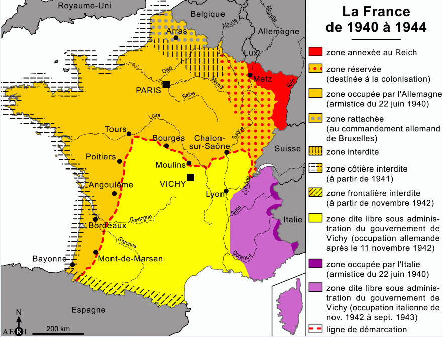
La France de 1940 à 1944
France, 1942: Carte départamentale avec délimitations des nouvelles régions
La guerre d’Algérie, 1954-1962
(larousse.fr)
French History on Maps
La Gaule en 481
La Gaule en 486-511
La Gaule en 511
Roy. des Francs en 548
Roy. des Francs en 561
Roy. des Francs en 567
Roy. des Francs en 581
Roy. des Francs en 628
Old School History Maps
Gaule en 481
Gaule en 511
Gaule en 561
Gaule en 587
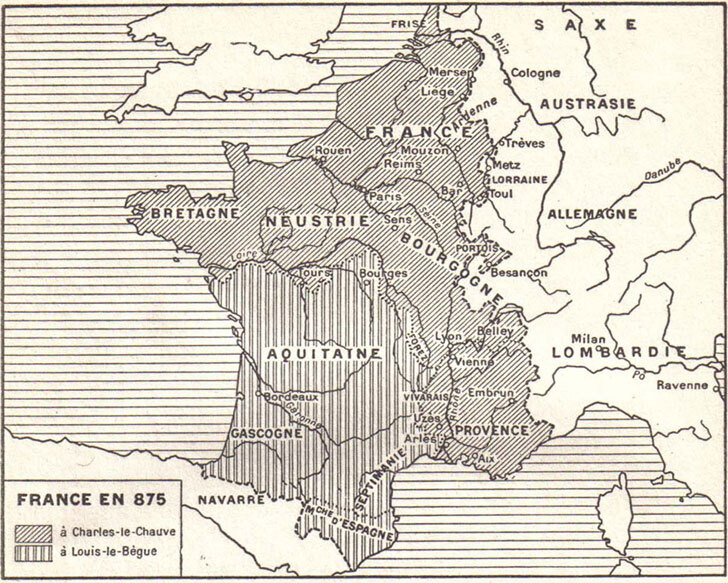
France en 875
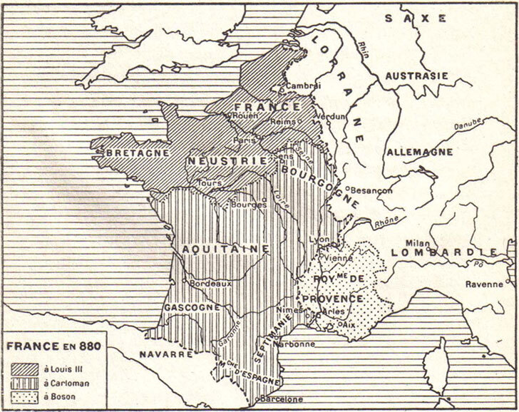
France en 880
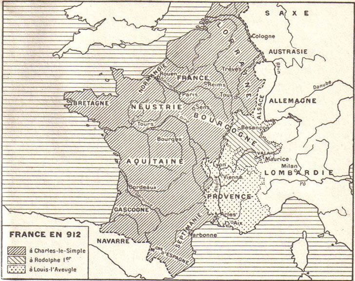
France en 912
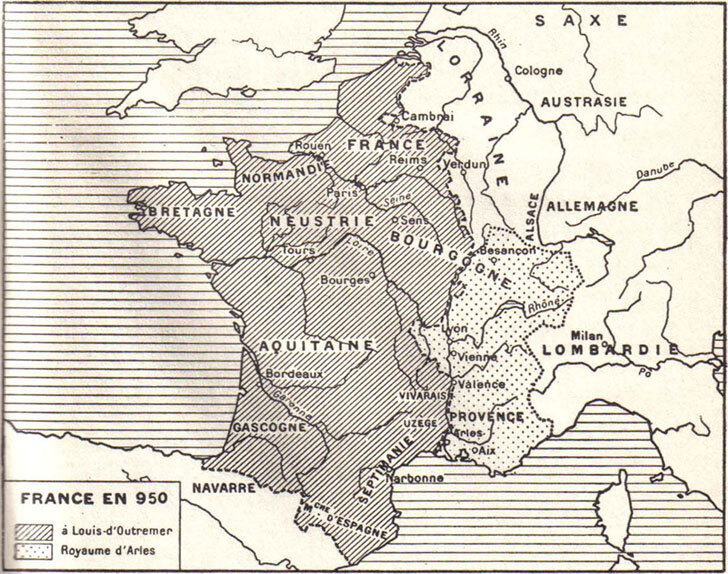
France en 950


