Skip to main content
Home
Historical Maps
World History
U.S. History
Canadian History
Canada (English)
Canada (Français)
Old school history maps
Stories on the Map
Armenia
Assyria
Catalonia
Kurdistan
Palestine
Ukraine
Edmaps +
HISTORICAL MAPS OF THE ROMAN EMPIRE
Map Collections and Atlases
Atlas of Ancient and Classical Geography
(J. M. Dent & Son, 1912)
40 maps that explain the Roman Empire
(vox.com)
Historical Maps of the Roman Empire
(University of Alabama)
Maps of Ancient Rome
Mapping Past Societies
(Harvard University)
Rappresentazioni Cartografiche Storiche della Città di Roma
(Geoportale cartografico - Roma Capitale)
The Roman Empire: 18 Centuries in 19 Maps
(Howard Wiseman)
The Provinces of the Roman Empire
Maps
Ancient Italy, 600-300 B.C.
(undevicesimus)
Plan of Rome - Neighbourhood of Rome
(Droysens Allgemeiner Historischer Handatlas, 1886)
Plan of Republican Rome
(William Shepherd, Historical Atlas, 1926)
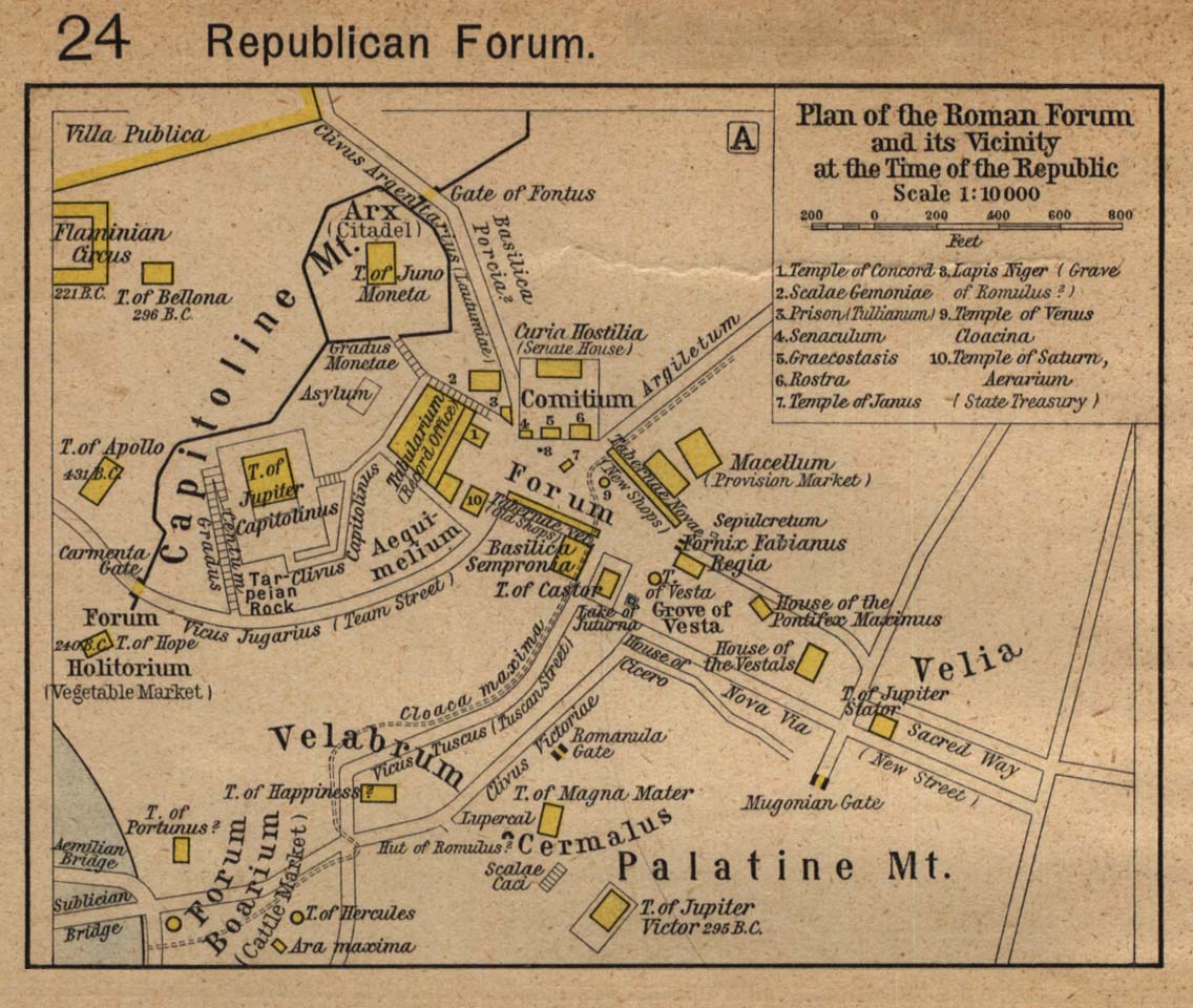
Plan of the Roman Forum and its Vicinity at the Time of the Republic
(William Shepherd, Historical Atlas, 1923)
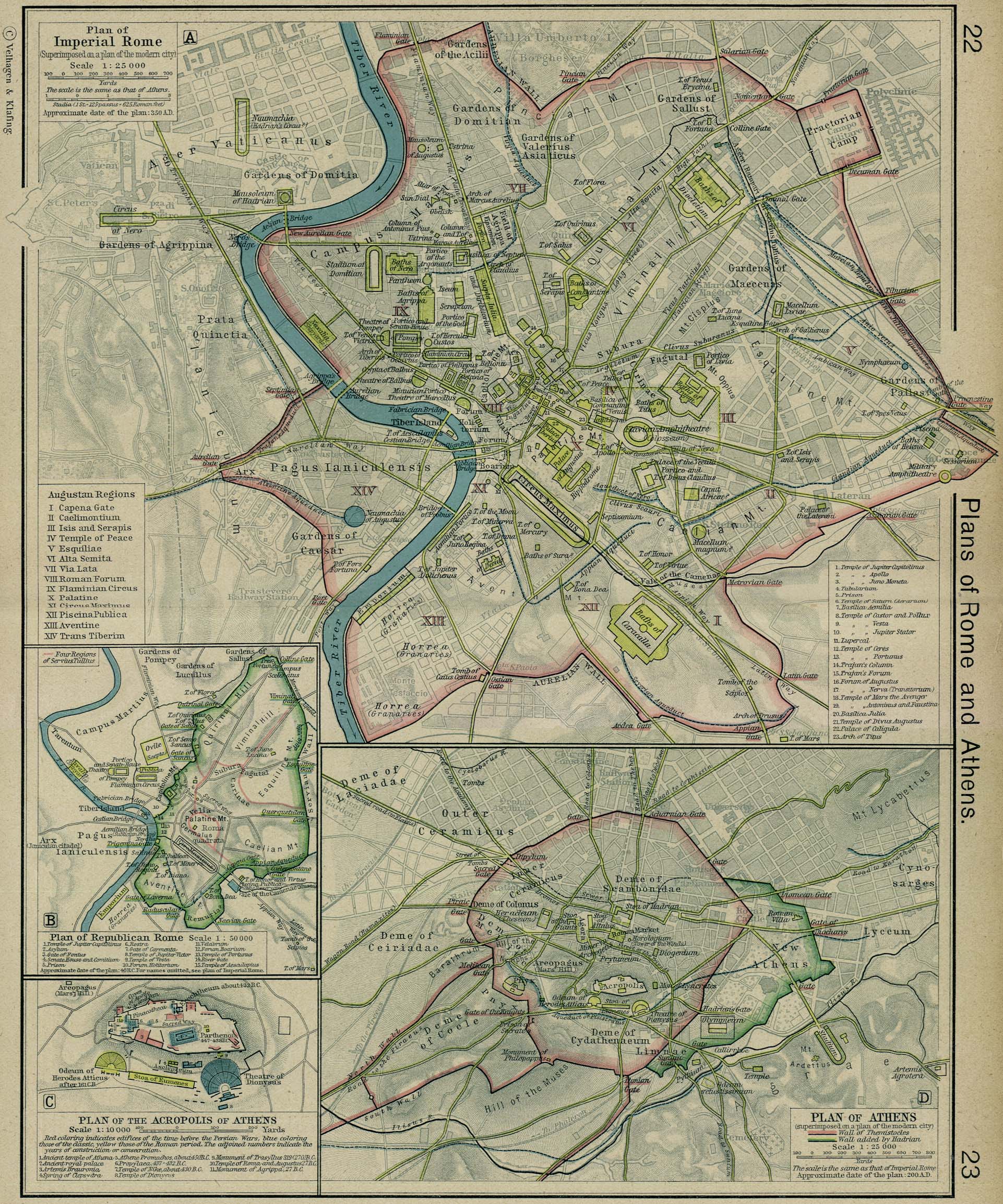
Plan of Imperial Rome
(William Shepherd, Historical Atlas, 1926)
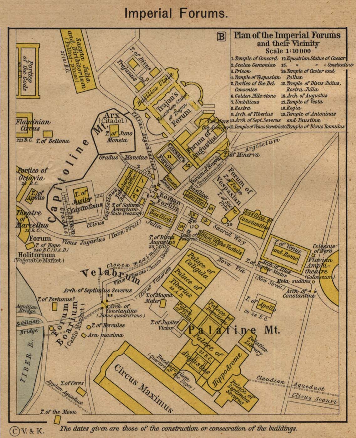
Plan of the Imperial Forums and their Vicinity
(William Shepherd, Historical Atlas, 1923)
Italy
(Droysens Allgemeiner Historischer Handatlas, 1886)
Italie ancienne a
(Vidal-Lablache, Atlas général d'histoire..., 1912)
Italie ancienne b
(Vidal-Lablache, Atlas général d'histoire..., 1912)
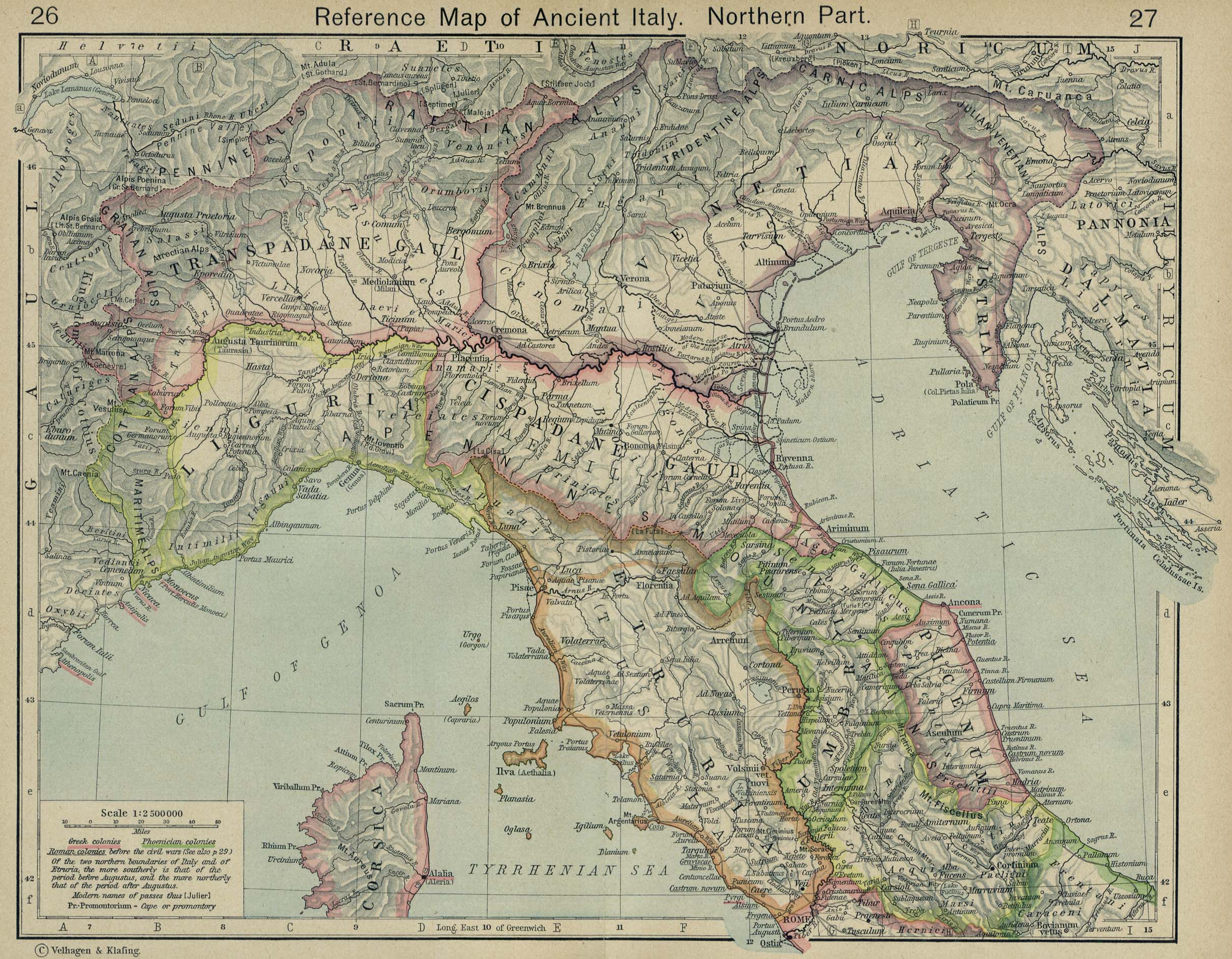
Reference Map of Ancient Italy (Northern Part)
(William Shepherd, Historical Atlas, 1926)
Reference Map of Ancient Italy (Southern Part)
(William Shepherd, Historical Atlas, 1926)
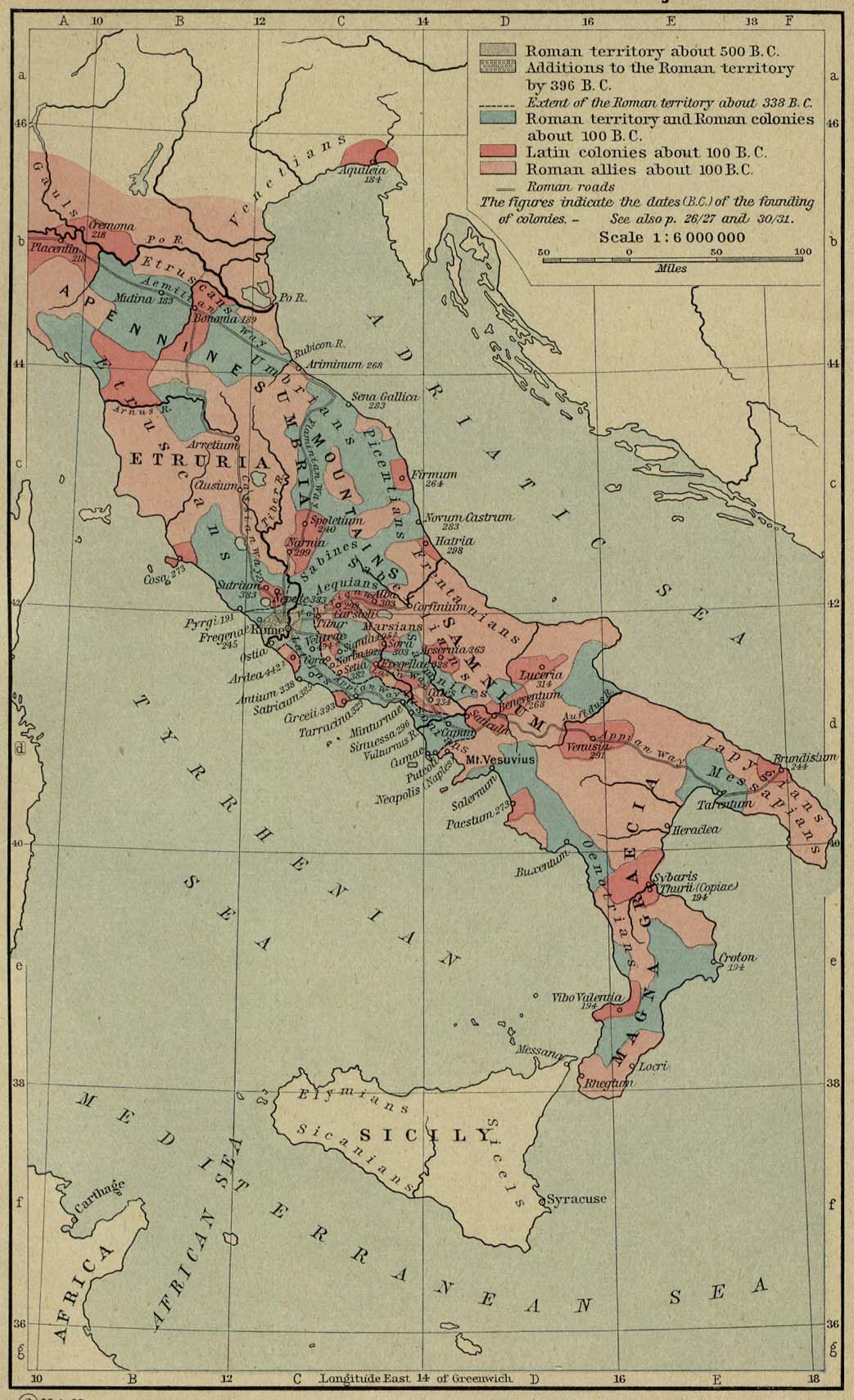
The Growth of Roman Power in Italy
(William Shepherd, Historical Atlas, 1926)
The Spread of Roman Rule up to 218 B.C.
(Putzgers Historischer Weltatlas, 1923)
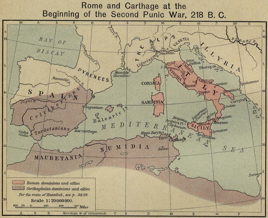
Rome and Carthage at the Beginning of the Second Punic War, 218 B.C.
(William Shepherd, Historical Atlas, 1926)
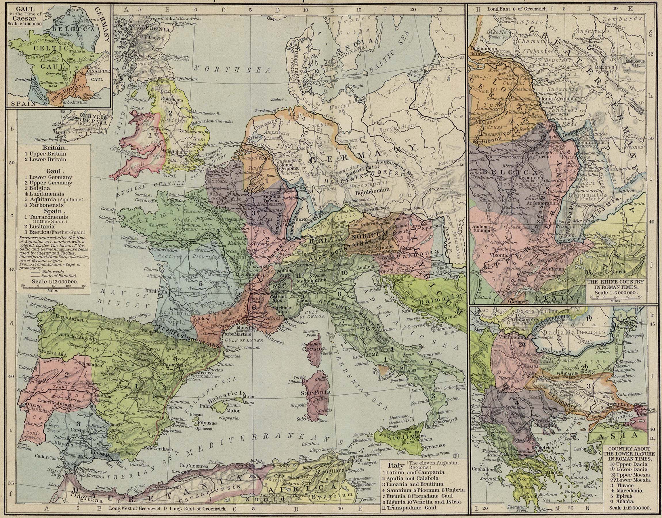
Territorial Expansion of Rome
(William Shepherd, Historical Atlas, 1926)
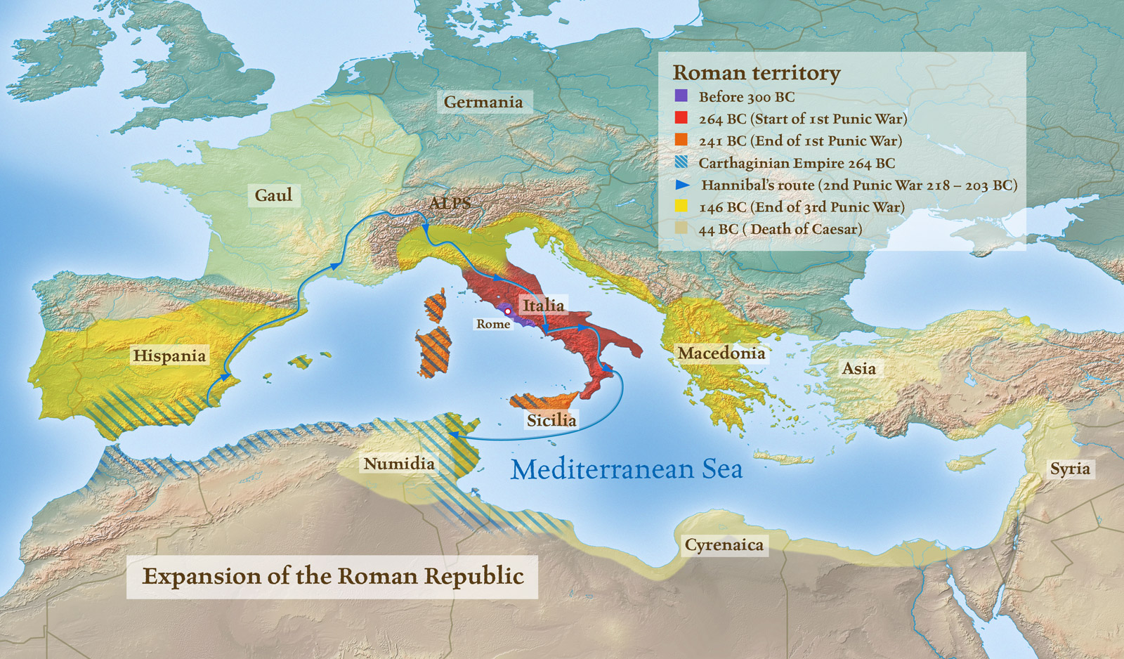
Expansion of the Roman Republic
Roman Territories
Hannibal crossing of the Alps. Lake Trasimene
(Putzgers Historischer Weltatlas, 1923)
Cannae
(Putzgers Historischer Weltatlas, 1923)
Growth of the Roman Empire
(Droysens Allgemeiner Historischer Handatlas, 1886)
Organisation de l’Empire romain du Ier au IIIe siècle
(Vidal-Lablache, Atlas général d'histoire et de géographie, 1912)
Organisation de l’Empire romain à partir de Dioclétien (284)
(Vidal-Lablache, Atlas gén. d'histoire et de géographie, 1912)
The Roman Empire under Diocletian, AD 284-305
European Provinces of the Roman Empire
(Putzgers Historischer Weltatlas, 1905)
Hispania, Mauretania et Africa
(H. Kiepert)
Reference Map of the European Provinces of the Roman Empire
(William Shepherd, Historical Atlas, 1926)
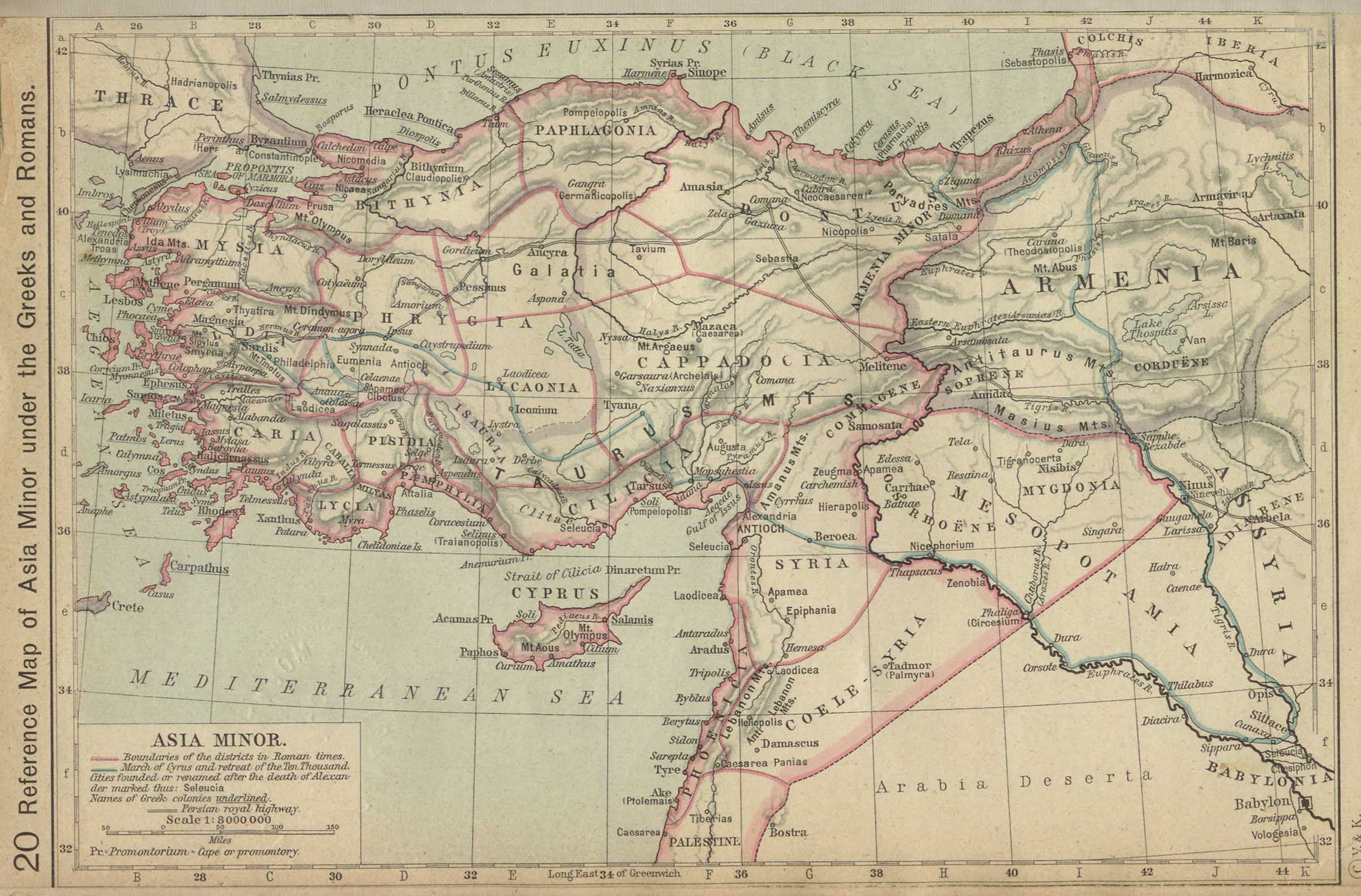
Reference Map of Asia Minor under the Greeks and Romans
(William Shepherd, Historical Atlas, 1923)
Asia Minor
(Droysens Allgemeiner Historischer Handatlas, 1886)
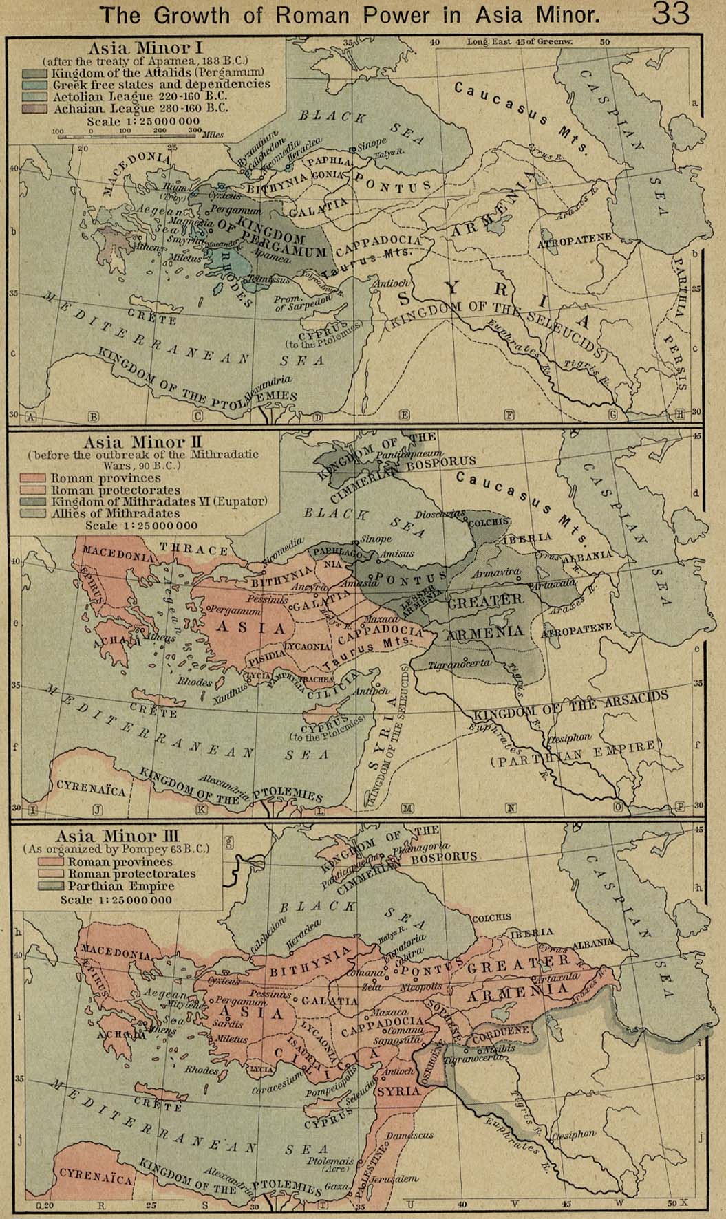
The Growth of Roman Power in Asia Minor
(William Shepherd, Historical Atlas, 1926)
Italy at the Gallic invasion. Britain
(Droysens Allgemeiner Historischer Handatlas, 1886)
Roman Britain, circa 400
(Charles Colbeck, The Public Schools Historical Atlas, 1905)
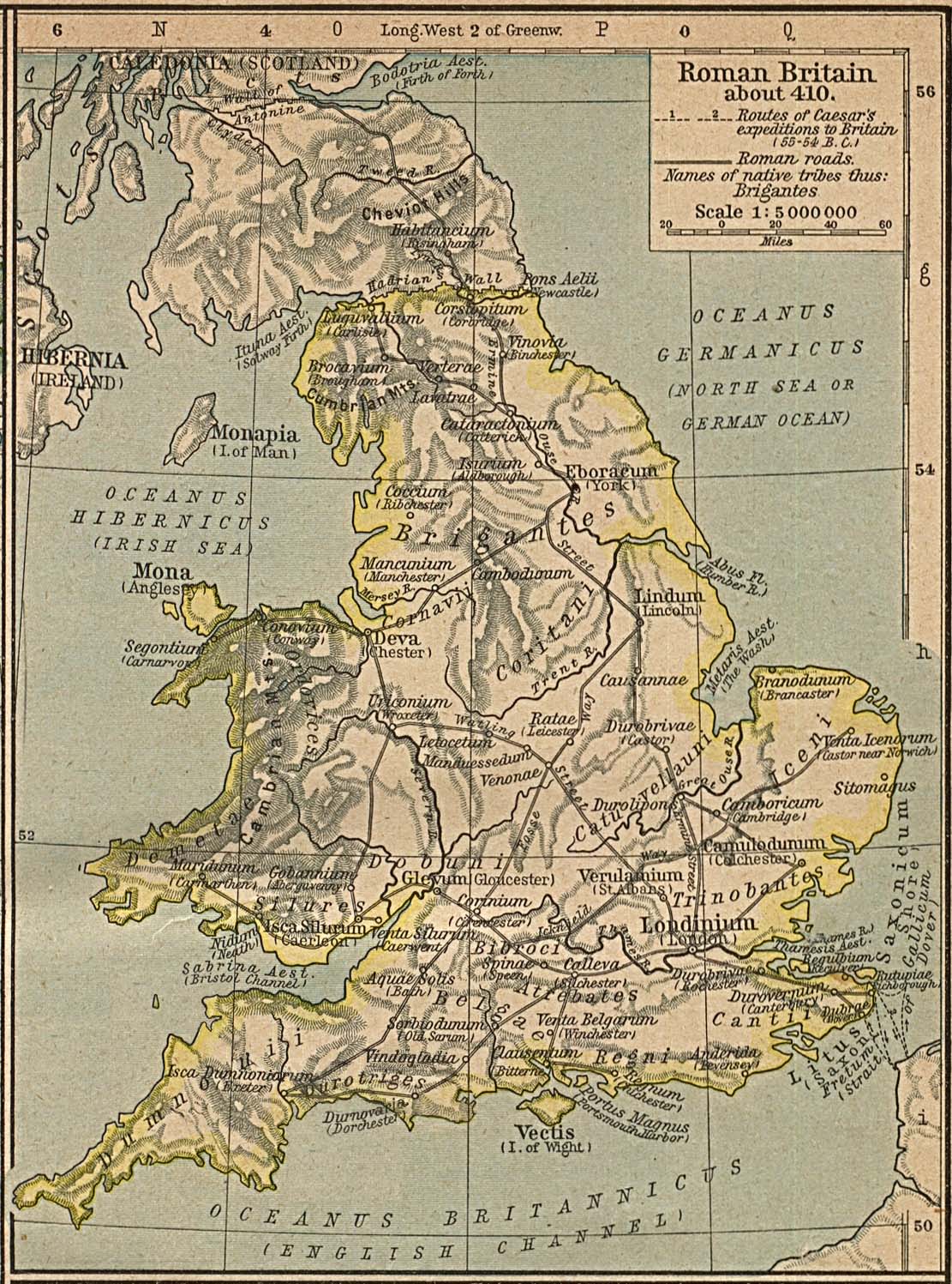
Roman Britain about 410
(William Shepherd, Historical Atlas, 1923)
North Africa
(Droysens Allgemeiner Historischer Handatlas, 1886)
North-west Africa
(Putzgers Historischer Weltatlas, 1923)
Gaul. Spain
(Droysens Allgemeiner Historischer Handatlas, 1886)
Gaul at the time of Caesar
(Putzgers Historischer Weltatlas, 1923)
The Lands of the Lower Danube in Roman Times. Germany
(Droysens Allgemeiner Historischer Handatlas, 1886)
Germanie ancienne
(Vidal-Lablache, Atlas général d'histoire et de géographie, 1912)
Roman Empire under Constantine
(thecollector.com)
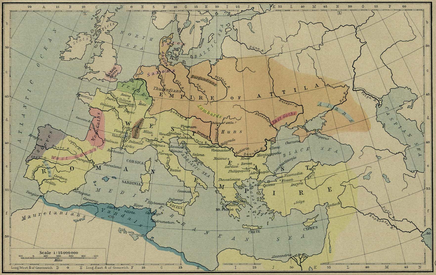
Europe at the Time of the Migrations
(Droysens Allgemeiner Historischer Handatlas, 1886)
The Roman and Hunnic Empires about 450
(William Shepherd, Historical Atlas, 1926)
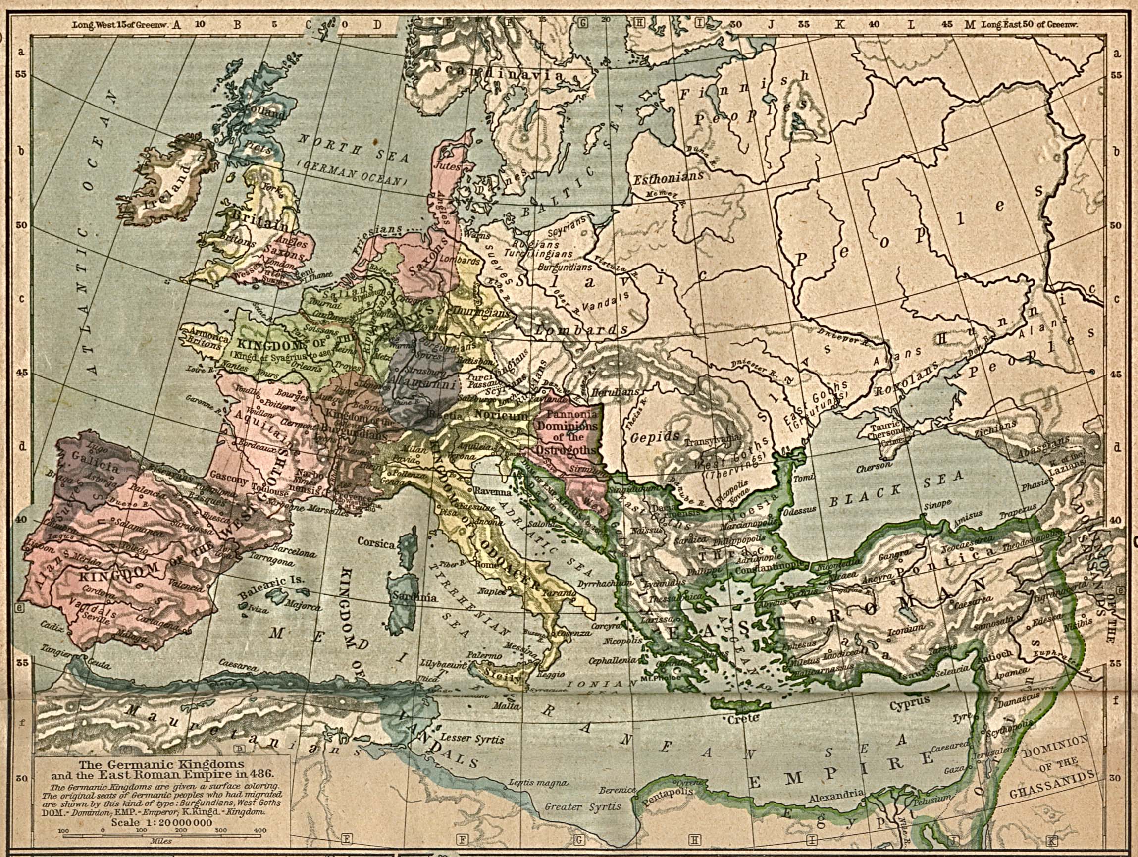
The Germanic Kingdoms and the East Roman Empire in 486
(William Shepherd, Historical Atlas, 1923)
The Germanic Kingdoms and the East Roman Empire in 526
(William Shepherd, Historical Atlas, 1926)
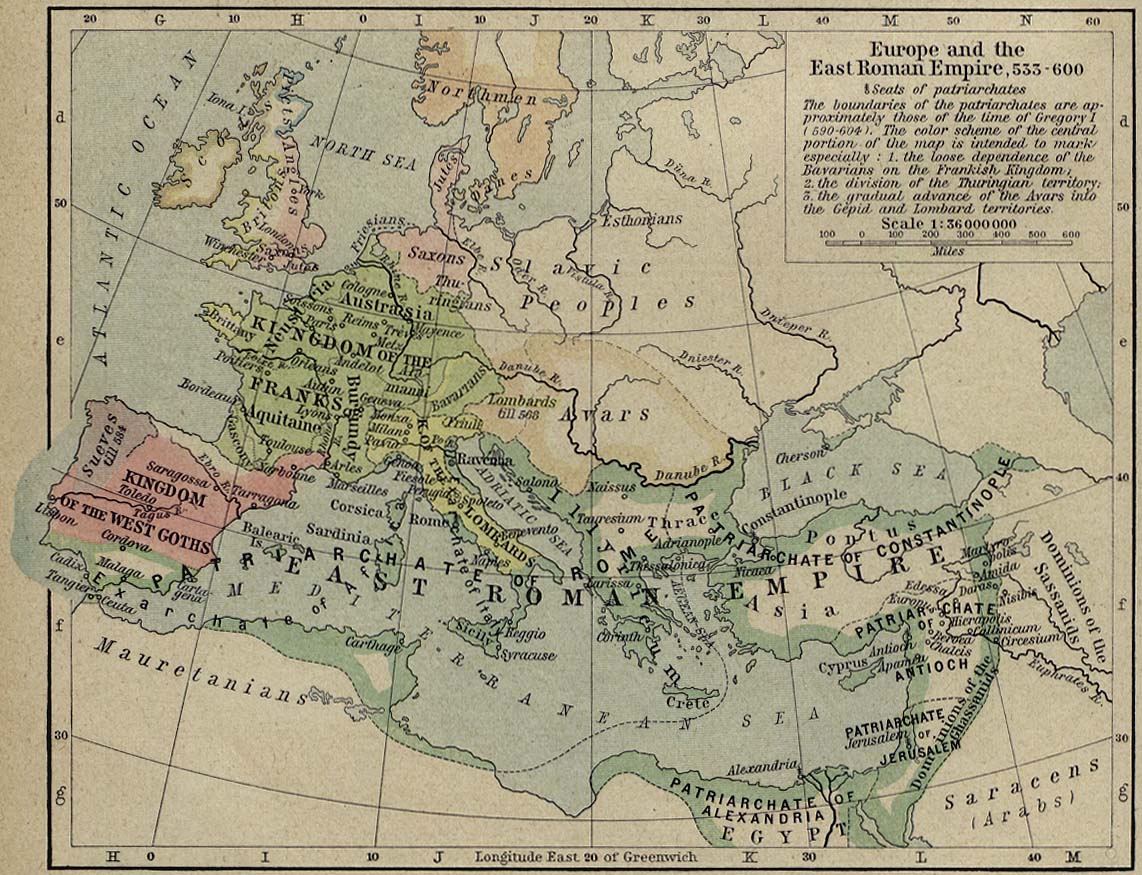
Europe and the East Roman Empire, 533-600
(William Shepherd, Historical Atlas, 1926)
Byzantine Empire, 1025 (at the Death of Basil II)
(thecollector.com)
Byzantine Empire, 1453 (before the Fall of Constantinople)
(thecollector.com)
World
Albania
France
Netherlands
Spain & Portugal
Caucasus
Latin America
Ancient Greece
Austria
Germany
Poland
Switzerland
Middle East
Mexico
Roman Empire
Britain
Greece
Romania
Türkiye
Asia
Canada
Holy Roman Empire
Bulgaria
Hungary
Scandinavia
Ukraine
China
U.S.A.
Europe
Croatia
Italy
Serbia
Russia
Japan
Australia

