Skip to main content
HISTORICAL MAPS OF BRITAIN
Map Collections and Atlases
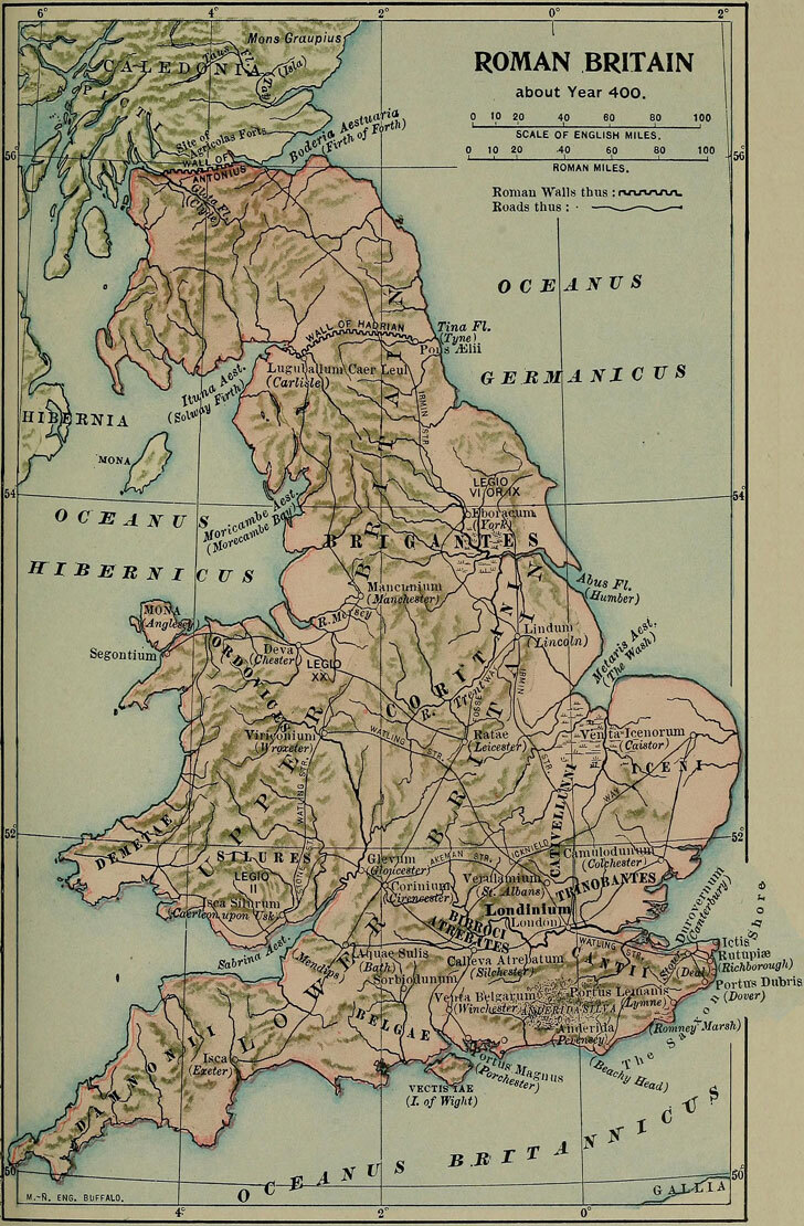
Maps of the Roman Britain
Maps of the Anglo-Saxon Kingdoms
- Anglo-Saxon Invasion of England, 4th and 5th Century CE
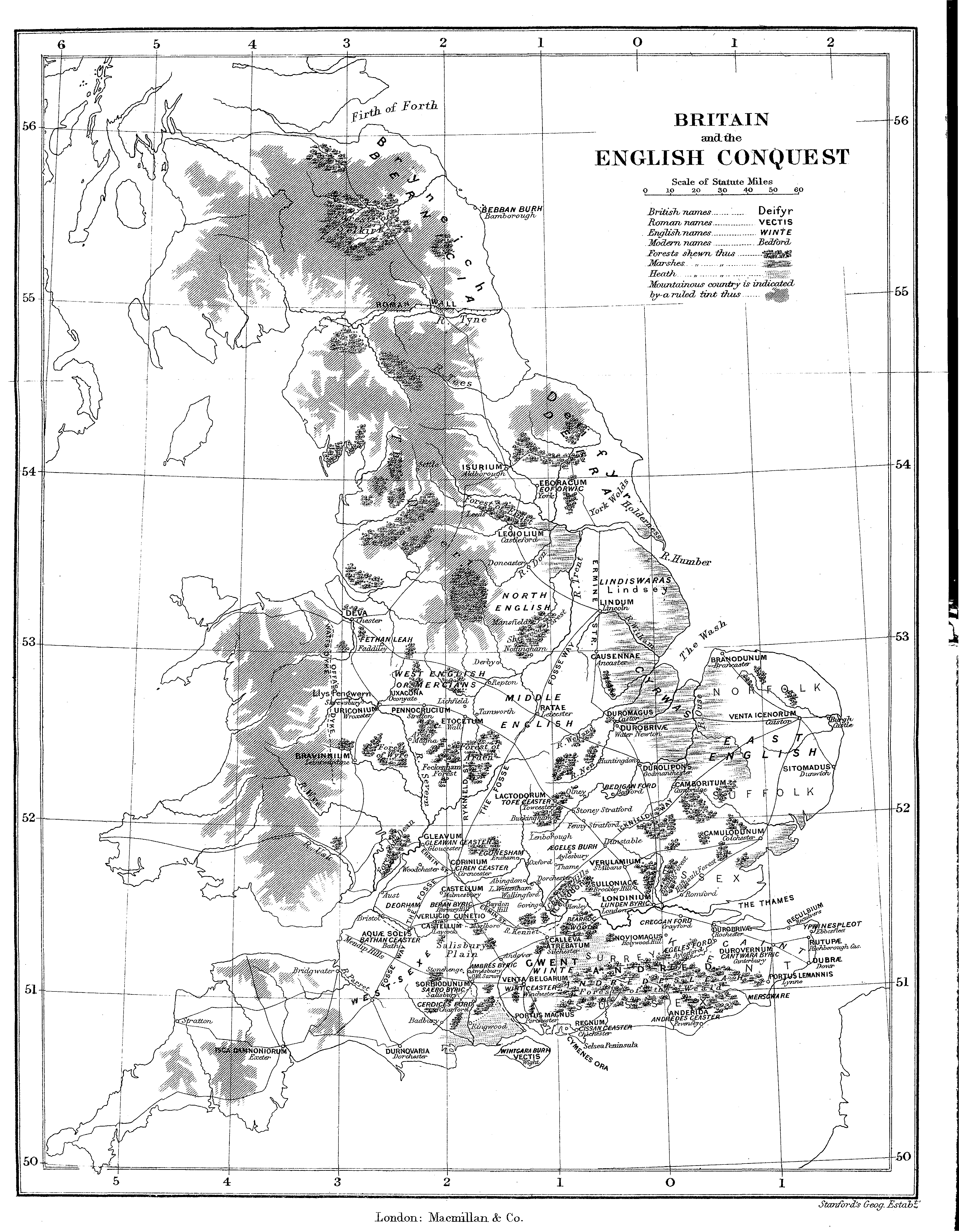
- Britain and the English Conquest
- England under the Anglo-Saxon Kings (Droysens Allgemeiner Historischer Handatlas, 1886)
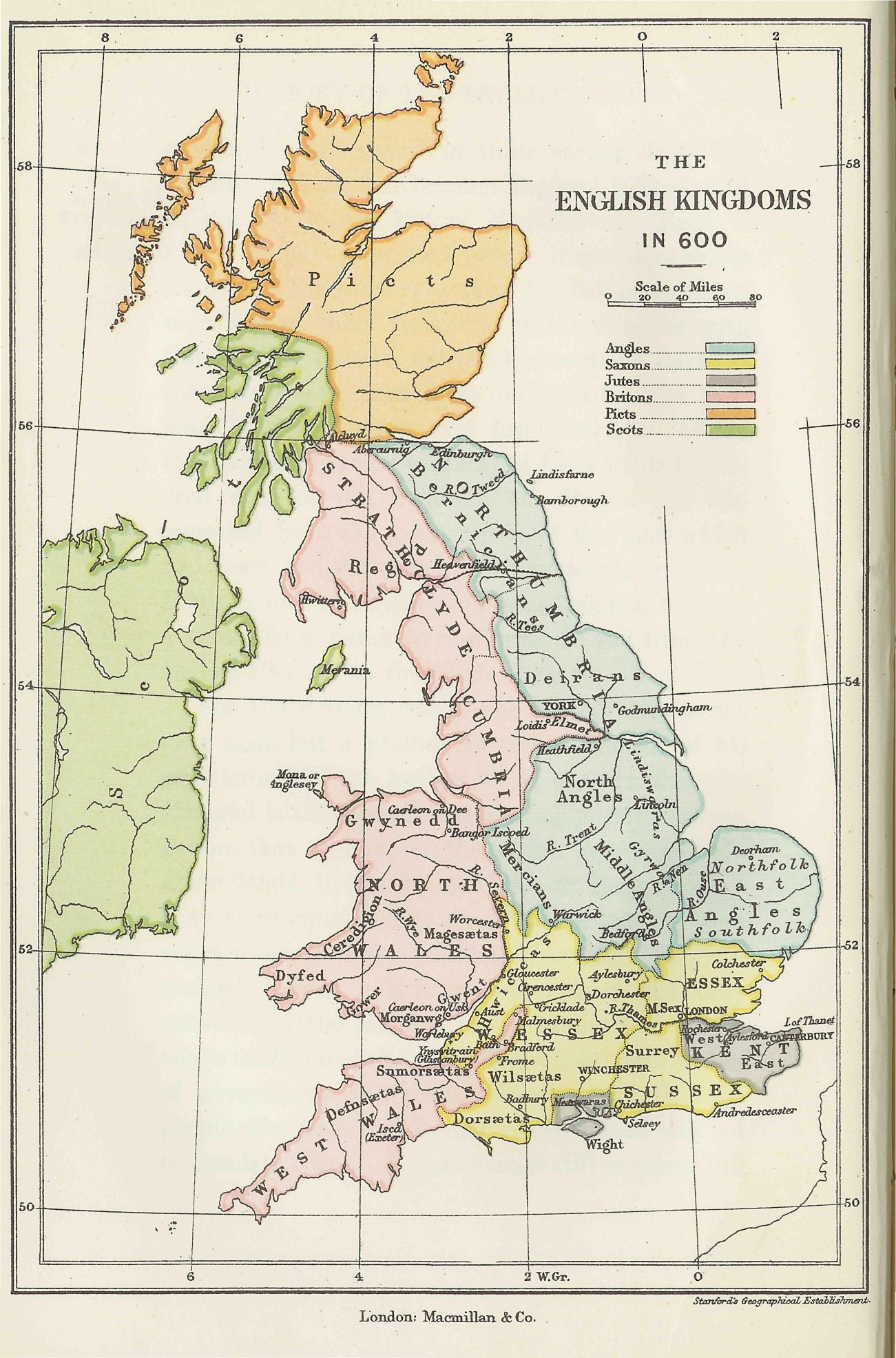
- The English Kingdoms in 600
- Southern England in the Eighth Century (Reginald Piggott)
- The Heptarchy (c. 700) (Reginald Piggott)
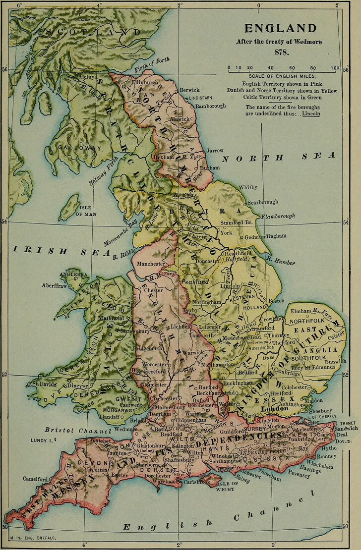
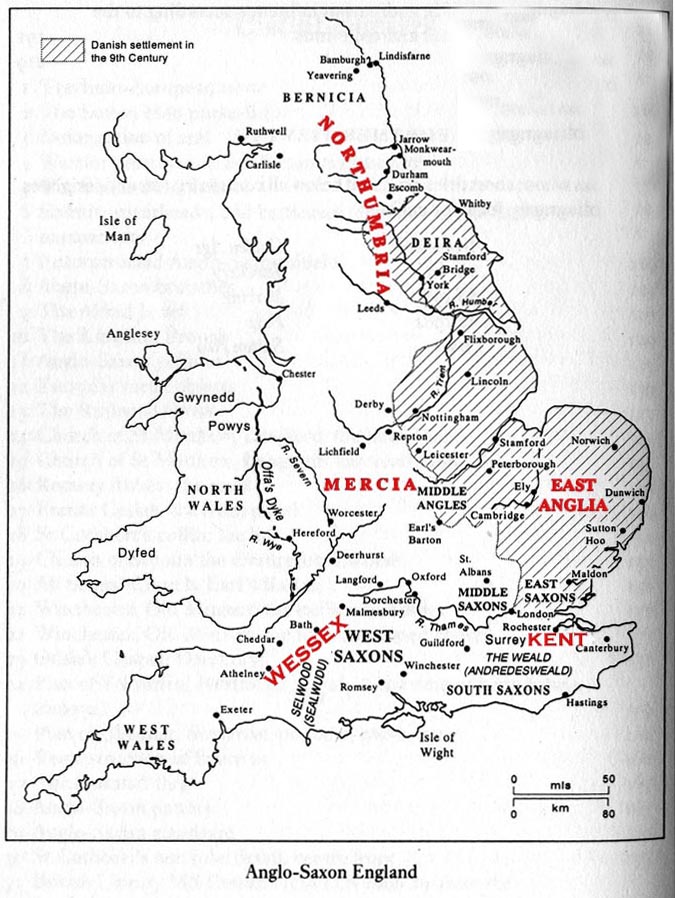
- Anglo-Saxon England
- Southern England in the Ninth Century (Reginald Piggott)
- The Mercian Supremacy (c. 800) (Reginald Piggott)
- The British Isles about 802 (William Shepherd, Historical Atlas, 1926)
- The Great Heathen Army of 865
- Alfred’s Kingdom of the Anglo-Saxons (Reginald Piggott)
- England During the Reign of Edward the Elder (899-924) (Reginald Piggott)
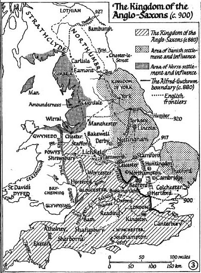
- The Kingdom of the Anglo-Saxons (c. 900) (Reginald Piggott)
- The Midlands, c. 912 (World History Encyclopedia)
- England During the Reign of King Ethelstan (924-939) (Reginald Piggott)
- Viking Campaigns in England, 991-1005 (Reginald Piggott)
- The Kingdom of the England (c. 1000) (Reginald Piggott)
- Southern England, c. 1000 (During the Reign of King Ethelred the Unready) (Reginald Piggott)
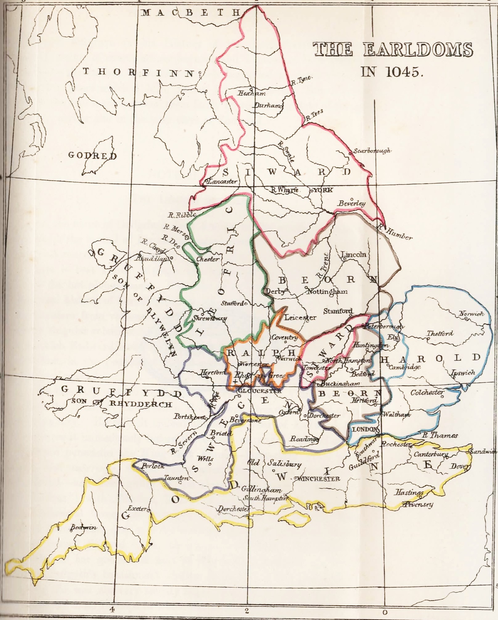
- The Earldoms in 1045
- England in 1065 (Gardiner’s Atlas of English History, 1914)
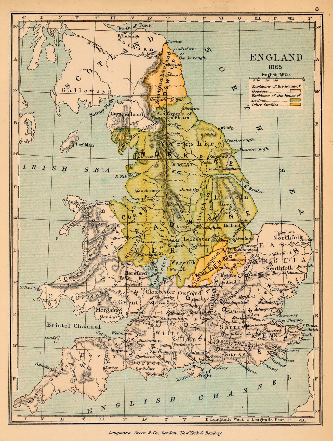
- England, 1065 (Charles Colbeck, The Public Schools Historical Atlas, 1905)
- England on the eve of the Norman conquest
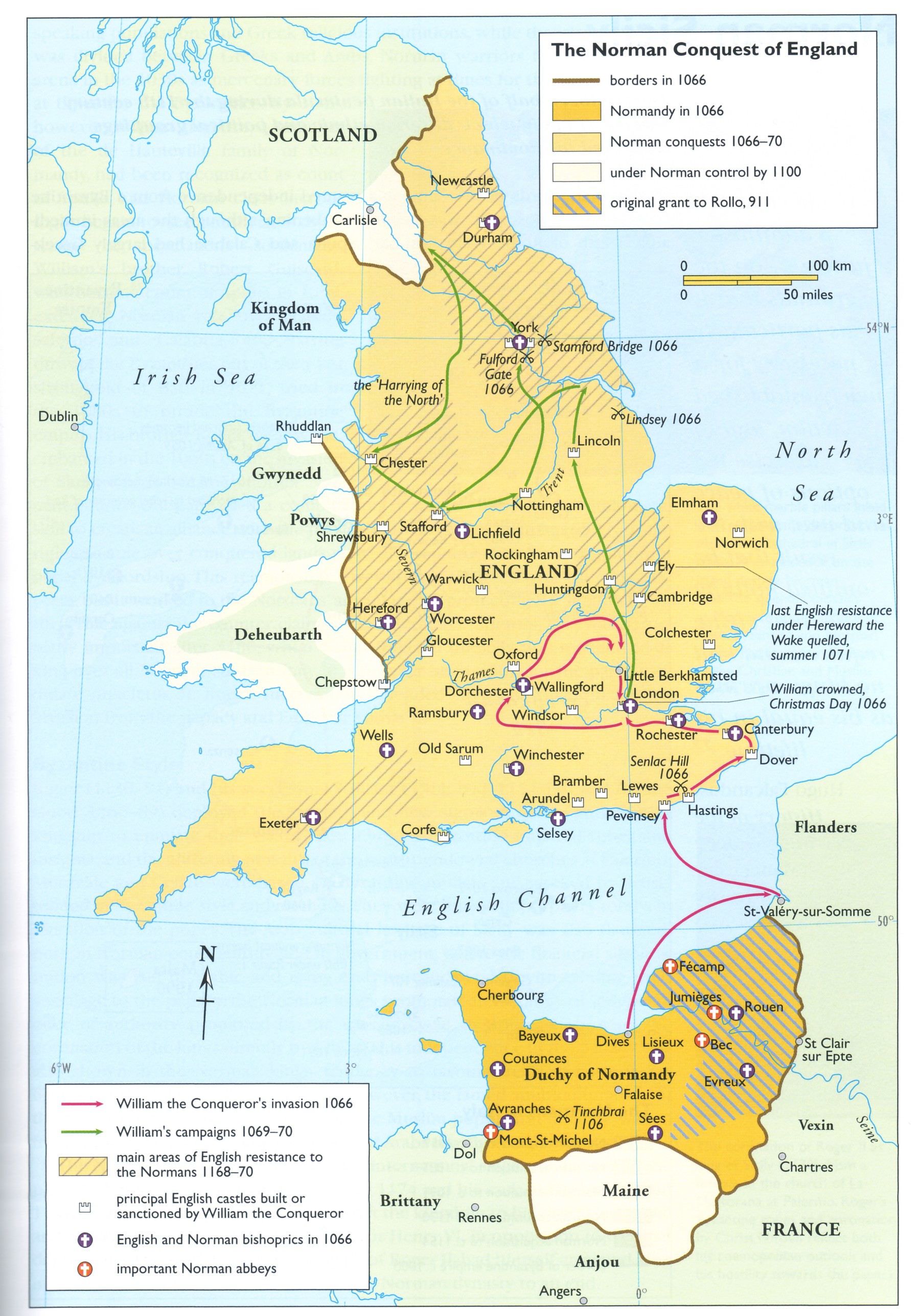
- The Norman Conquest of England
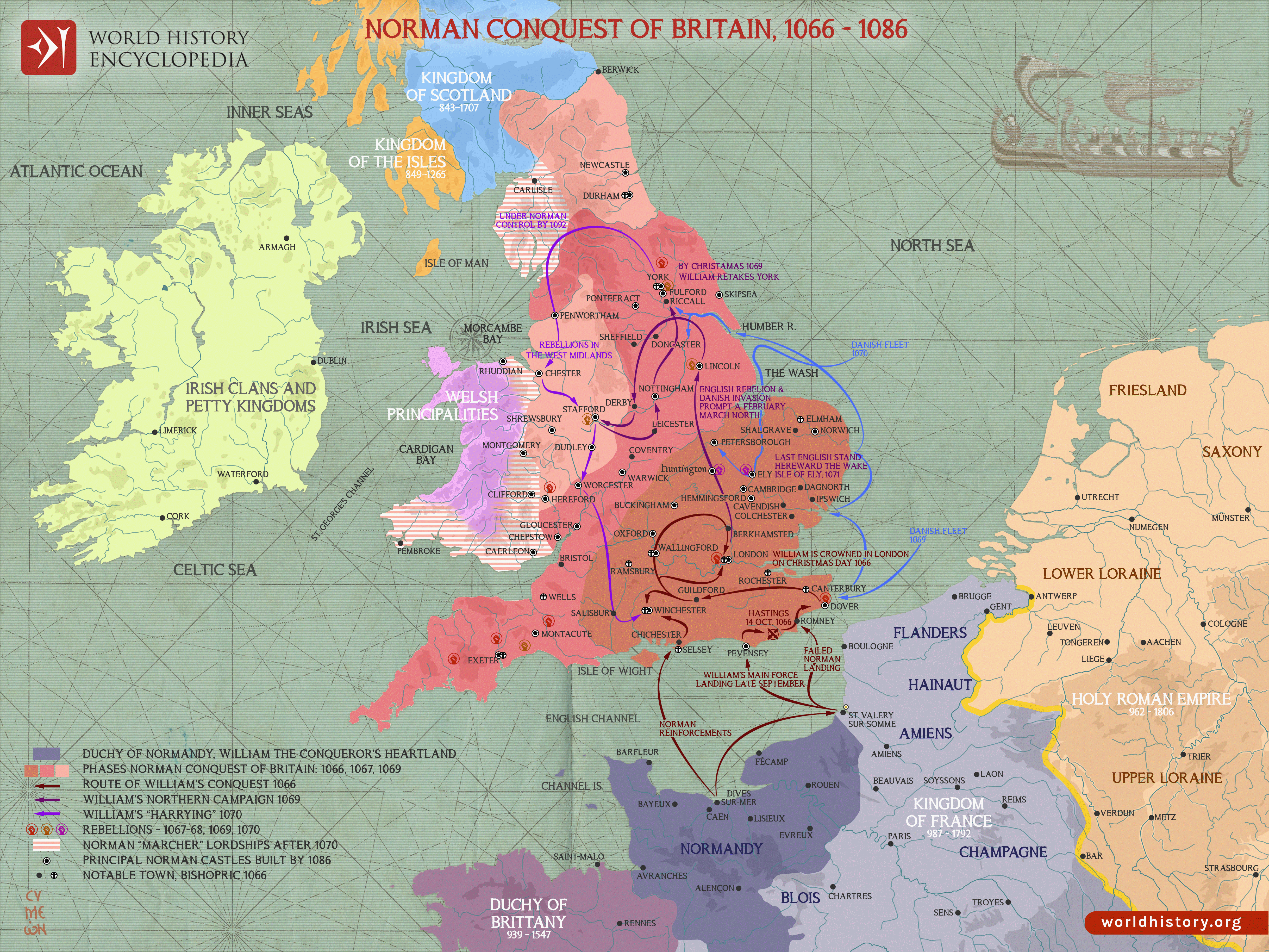
- The Norman Conquest of Britain, 1066-1086 (Simeon Netchev)
- England and the French possessions of William I in 1087
British Isles before 1801
United Kingdom and the British Empire
England and Wales
- Ireland, c. 950
- England in the 11th and 12th Centuries (Droysens Allgemeiner Historischer Handatlas, 1886)
- Norman England, 1066-1087 (J. Bartholomew, A Litterary and Historical Atlas of Europe, 1910)
- England in 1087 (William Shepherd, Historical Atlas, 1926)
- Wales and the Marches in the XIIIth Century
- England and Wales at the End of the Thirteenth Century (E. Dow, Atlas of European History, 1907)
- England in the Reign of Edward III (1327-1377)
- Extent of the English Conquests in France, 1429 (Gardiner’s Atlas of English History, 1892)
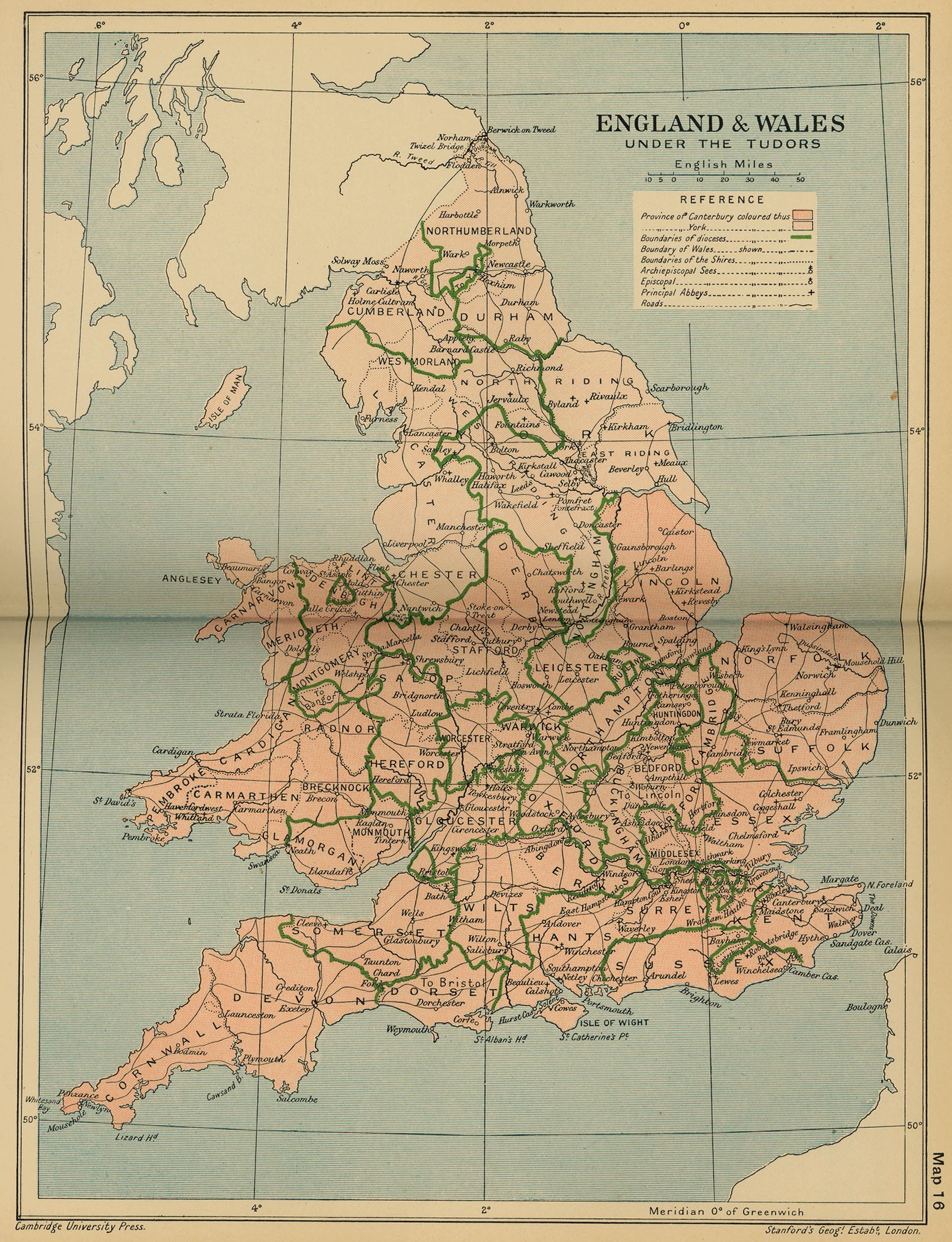
- England and Wales under the Tudors (Cambridge Modern History Atlas, 1912)
- Maps of Wales, 16th to 20th Centuries (National Library of Scotland)
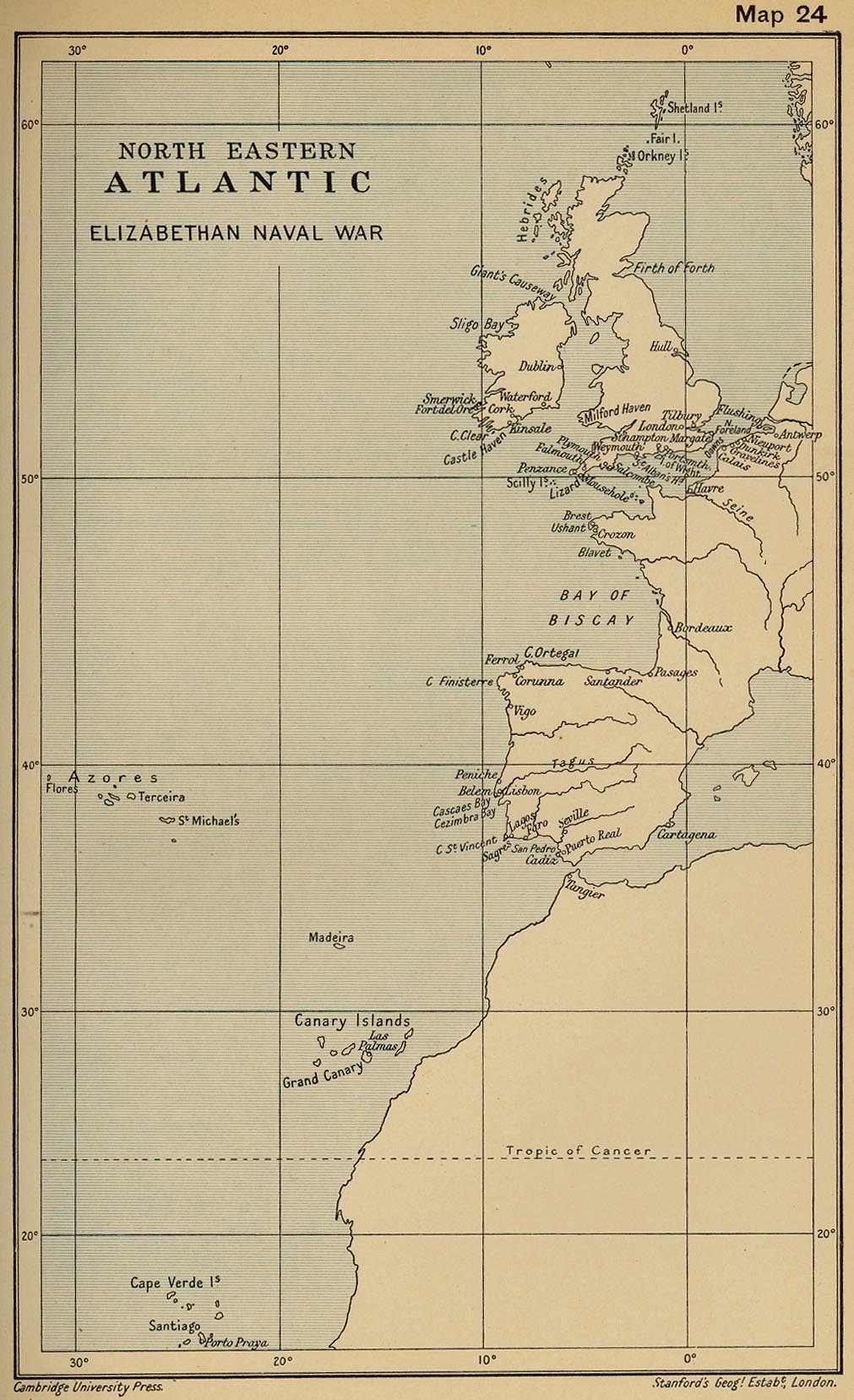
- Northeastern Atlantic Elizabethan Naval War (Cambridge Modern History Atlas, 1912)
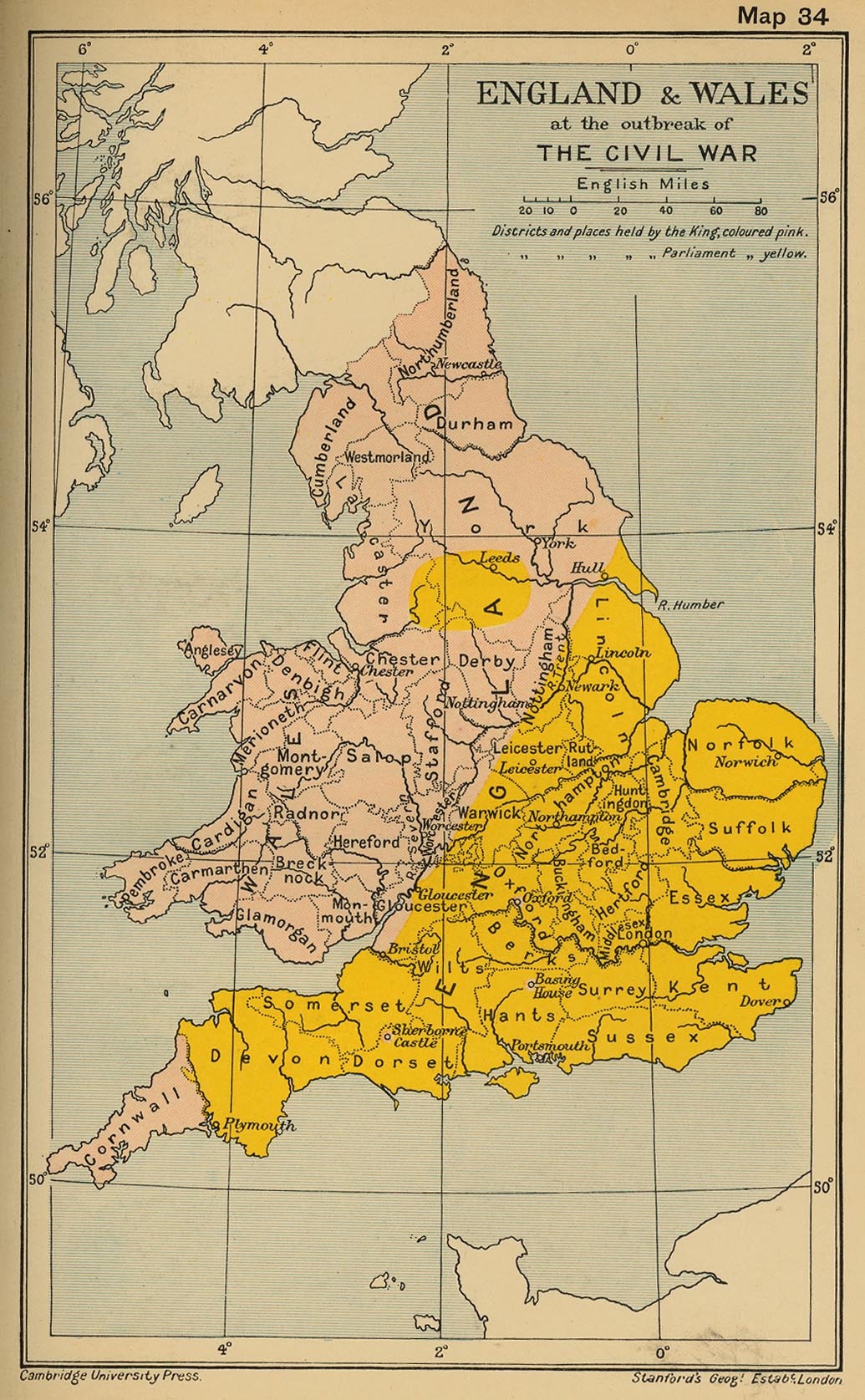
- England and Wales at the Outbreak of The Civil War (Cambridge Modern History Atlas, 1912)
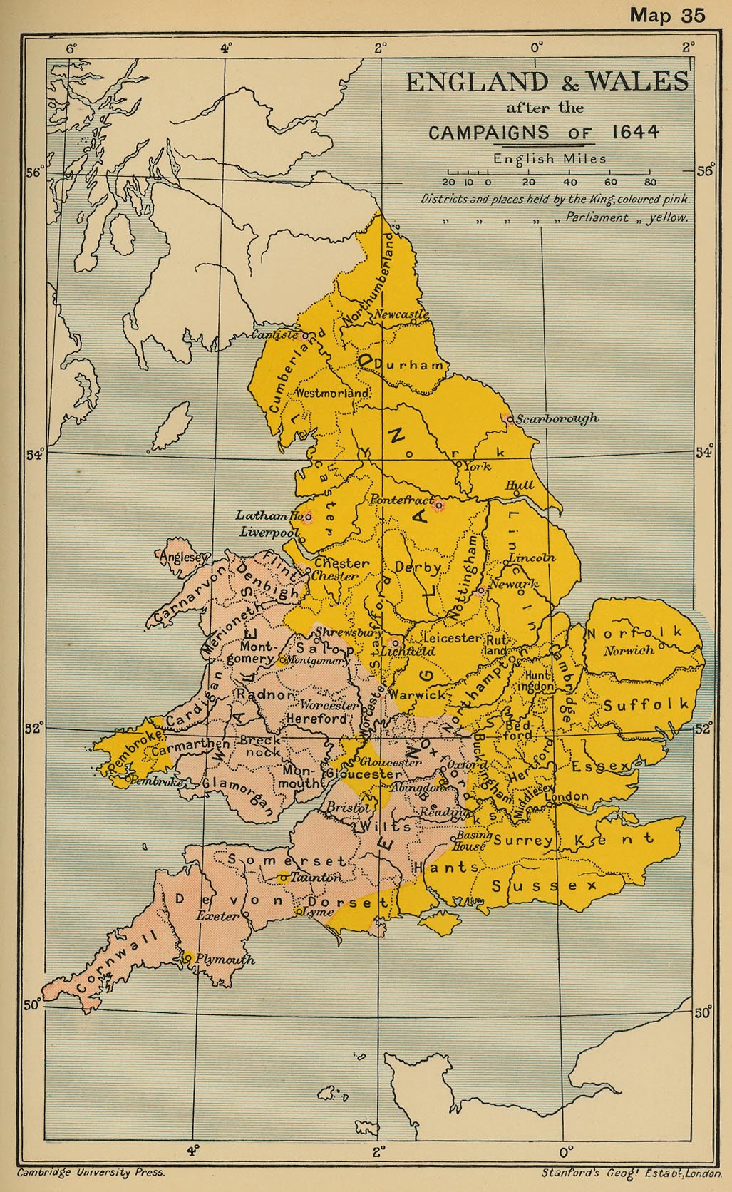
- England and Wales after the Campaigns of 1644 (Cambridge Modern History Atlas, 1912)
- England during the Civil War
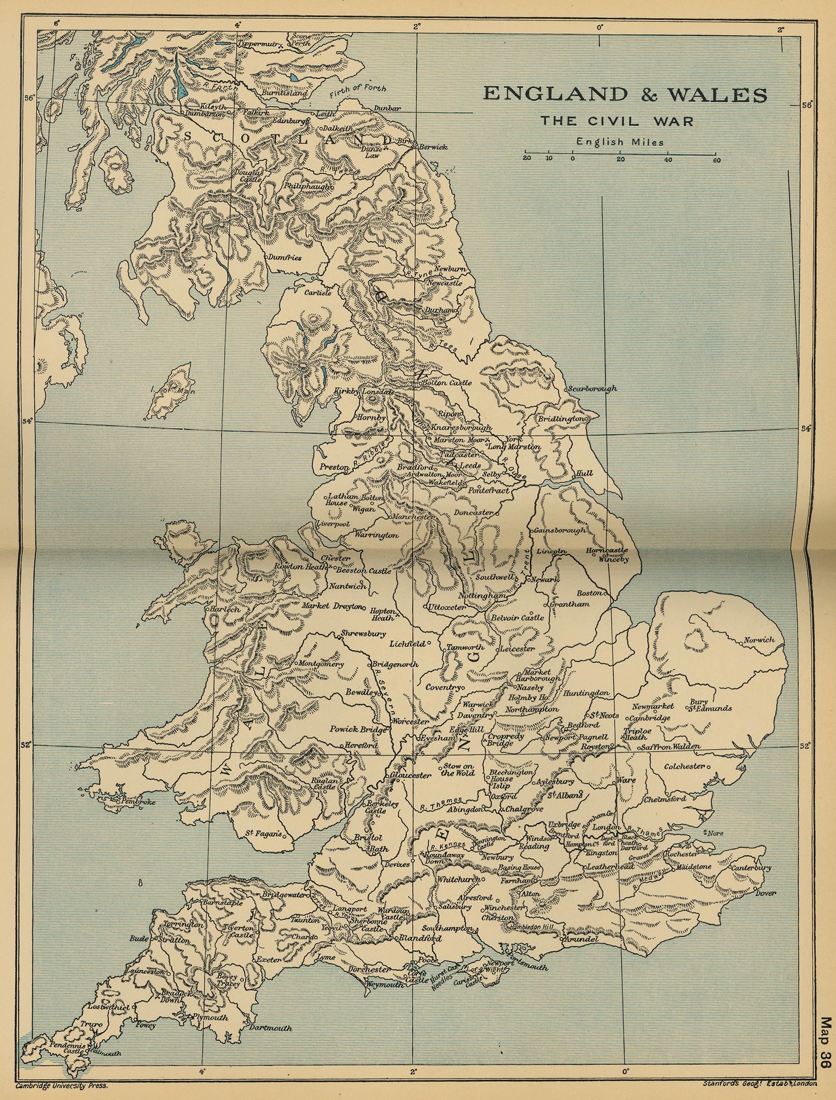
- England and Wales: The Civil War (Cambridge Modern History Atlas, 1912)
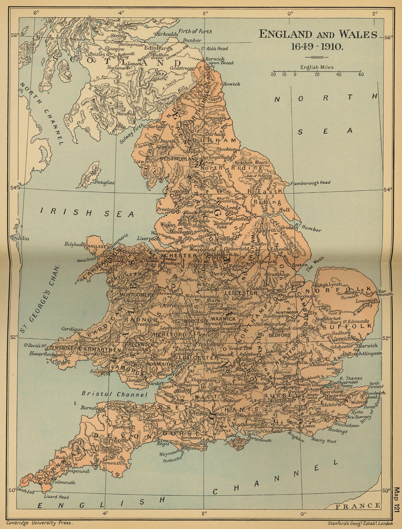
- England and Wales 1649-1910 (Cambridge Modern History Atlas, 1912)
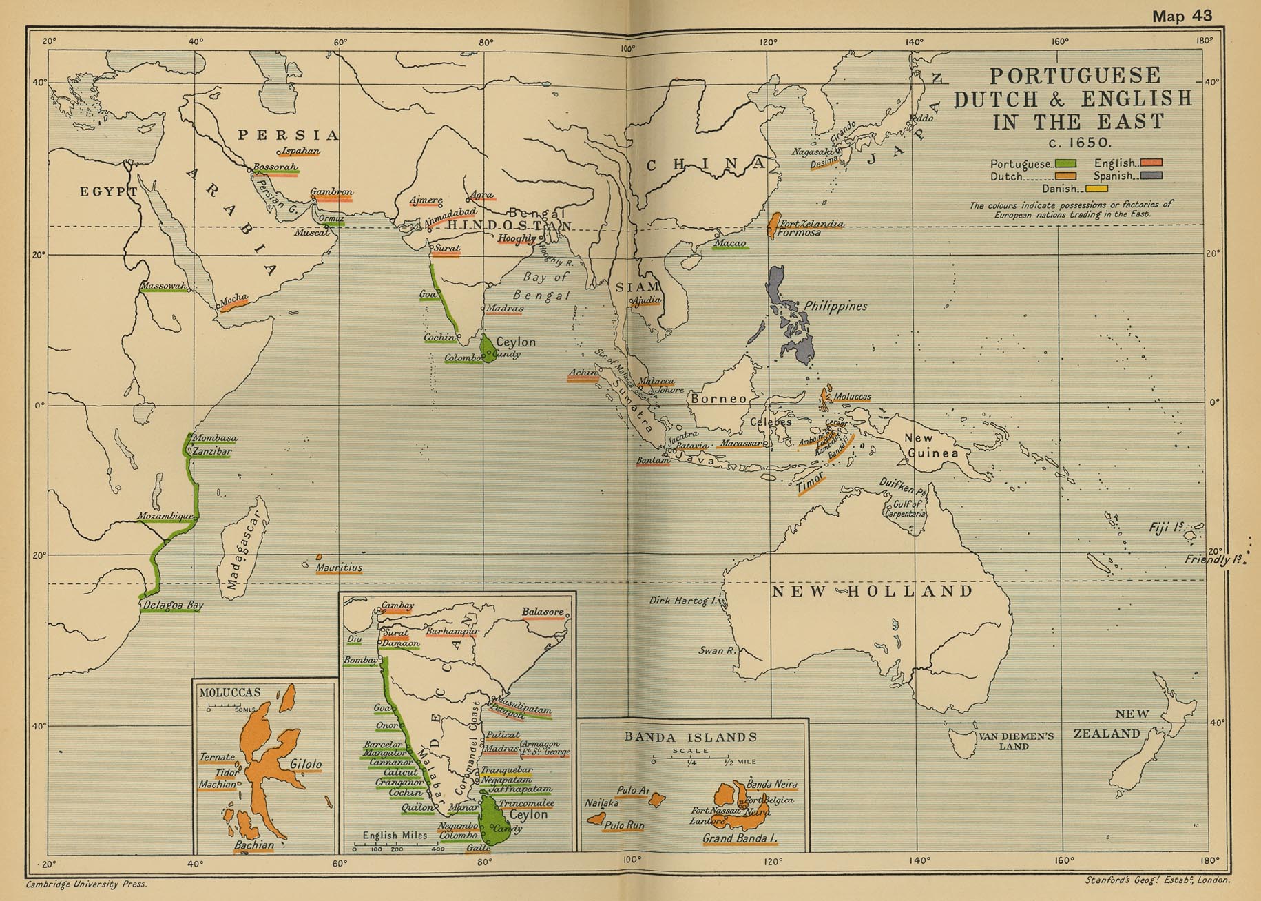
- Portuguese, Dutch and English in the East c. 1650 (Cambridge Modern History Atlas, 1912)
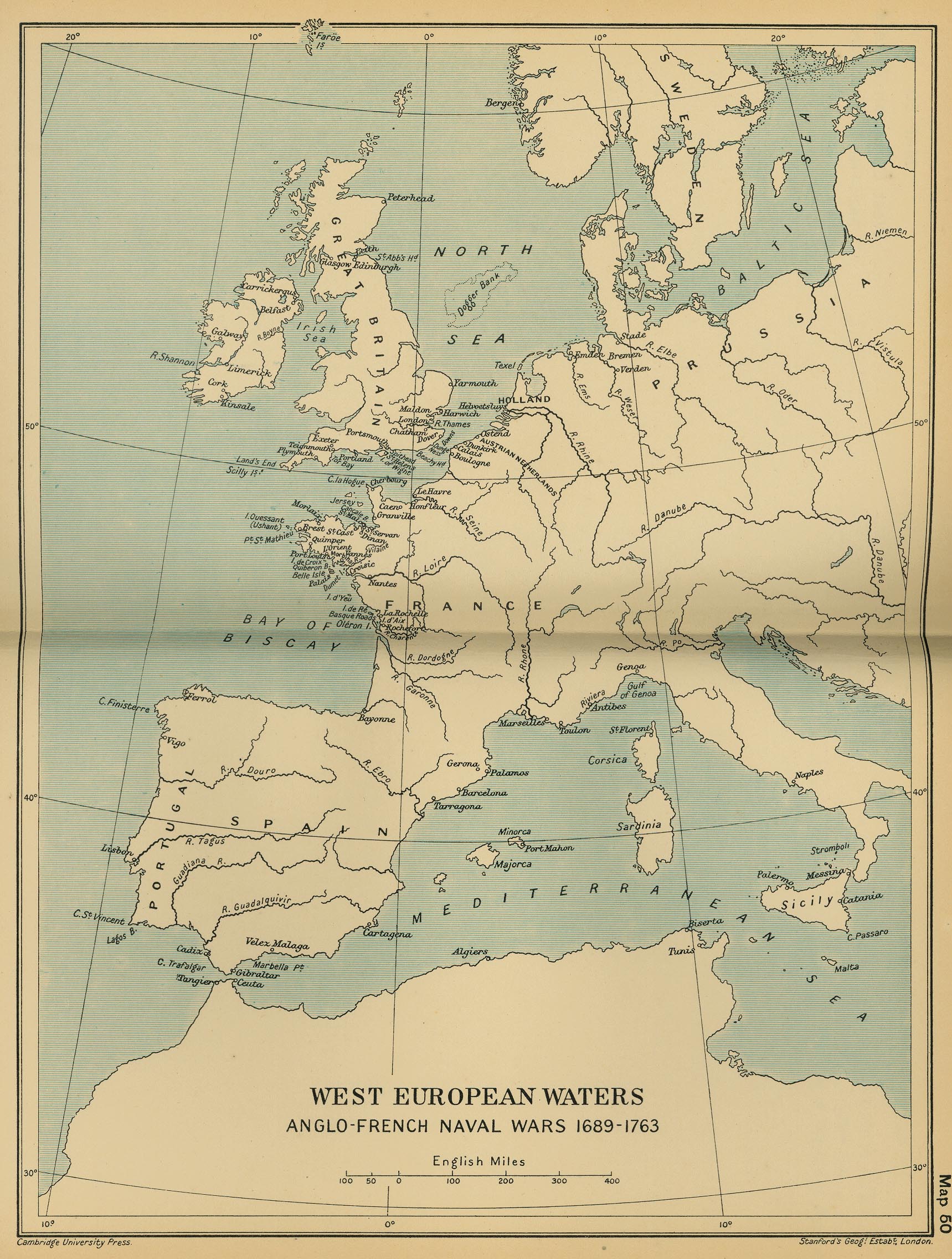
- West European Waters: Anglo-French Naval Wars 1689-1763 (Cambridge Modern History Atlas, 1912)
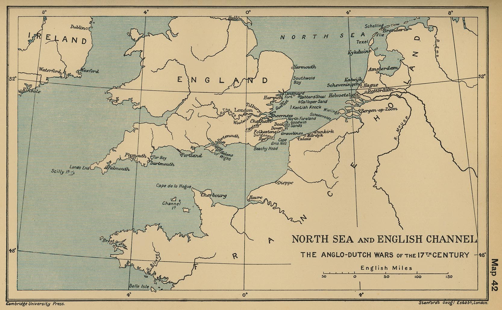
- North Sea and English Channel: The Anglo-Dutch Wars of the 17th Century (Cambridge Modern History Atlas, 1912
- England before the Industrial Revolution (c. 1701)
- England and Wales, 1832 (John Dower)
Old School History Maps: England

Britain about 500 A.D.
Britain after 577 A.D.
Britain in 626 A.D.
Britain in 658 A.D.
Scotland
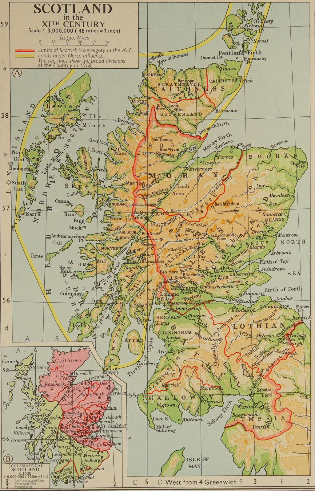
- Scotland in the XIth Century
- Scotland in 1285
- Scotland in the 16th and 17th Centuries showing the principal Clans and Families
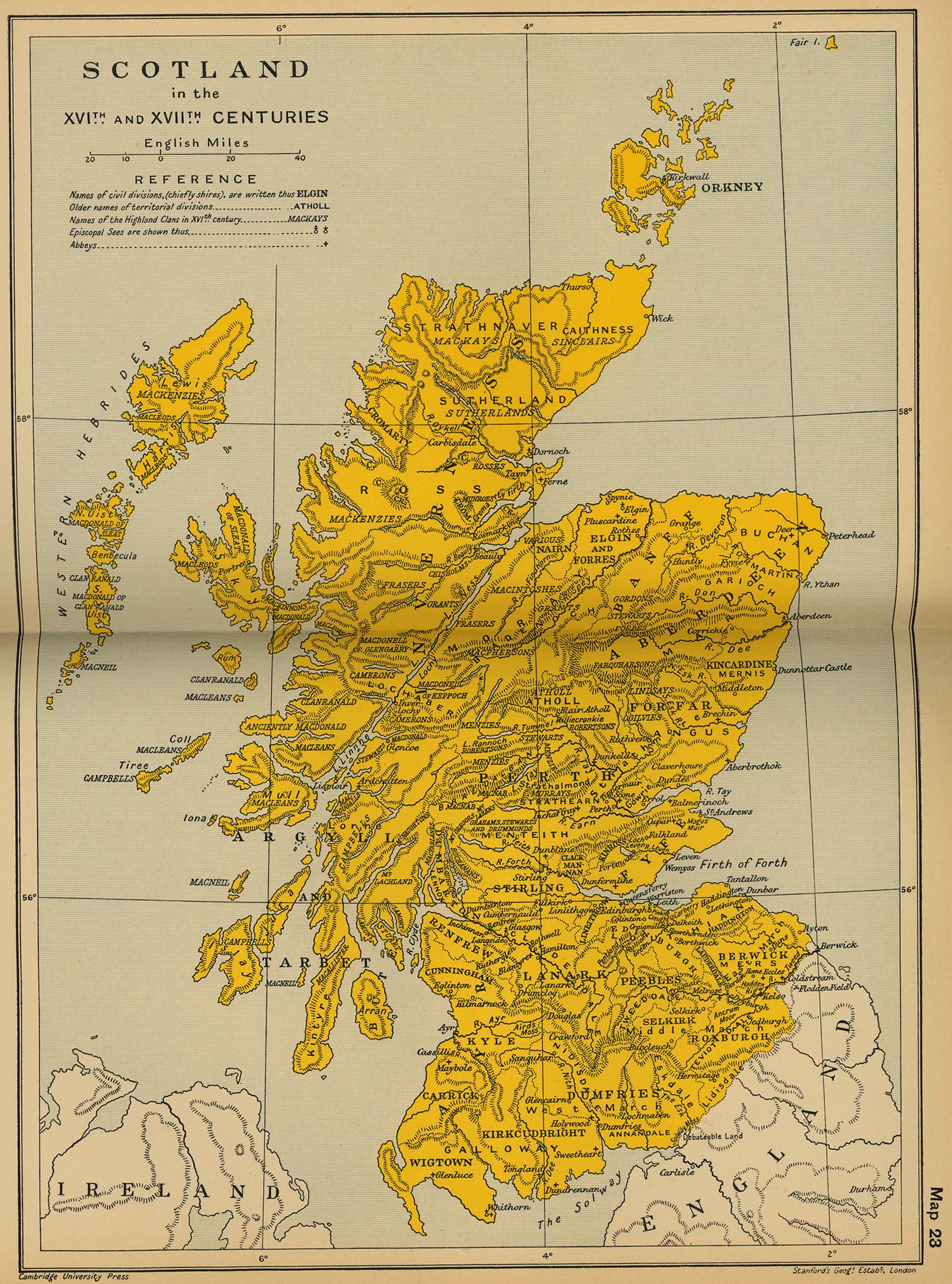
- Scotland in the XVIth and XVIIth Centuries (Cambridge Modern History Atlas, 1912)
- Maps of Scotland, 1560-1950 (National Library of Scotland)
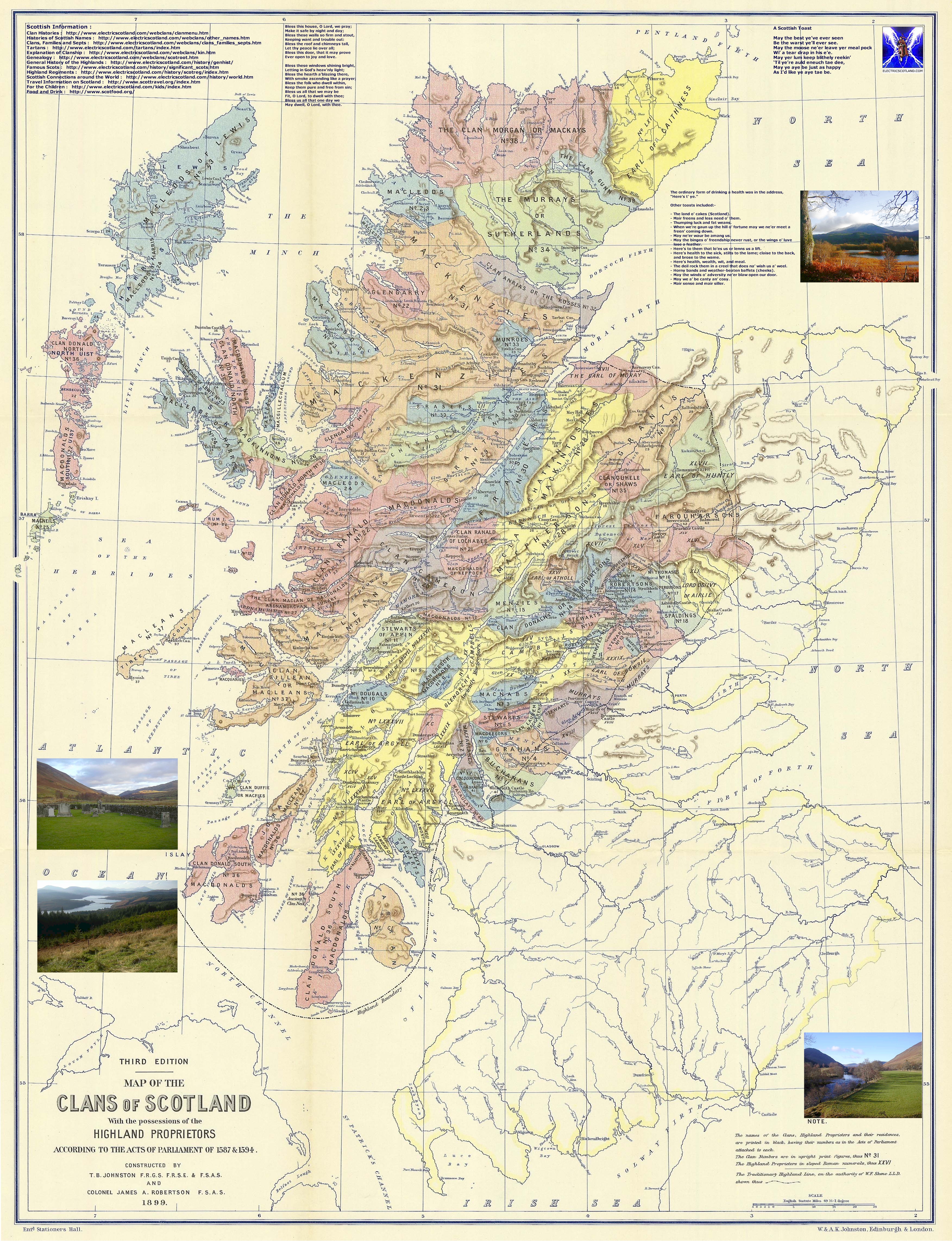
- Scotland, 1587-1594: The Map of the Clans of Scotland (T. B. Johnston, J. A Robertson, 1899)
- Scotland, 1641-1892
- Scotland and Northern England, 1688-1746 (Cambridge Modern History Atlas, 1912)
- Scotland, 1810 (Frances Bowen)
- Map of the Highlands of Scotland denoting the districts or counties inhabited by the Highland Clans, 1822 (W. H. Lizars)
- Scotland, 1832 (John Dower)
- Scotland, 1864 (George Philip and Son)
- Scotland, 1901 (George F. Cram)
- Scotland, 1912 (Rand McNally)
Old School History Maps: Scotland

Scotland in the XIth Century
Scotland in the XVI and XVII Centuries
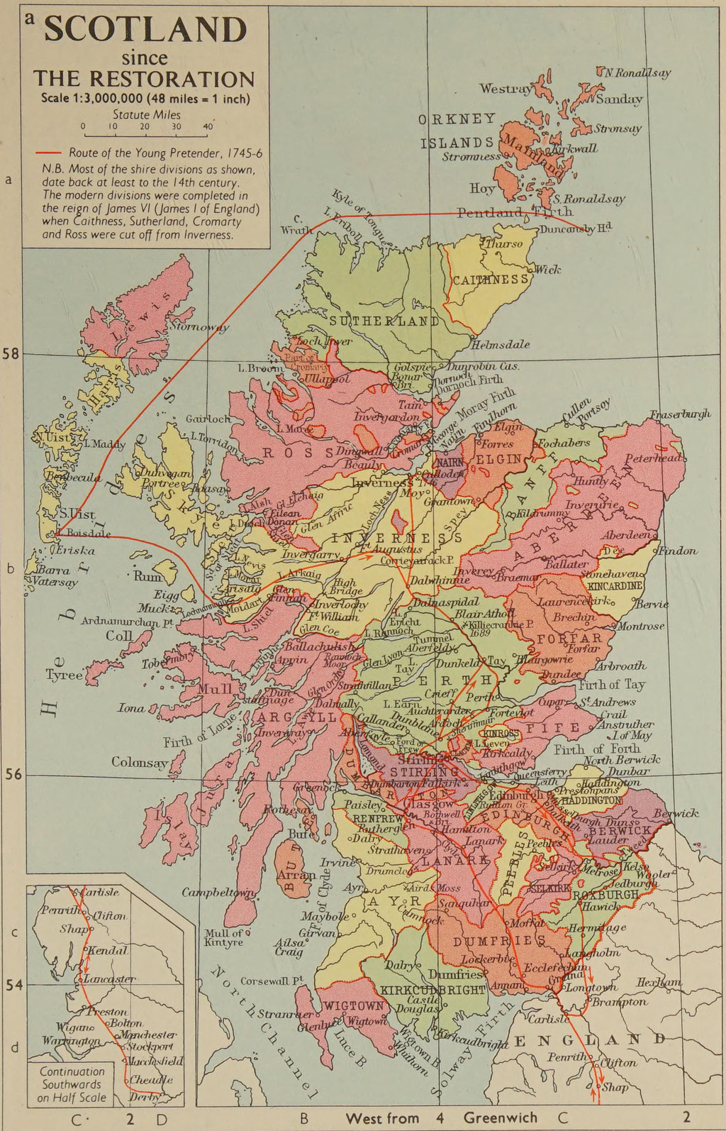
Scotland since the Restoration
More Maps of Interest

Scotland, ca. 1018
Scotland, 1285
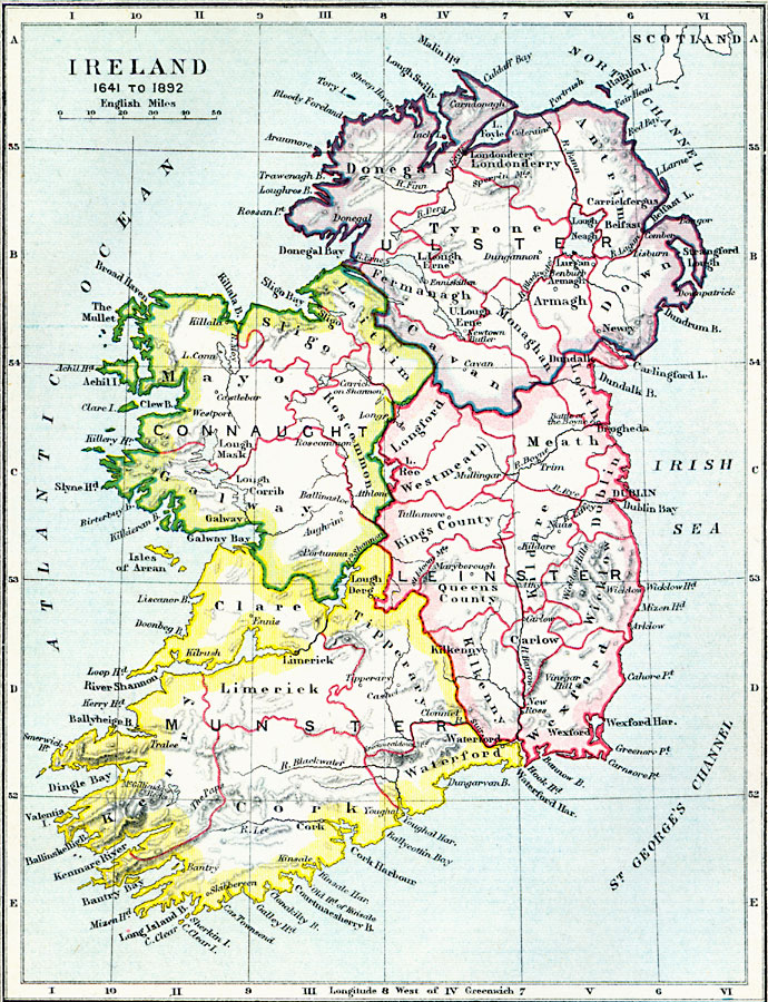
Scotland, 1641-1892
Scotland post-Restoration
Ireland
- Ireland, c. 950
- Ireland before the English invasion
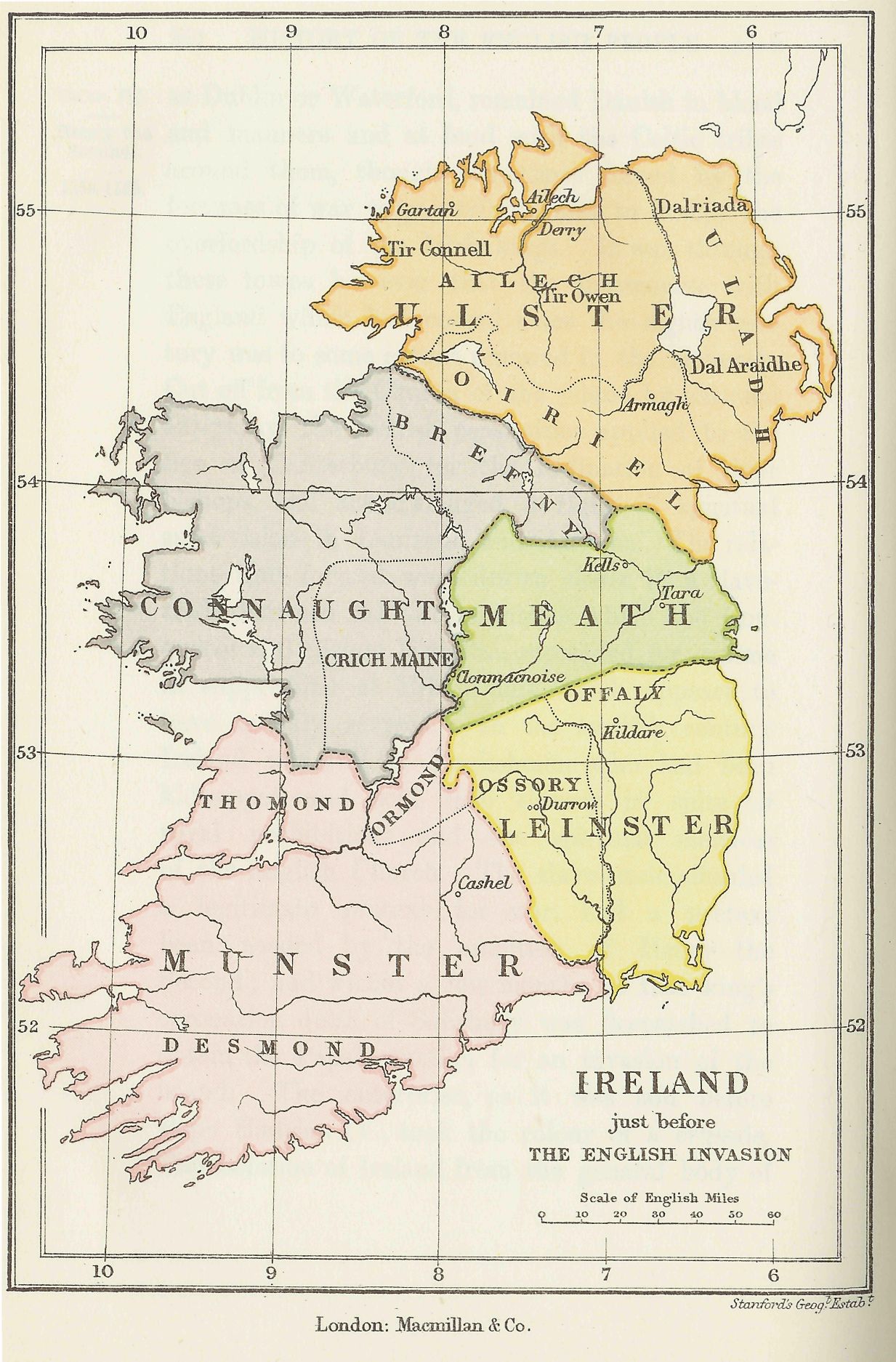
- Ireland just before the English Invasion
- Ireland, ca. 1250 (www.irelandstory.com)
- Ireland the Middle Ages showing principal families and clans
- Ireland, ca. 1450
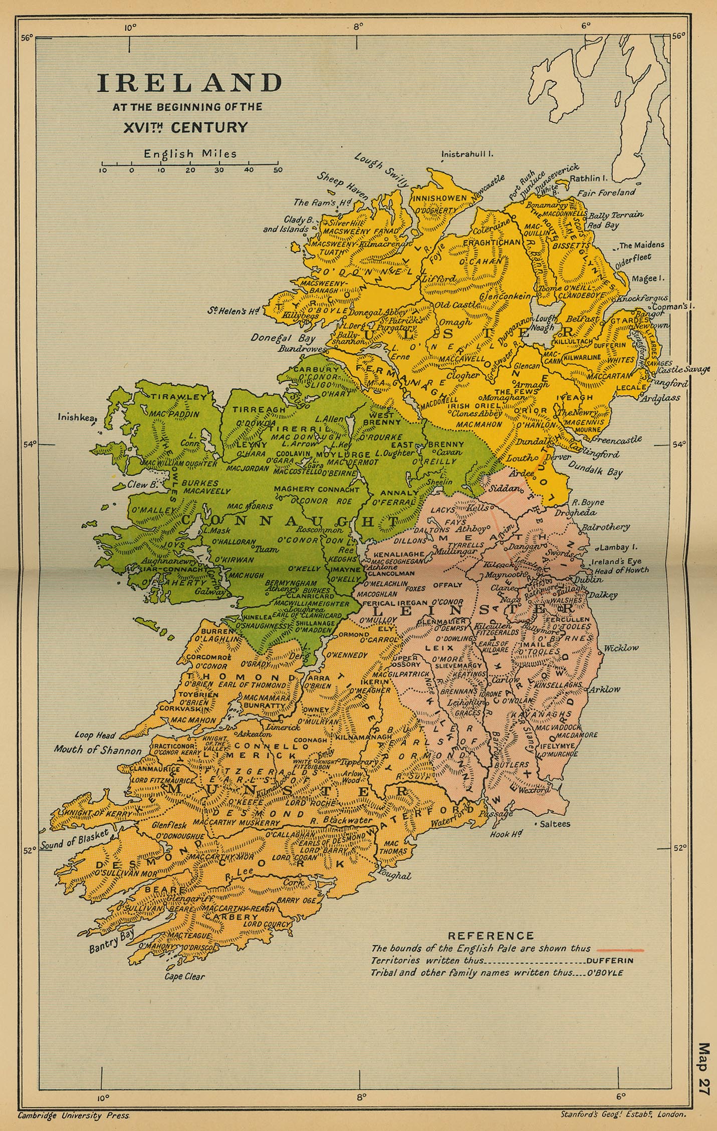
- Ireland at the beginning of the Sixteenth Century (Cambridge Modern History Atlas, 1912)
- Maps of Ireland, 16th to 20th Centuries (National Library of Scotland)
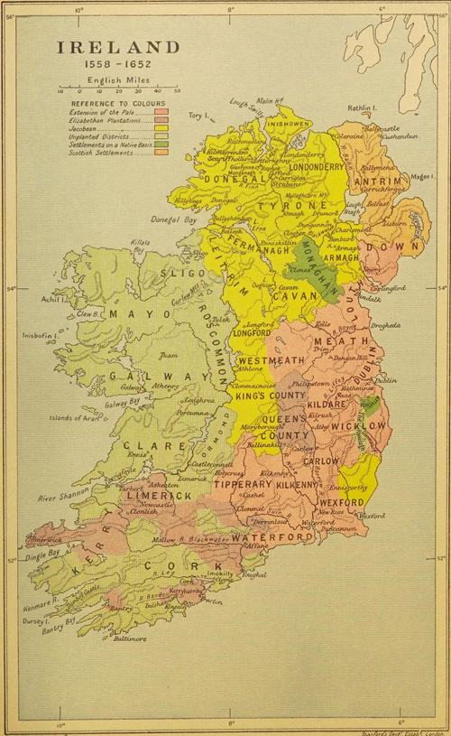
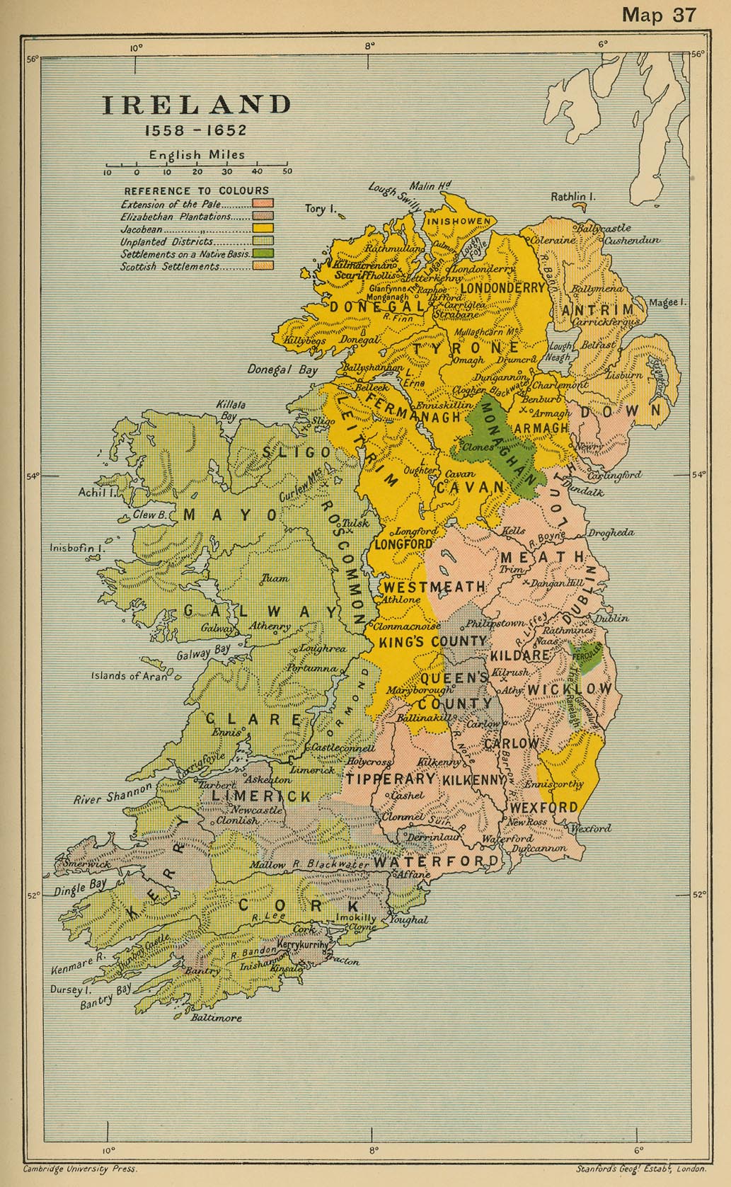
- Ireland 1558-1652 (Cambridge Modern History Atlas, 1912)
- Ireland, 1641-1892
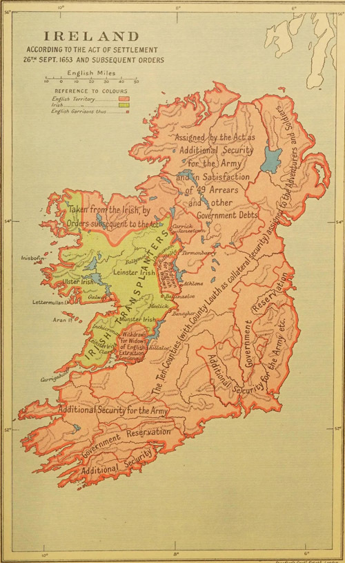
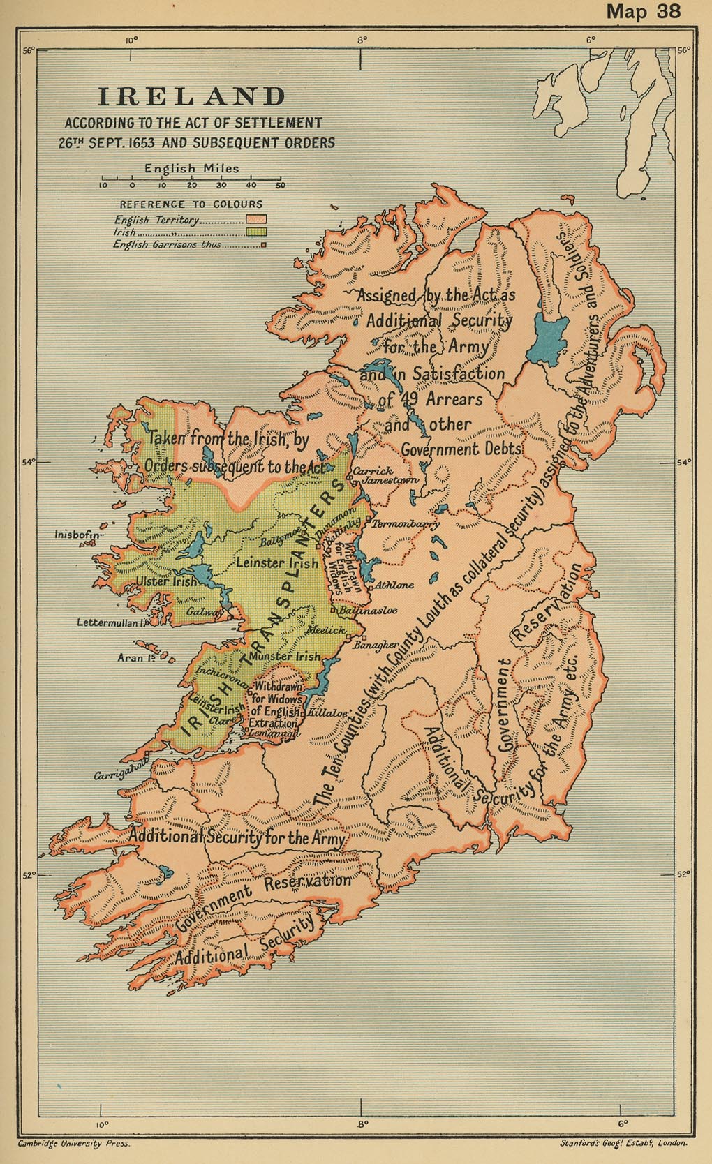
- Ireland According to the Act of Settlement 26th September, 1653, and Subsequent Orders (Cambridge Modern History Atlas,1912)
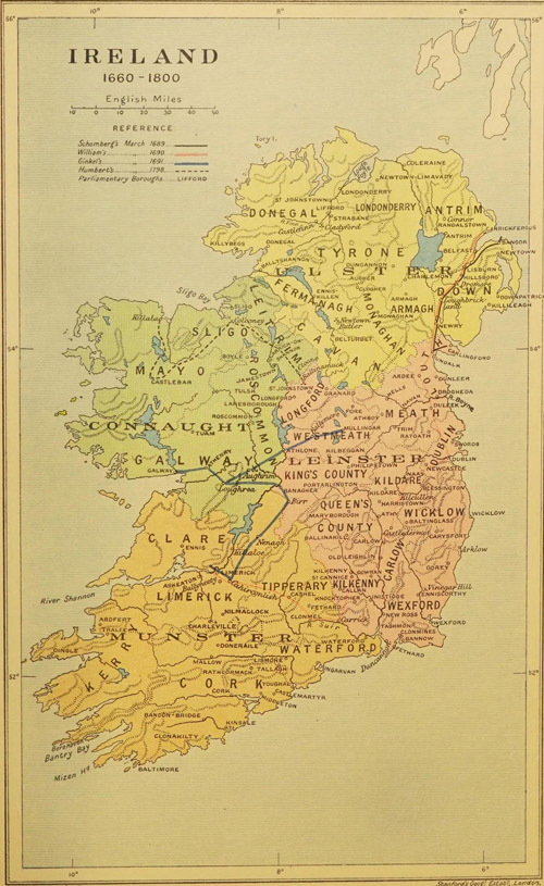
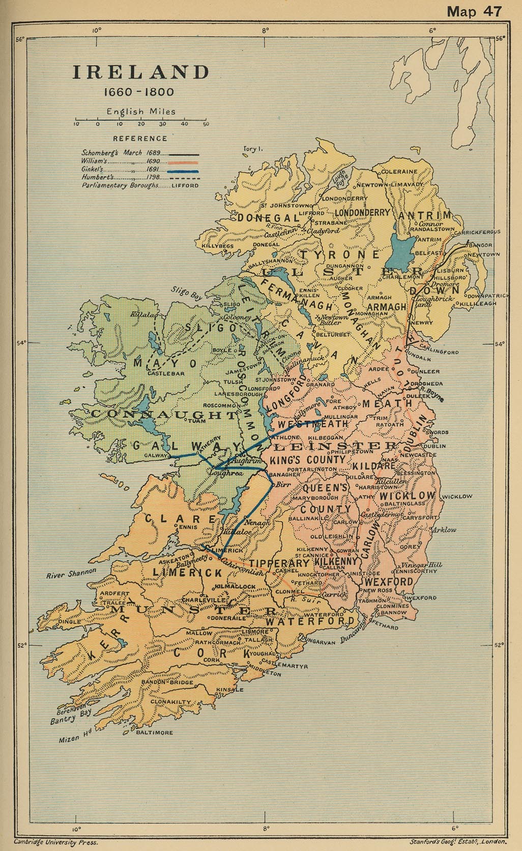
- Ireland, 1660-1800 (Cambridge Modern History Atlas, 1912)
- Ireland, 1832 (John Dower)
- Ireland, 1835 (American Geographical Society Library)
- Ireland, 1878 (American Geographical Society Library)
- Ireland, 1886 (American Geographical Society Library)
- Ireland, 1901 (George F. Cram)
- Ireland, 1906 (American Geographical Society Library)
- Ireland, 1910 (George Philip and Son)
- Ireland, 1912 (Rand McNally)
- Irish (UK) General Election 1918
- Ireland, 1923 (American Geographical Society Library)
- Geographic Distribution of the Gaelic Languages (Irish, Scottish Gaelic, Manx), 2011
Old School History Maps: Ireland

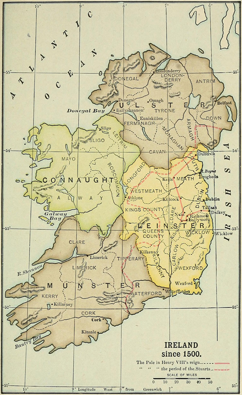
Ireland since 1500
Ireland 1558-1652
Ireland in 1653
Ireland 1600-1800


