Skip to main content
Home
Historical Maps
World History
U.S. History
Canadian History
Canada (English)
Canada (Français)
Old school history maps
Stories on the Map
Armenia
Assyria
Catalonia
Kurdistan
Palestine
Ukraine
Edmaps +
HISTORICAL MAPS OF THE NETHERLANDS AND BELGIUM
Map Collections and Atlases
Atlas der Neederlanden: de vorming van Nederland in kaarten
(Oneindig Noord-Holland)
Blank and Outline Maps of the Netherlands
(d-maps.com)
Historical Maps of the Netherlands
(American Geographical Society Library Digital Map Collection)
Kaarten van Nederland
(Atlas en Kaart)
Nederland: 100 thematische kaarten
(Utrecht University Library)
Netherlands: Historical Maps Collection
(Library of Congress)
Old Maps of the Netherlands
(oldmapsonline.org)
The Netherlands on old maps
Rotterdam op oude kaarten
(Rotterdam on old maps)
Blank and Outline Maps of Belgium
(d-maps.com)
Belgium: Historical Maps Collection
(Library of Congress)
Historical Maps of Belgium
(American Geographical Society Library Digital Map Collection)
Historical Maps of Belgium
(David Rumsey Map Collection)
Old Maps of Belgium
(oldmapsonline.org)
Blank and Outline Maps of Luxembourg
(d-maps.com)
Maps
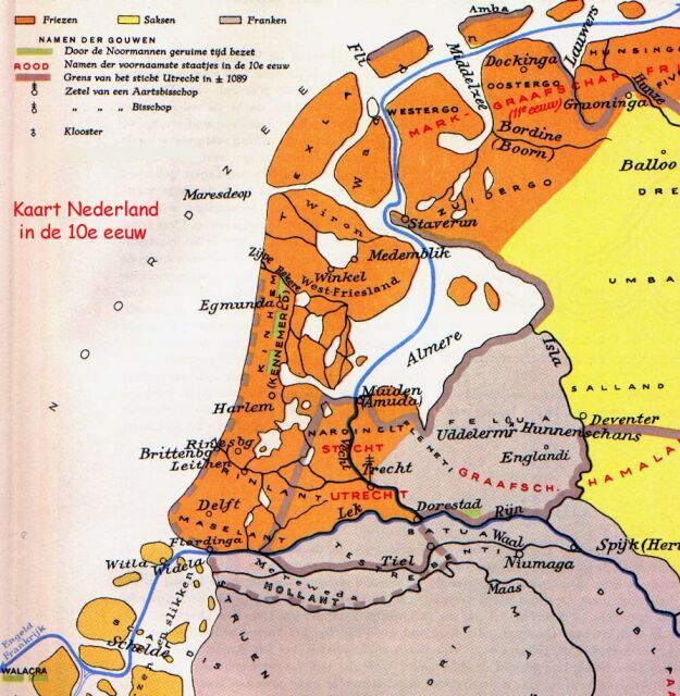
The Netherlands in the 10th Century
(in Dutch)
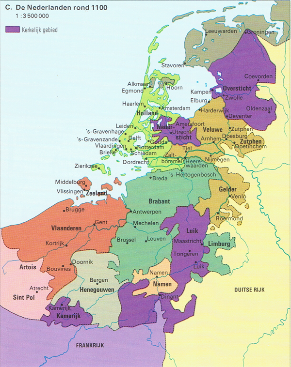
The Netherlands, ca. 1100
(in Dutch)
The Netherlands in the 14th Century
(in Dutch)
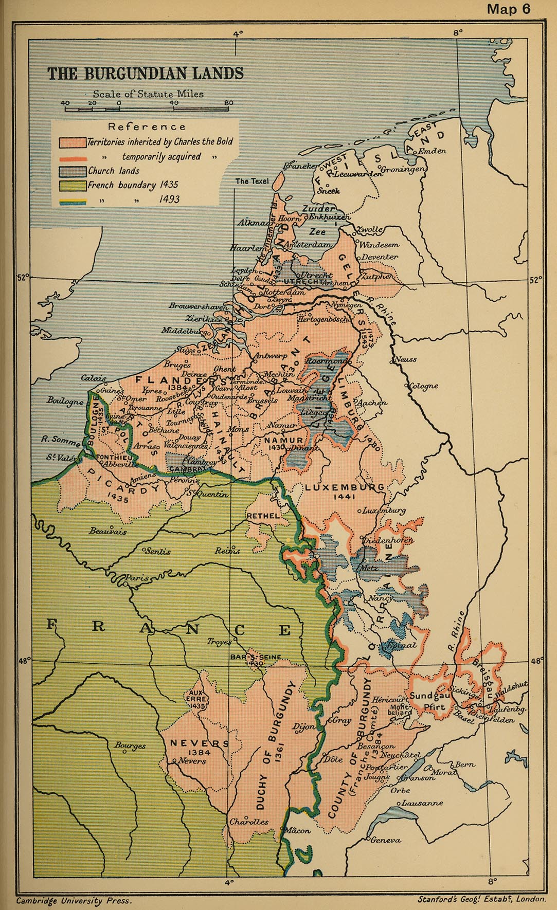
The Burgundian Lands in 1477
(The British Library)
The Burgundian Lands in 1493
(Cambridge Modern History Atlas, 1912)
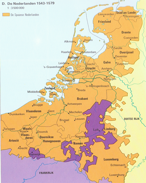
The Netherlands, 1543-1579
(in Dutch)
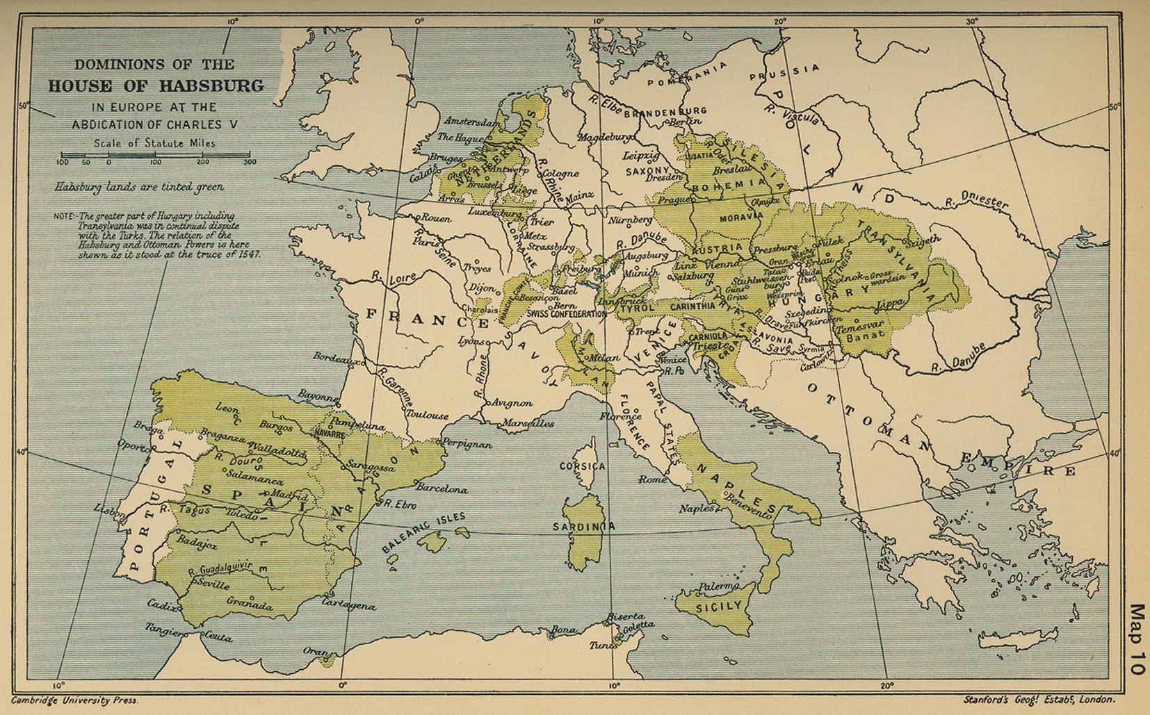
Dominions of the House of Habsburg in Europe at the Abdication of Charles V
(Cambridge Modern History Atlas, 1912)
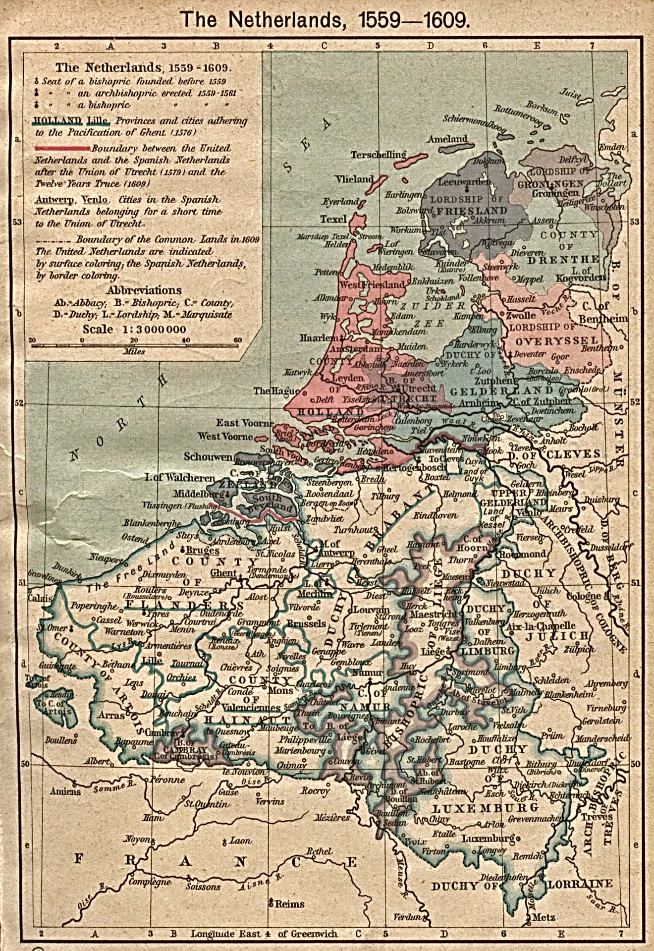
The Netherlands, 1559-1609
(William Shepherd, Historical Atlas, 1923)
The Netherlands in 1560
(C. Brinkman; in Dutch)
The Netherlands in 1580
(in Dutch)
The Netherlands during the Dutch Revolt, 1580
The Netherlands during the Wars of Independence
Republic of the United Netherlands
(Droysens Allgemeiner Historischer Handatlas, 1886)
The United Provinces in 1610
(C. Brinkman; in Dutch)
The Netherlands in the 16th century
(Droysens Allgemeiner Historischer Handatlas, 1886)
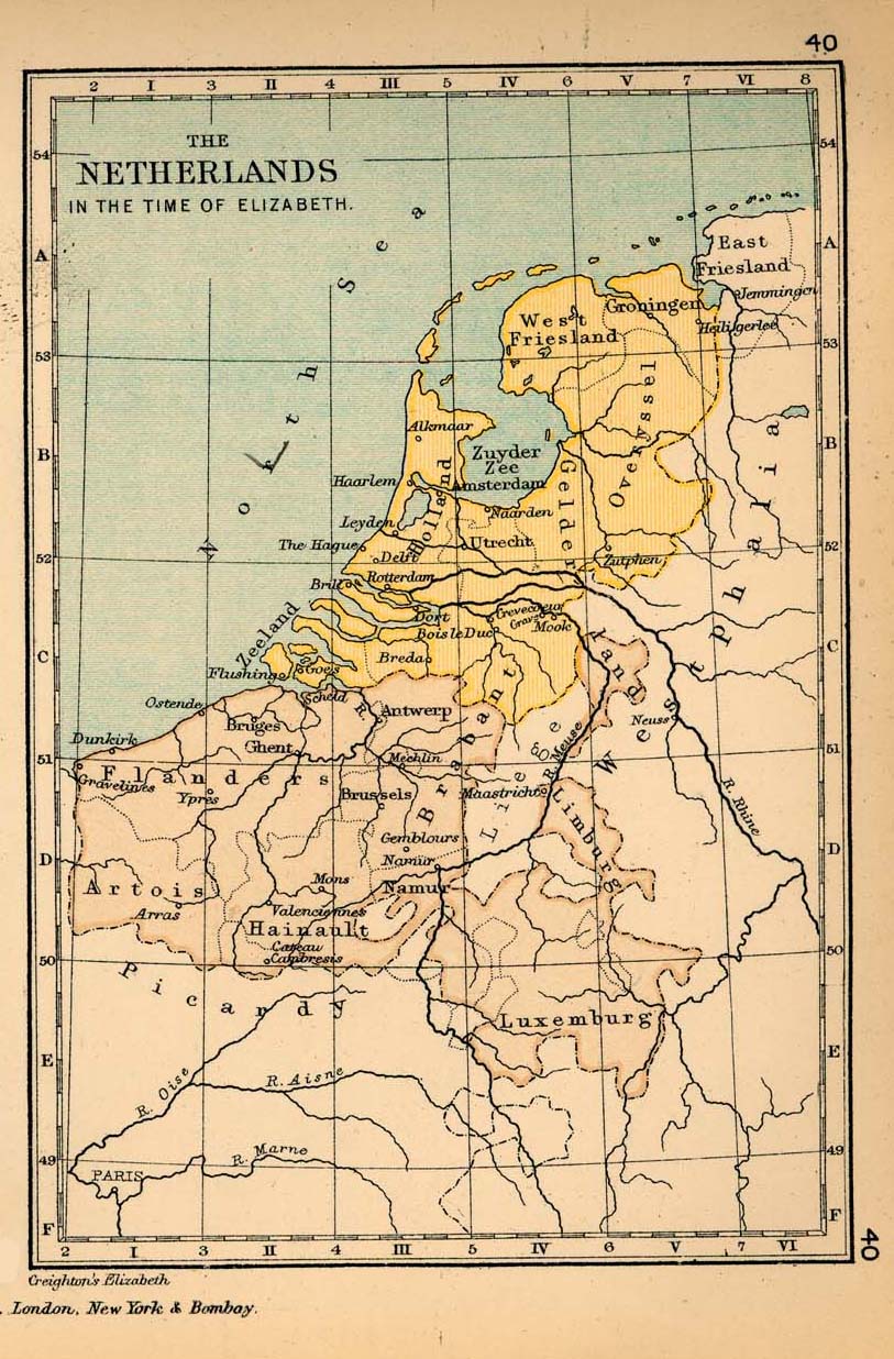
The Netherlands in the time of Elizabeth
(Charles Colbeck, The Public Schools Historical Atlas, 1905)
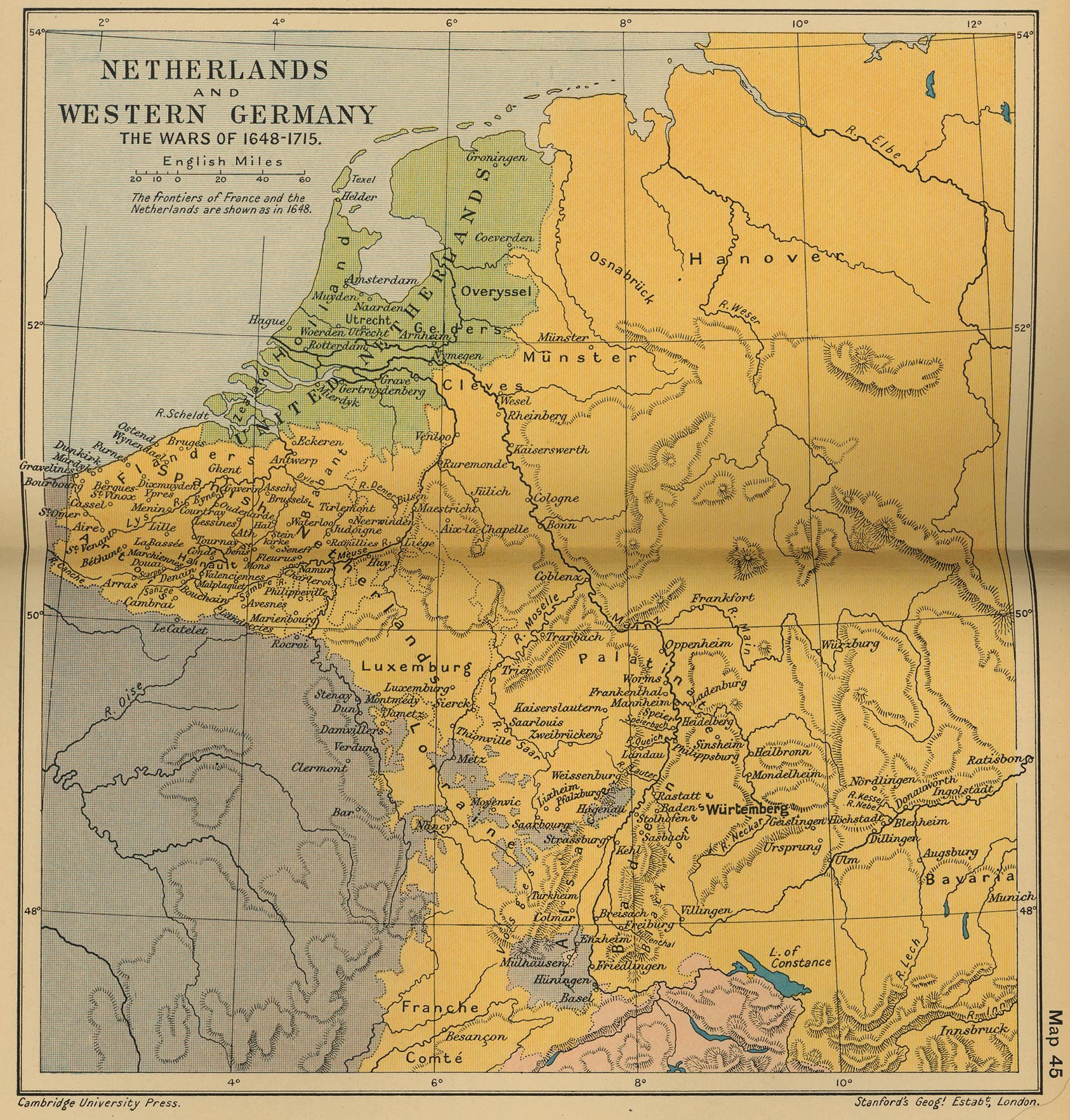
The Netherlands and Western Germany: The Wars of 1648-1715
(Cambridge Modern History Atlas, 1912)
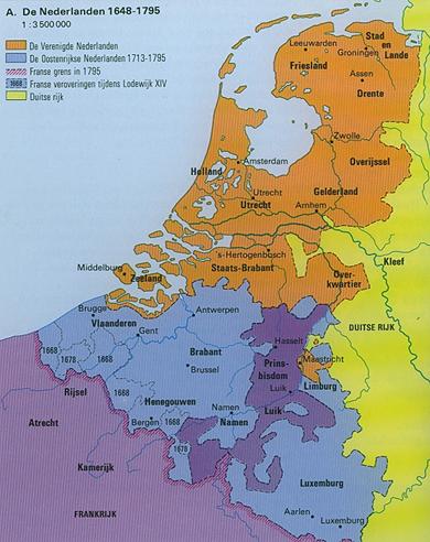
The Netherlands, 1648-1795
(in Dutch)
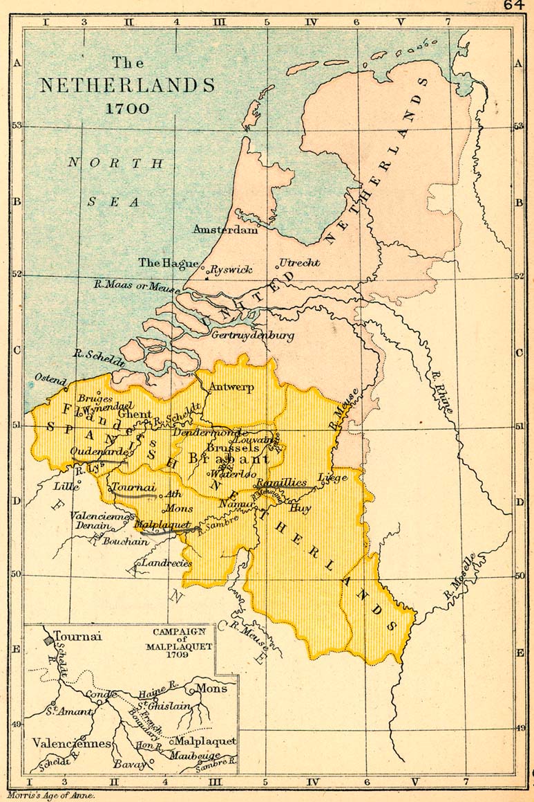
The Netherlands in 1700
(Charles Colbeck, The Public Schools Historical Atlas, 1905)
Republic of the United Netherlands
(C. Brinkman; in Dutch)
Carte des Provinces-Unies des Pays-Bas, 1748
(R. Vaugondy)
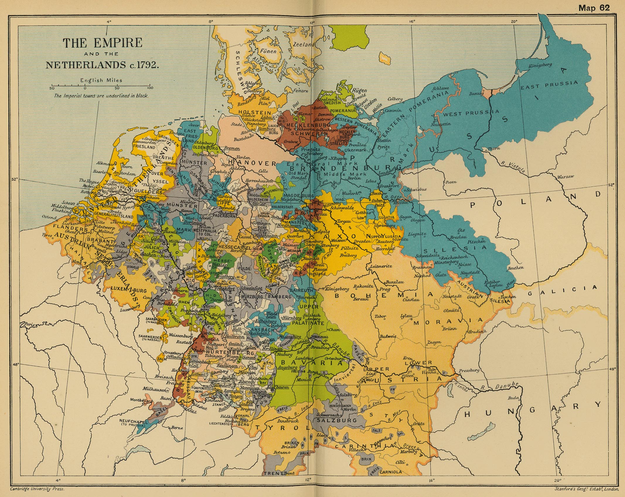
The Empire and the Netherlands, c. 1792
(Cambridge Modern History Atlas, 1912)
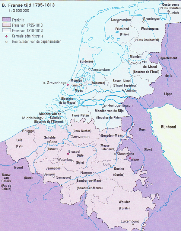
The French Netherlands, 1795-1813
(in Dutch)
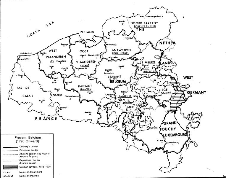
Belgium (from 1795 to our days)
The Batavian Republic in 1798
(C. Brinkman; in Dutch)
The Batavian Republic in 1801
(C. Brinkman; in Dutch)
The Kingdom of Holland in 1806
(C. Brinkman; in Dutch)
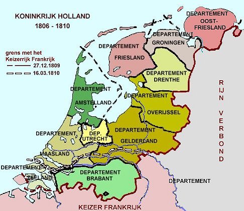
The Kingdom of Holland, 1806-1810
(in Dutch)
The Kingdom of Holland in 1807
(in Dutch)
The Kingdom of Holland in 1810
(in Dutch)
The Kingdom of Holland in 1810
(C. Brinkman; in Dutch)
The Dutch Provinces of the French Empire in 1812
(C. Brinkman; in Dutch)
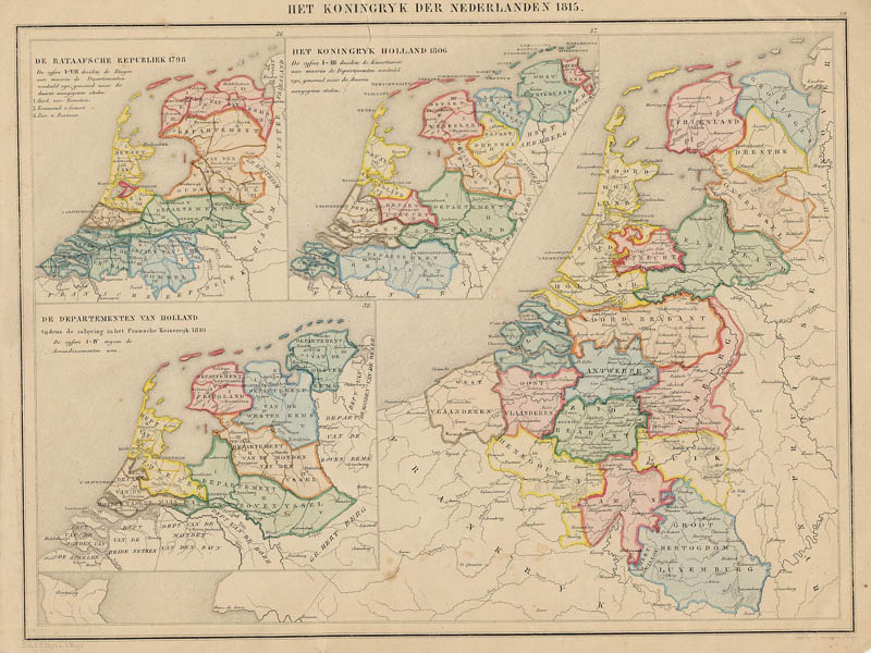
The Kingdom of the Netherlands in 1815
(in Dutch)
The Kingdom of the Netherlands in 1815
(in Dutch)
The Kingdom of the Netherlands in 1815
(in Dutch)
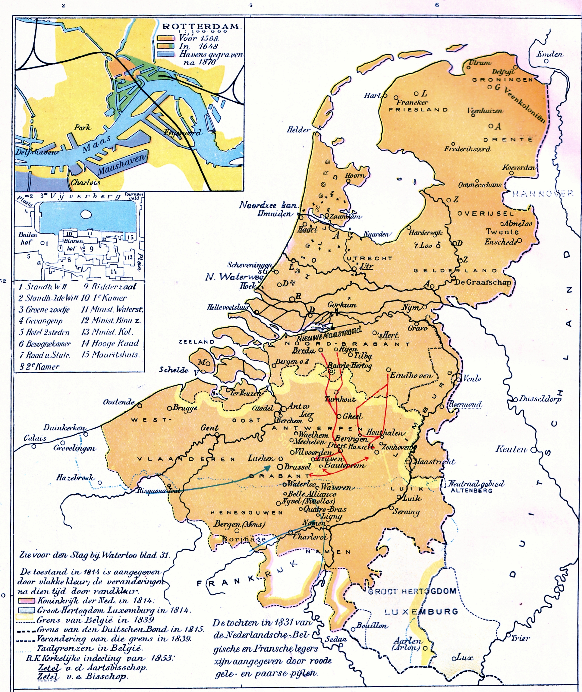
The Netherlands 1815-39, Holland & Belgium since 1839
(Cambridge Modern History Atlas, 1912)
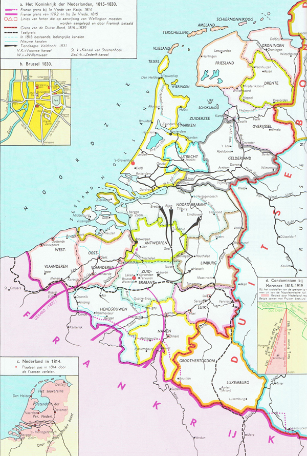
The Kingdom of the United Netherlands, 1815-1830
(in Dutch)
Hollande et Belgique, 1839
(C. Morin)
Royaume de Hollande, 1843
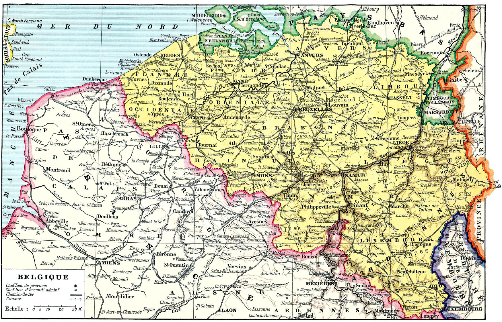
Netherlands, Belgium and Luxembourg in 1872
(P. Trap; in Dutch)
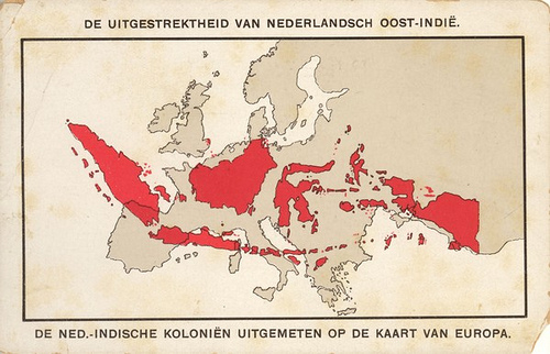
Dutch West & East Indias, 1891
(in Dutch)
Dutch Indonesia and Europe, c. 1900
(in Dutch)
Belgium and Holland, 1920
(J.G. Bartholomew)
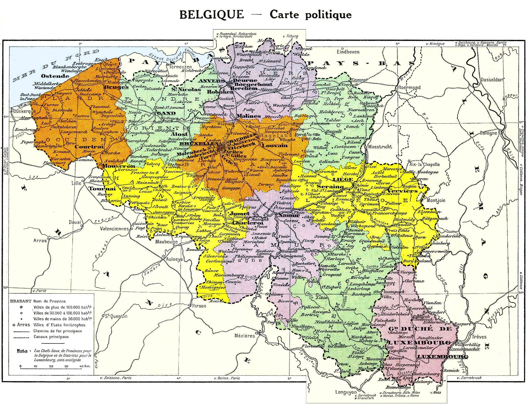
Belgique, 1922
Belgique et Luxembourg, 1934
Dutch East India, 1939
(in Dutch)
World
Albania
France
Netherlands
Spain & Portugal
Caucasus
Latin America
Ancient Greece
Austria
Germany
Poland
Switzerland
Middle East
Mexico
Roman Empire
Britain
Greece
Romania
Türkiye
Asia
Canada
Holy Roman Empire
Bulgaria
Hungary
Scandinavia
Ukraine
China
U.S.A.
Europe
Croatia
Italy
Serbia
Russia
Japan
Australia

