Skip to main content
Home
Historical Maps
World History
U.S. History
Canadian History
Canada (English)
Canada (Français)
Old school history maps
Stories on the Map
Armenia
Assyria
Catalonia
Kurdistan
Palestine
Ukraine
Edmaps +
HISTORICAL MAPS OF AUSTRIA
Map Collections and Atlases
Blank and Outline Maps of Austria
(d-maps.com)
Austria: Historical Maps Collection
(Library of Congress)
Historical Maps of Austria
(American Geographical Society Library Digital Map Collection)
Historical Maps of Austria
(David Rumsey Map Collection)
Historical Maps of Germany, 1378-2003
(Institut of European History - Mainz
Historical Maps of Germany before 1825
(University of Alabama)
Historical Maps of the Habsburg Empire & Austria-Hungary, 1763-1887
(maps.arcanum.com)
Historical Maps of the Holy Roman Empire
(German History in Documents and Images)
German History Maps - The Essential List I
(Helmut Smith)
Old Maps of Austria
(oldmapsonline.org)
Maps
Saint-Empire romain germanique du Xe au XIIIe siècle
(Vidal-Lablache, Atlas général d'histoire et de géographie, 1912)
Germany around the year 1000
(Droysens Allgemeiner Historischer Handatlas, 1886)
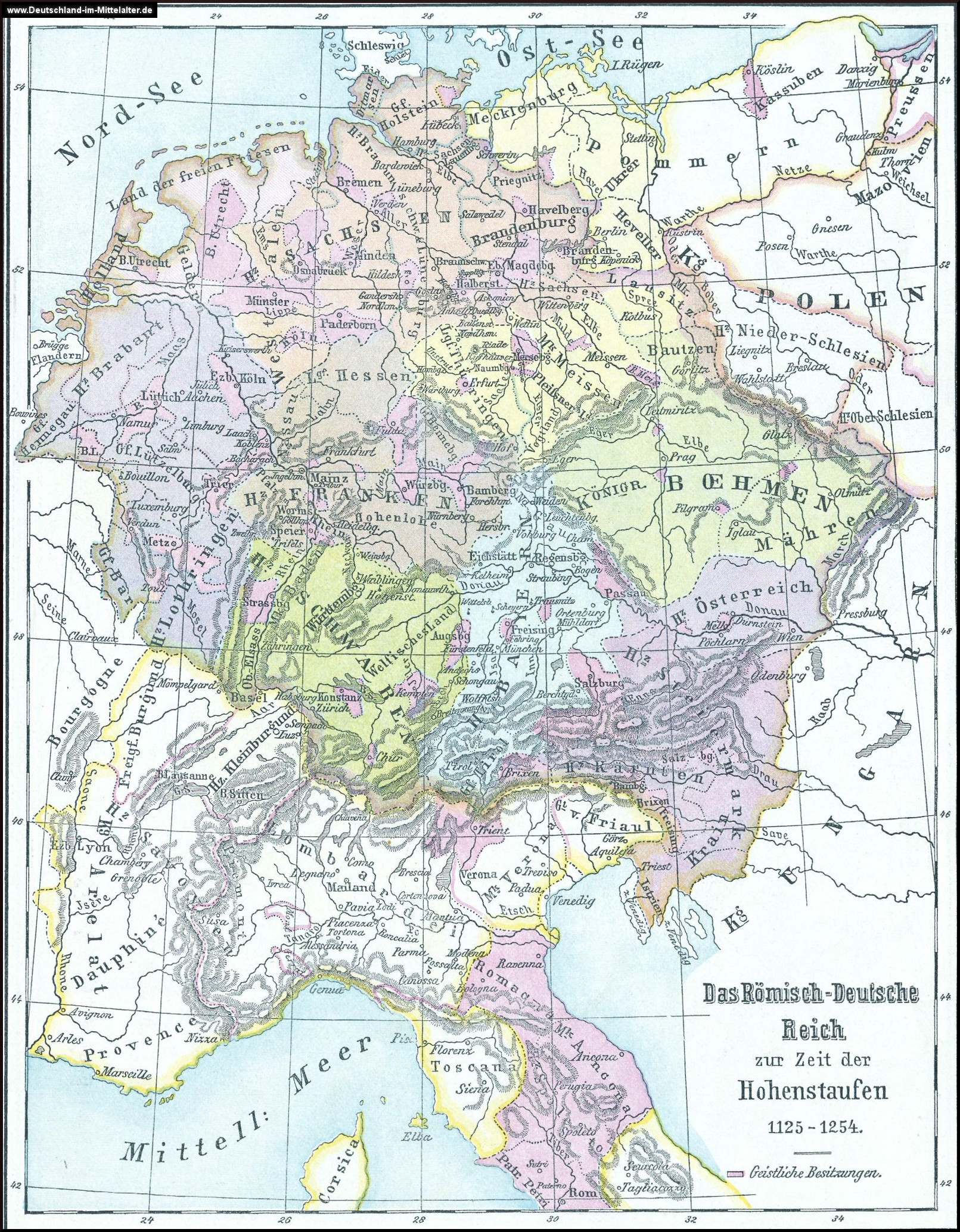
Das römisch-deutsche Reich zur Zeit der Hohenstaufen (1125-1254)
Central Europe in the time of the Staufens
(Droysens Allgemeiner Historischer Handatlas, 1886)
Germany at the time of the Saxon and Salian Emperors
(Putzgers Historischer Weltatlas, 1905)
Germany and Upper Italy in the 14th Century (1378
) (Putzgers Historischer Weltatlas, 1905)
Germany in the 14th Century
(Droysens Allgemeiner Historischer Handatlas, 1886)
Germany and Upper Italy in the 15th Century (1477)
(Putzgers Historischer Weltatlas, 1905)
Germany in the 15th Century
(Droysens Allgemeiner Historischer Handatlas, 1886)
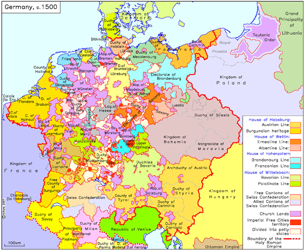
Holy Roman Empire, c. 1500
Germany, 1500
Germany at the Time of the Reformation (1547)
(Putzgers Historischer Weltatlas, 1905)
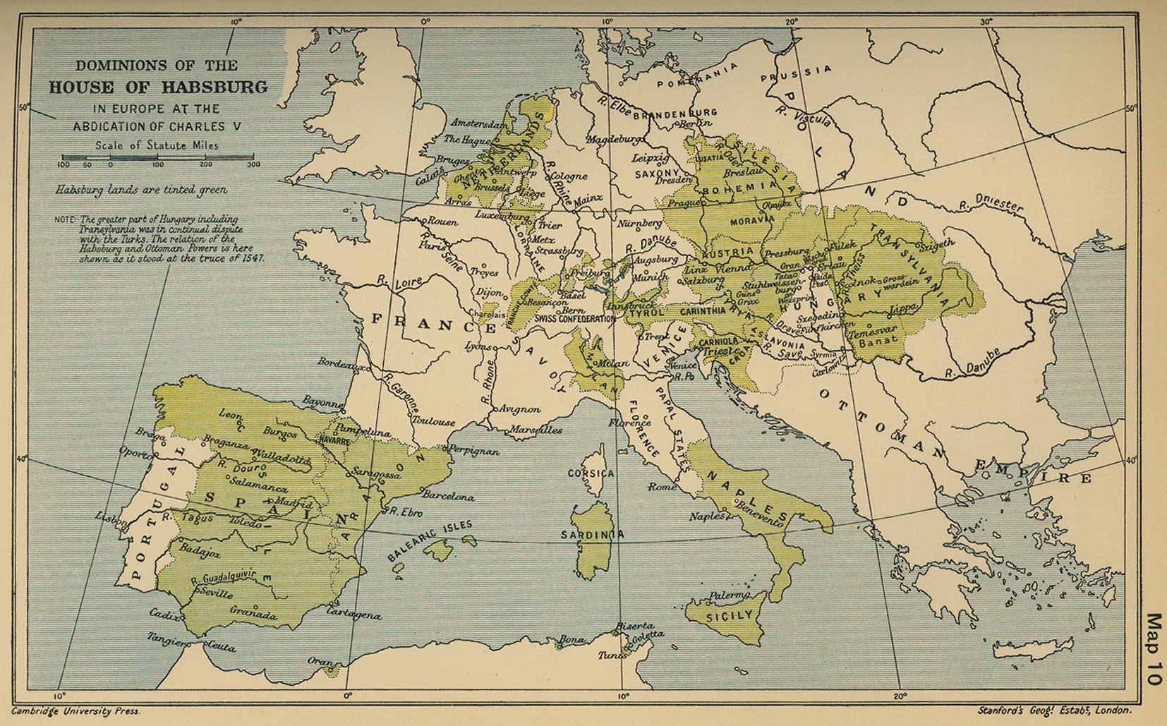
Dominions of the House of Habsburg in Europe at the Abdication of Charles V
(Cambridge Modern History Atlas, 1912)
Germany at the Time of the 30 Years War
(Droysens Allgemeiner Historischer Handatlas, 1886)
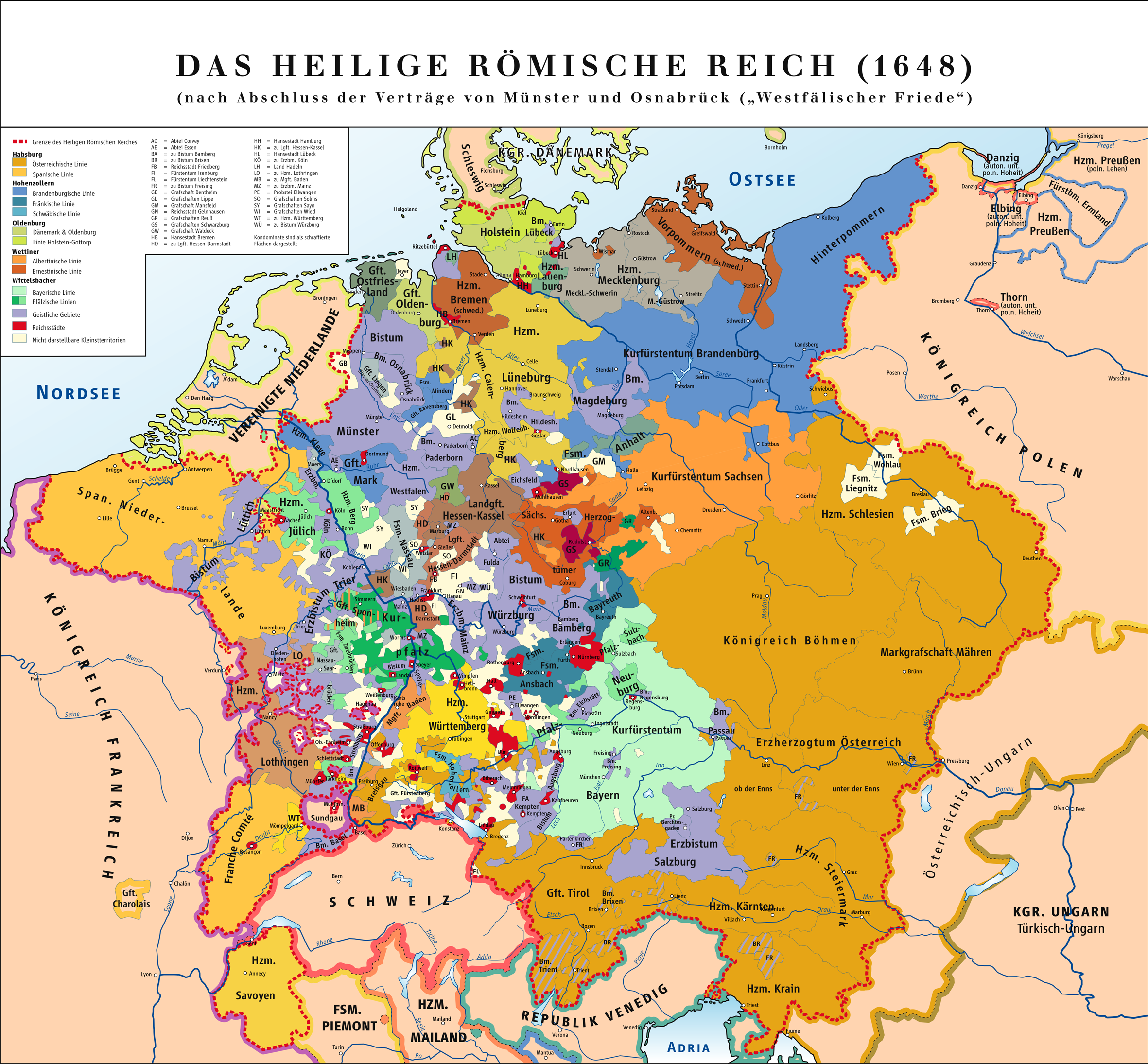
Holy Roman Empire, 1648
Austria Empire: Treaty Territorial Adjustments, 1814-1815
The Austrian Dominions since 1815
Europe, 1867
(IEH - Maps)
Ethnic and Linguistic Map of Germany, 1872 (Völker- und Sprachen-Karte von Deutschland)
(Heinrich Kiepert)
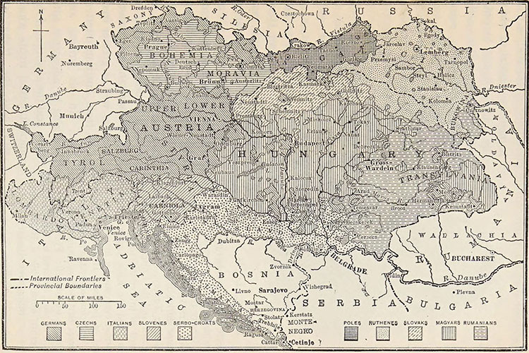
Austria-Hungary
(britannica.com)
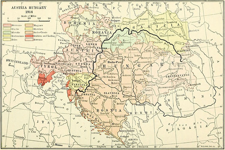
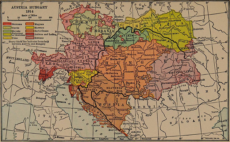
Austria-Hungary, 1911
The Proposed States of Greater Austria
(brilliantmaps.com)
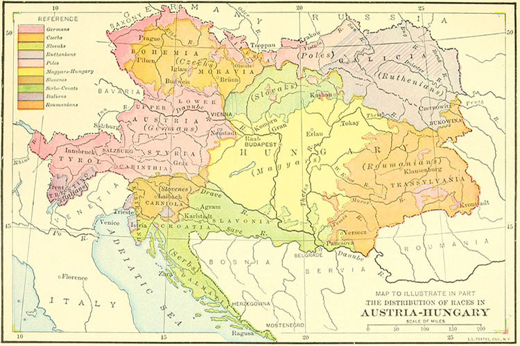
Ethnic Map of Austria-Hungary, 1914
(Mittelsbach’s Verlag)
Linguistic Map of the Austro-Hungarian Monarchy, 1914
(De Agostini)
Carte ethnographique de l’Autriche-Hongrie, 1918
Ethnolinguistic Map of Austria-Hungary, 1918
(in German, G. Freytag & Berndt)
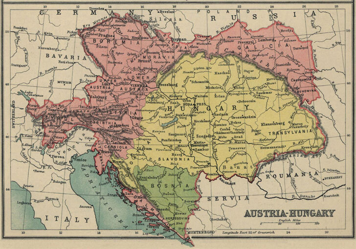
Austria-Hungary in 1913
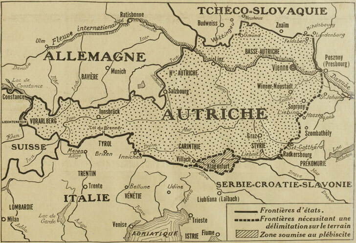
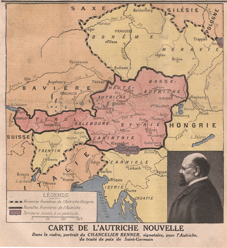
Austria after the Treaty of Saint-Germain (1919) a
Austria after the Treaty of Saint-Germain (1919) b
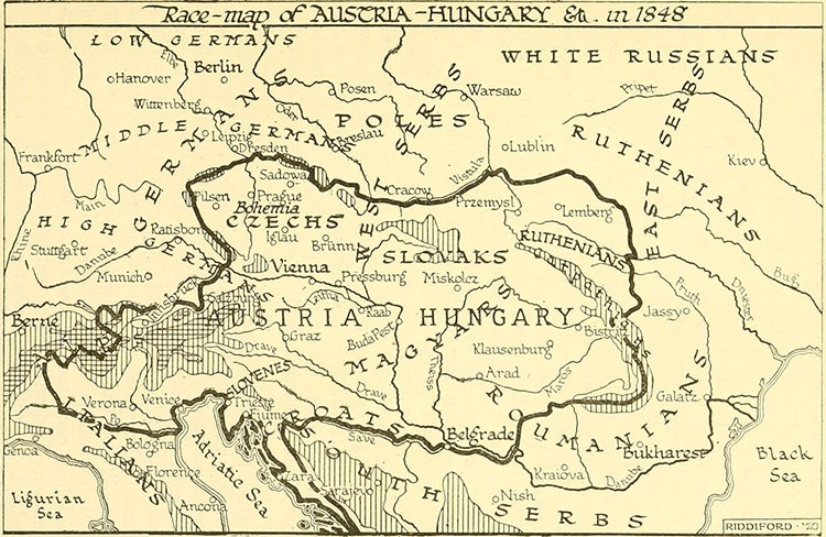
Ethnographic Map of Austria (1848) a
Ethnographic Map of Austria (1848) b
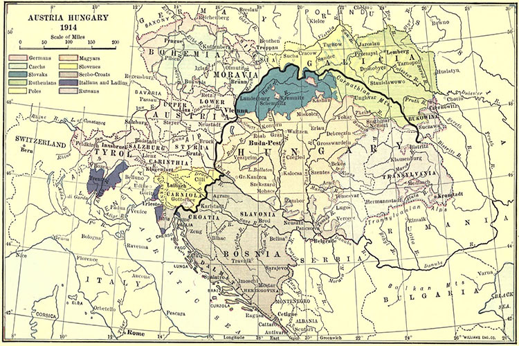
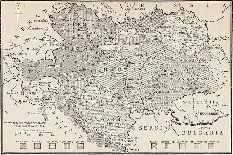
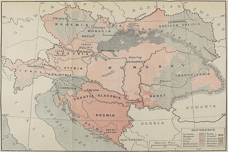
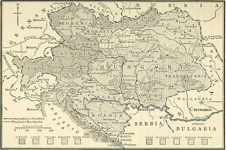
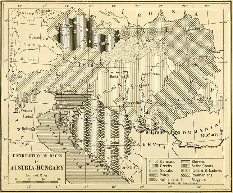
Ethnographic Map of Austria-Hungary (1914) a
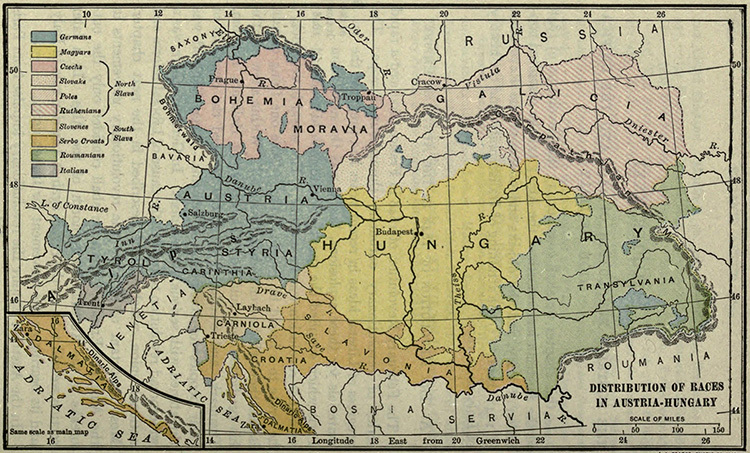
Ethnographic Map of Austria-Hungary (1914) b
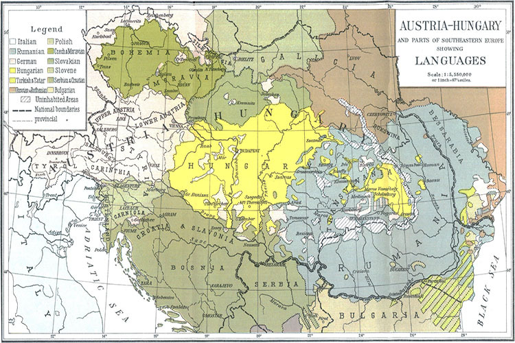
Ethnographic Map of Austria-Hungary (1914) c
Ethnographic Map of Austria-Hungary (1914) d
Ethnographic Map of Austria-Hungary (1914) e
Ethnographic Map of Austria-Hungary (1914) f
Ethnographic Map of Austria-Hungary (1914) g
Ethnographic Map of Austria-Hungary (1914) h
Ethnographic Map of Austria-Hungary (1914) i
Ethnographic Map of Austria-Hungary (1915)
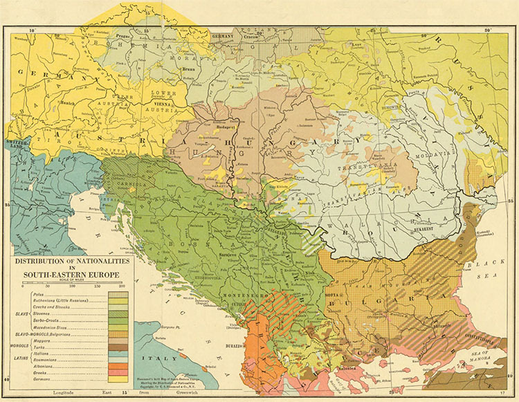
Ethnographic Map of South-Eastern Europe (1918)
World
Albania
France
Netherlands
Spain & Portugal
Caucasus
Latin America
Ancient Greece
Austria
Germany
Poland
Switzerland
Middle East
Mexico
Roman Empire
Britain
Greece
Romania
Türkiye
Asia
Canada
Holy Roman Empire
Bulgaria
Hungary
Scandinavia
Ukraine
China
U.S.A.
Europe
Croatia
Italy
Serbia
Russia
Japan
Australia


