Skip to main content
Home
Historical Maps
World History
U.S. History
Canadian History
Canada (English)
Canada (Français)
Old school history maps
Stories on the Map
Armenia
Assyria
Catalonia
Kurdistan
Palestine
Ukraine
Edmaps +
HISTORICAL MAPS OF HUNGARY
Map Collections and Atlases
Blank and Outline Maps of Hungary
(d-maps.com)
Historical Maps of Hungary
(American Geographical Society Library Digital Map Collection)
Historical Maps of Hungary
(David Rumsey Map Collection)
Hungary: Historical Maps Collection
(Library of Congress)
Old Maps of Hungary
(oldmapsonline.org)
Maps
The Kingdom of Hungary during the Reign of Matthias Corvinus (1458-1490)
Royaume d’Hongrie, Principauté de Transylvanie et Banat de Temeswar, 1788
Hungary and Transylvania, 1811
(S.A. Oddy)
Kingdom of Hungary, with Croatia and Slavonia, 1835
(in German; F. W. Streit)
Carte de la Hongrie et des pays limitrophes appartenant à l’Empire d’Autriche, 1849
(V. Janson)
Kingdom of Hungary, 1865
(in Hungarian)
Ethnographic Map of the Austro-Hungarian Monarchy, 1870
(in German; K. Hauptmann)
Balkan States & Ottoman Empire, 1877-1878
(Stanford’s Popular Map)
Austria-Hungary, 1884
(A. Black)
Ethnographic Map of Austria-Hungary, 1895
(R. Andree)
Autriche-Hongrie, 1900
(Larousse)
Ethnographic Map of Hungary, 1903
(in Hungarian; Cholnoky Jeno)
Austria-Hungary, 1904
(in German; A. Stieler)
Ethnographic School Map of the Kingdom of Hungary, 1909
(in Hungarian; Batky Z.)
Ethnographic Map of Hungary Based on the Census of 1910
Ethnographic Map of Hungary, 1912
(in German; P. Langhans)
Allemagne et Autriche-Hongrie, 1915
(A. Taride)
Ethnographic Map of Austria-Hungary, 1918
(in German; J. Kettler)
Carte ethnographique de l’Autriche-Hongrie, 1919
Hongrie en 1920 après le Traité de Trianon
(larousse)
Austria, Hungary and Czechoslovakia, 1925
(Cummins)
Hungary and Danubian States, 1944
(in German; A. Stieler)
Hungary, 1967
(Pergamon)
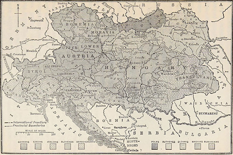
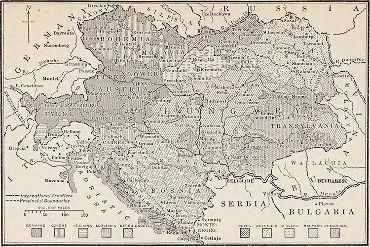
Ethnographic Map of Austria (1848) a
Ethnographic Map of Austria (1848) b
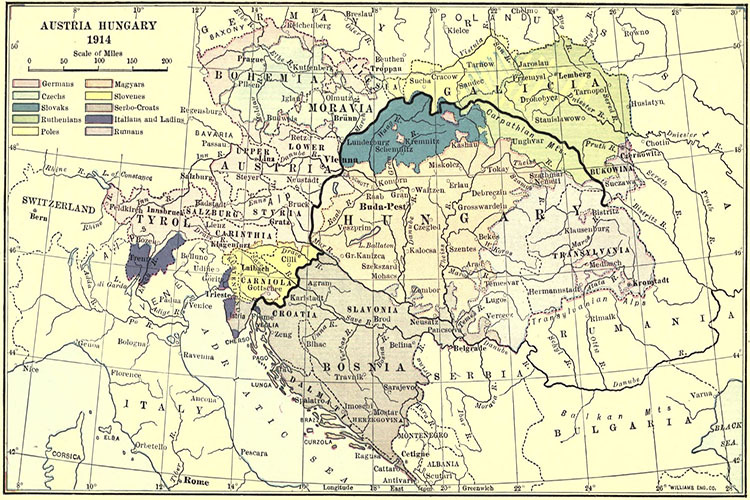
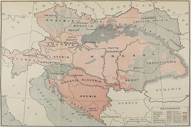
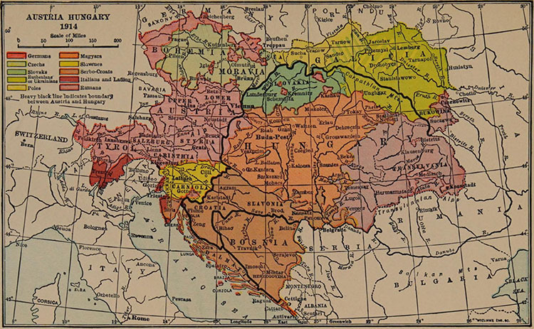
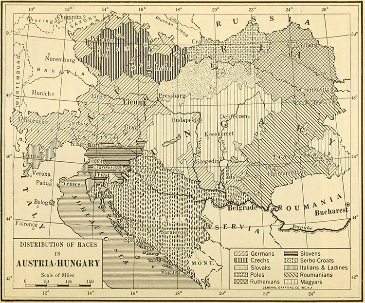
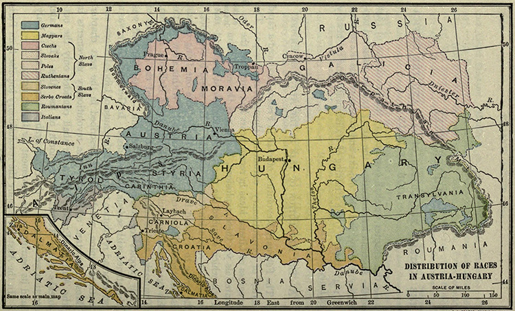
Ethnographic Map of Austria-Hungary (1914) a
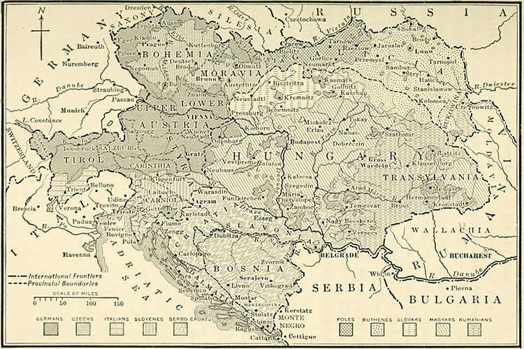
Ethnographic Map of Austria-Hungary (1914) b
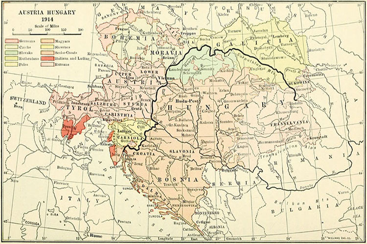
Ethnographic Map of Austria-Hungary (1914) c
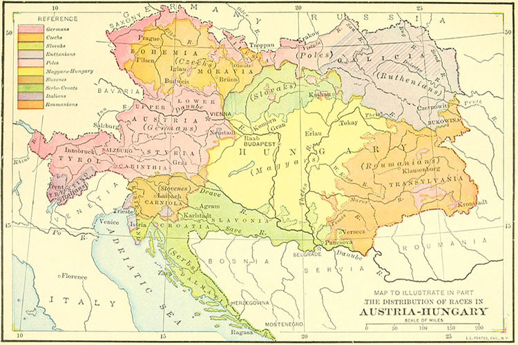
Ethnographic Map of Austria-Hungary (1914) d
Ethnographic Map of Austria-Hungary (1914) e
Ethnographic Map of Austria-Hungary (1914) f
Ethnographic Map of Austria-Hungary (1914) g
Ethnographic Map of Austria-Hungary (1914) h
Ethnographic Map of Austria-Hungary (1914) i
World
Albania
France
Netherlands
Spain & Portugal
Caucasus
Latin America
Ancient Greece
Austria
Germany
Poland
Switzerland
Middle East
Mexico
Roman Empire
Britain
Greece
Romania
Türkiye
Asia
Canada
Holy Roman Empire
Bulgaria
Hungary
Scandinavia
Ukraine
China
U.S.A.
Europe
Croatia
Italy
Serbia
Russia
Japan
Australia