Skip to main content
Home
Historical Maps
World History
U.S. History
Canadian History
Canada (English)
Canada (Français)
Old school history maps
Stories on the Map
Armenia
Assyria
Catalonia
Kurdistan
Palestine
Ukraine
Edmaps +
HISTORICAL MAPS OF CROATIA
Map Collections and Atlases
Blank and Outline Maps of Croatia
(d-maps.com)
Mappae Croaticae
(National and University Library in Zagreb)
Croatia: Historical Maps Collection
(Library of Congress)
Historical Maps of Croatia
(American Geographical Society Library Digital Map Collection)
Historical Maps of Croatia
(David Rumsey Map Collection)
Old Maps of Croatia
(oldmapsonline.org)
Maps
Croatia, c. 800
(in Croatian)
Croatia, 1073
(in Croatian)
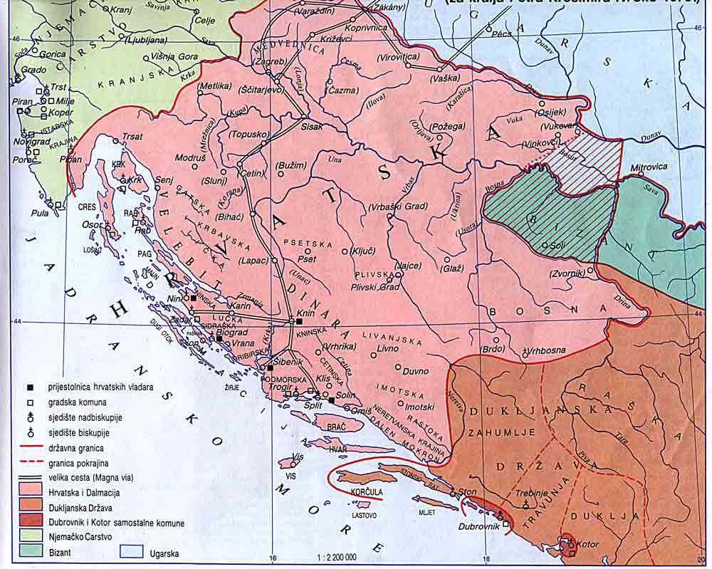
Croatia, 1102
(in Croatian)
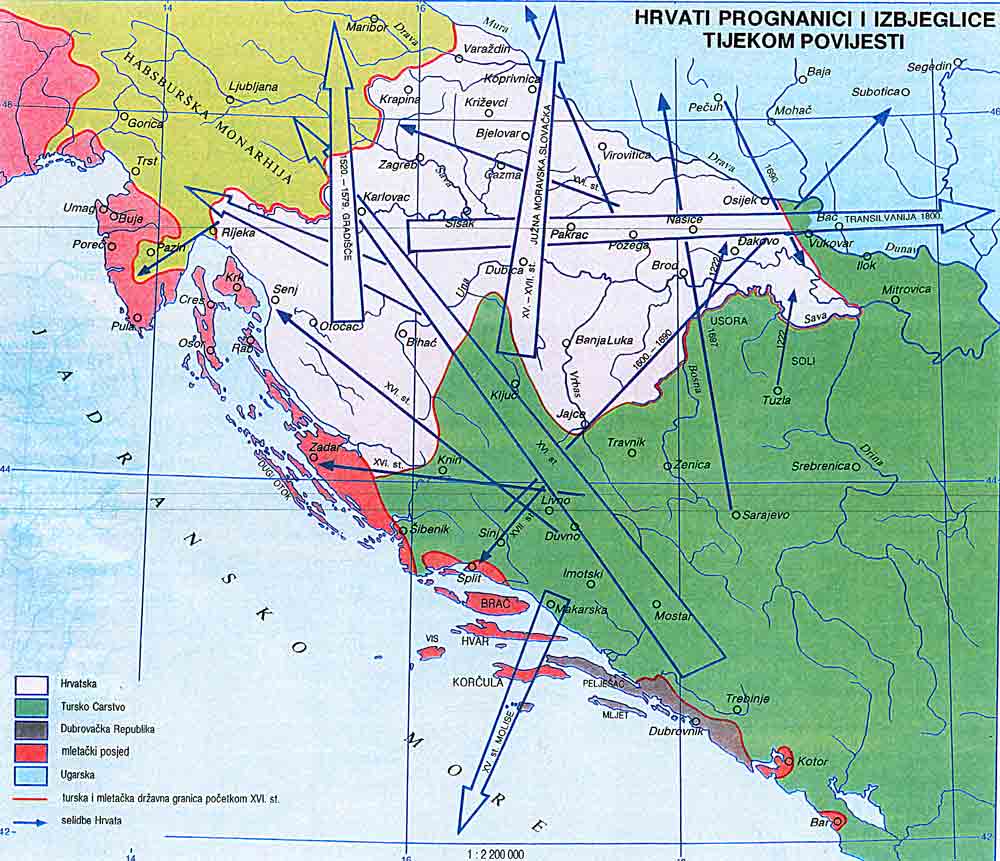
Croatian Migration from 1222 to the 17th Century
(in Croatian)
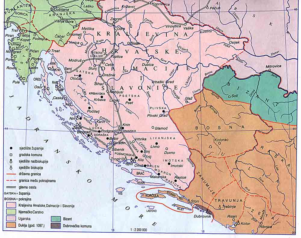
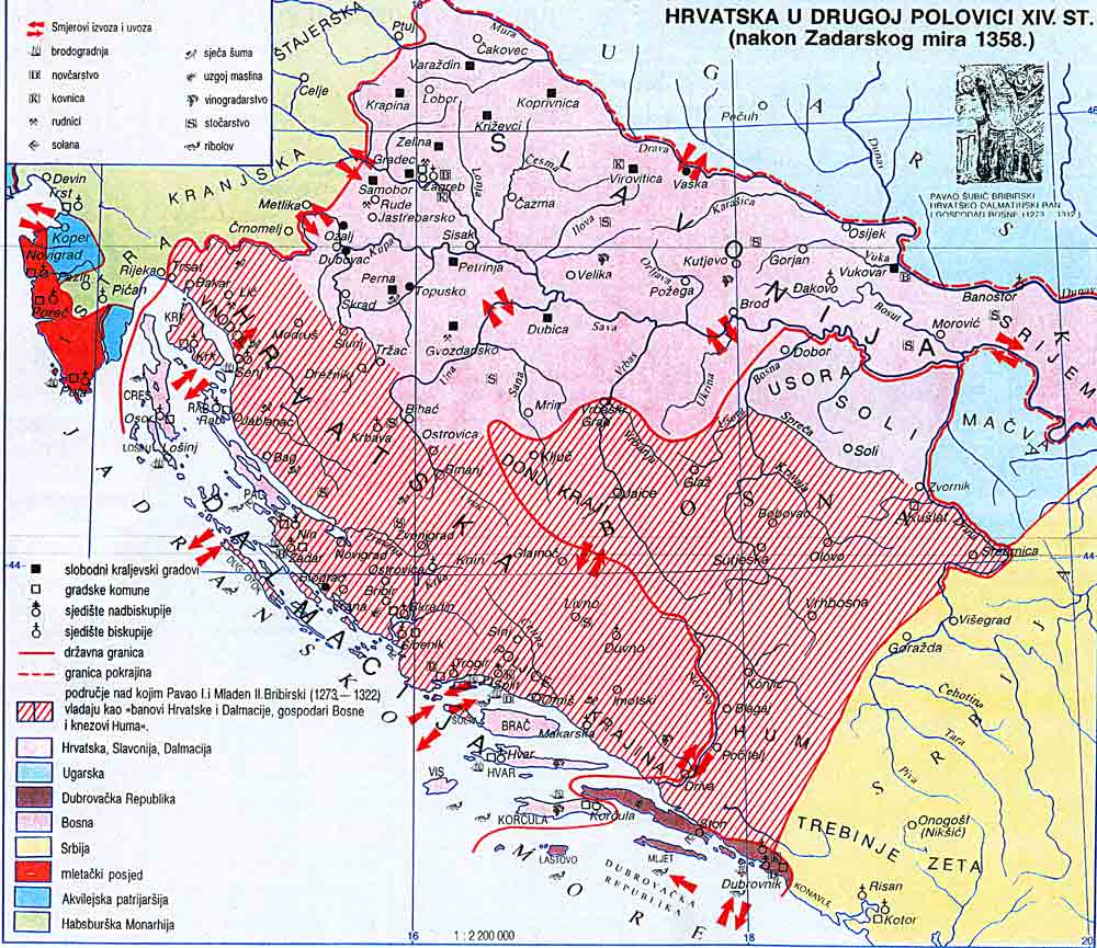
Croatia, 1358
(in Croatian)
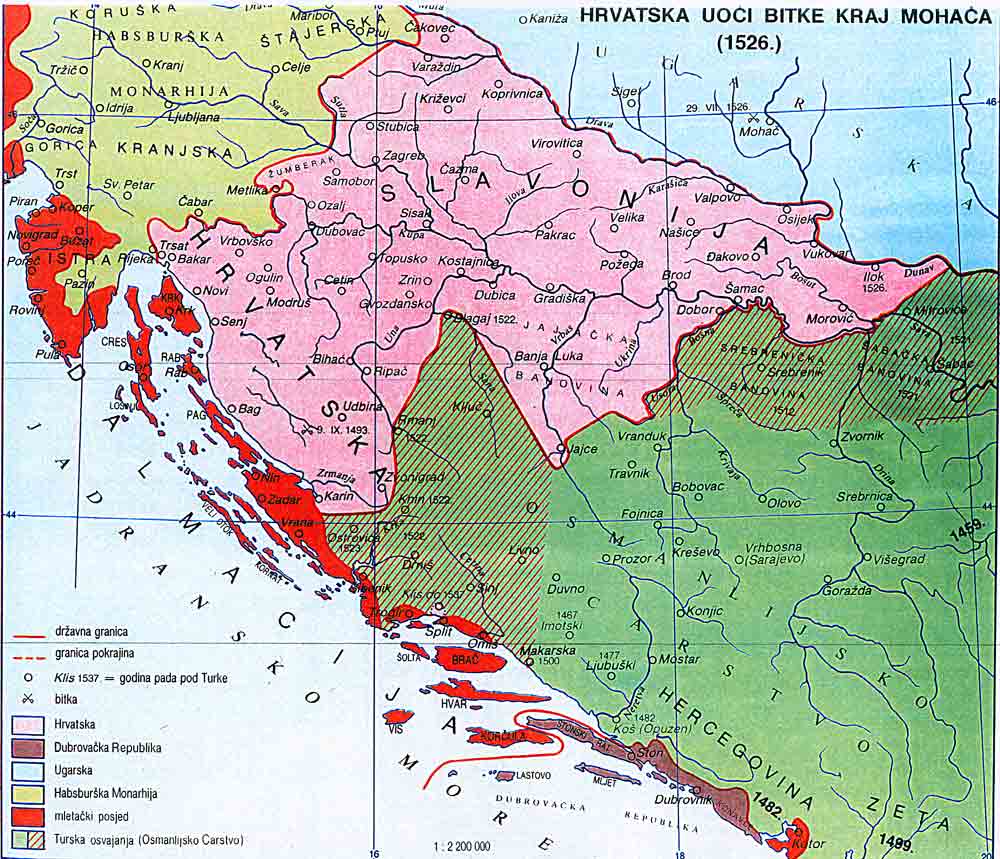
Croatia, 1526
(in Croatian)
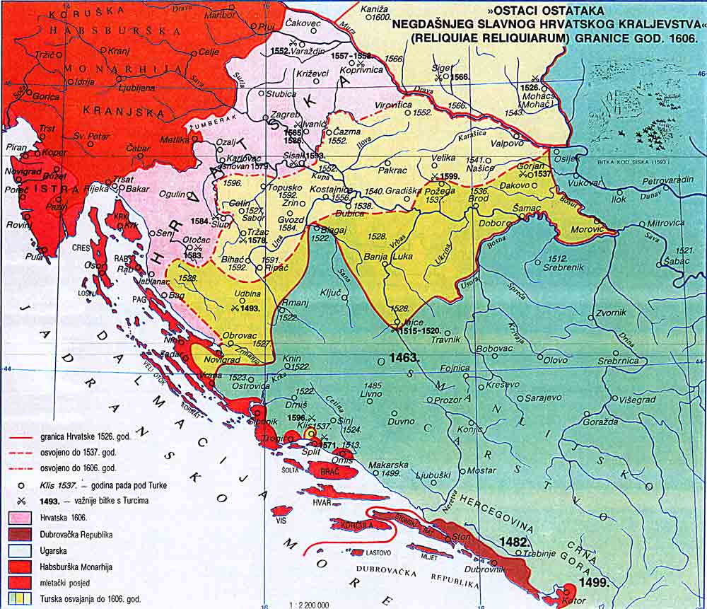
Croatia, 1606
(in Croatian)
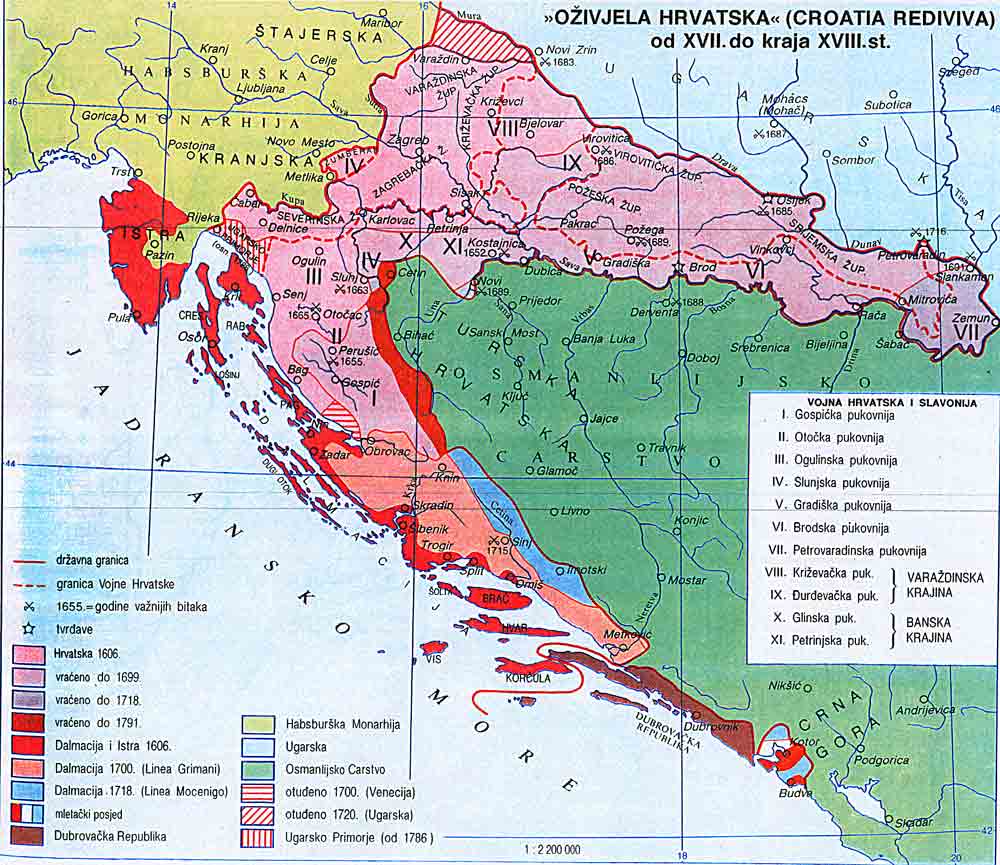
Croatia, 17th-18th
(in Croatian)
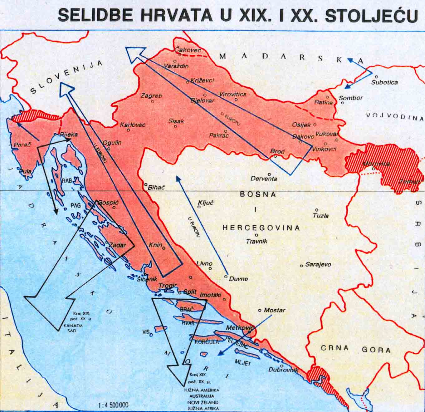
Croatian Migration in the 19th-20th Centuries
(in Croatian)
Croatia, Slavonia & the Western Slavic Lands of the Ottoman Empire, 1844
(in German; H. Berghaus)
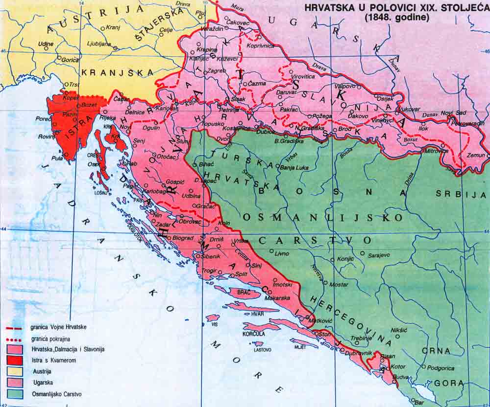
Croatia, 1848
(in Croatian)
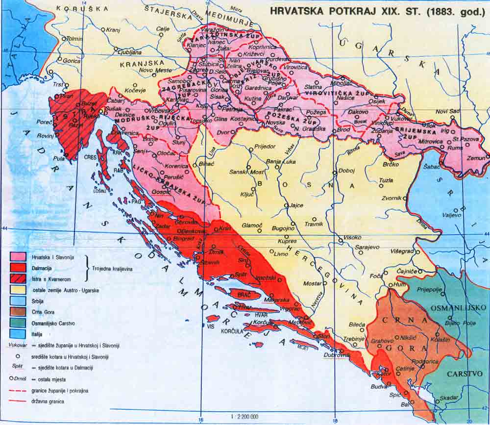
Croatia, 1883
(in Croatian)
Carte des Balkans en 1910
(Gallica - Bibliothèque nationale de France)
The Balkan states showing boundaries finally adopted, 1913
(W. Sloane)
Ethnic Map of the Balkan Peninsula, 1914
(in German, J. J. Kettler)
Lands of Serbian, Croats and Slovens, 1917
(Marcel Kolin)
Ethnographic Map of the Balkan Peninsula, 1918
(Jovan Cvijić)
Zones of Civilization of the Balkan Peninsula
(Jovan Cvijić)
Kingdom of Serbs, Croats and Slovenes, 1920
(in Serbian/Croatian)
Jugoslavia, 1929
(in Italian; Touring Club Italiano)
Independent State of Croatia, 1942
(in Croatian)
Independent State of Croatia, 1943
(in Croatian)
Ethnographic Map of Jugoslavia (1951)
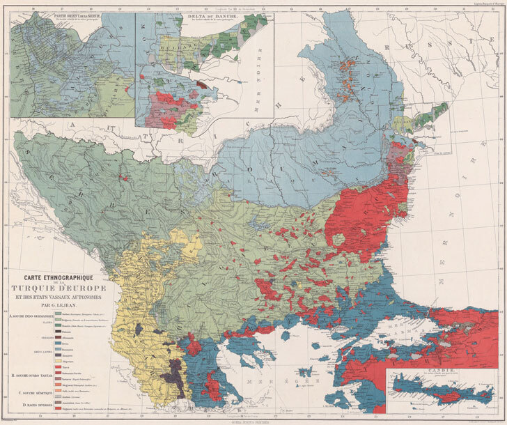
Ethnographic Map of the Balkan Peninsula (1861)
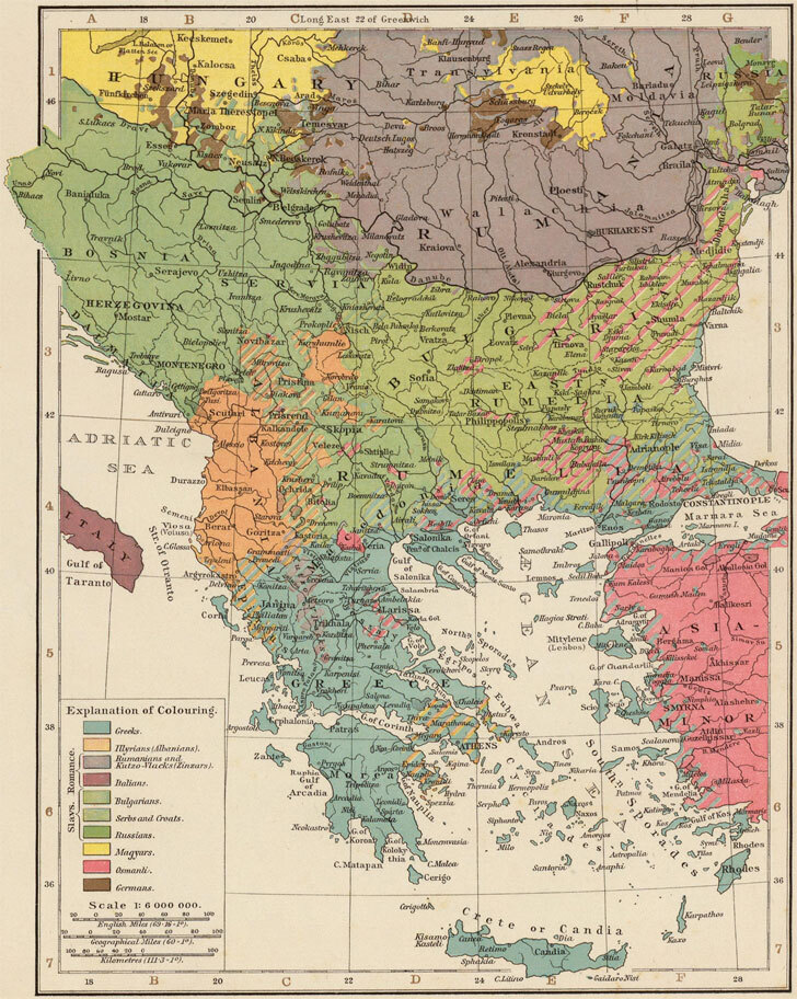
Ethnographic Map of the Balkan Peninsula (1895)
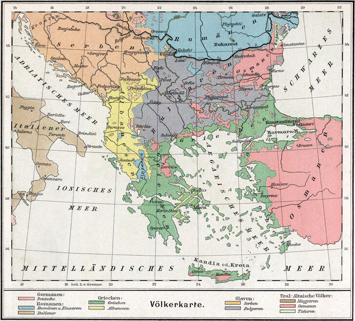
Ethnographic Map of the Balkan Peninsula (1896)
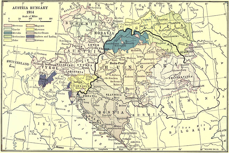
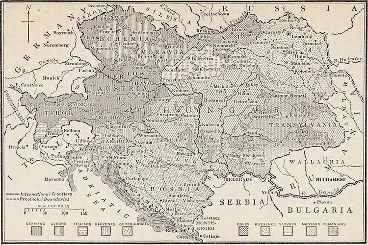
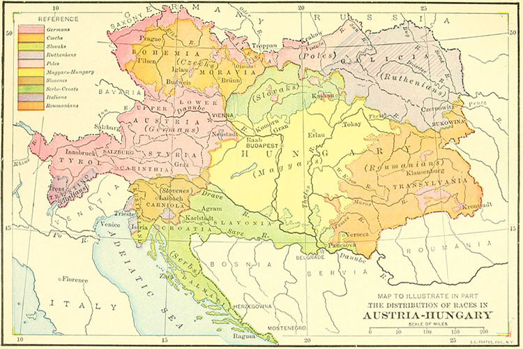
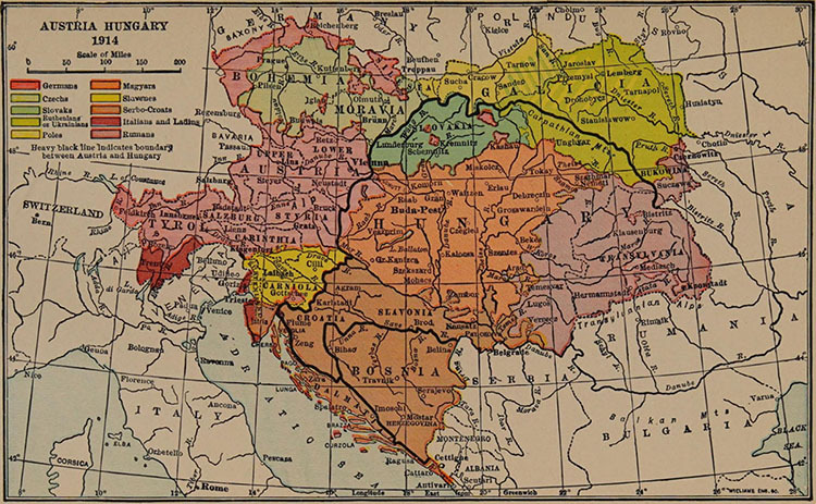
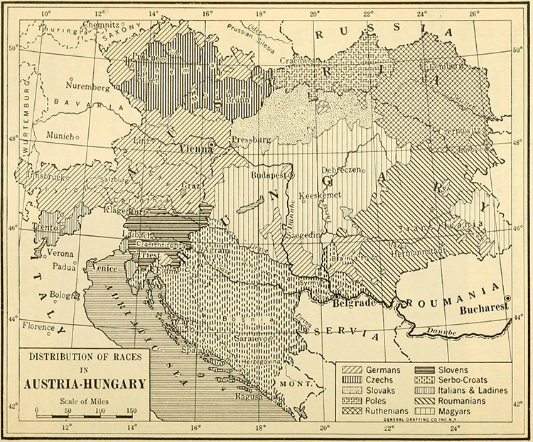
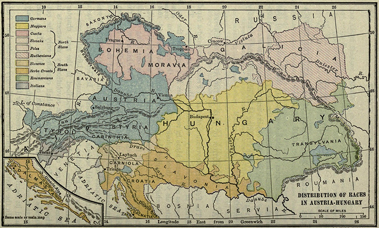
Ethnographic Map of Austria-Hungary (1914) a
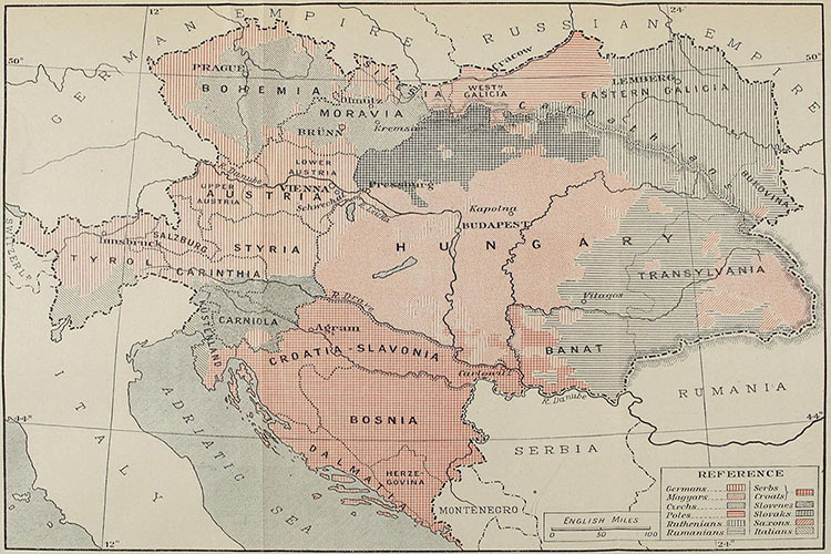
Ethnographic Map of Austria-Hungary (1914) b
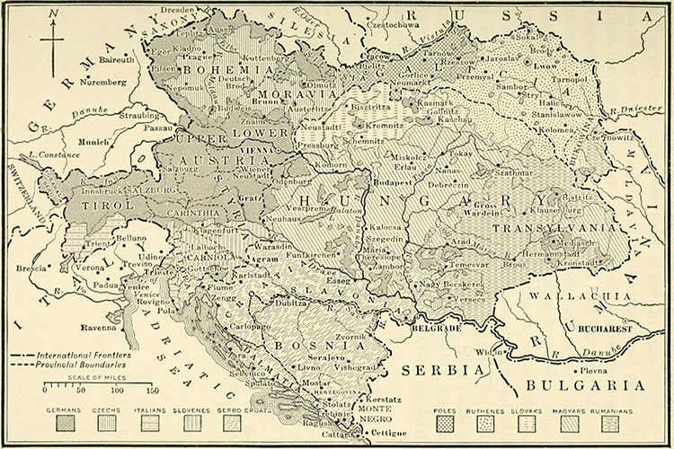
Ethnographic Map of Austria-Hungary (1914) c
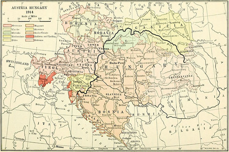
Ethnographic Map of Austria-Hungary (1914) d
Ethnographic Map of Austria-Hungary (1914) e
Ethnographic Map of Austria-Hungary (1914) f
Ethnographic Map of Austria-Hungary (1914) g
Ethnographic Map of Austria-Hungary (1914) h
Ethnographic Map of Austria-Hungary (1914) i
World
Albania
France
Netherlands
Spain & Portugal
Caucasus
Latin America
Ancient Greece
Austria
Germany
Poland
Switzerland
Middle East
Mexico
Roman Empire
Britain
Greece
Romania
Türkiye
Asia
Canada
Holy Roman Empire
Bulgaria
Hungary
Scandinavia
Ukraine
China
U.S.A.
Europe
Croatia
Italy
Serbia
Russia
Japan
Australia


