Skip to main content
Home
Historical Maps of USA
Historical Maps of Canada
Old school history maps
Stories on the Map
Edmaps +
Historical Maps of Türkiye
World
Ancient Greece
Roman Empire
Holy Roman Empire
Europe
Albania
Austria
Britain
Bulgaria
Croatia
France
Germany
Greece
Hungary
Italy
Netherlands
Poland
Romania
Scandinavia
Serbia
Spain & Portugal
Switzerland
Türkiye
Ukraine
Russia
Caucasus
Middle East
Asia
Latin America
Canada
U.S.A.
Australia
Map Collections and Atlases
Blank and Outline Maps of Turkey
(d-maps.com)
Géographie-atlas de l’Empire ottoman: texte et cartes, 1907
(Joseph Dupont)
Historical Maps of Turkey
(American Geographical Society Library Digital Map Collection)
Historical Maps of Turkey
(David Rumsey Map Collection)
Istanbul in Maps
(Istanbul Urban Database - Nil Tuzcu)
Old Maps of Turkey
(oldmapsonline.org)
Turkey: Historical Maps Collection
(Library of Congress)
Maps
Mediterranean Lands at the Time of the Crusades
(Droysens Allgemeiner Historischer Handatlas, 1886)
Ottoman Empire at Fall of Constantinople, 1453
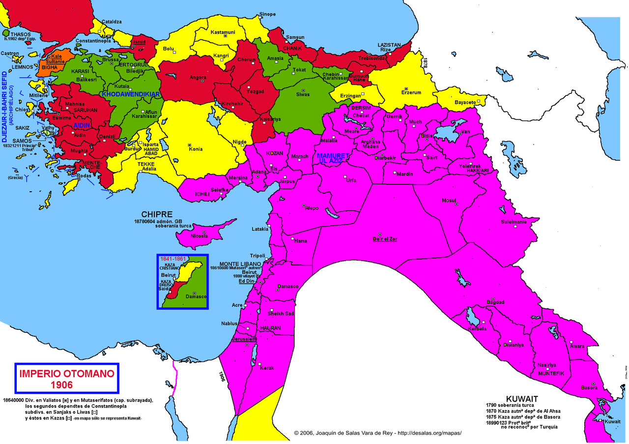
Ottoman Empire
(Joaquin de Salas Vara del Rey)
Ottoman Empire, 1683
Turkey in Europe, 1858
(J. Arrowsmith)
Balkan States & Ottoman Empire, 1877-1878
(Stanford’s Popular Map of the Seat of War)
The Ottoman Empire at the beginning of the 20th century
(houshmadyan.org)
Sketch Map of Western Turkey in Europe, 1909
(U.S. War Office)
Sketch Map to Shew Approximately Railways in Asiatic Turkey, 1911
(U.S. War Office)
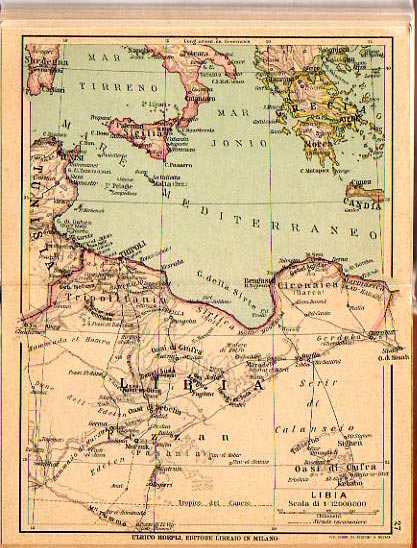
Libya, 1912
Ottoman Levant (Syria, Aleppo, Beirut, etc.) before 1914: Administrative division
La Guerre en Orient: La Turquie et ses voisins, 1914
(M. Dubois, J. G. Kergomard)
Stanford’s Map of part of the Turkish Empire with the Balkan Peninsula and Lower Egypt, 1914
Railroads in Turkey showing their connections and extensions, 1915
Part of Asiatic Turkey showing Distribution of Peoples, 1915
Egypt and the Near East, 1918
(Daily Telegraph)
The Middle East from the Treaty of Sèvres (1920) to the Treaty of Lausanne (1923)
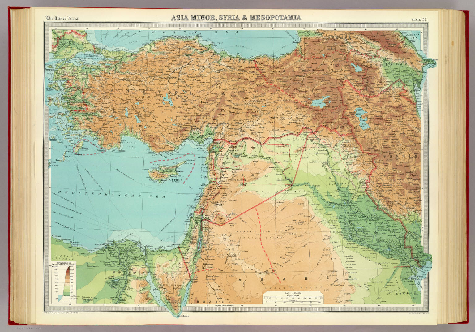
Asia Minor, Syria and Mesopotamia, 1922
(The Times Atlas, 1922)
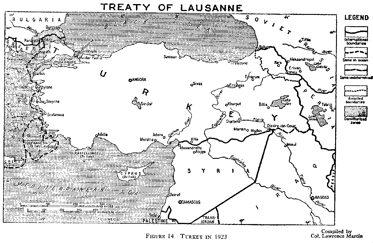
Treaty of Lausanne (1923)
Carte de la Turquie indiquant les divisions en Vilayets, 1931
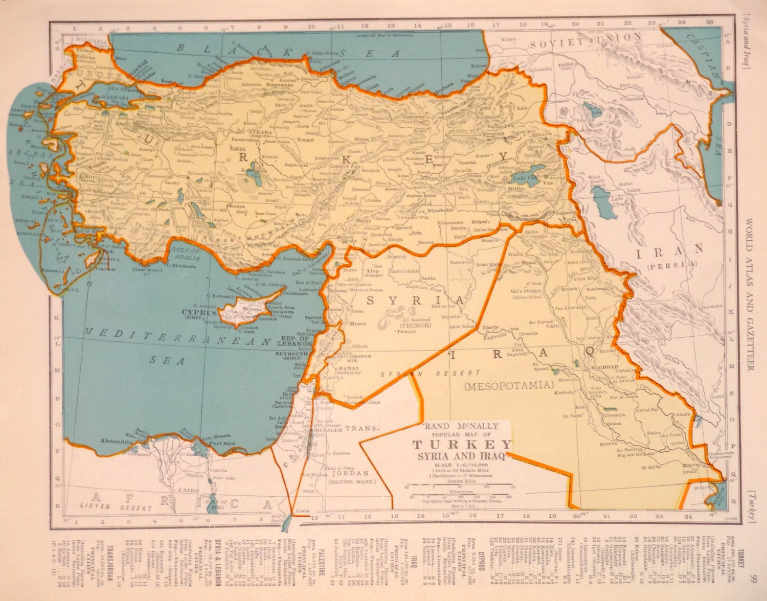
Rand McNally Popular Map of Turkey, Syria and Iraq, 1940
Turkey, Syria and Iraq, 1945
MORE MAPS OF INTEREST
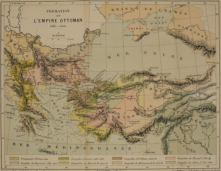
Formation of the Ottoman Empire, 1281-1520
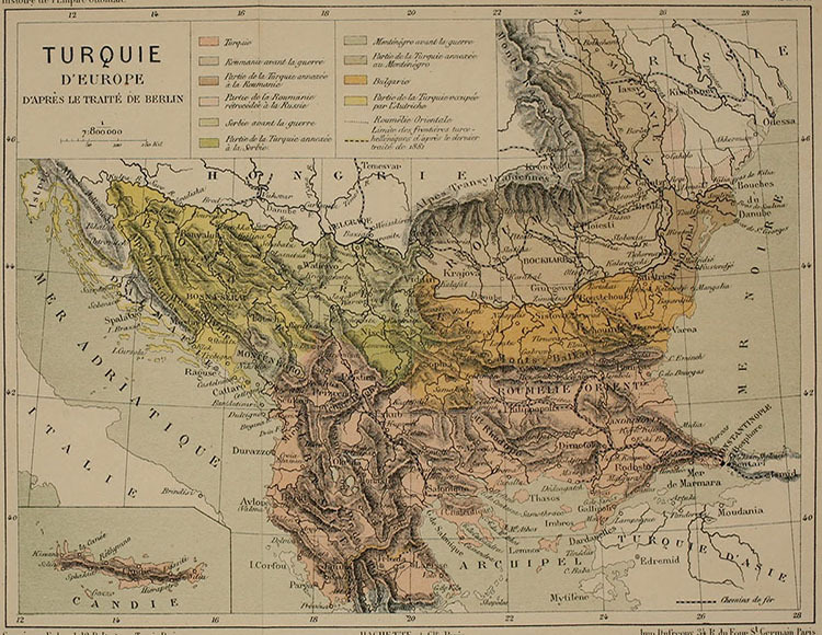
European Turkey after the Congress of Berlin (1878)
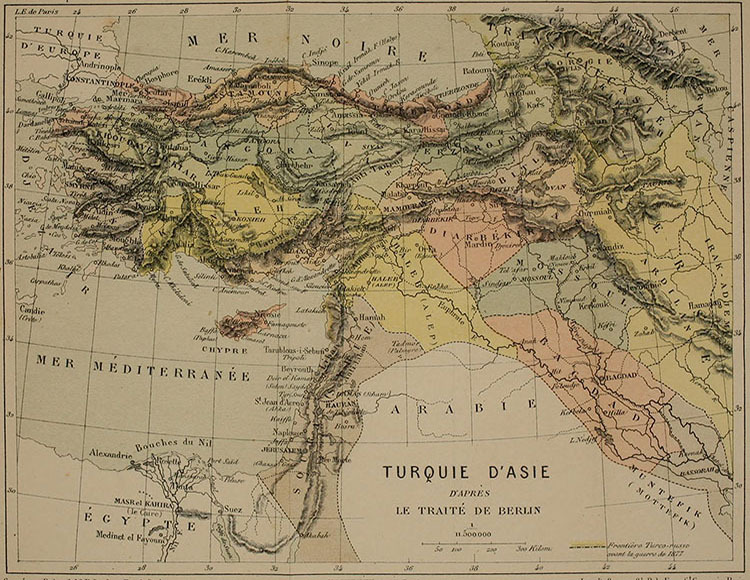
Asiatic Turkey after the congress of Berlin (1878)
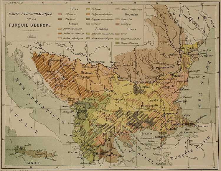
Ethnographic Map of European Turkey (1881)

