Skip to main content
Home
World History Maps
Historical Maps of USA
Historical Maps of Canada
Old School History Maps
Maps +
Historical Maps of the British Isles
World
Ancient Greece
Roman Empire
Holy Roman Empire
Europe
Albania
Austria
British Isles
Bulgaria
Croatia
France
Germany
Greece
Hungary
Italy
Netherlands
Poland
Romania
Scandinavia
Serbia
Spain & Portugal
Switzerland
Turkiye
Ukraine
Russia
Caucasus
Middle East & Northern Africa
Asia
Latin America
Canada
U.S.A.
Australia
Map Collections and Atlases
Blank and Outline Maps of the United Kingdom
(d-maps.com)
Blank and Outline Maps of Ireland
(d-maps.com)
Atlas of Hillforts
(UK & Ireland)
British Isles: Historical Maps Collection
(Library of Congress)
Historical Map Collection: Wales, UK & World
(The National Library of Wales)
Historical Maps of Britain
(A Vision of Britain through Time)
Historical Maps of Great Britain
(American Geographical Society Library Digital Map Collection)
Historical Maps of Great Britain
(David Rumsey Map Collection)
Historical Ordnance Survey Maps of Great Britain
(Digimap - University of Edinburgh)
Historical Ordnance Survey Maps of Northern Ireland
(Public Record Office of Northern Ireland)
Layers of London: A Collection of Digitised Historic Maps of London
(Institute of Historical Research)
Map Images: A Collection of Historical Maps of Scotland, UK & World
(National Library of Scotland)
Old Maps of United Kingdom
(oldmapsonline.org)
Maps of the Roman Britain
Pre-Roman Britain, 55 BC-AD 43
(P.L. Kessler)
Roman Conquest of Britain, 43-84
(wikipedia)
Roman Britain
Roman Britain
Roman Britain
(Encyclopaedia Britannica)
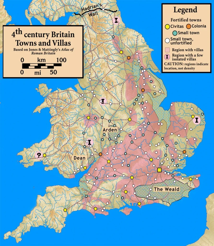
4th Century Britain: Towns and Vilas
Roman Britain about 410
(R. Botev)
Maps of the Anglo-Saxon Kingdoms
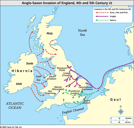
Anglo-Saxon Invasion of England, 4th and 5th Century CE
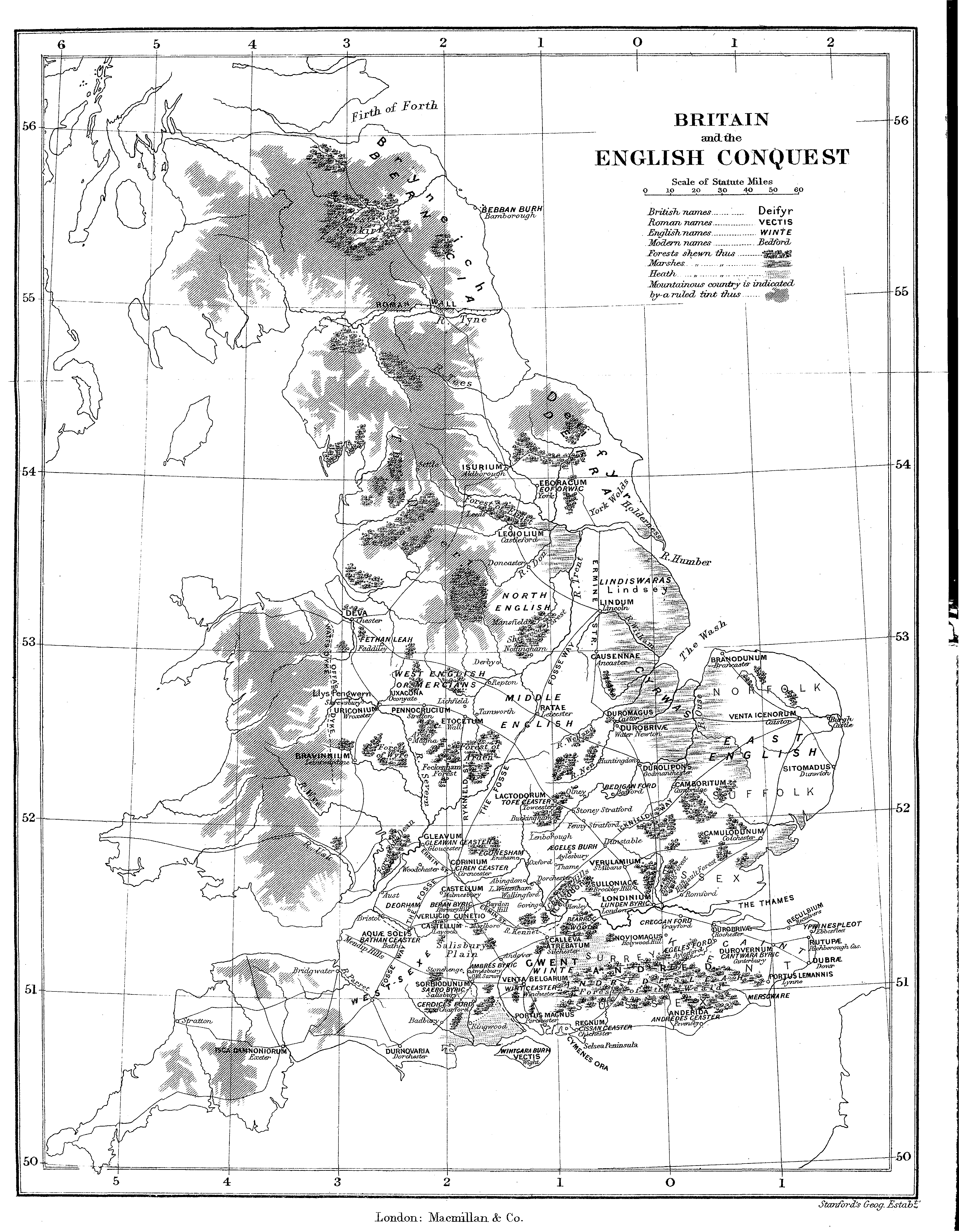
Britain and the English Conquest
England under the Anglo-Saxon Kings
(Droysens Allgemeiner Historischer Handatlas, 1886)
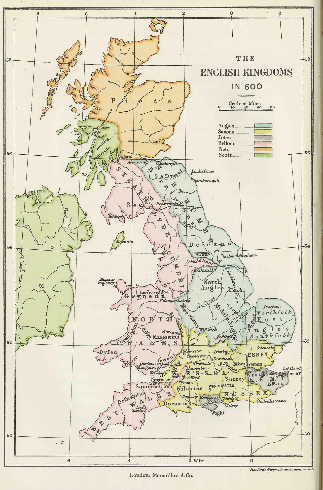
The English Kingdoms in 600
Southern England in the Eighth Century
(Reginald Piggott)
The Heptarchy (c. 700)
(Reginald Piggott)
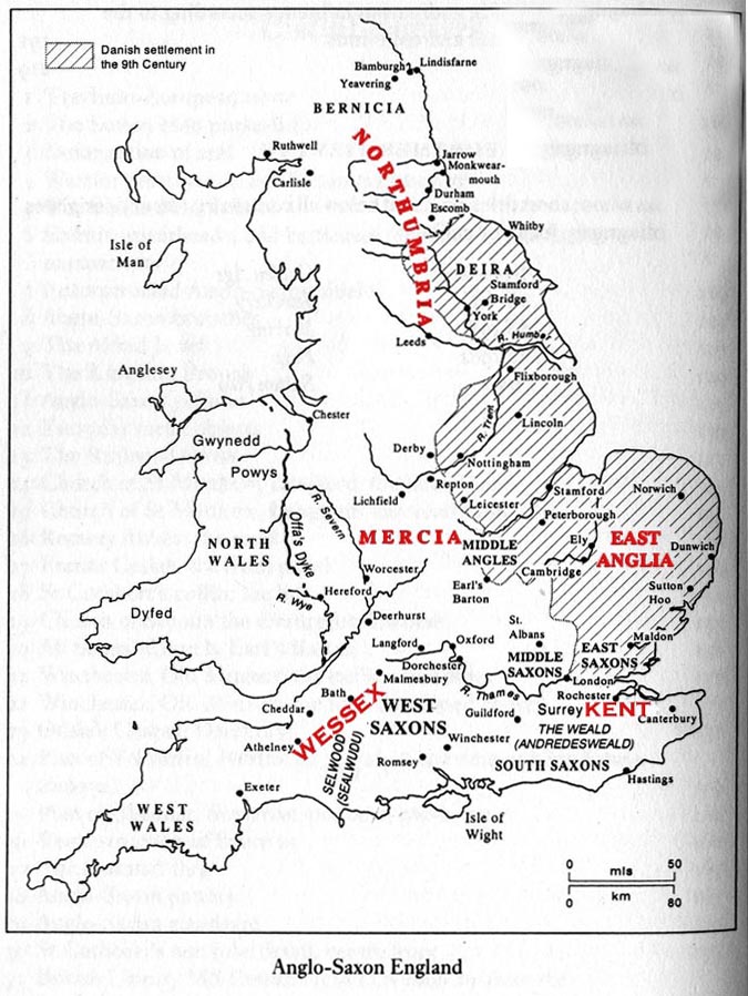
Anglo-Saxon England
Southern England in the Ninth Century
(Reginald Piggott)
The Mercian Supremacy (c. 800)
(Reginald Piggott)
The British Isles about 802
(William Shepherd, Historical Atlas, 1926)
The Great Heathen Army of 865
Alfred’s Kingdom of the Anglo-Saxons
(Reginald Piggott)
England During the Reign of Edward the Elder (899-924)
(Reginald Piggott)
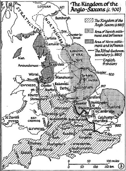
The Kingdom of the Anglo-Saxons (c. 900)
(Reginald Piggott)
The Midlands, c. 912
England During the Reign of King Ethelstan (924-939)
(Reginald Piggott)
Viking Campaigns in England, 991-1005
(Reginald Piggott)
The Kingdom of the England (c. 1000)
(Reginald Piggott)
Southern England, c. 1000 (During the Reign of King Ethelred the Unready)
(Reginald Piggott)
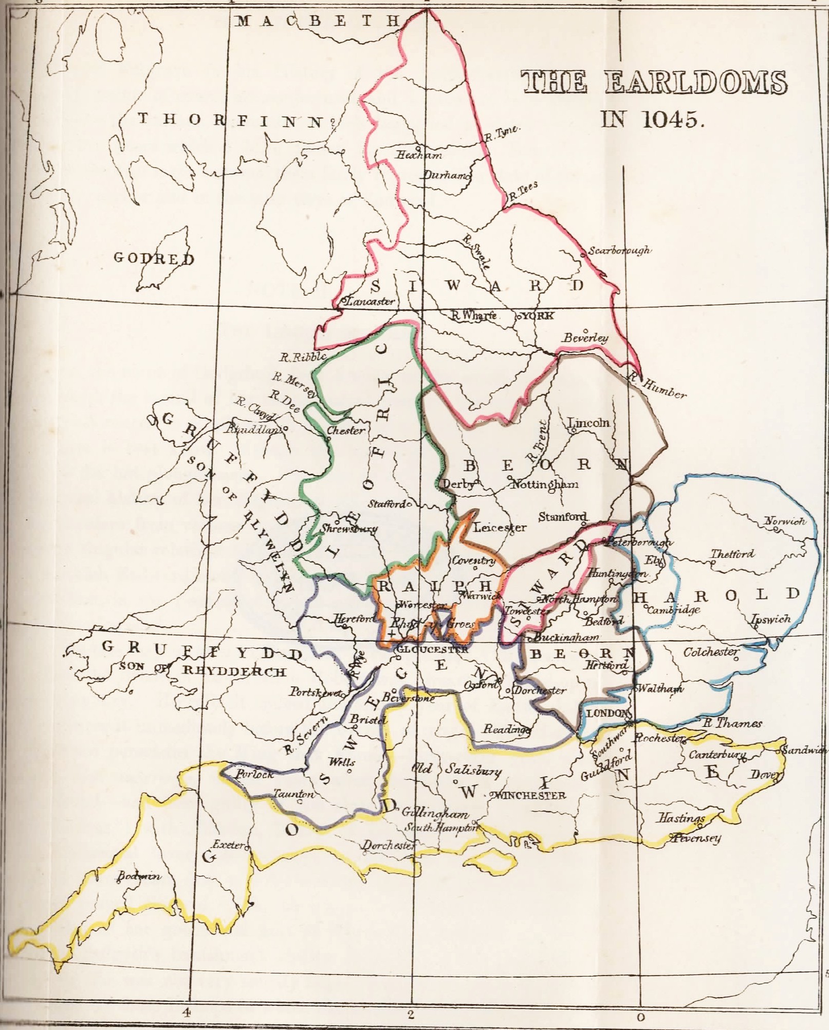
The Earldoms in 1045
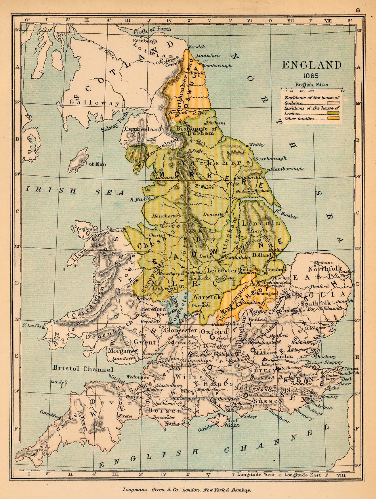
England in 1065
(Gardiner’s Atlas of English History, 1914)
England, 1065
(Charles Colbeck, The Public Schools Historical Atlas, 1905)
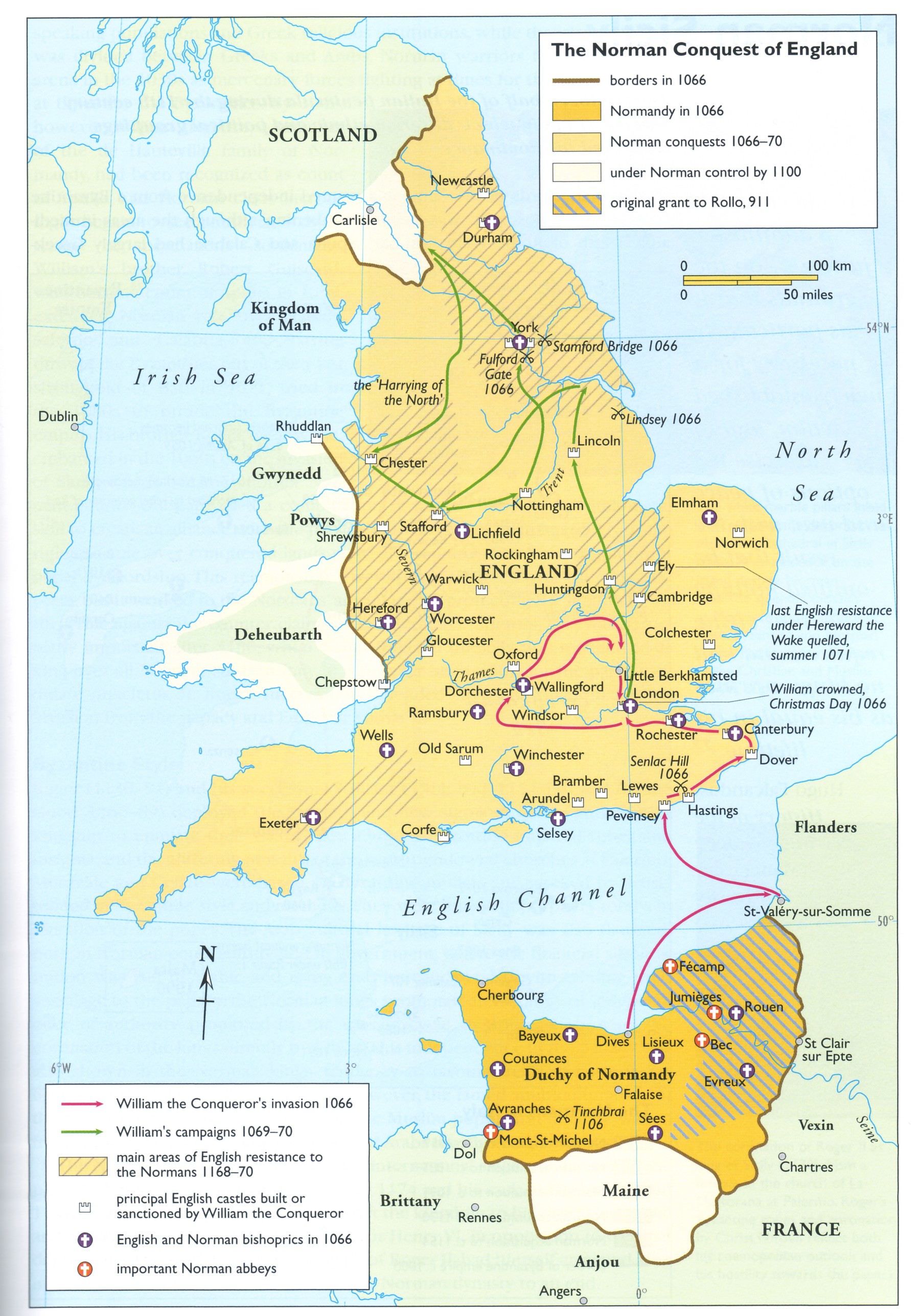
The Norman Conquest of England
British Isles before 1801
The British Isles about 1300
(William Shepherd, Historical Atlas, 1926)
The British Isles under the Plantagenet and Tudor Houses
(Droysens Allgemeiner Historischer Handatlas, 1886)
The British Isles after 1603
(Droysens Allgemeiner Historischer Handatlas, 1886)
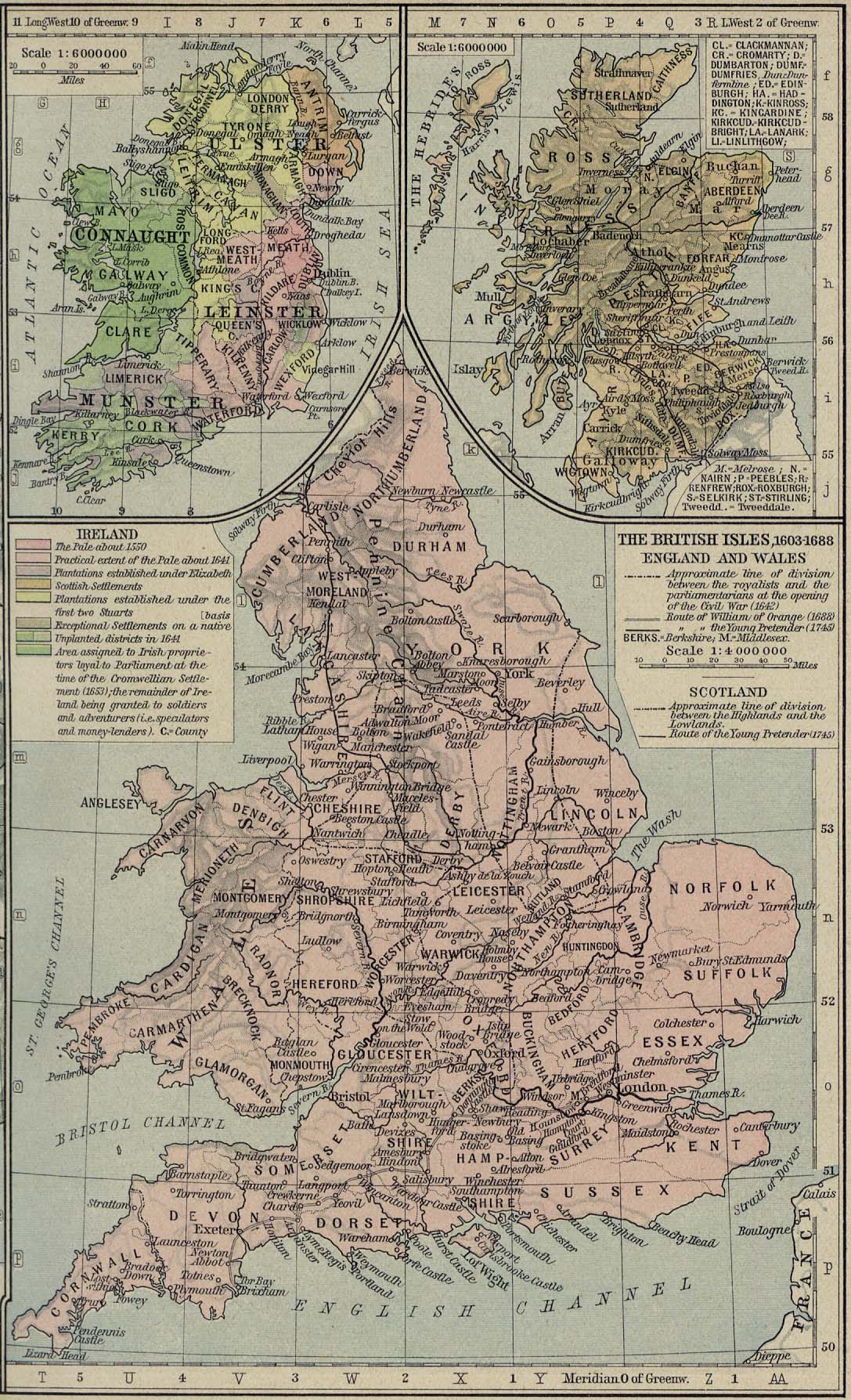
The British Isles, 1603-1688
(William Shepherd, Historical Atlas, 1926)
United Kingdom and the British Empire
Great Britain, Atlas and Index of Parish Registers
(ancestry.ca)
Philips’ Handy Atlas of the Counties of England, 1900
The British Isles, 1920
(Times Survey Atlas of the World, 1920)
United Kingdom of Great Britain and Ireland before 1922
Map of the London Midland and Scottish Railway, 1927
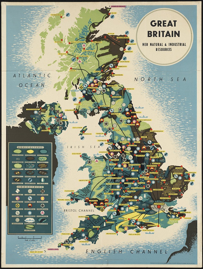
Great Britain, 1939: Her Natural & Industrial Resources
England and Wales
England in the 11th and 12th Centuries
(Droysens Allgemeiner Historischer Handatlas, 1886)
Norman England, 1066-1087
(J. Bartholomew, A Litterary and Historical Atlas of Europe, 1910)
England in 1087
(William Shepherd, Historical Atlas, 1926)
England and Wales at the End of the Thirteenth Century
(E. Dow, Atlas of European History, 1907)
Extent of the English Conquests in France, 1429
(Gardiner’s Atlas of English History, 1892)
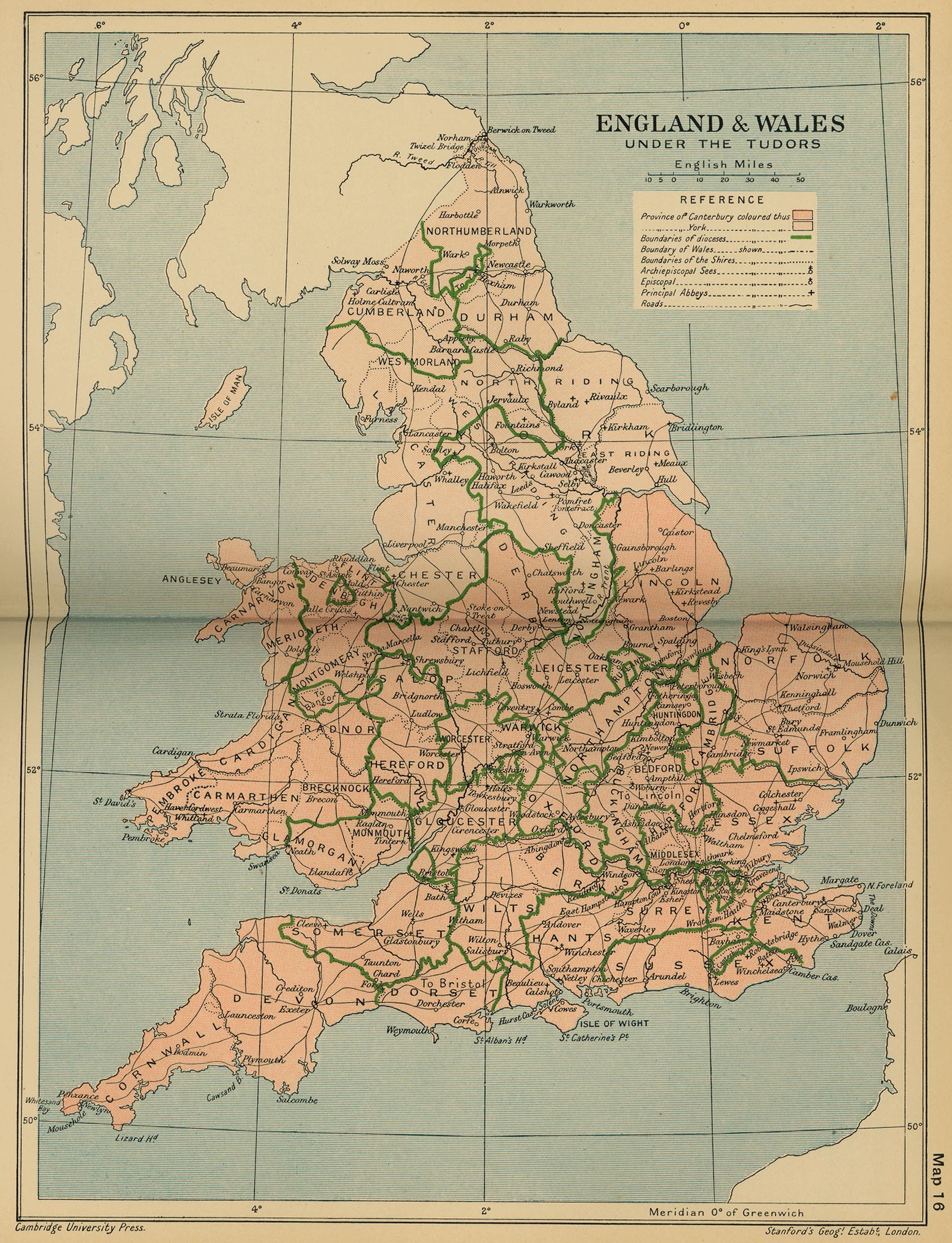
England and Wales under the Tudors
(Cambridge Modern History Atlas, 1912)
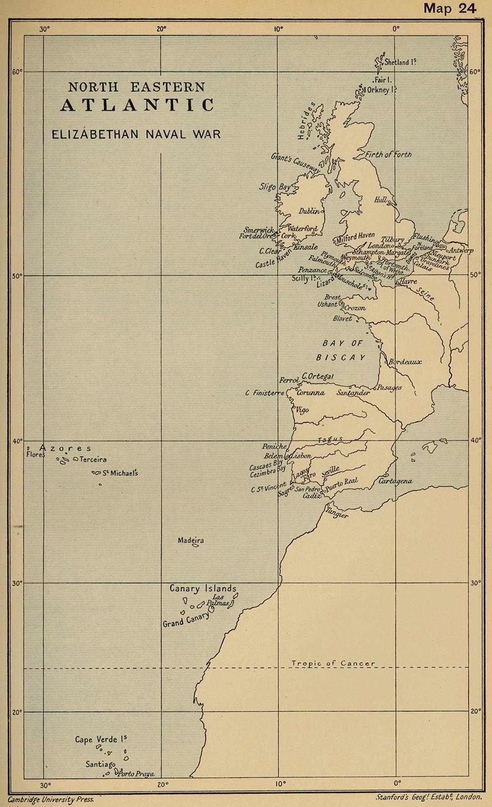
Northeastern Atlantic Elizabethan Naval War
(Cambridge Modern History Atlas, 1912)
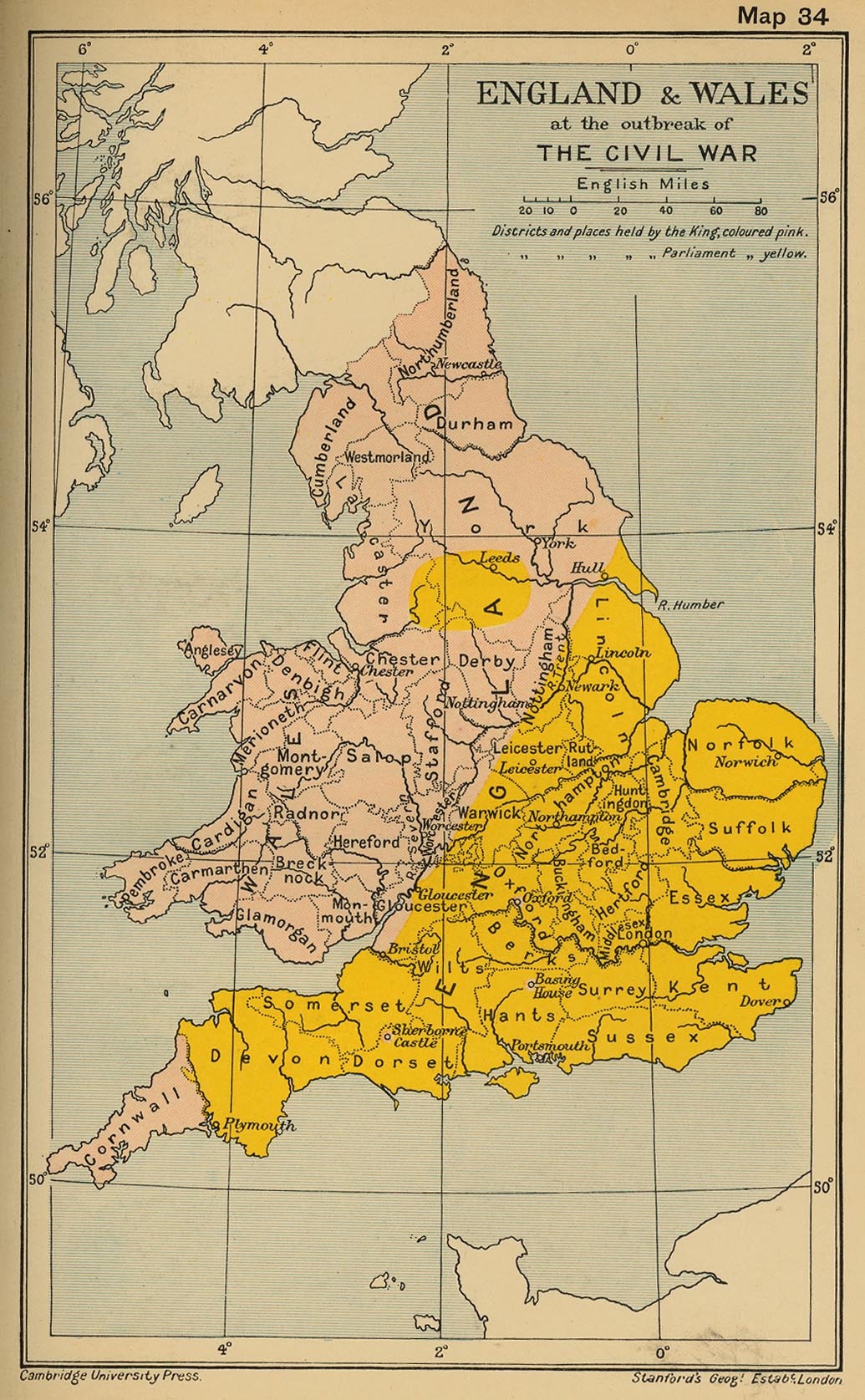
England and Wales at the Outbreak of The Civil War
(Cambridge Modern History Atlas, 1912)
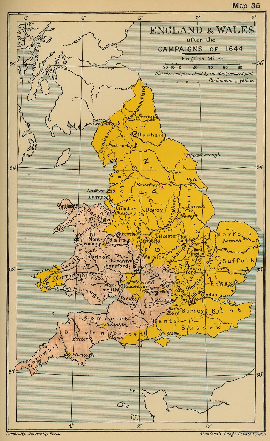
England and Wales after the Campaigns of 1644
(Cambridge Modern History Atlas, 1912)
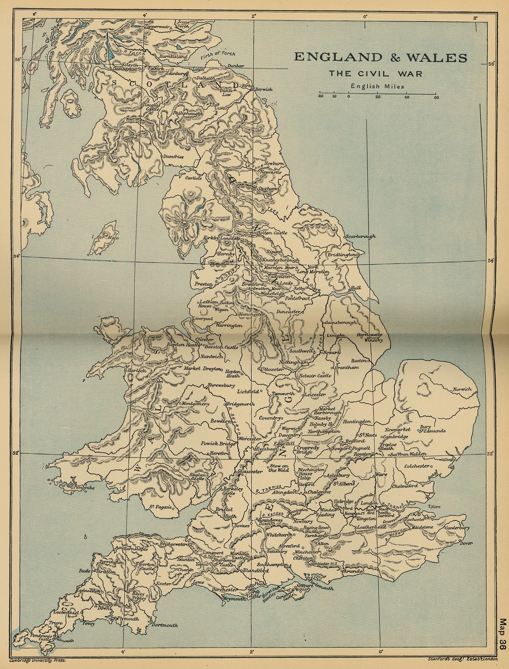
England and Wales: The Civil Wa
r (Cambridge Modern History Atlas, 1912)
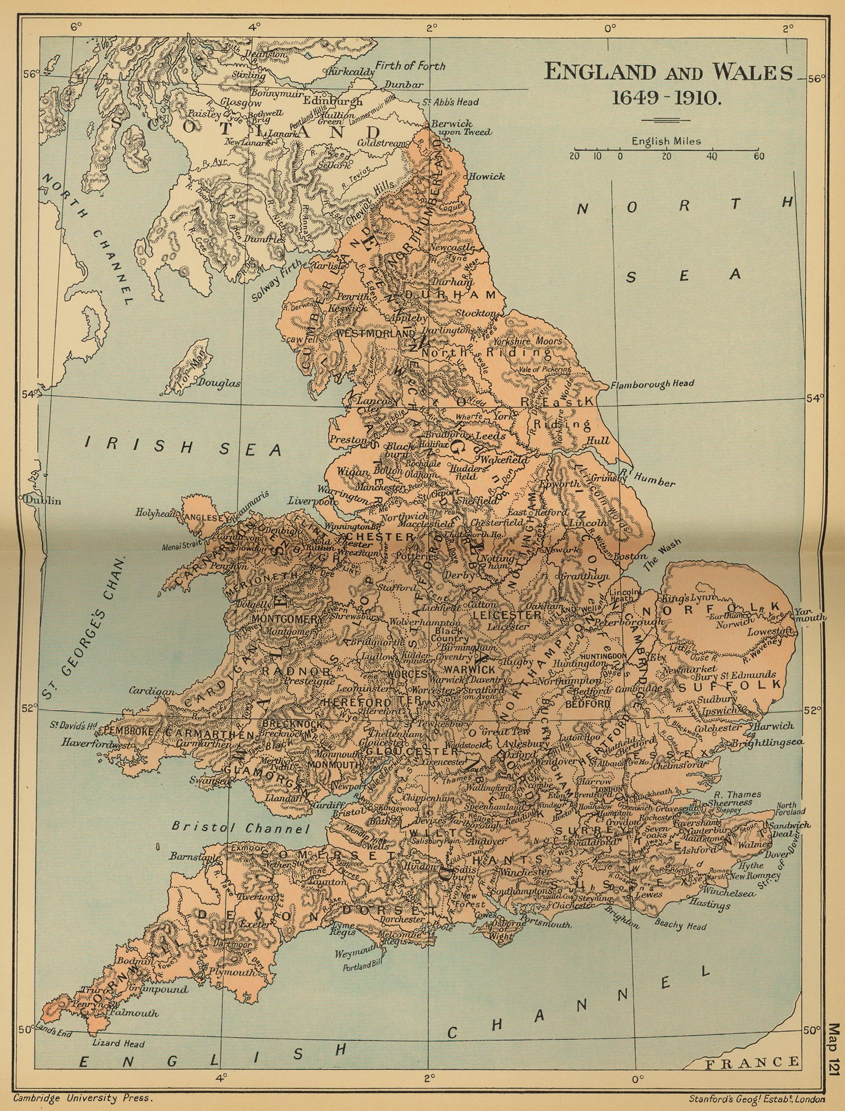
England and Wales 1649-1910
(Cambridge Modern History Atlas, 1912)
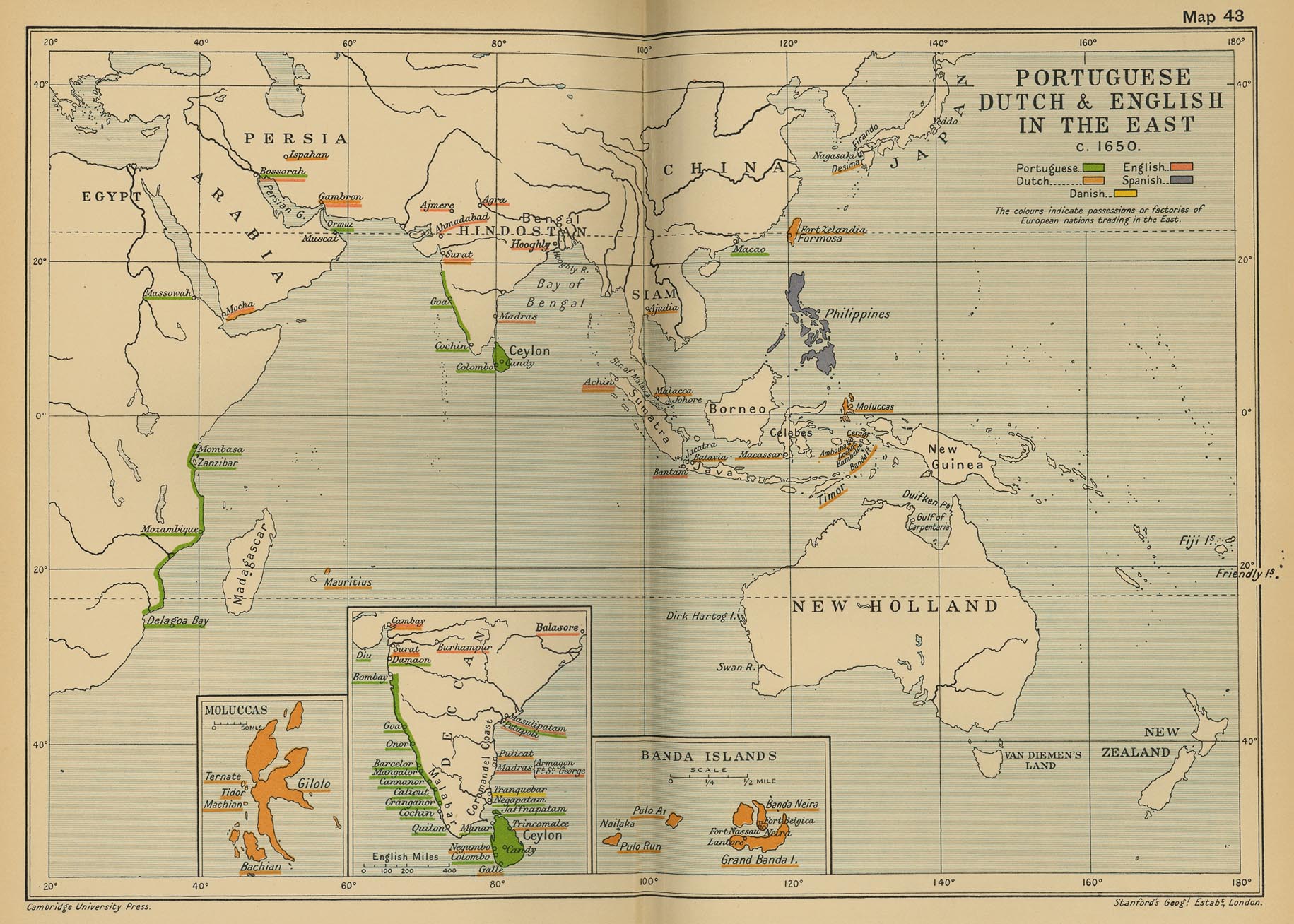
Portuguese, Dutch and English in the East c. 1650
(Cambridge Modern History Atlas, 1912)
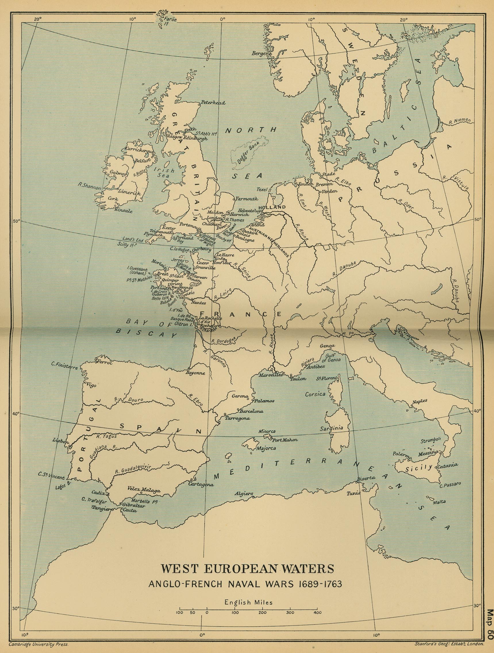
West European Waters: Anglo-French Naval Wars 1689-1763
(Cambridge Modern History Atlas, 1912)
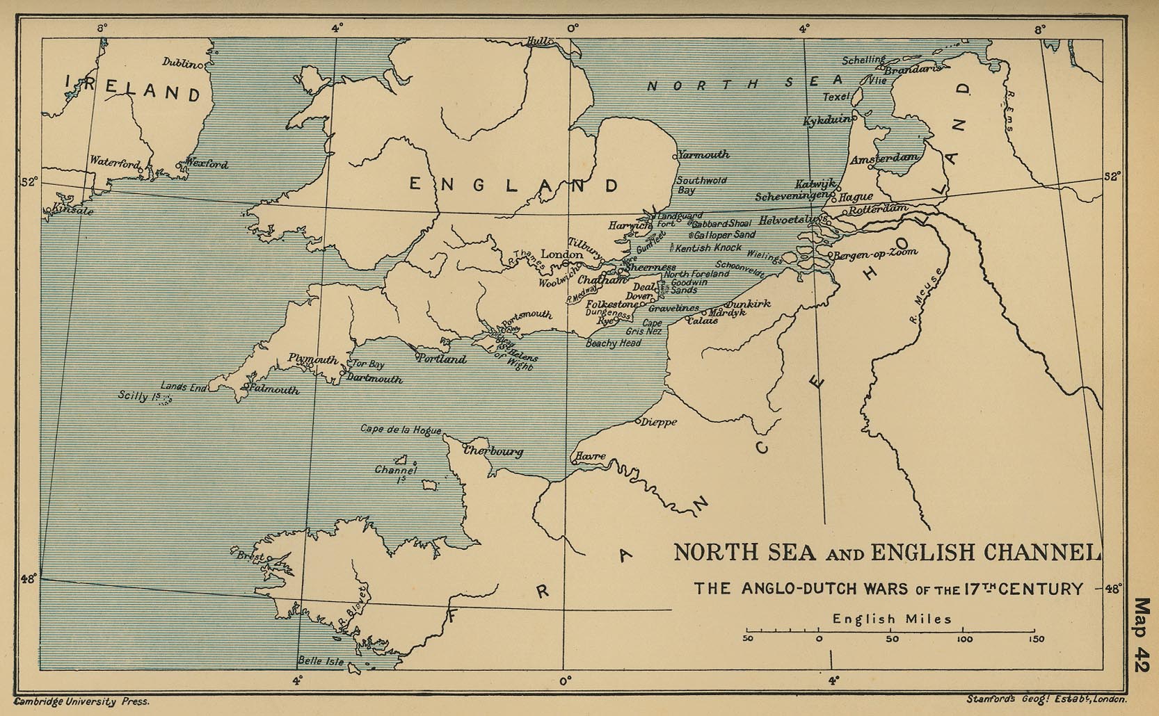
North Sea and English Channel: The Anglo-Dutch Wars of the 17th Century
(Cambridge Modern History Atlas, 1912
England and Wales, 1832
(John Dower)
Scotland
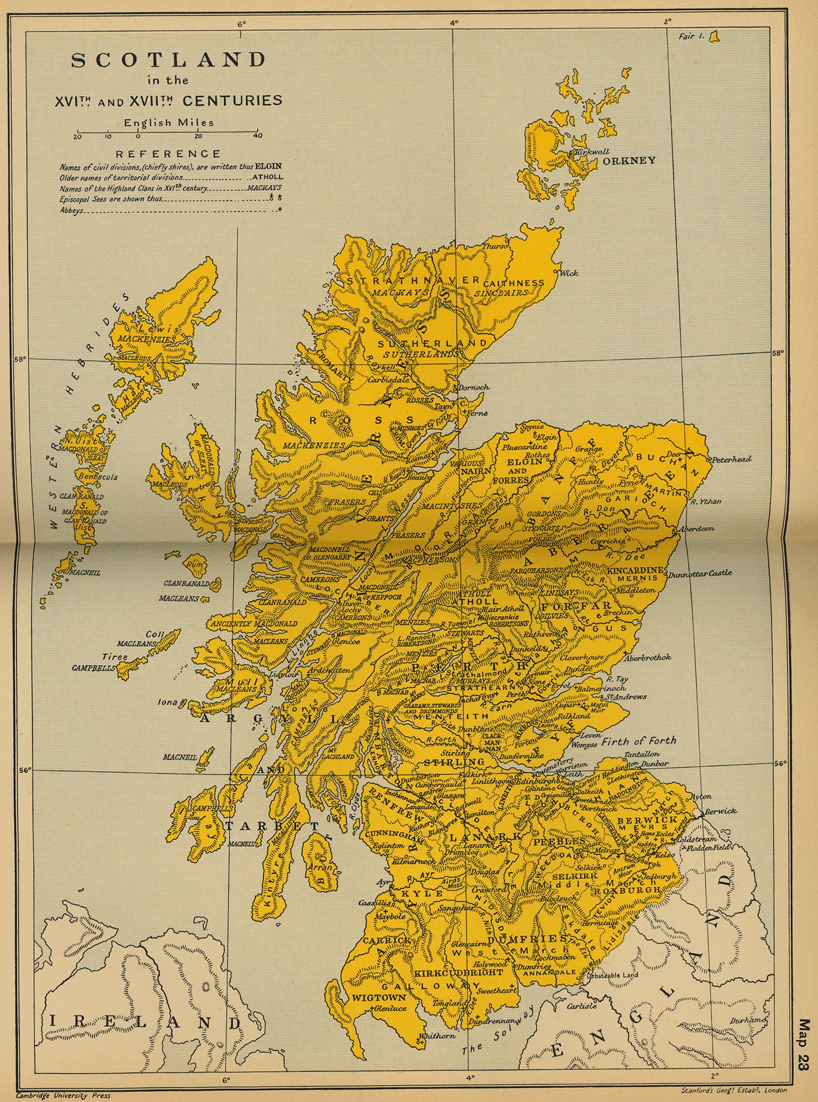
Scotland in the XVIth and XVIIth Centuries
(Cambridge Modern History Atlas, 1912)
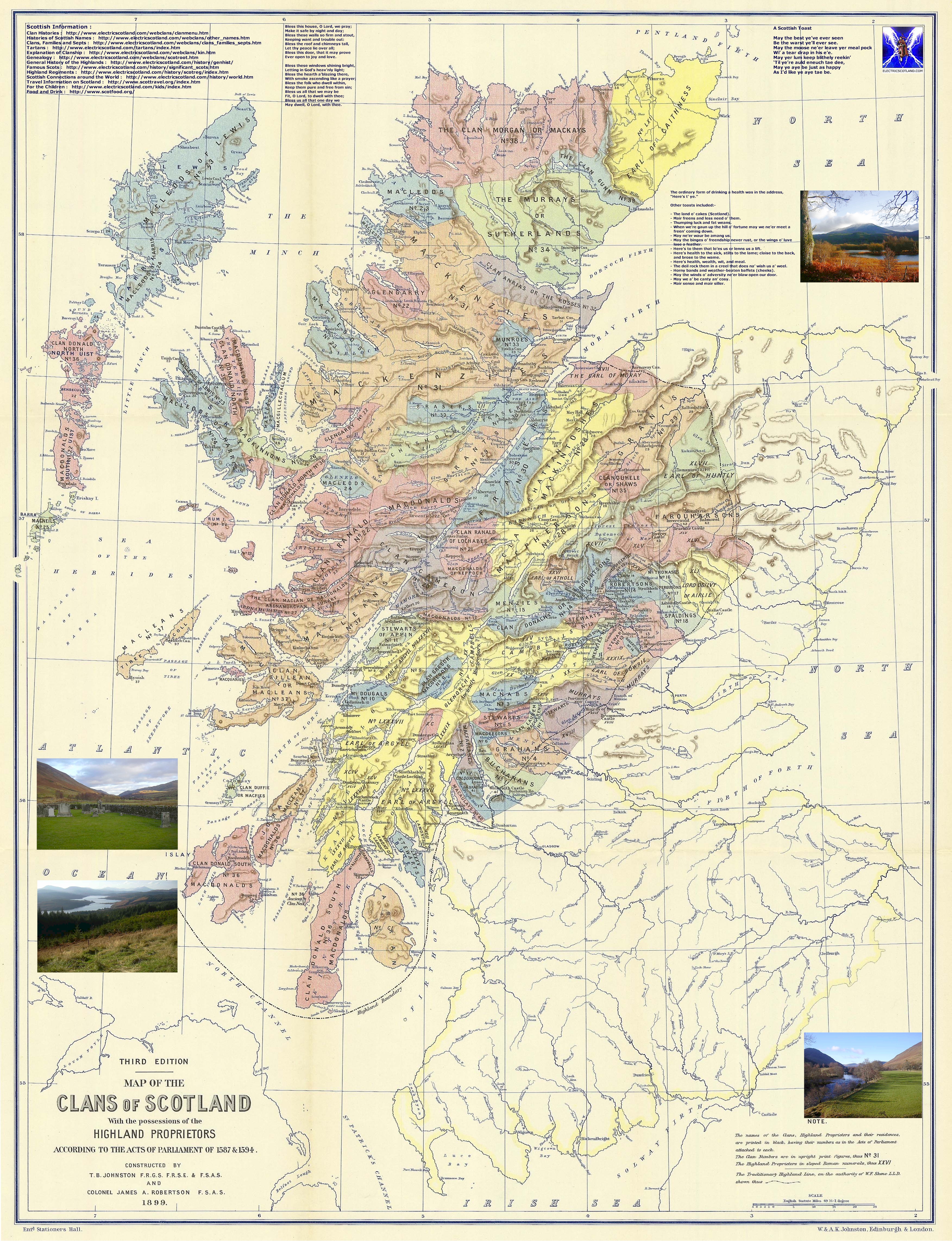
Scotland, 1587-1594: The Map of the Clans of Scotland
(T. B. Johnston, J. A Robertson, 1899)
Scotland and Northern England, 1688-1746
(Cambridge Modern History Atlas, 1912)
Scotland, 1832
(John Dower)
Ireland
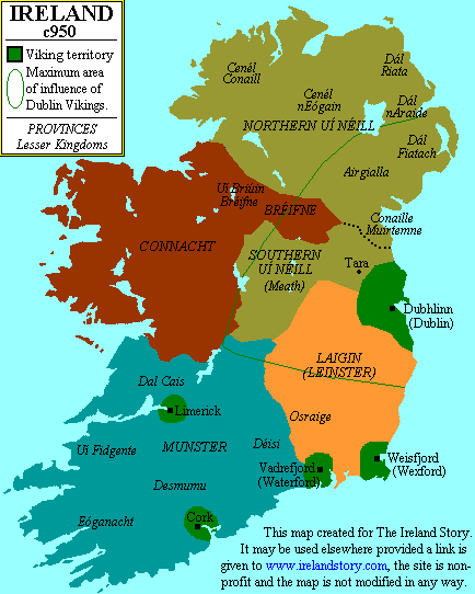
Ireland, c. 950
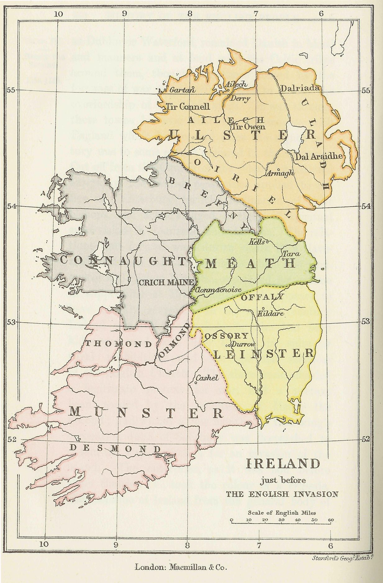
Ireland just before the English Invasion
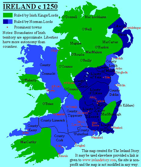
Ireland, ca. 1250
(www.irelandstory.com)
Ireland, ca. 1300
Ireland, ca. 1450
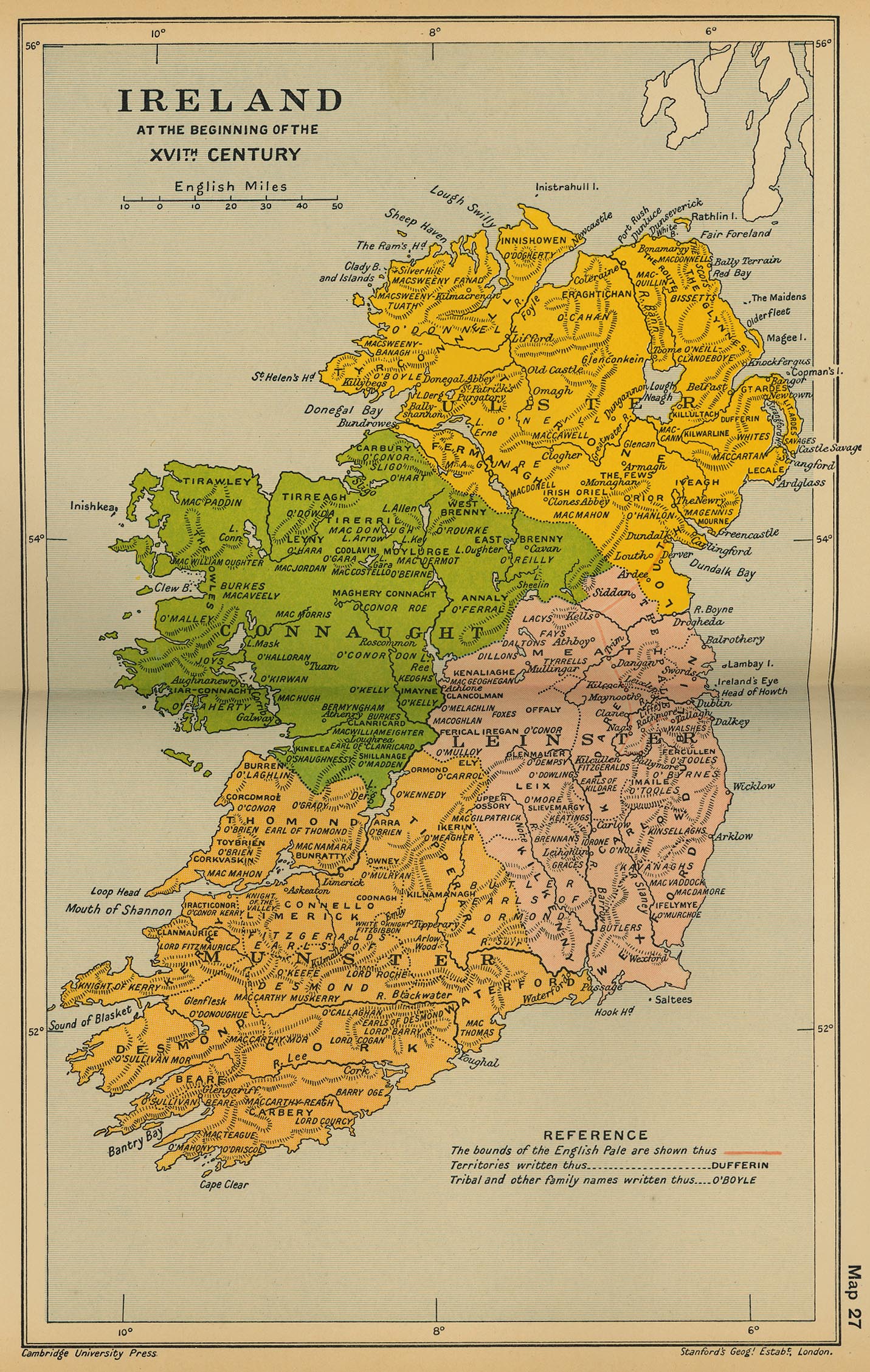
Ireland at the beginning of the Sixteenth Century
(Cambridge Modern History Atlas, 1912)
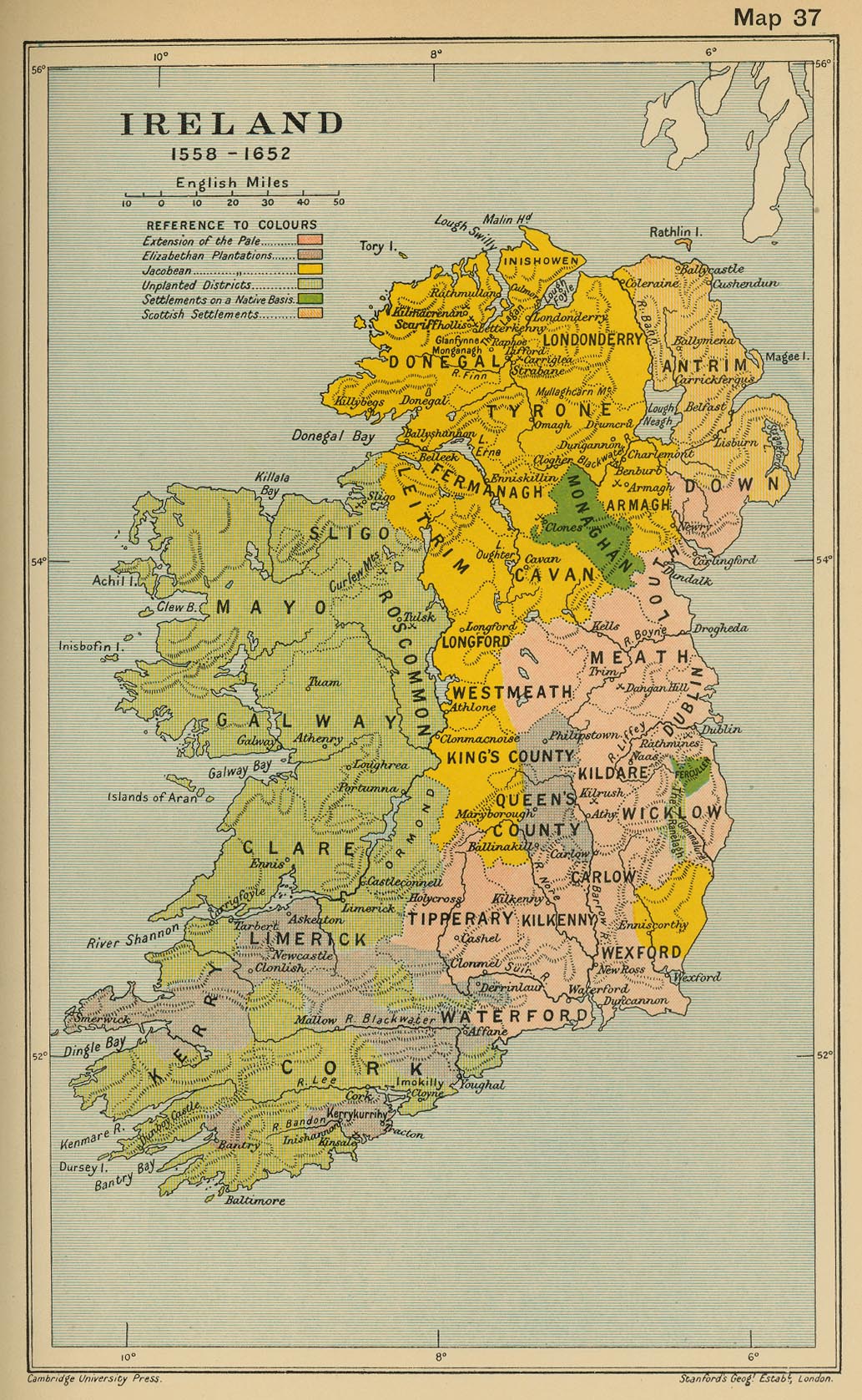
Ireland 1558-1652
(Cambridge Modern History Atlas, 1912)
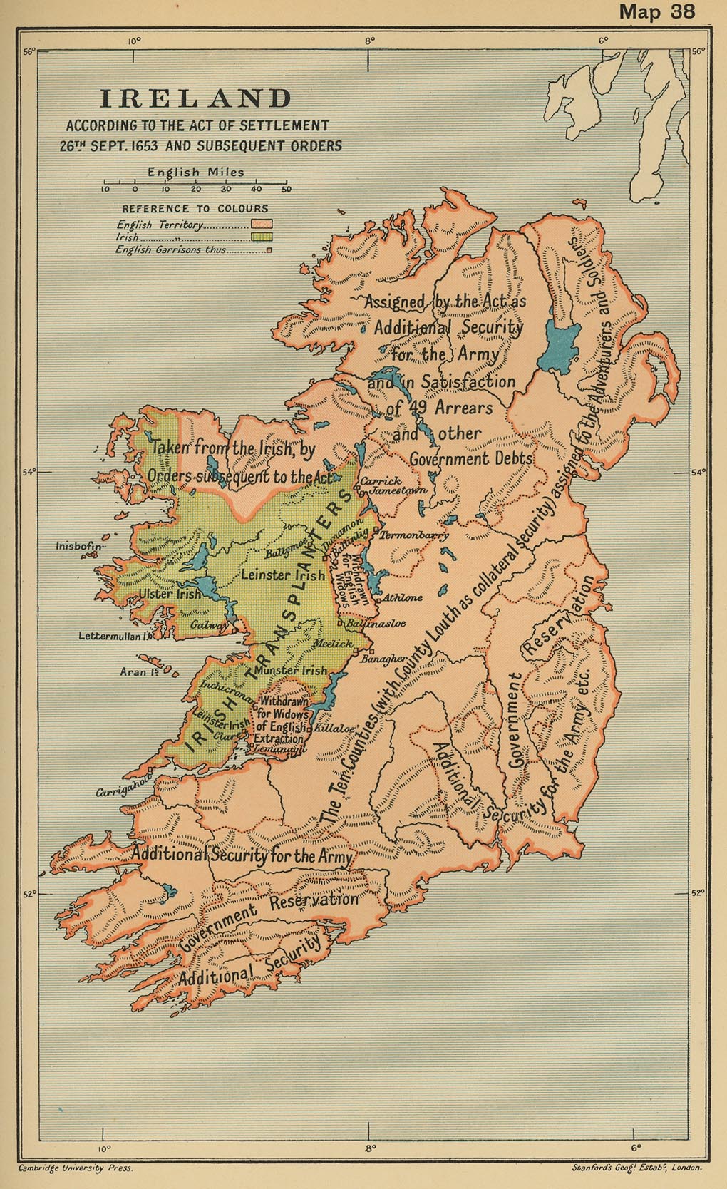
Ireland According to the Act of Settlement 26th September and Subsequent Orders
(Cambridge..., 1912)
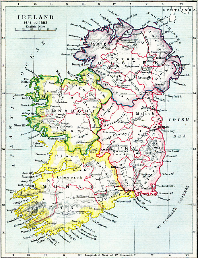
Ireland, 1641-1892
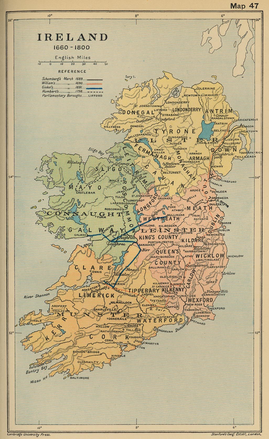
Ireland, 1660-1800
(Cambridge Modern History Atlas, 1912)
Ireland, 1832
(John Dower)
Ireland, 1835
(American Geographical Society Library)
Ireland, 1878
(American Geographical Society Library)
Ireland, 1886
(American Geographical Society Library)
Ireland, 1906
(American Geographical Society Library)
Irish (UK) General Election 1918
Ireland, 1923
(American Geographical Society Library)
Geographic Distribution of the Gaelic Languages (Irish, Scottish Gaelic, Manx), 2011

