Skip to main content
Home
Historical Maps
World History
U.S. History
Canadian History
Canada (English)
Canada (Français)
Old school history maps
Stories on the Map
Armenia
Assyria
Catalonia
Kurdistan
Palestine
Ukraine
Edmaps +
Historical Maps of Germany
World
Ancient Greece
Roman Empire
Holy Roman Empire
Europe
Albania
Austria
Britain
Bulgaria
Croatia
France
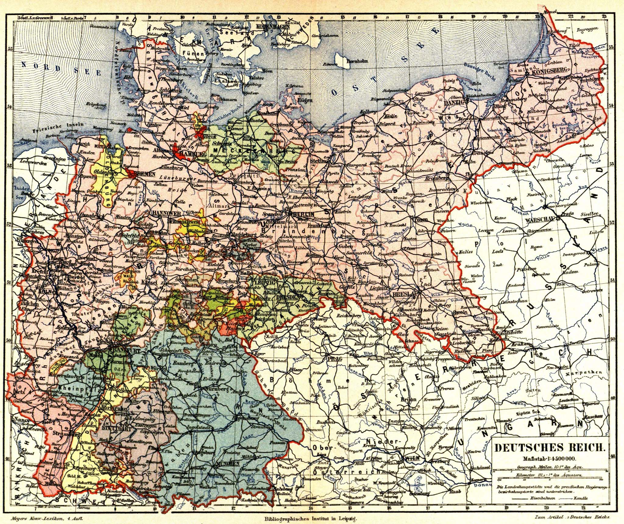
Germany
Greece
Hungary
Italy
Netherlands
Poland
Romania
Scandinavia
Serbia
Spain & Portugal
Switzerland
Türkiye
Ukraine
Russia
Caucasus
Middle East
Asia
Latin America
Canada
U.S.A.
Australia
Map Collections and Atlases
Blank and Outline Maps of Germany
(d-maps.com)
Das Deutsche Kaiserreich 1871-1918
(Bundeszentrale für politische Bildung)
Deutschland - Historische Entwicklung
(Diercke)
German History Maps I - The Essential List, 1500-1870
(Helmut Walser Smith)
German History Maps II - The Essential List, 1870-1945
(Helmut Walser Smith)
Germany: Historical Maps Collection
(Library of Congress)
Germany: Historical Maps Collection
(Perry-Castañeda Library)
Germany: World War II Maps
(Holocaust Encyclopedia)
Historical Maps of Germany
(American Geographical Society Library Digital Map Collection)
Historical Maps of Germany
(David Rumsey Map Collection)
Historical Maps of Germany
Historical Maps of Germany, 1378-2003
(Institut of European History - Mainz)
Historical Maps of Germany before 1825
(University of Alabama)
Historische Karten - Deutsches Reich 1789
(Thomas Hoeckmann)
L’Allemagne en cartes
(Gallica - Bibliothèque nationale de France)
L'Allemagne et ses frontières en 8 cartes
(L'Histoire)
Old Maps of Germany
(oldmapsonline.org)
Maps
Central Europe in Carolingian Times
(Droysens Allgemeiner Historischer Handatlas, 1886)
Germany around the Year 1000
(Droysens Allgemeiner Historischer Handatlas, 1886)
Holy Roman Empire. circa 1000
(worldhistory.org)
Germany in the 14th Century
(Droysens Allgemeiner Historischer Handatlas, 1886)
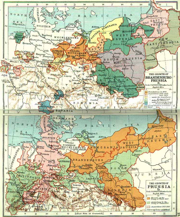
The Growth of Prussia
(Muir’s Historical Atlas, 1911)
Germany in the 15th Century
(Droysens Allgemeiner Historischer Handatlas, 1886)
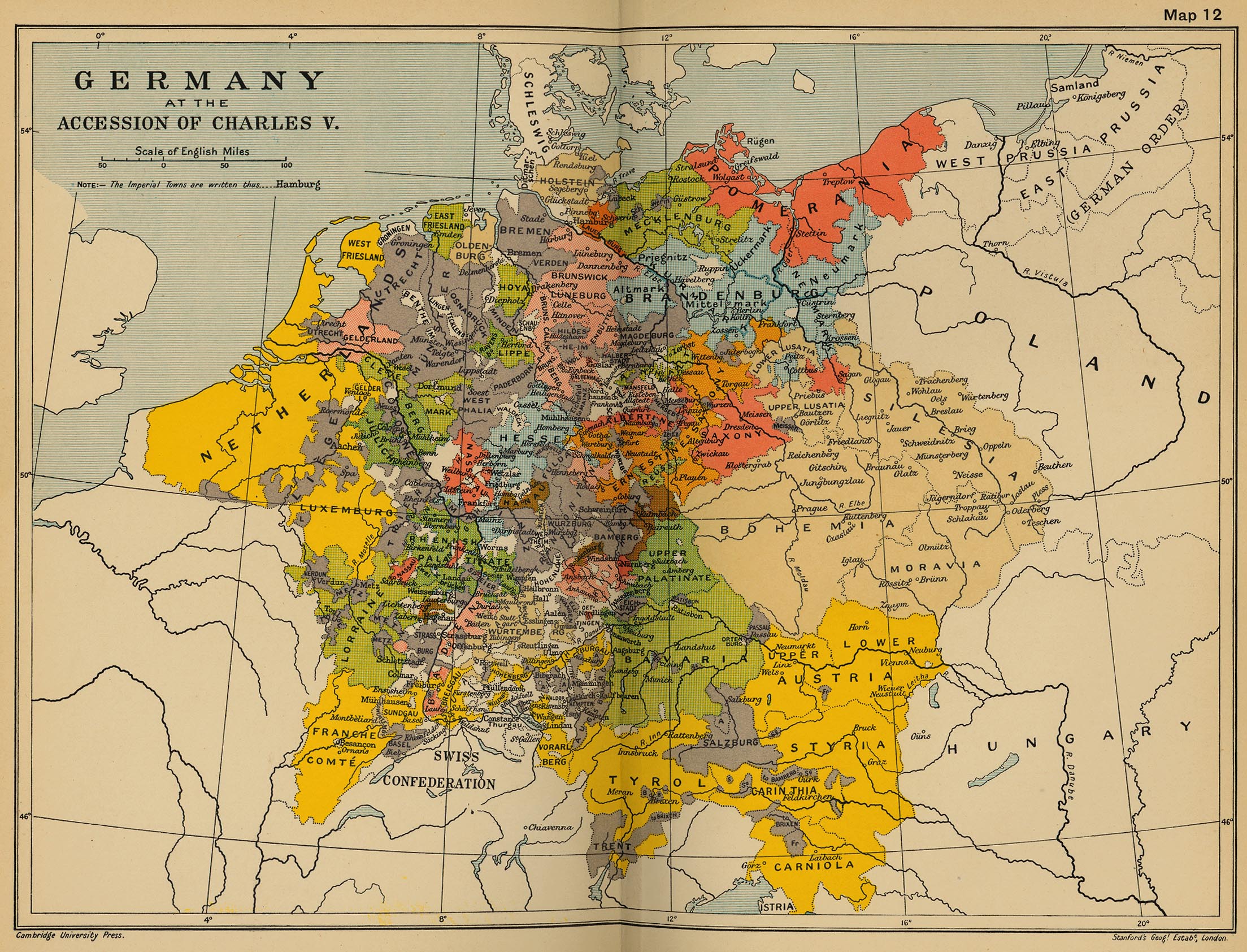
Germany at the Accession of Charles V
(Cambridge Modern History Atlas, 1912)
Holy Roman Empire, c. 1500
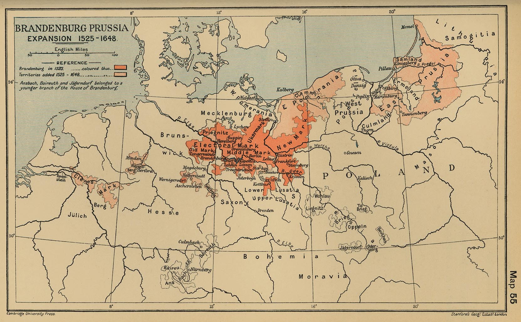
Brandenburg-Prussia Expansion 1525-1648
(Cambridge Modern History Atlas, 1912)
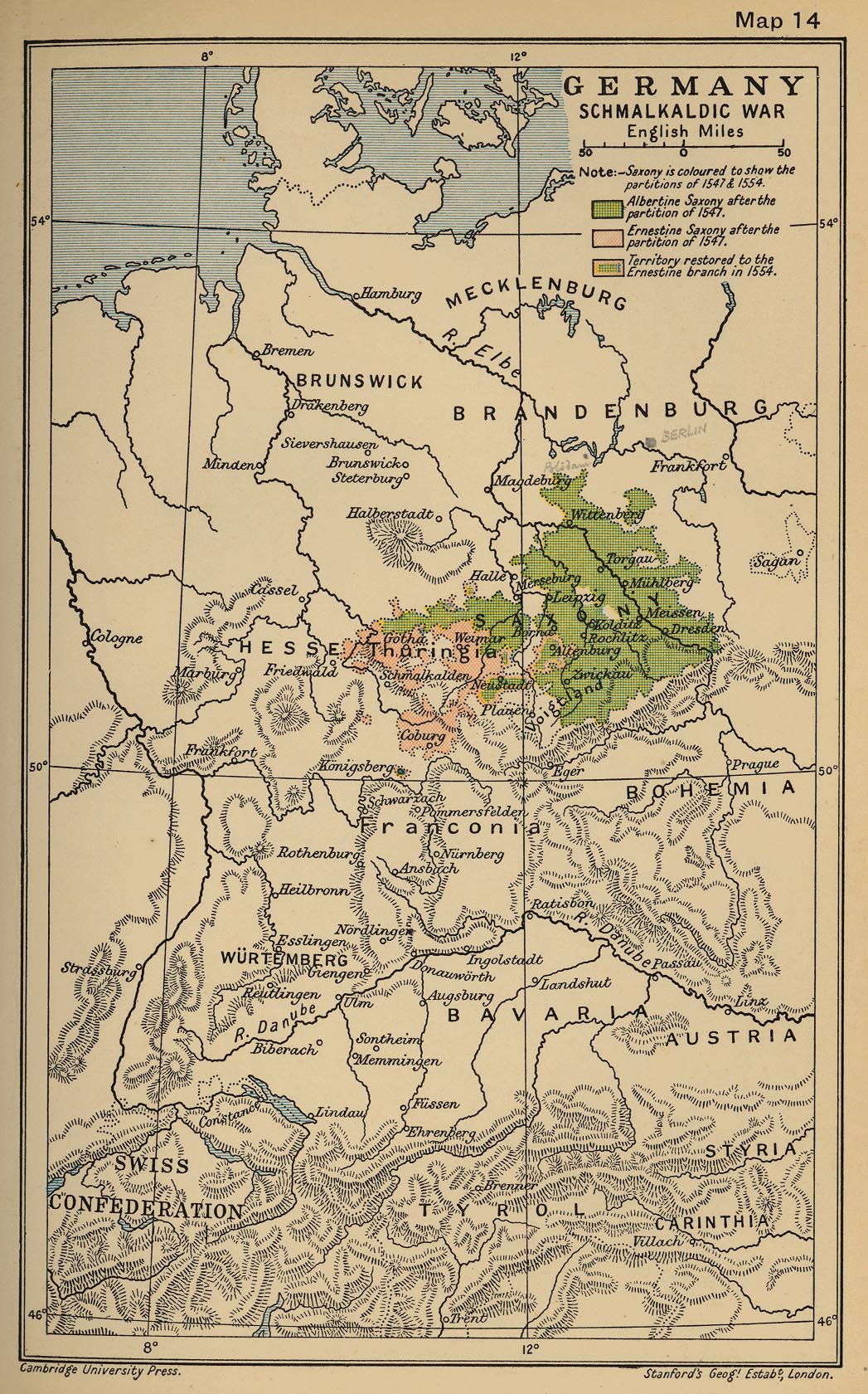
Germany. The Schmalkaldic War
(Cambridge Modern History Atlas, 1912)
Germany at the Time of the Reformation (1547)
(Putzgers Historischer Weltatlas, 1905)
Germany at the Time of the Reformation
(Droysens Allgemeiner Historischer Handatlas, 1886)
Allemagne après la paix d’Augsbourg (1555)
(Vidal-Lablache, Atlas général d'histoire et de géographie, 1912)
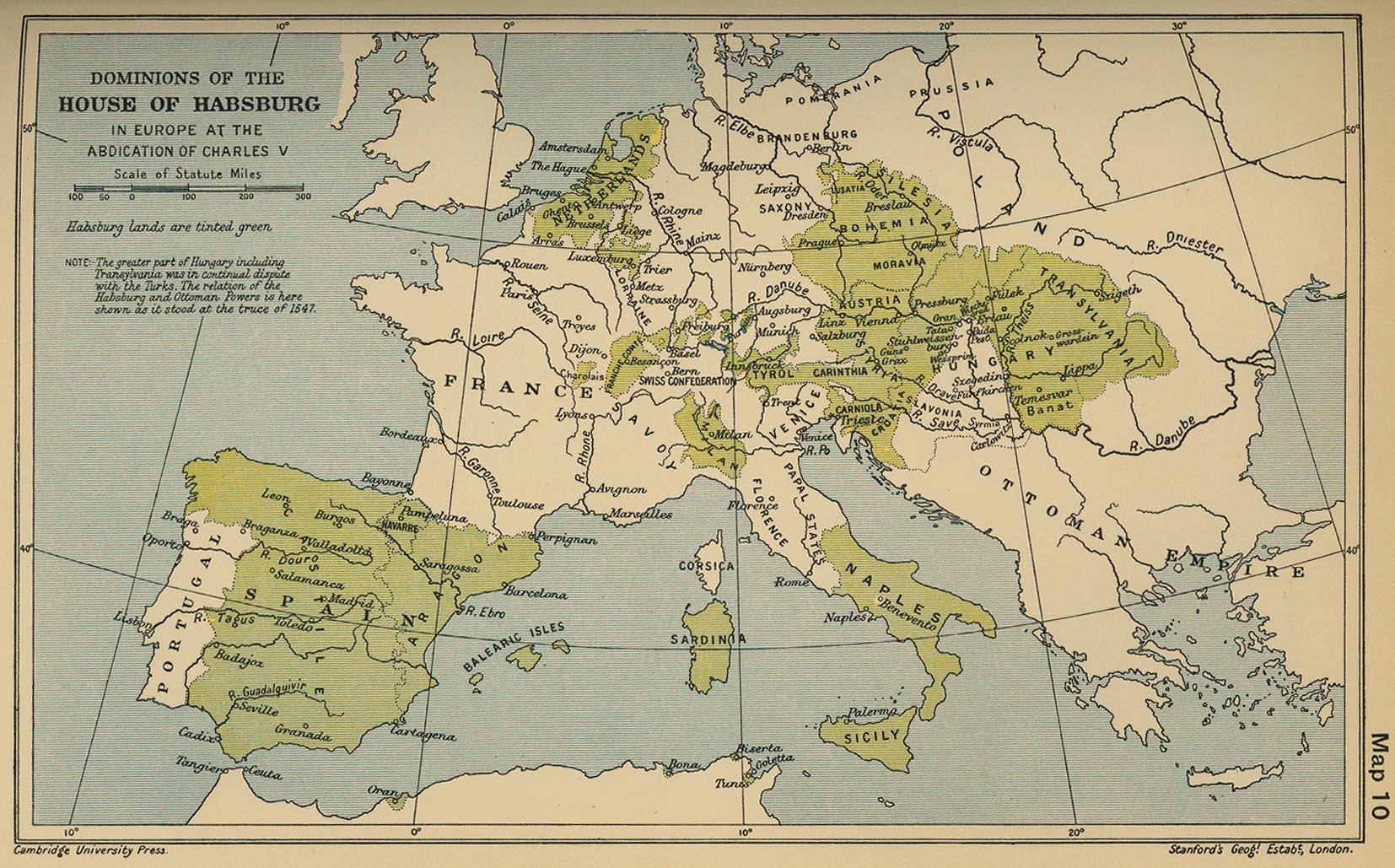
Dominions of the House of Habsburg in Europe at the Abdication of Charles V
(Cambridge Modern Hist. Atlas, 1912)
Growth of Brandenburg-Prussia, 1600-1795
(Mapping Solutions)
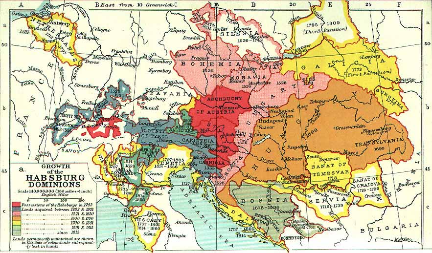
Growth of the Habsburg Dominions
(Muir’s Historical Atlas, 1911)
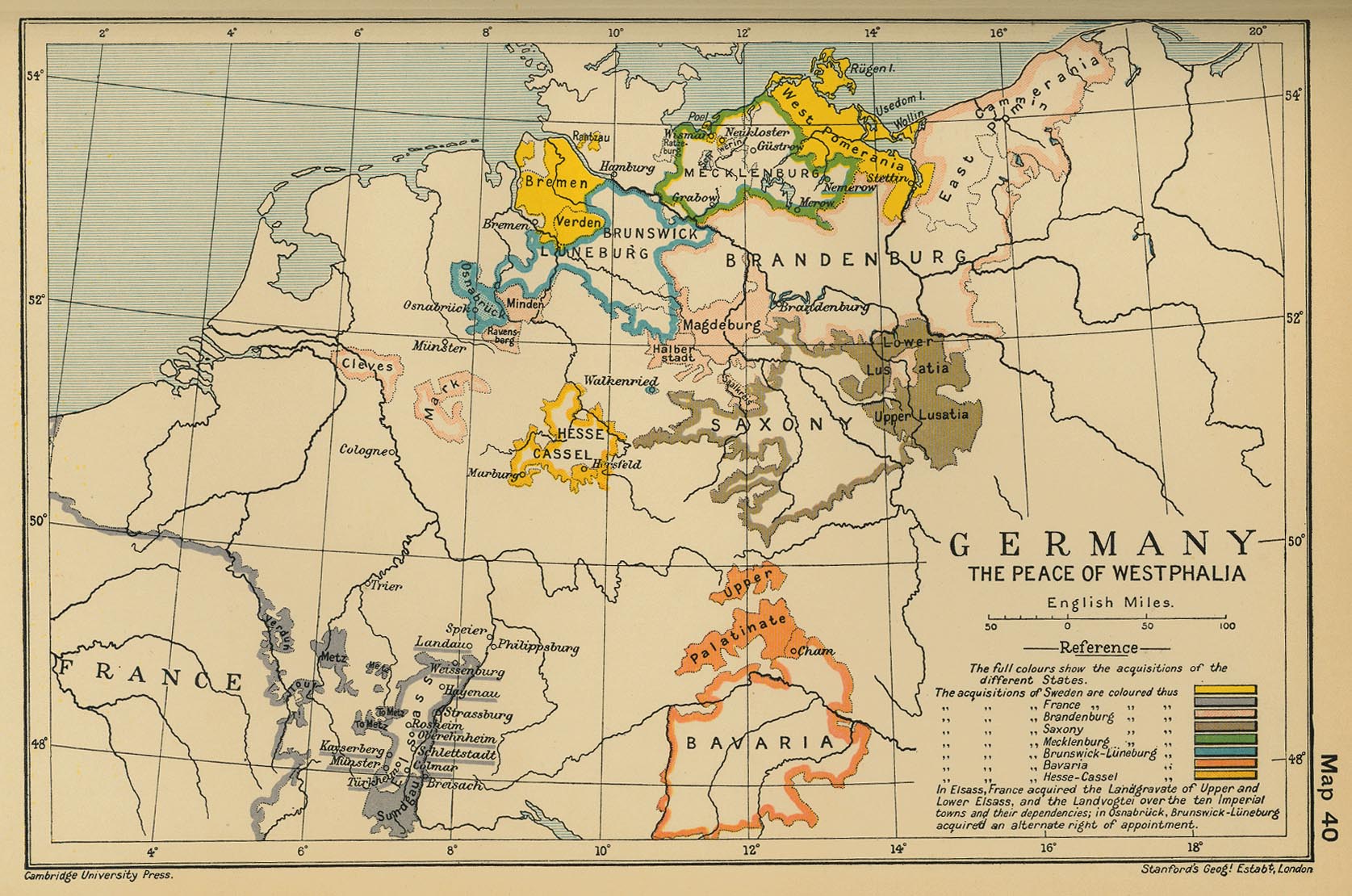
Germany: The Peace of Westphalia
(Cambridge Modern History Atlas, 1912)
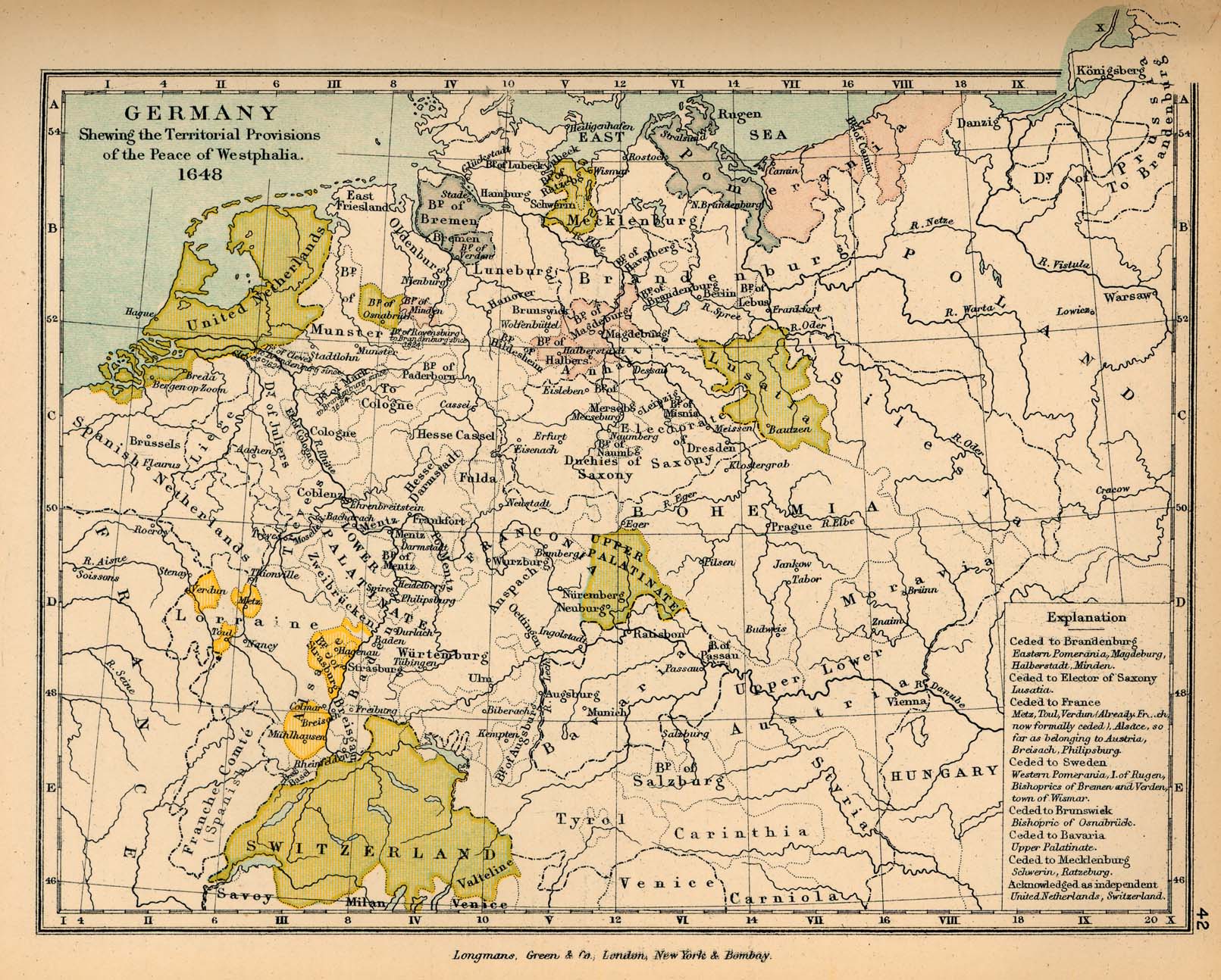
Germany after the Peace of Westphalia
(Charles Colbeck, The Public Schools Historical Atlas, 1905)
Germany at the Time of the 30 Years War
(Droysens Allgemeiner Historischer Handatlas, 1886)
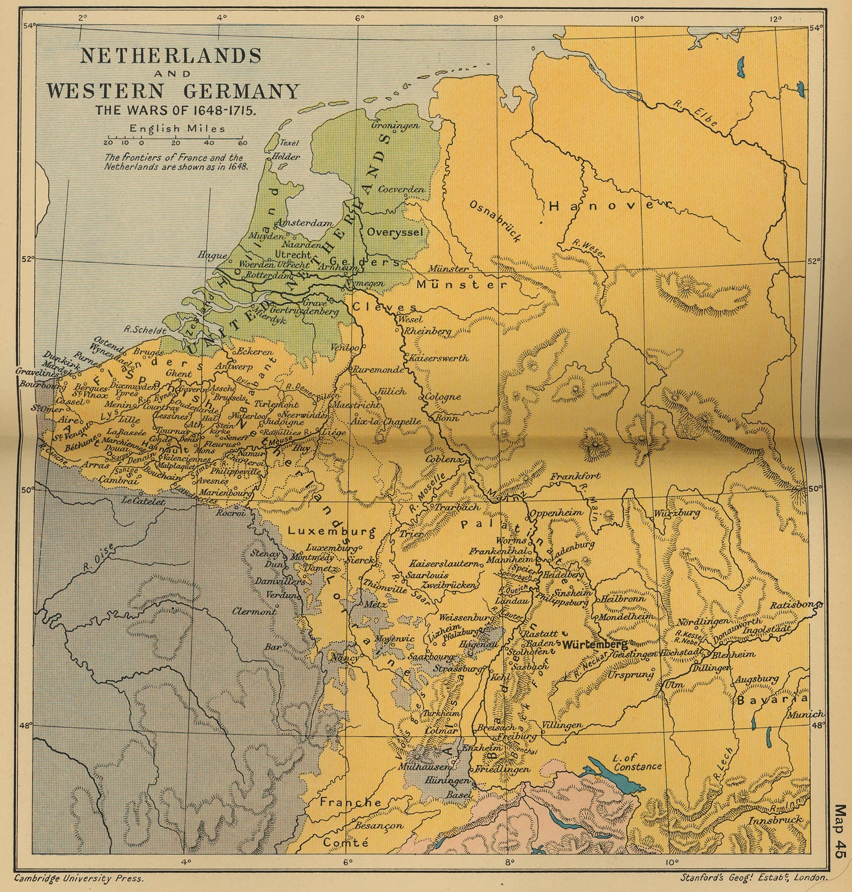
The Netherlands and Western Germany: The Wars of 1648-1715
(Cambridge Modern History Atlas, 1912)
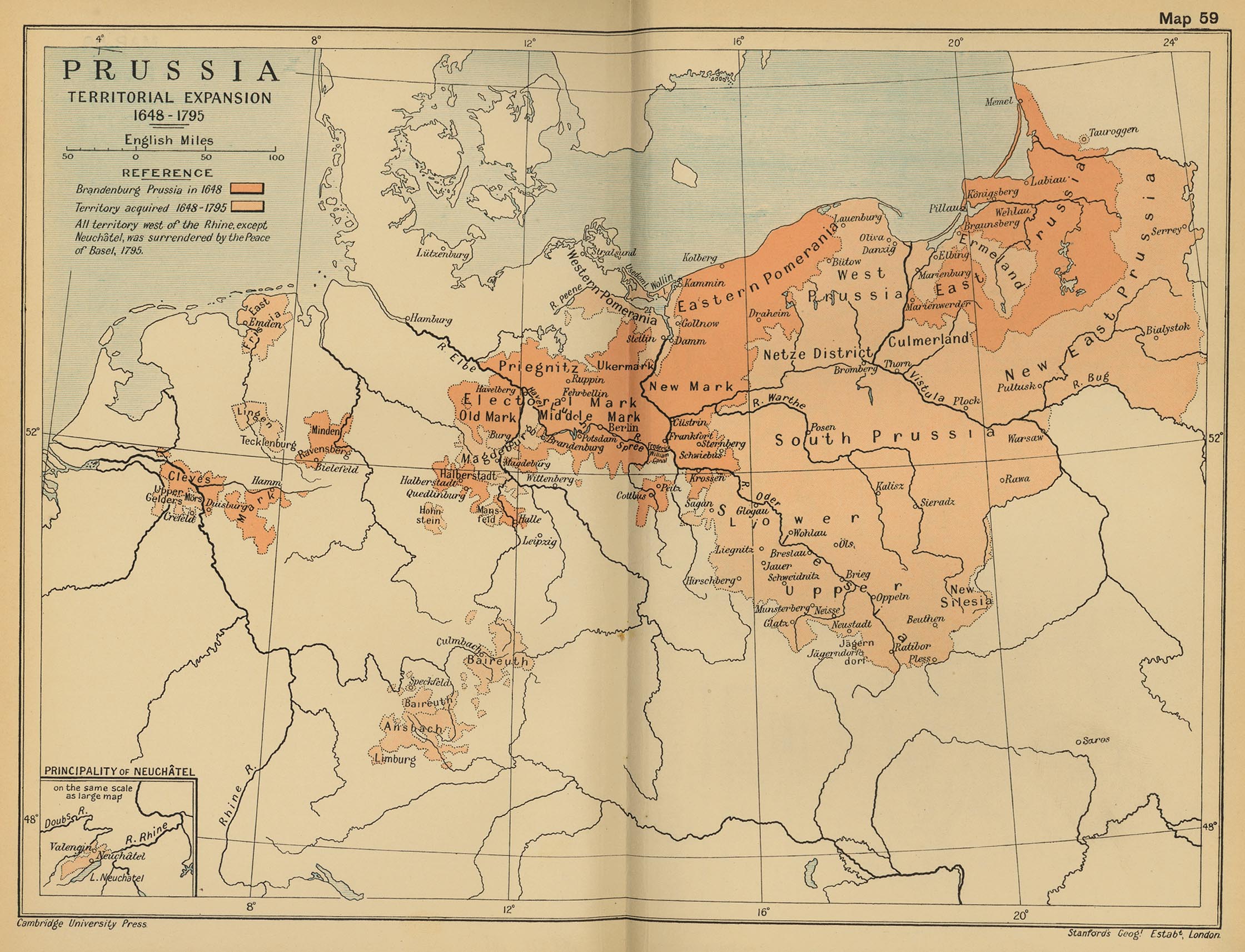
Prussia: Territorial Expansion 1648-1795
(Cambridge Modern History Atlas, 1912)
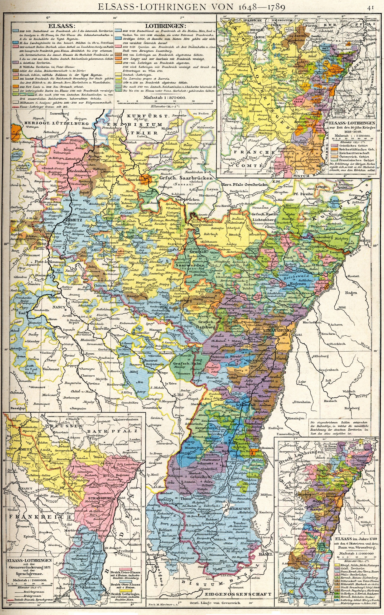
Alsace-Lorraine from 1648 to 1789
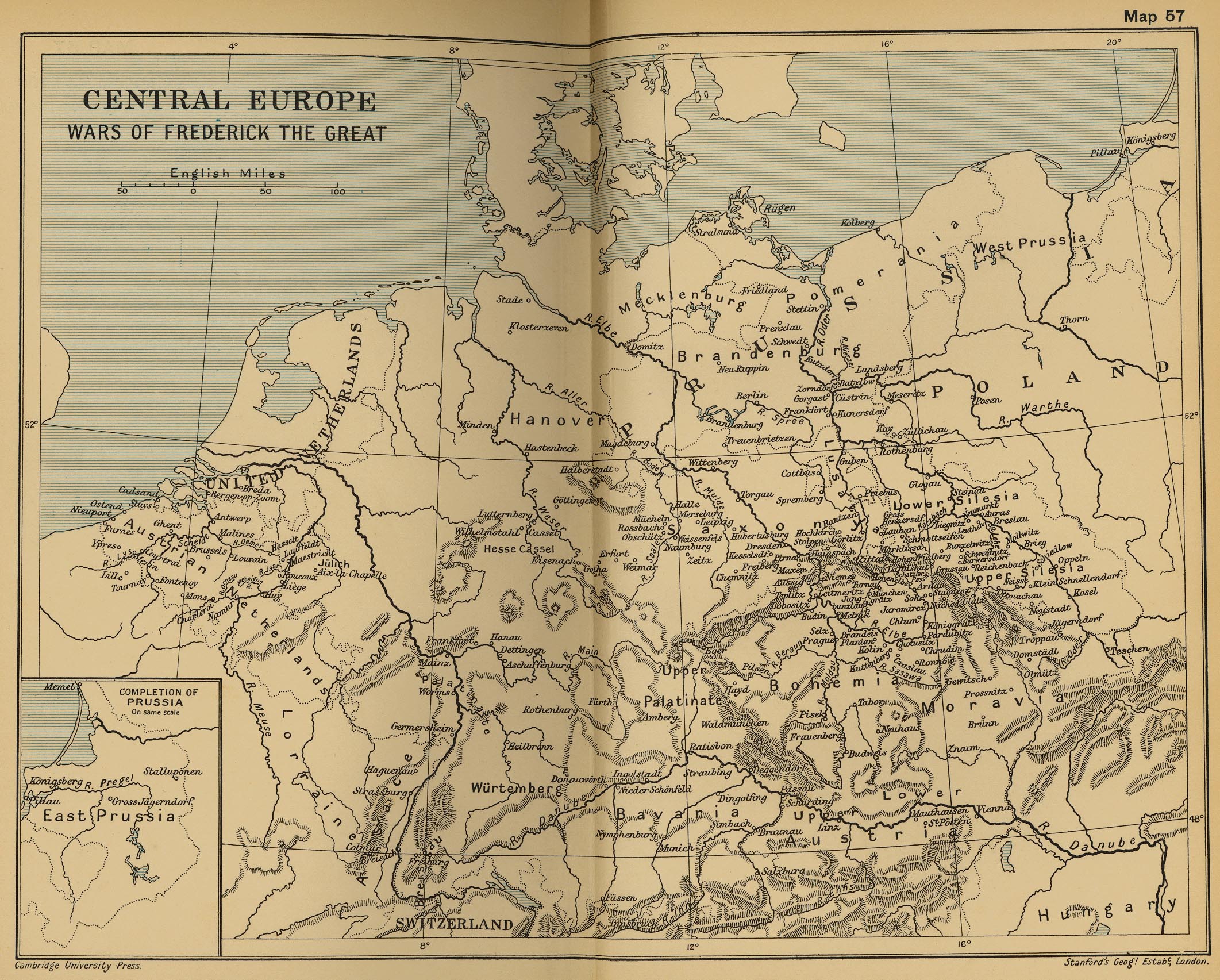
Central Europe: Wars of Frederick the Great
(Cambridge Modern History Atlas, 1912)
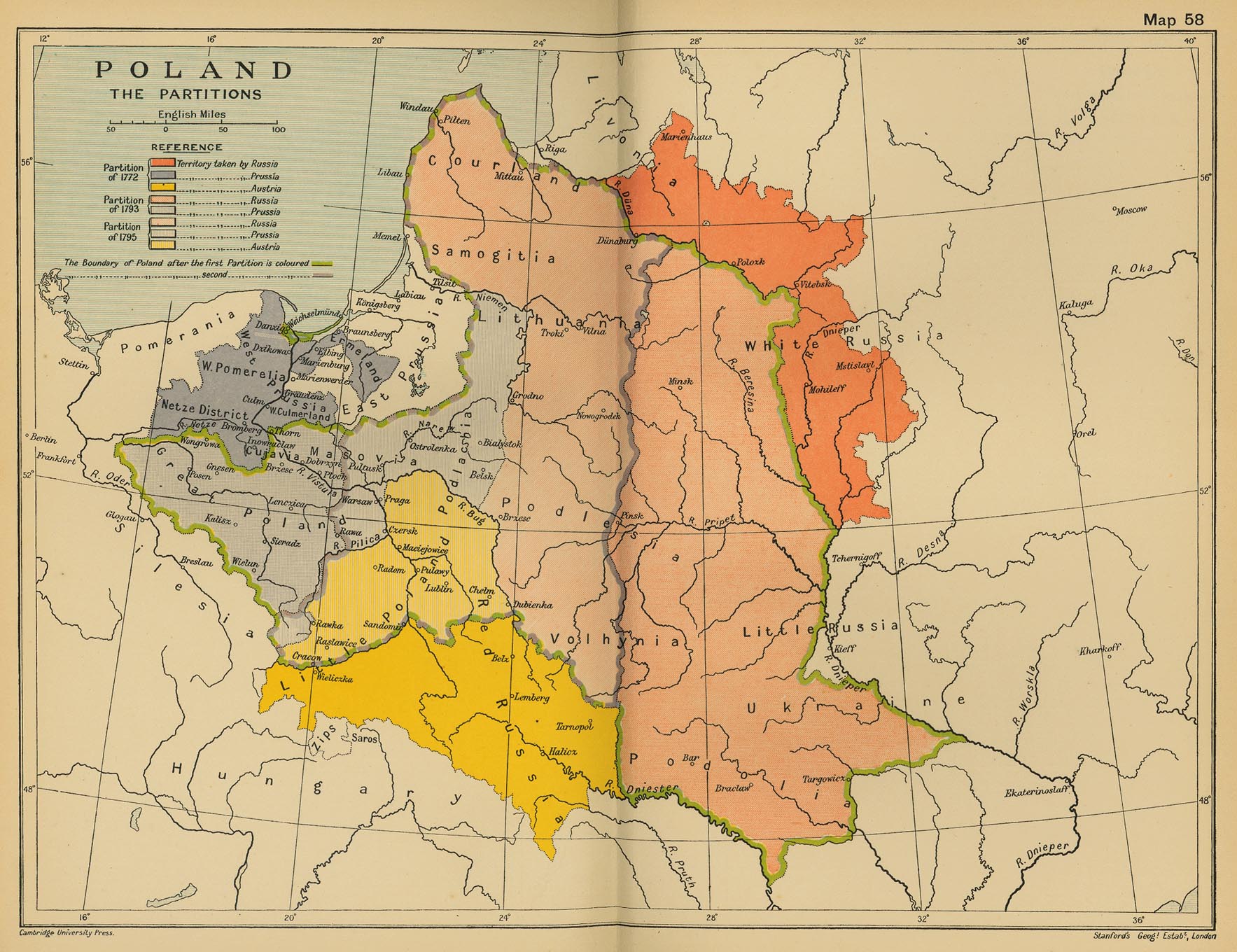
Poland: The Partitions
(Cambridge Modern History Atlas, 1912)
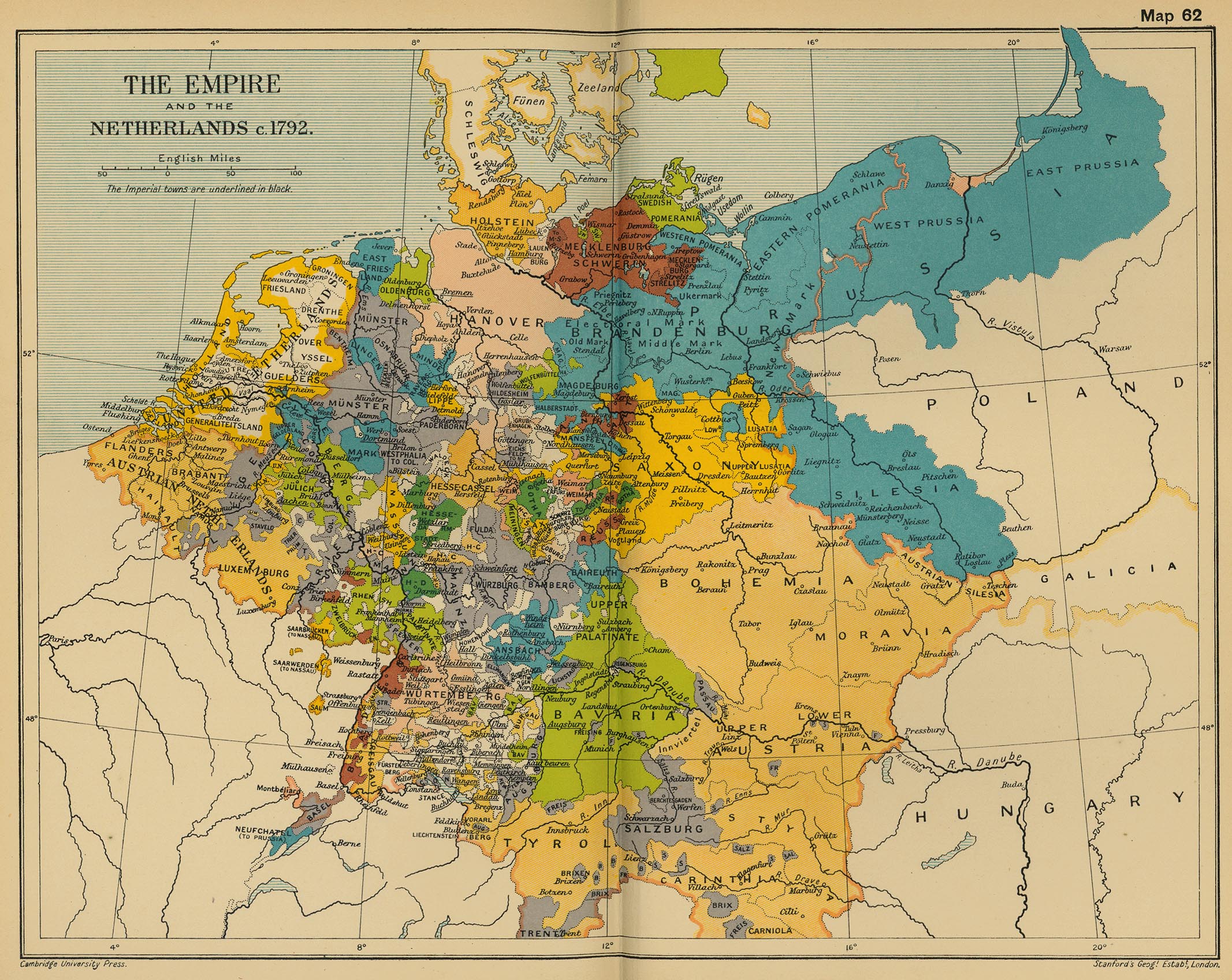
The Empire and the Netherlands, c. 1792
(Cambridge Modern History Atlas, 1912)
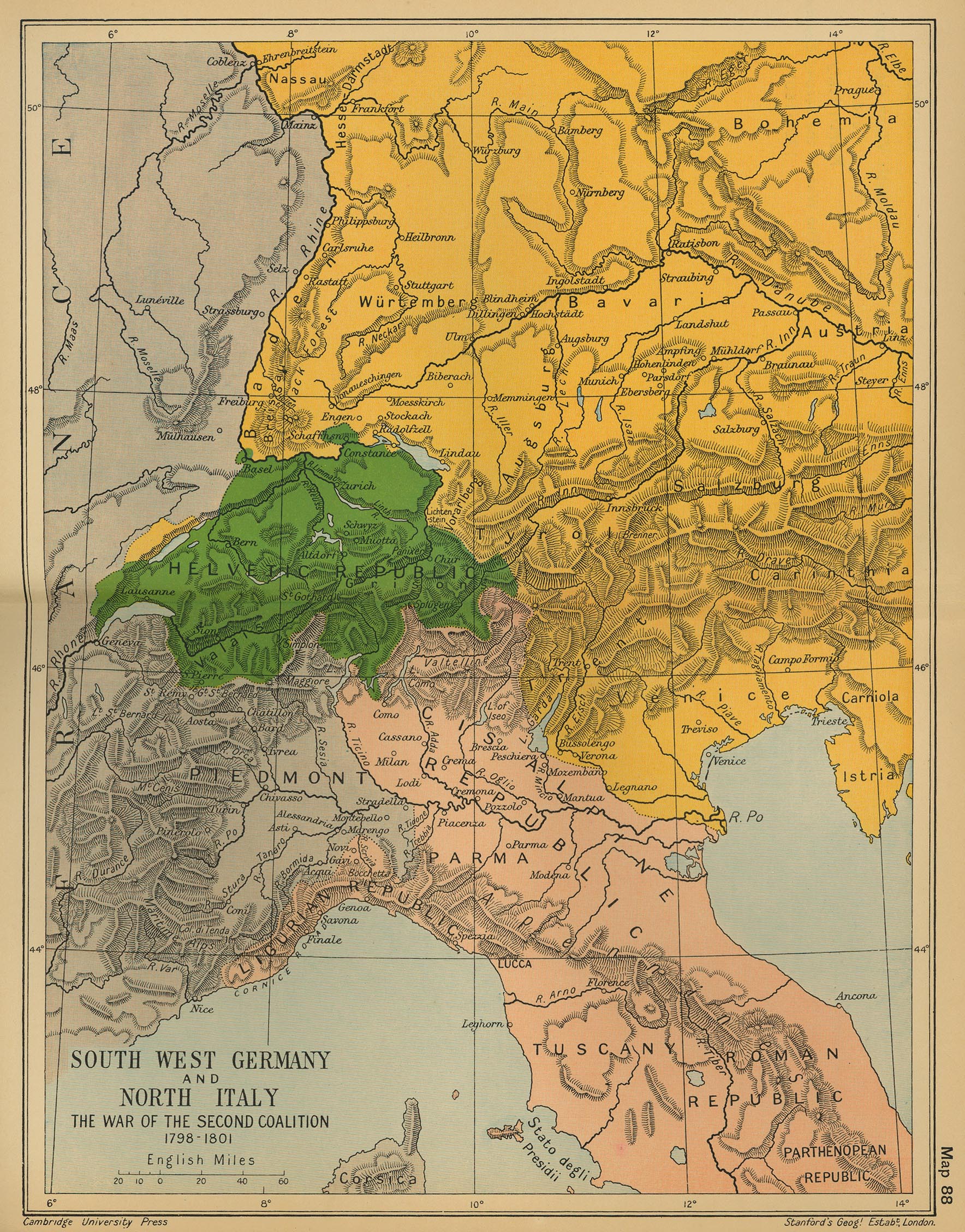
South West Germany and North Italy: The War of the Second Coalition 1798-1801
(CMHA, 1912)
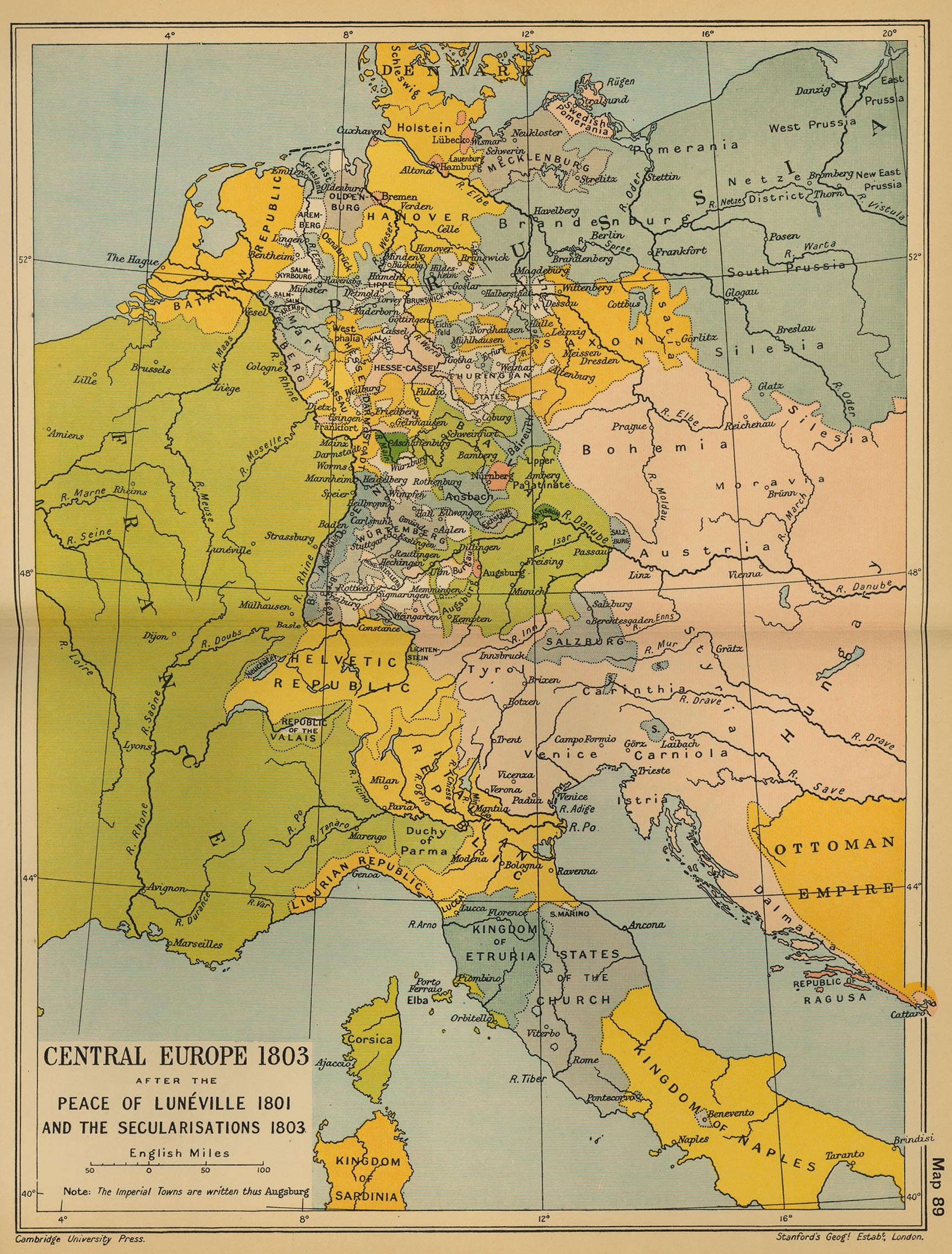
Central Europe 1803 after the Peace of Luneville 1801 and the Secularisations 1803
(CMHA, 1912)
Germany and Italy, 1803
(Mapping Solutions)
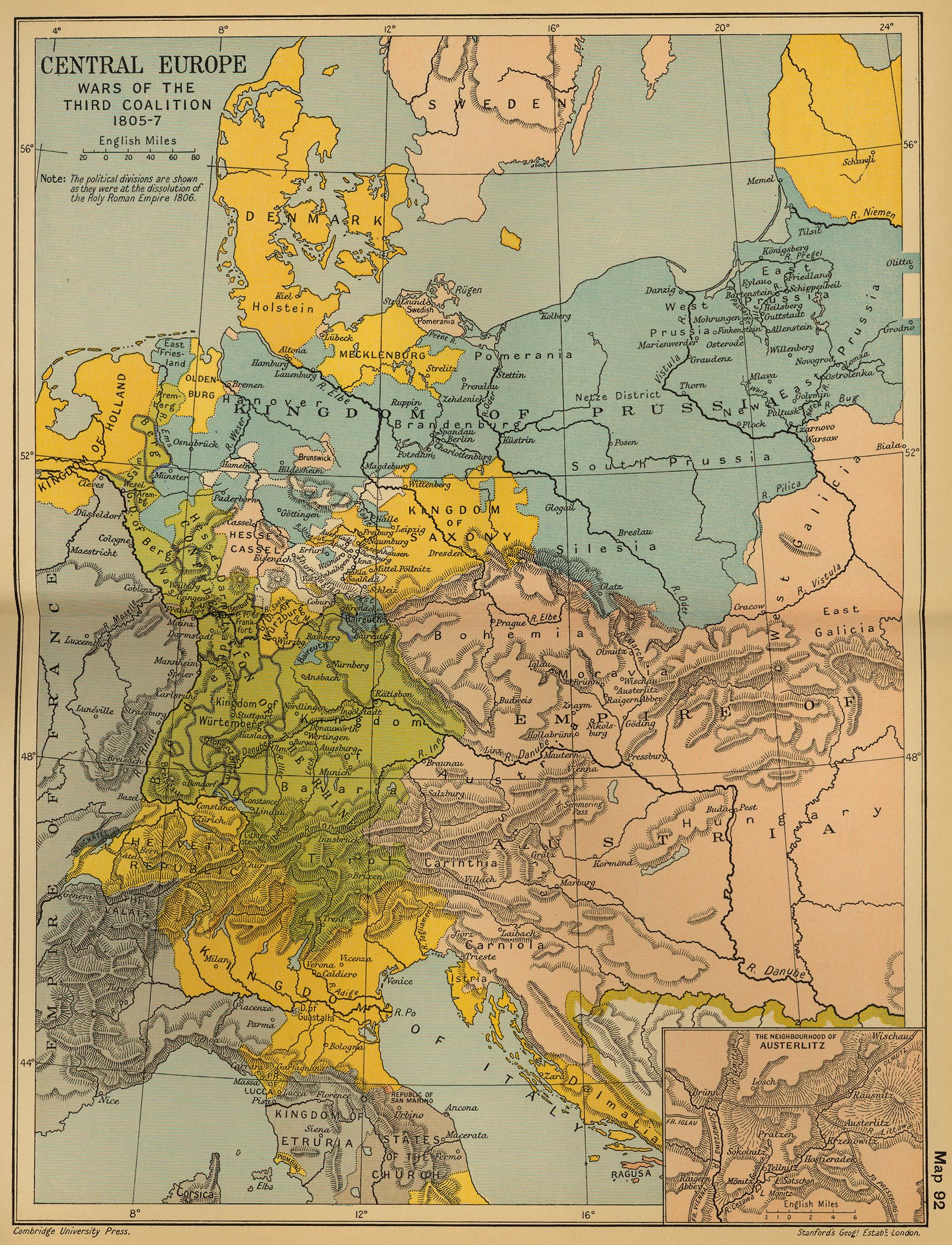
Central Europe: Wars of the Third Coalition 1805-1807
(Cambridge Modern History Atlas, 1912)
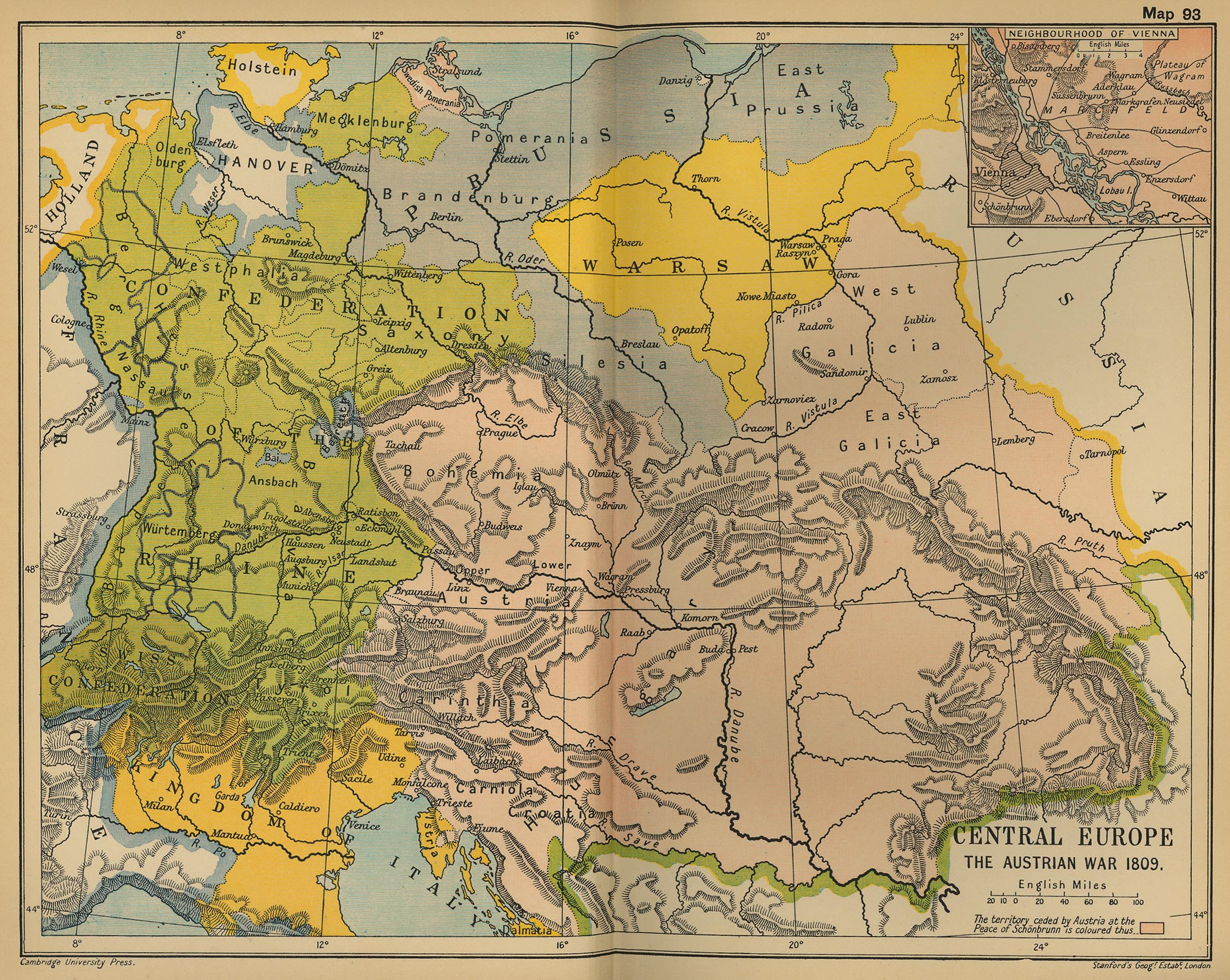
Central Europe: The Austrian War 1809
(Cambridge Modern History Atlas, 1912)
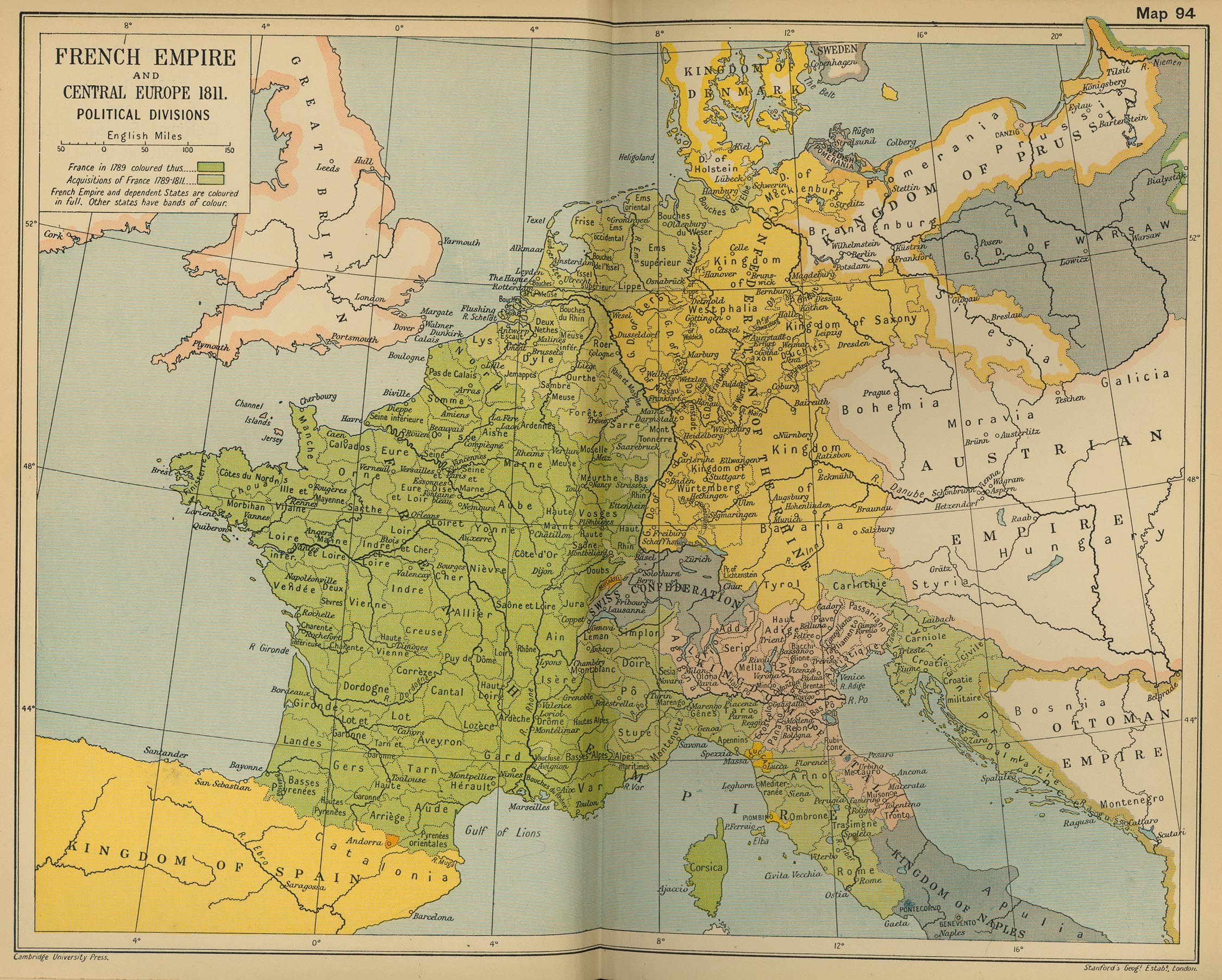
French Empire and Central Europe 1811 Political Divisions
(Cambridge Modern History Atlas, 1912)
Germany in 1812
(Droysens Allgemeiner Historischer Handatlas, 1886)
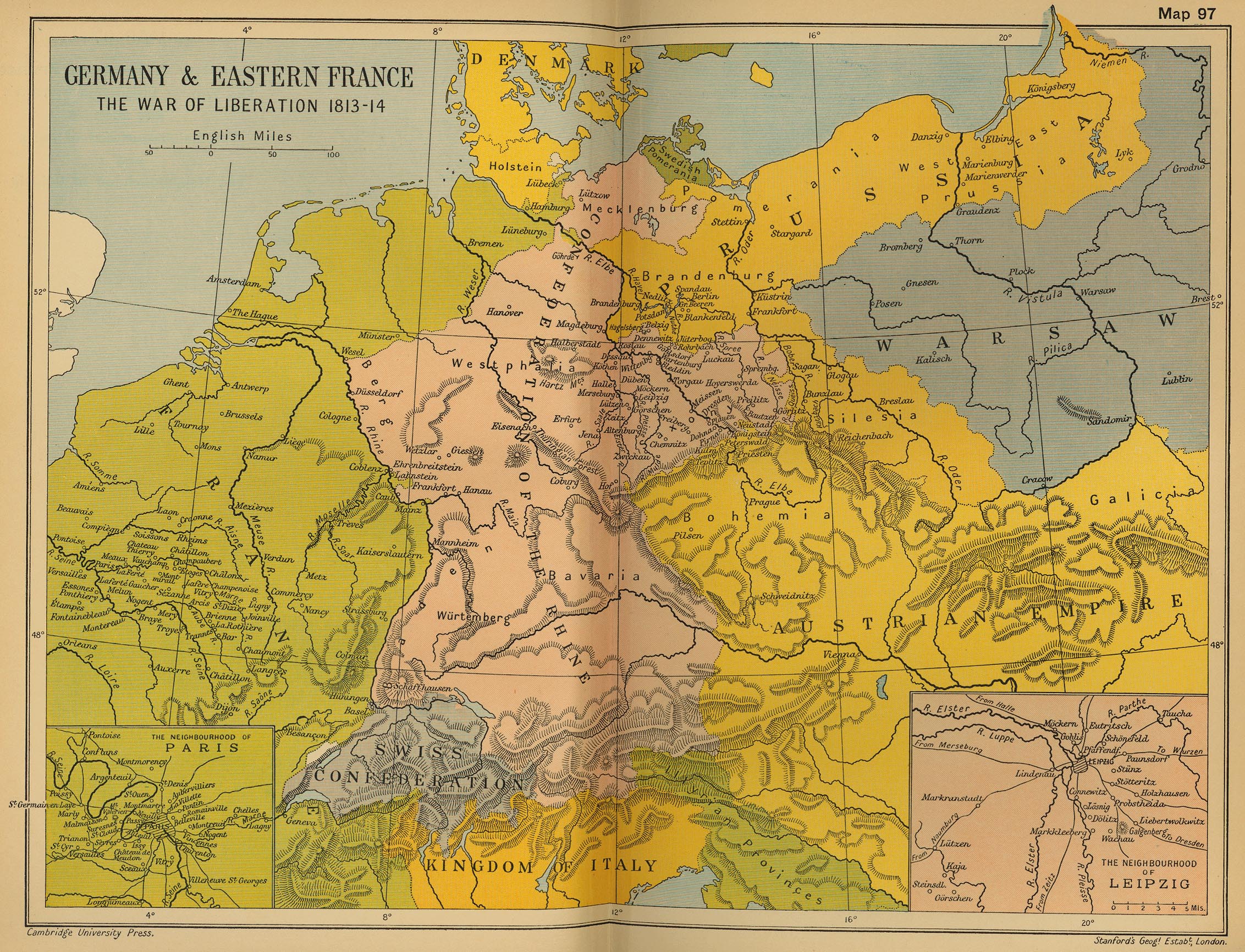
Germany and Eastern France: The War of Liberation 1813-1814
(Cambridge Modern History Atlas, 1912)
The Confederation of the Rhine, 1812
(IEG-Maps)
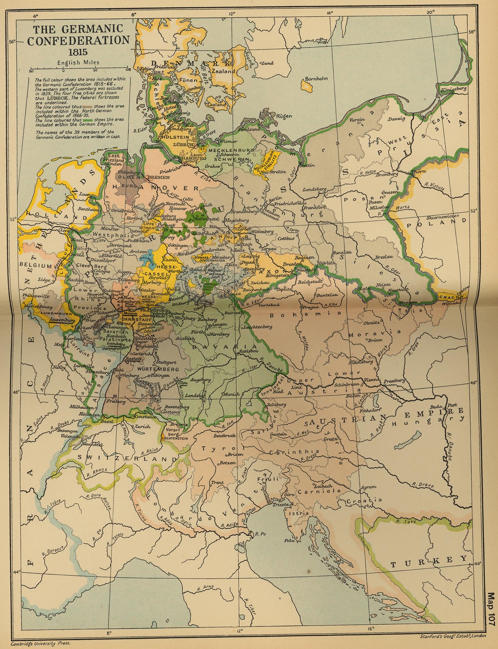
The Germanic Confederation 1815
(Cambridge Modern History Atlas, 1912)
German Confederation, 1820
(IEG-Maps)
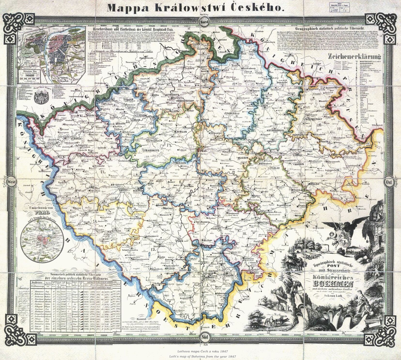
Kingdom of Bohemia, 1847
German Confederation, 1848
(IEG-Maps)
Kingdom of Bohemia, 1850
(Justus Perthes)
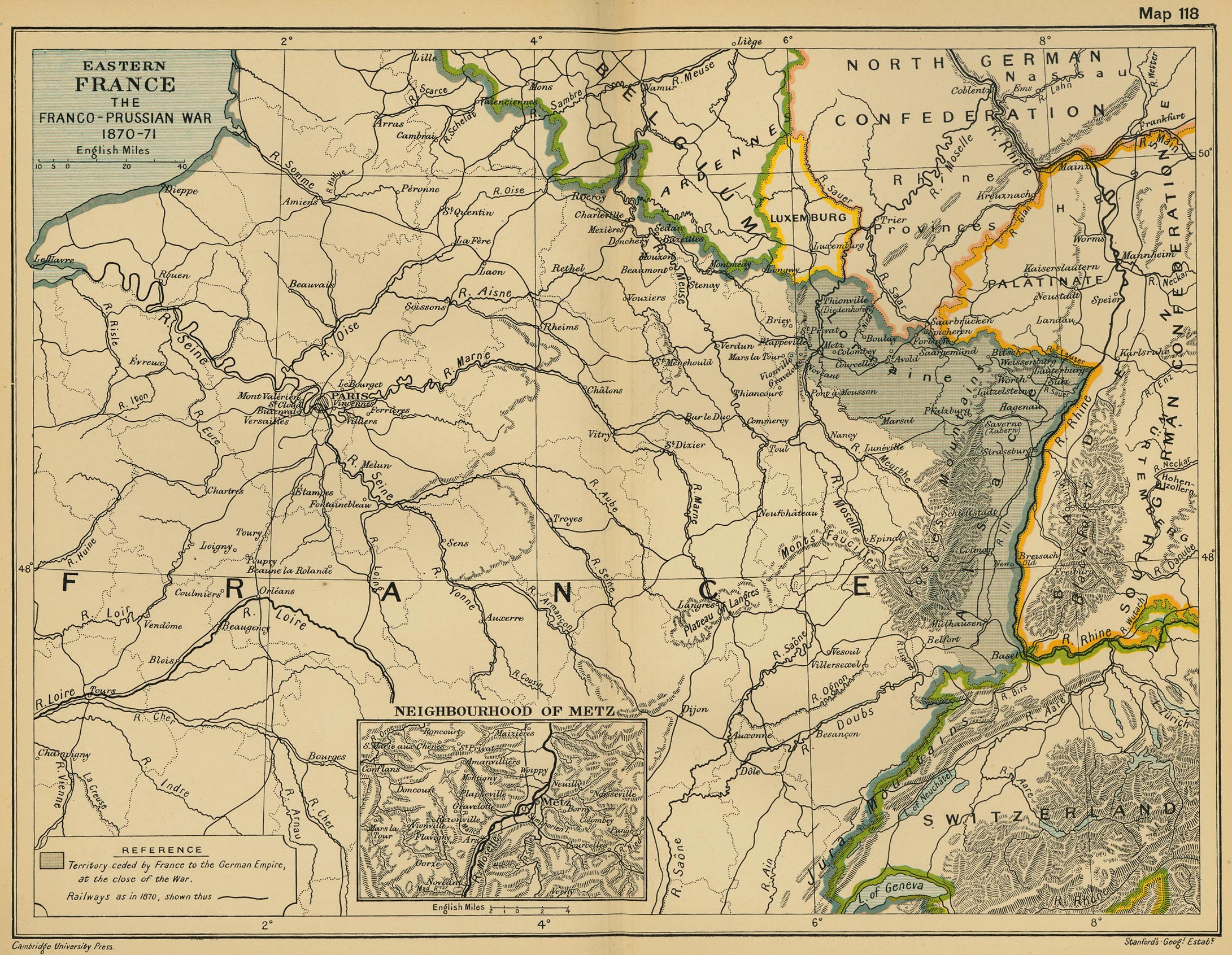
Eastern France: The Franco-Prussian War 1870-1871
(Cambridge Modern History Atlas, 1912)
Germany, 1871
(IEG-Maps)
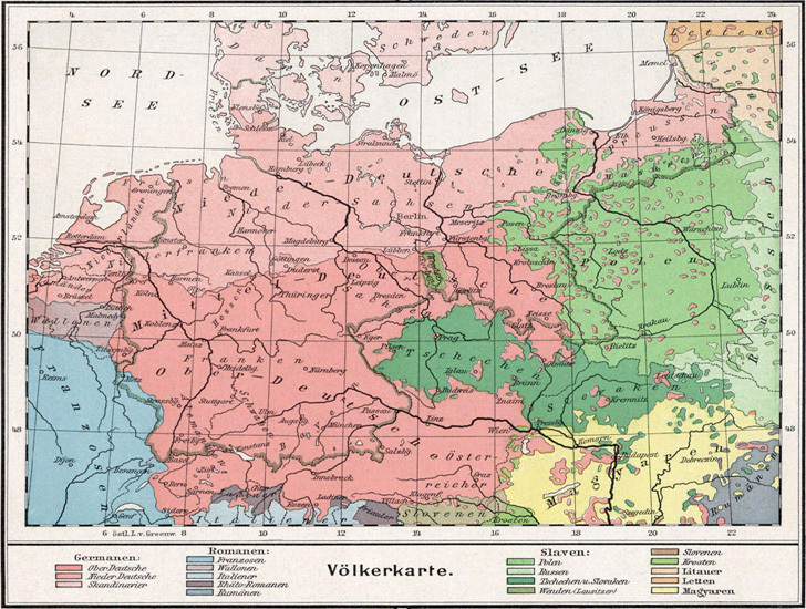
Ethnic and Linguistic Map of Germany, 1872 (Völker- und Sprachen-Karte von Deutschland)
(Heinrich Kiepert)
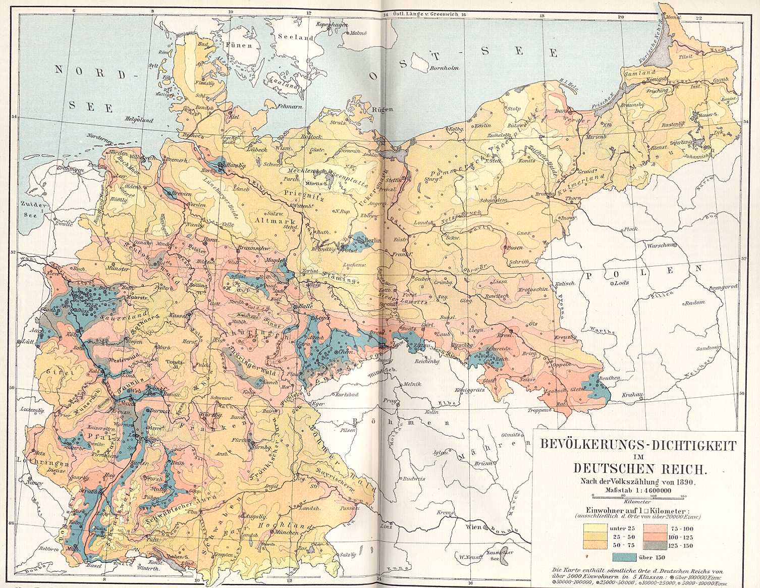
Germany, 1890: Population Density
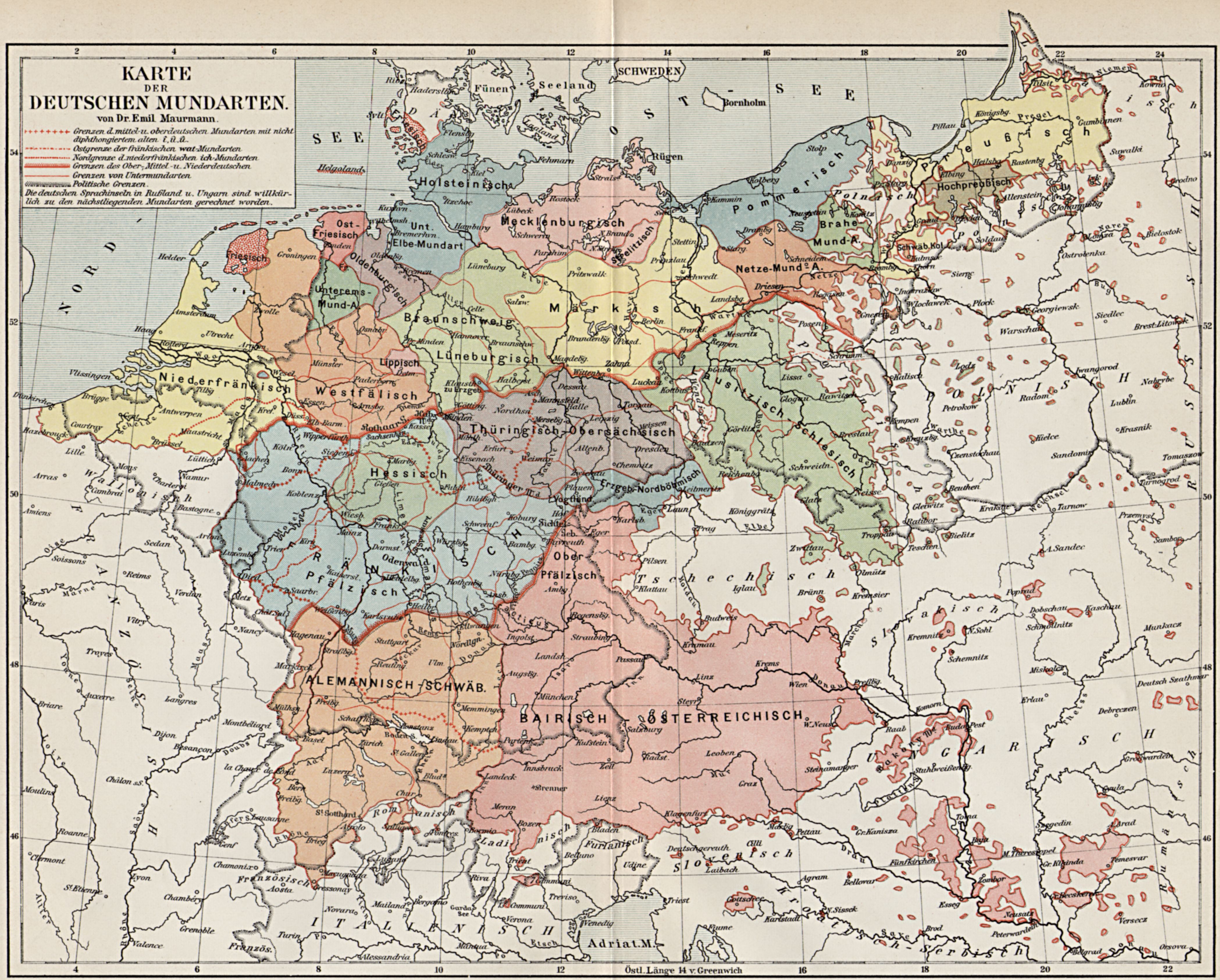
Linguistic (Dialect) Map of Germany, 1905: Karte der Deutschen Mundarten
(Emil Maurmann)
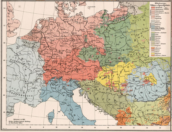
Ethnographic Map of Germany (1896)
Ethnographic Map of Germany (1906)
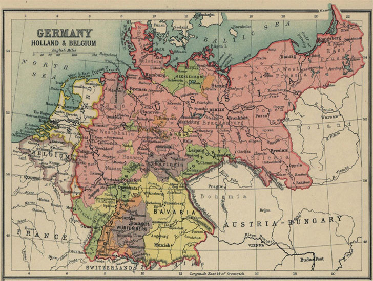
Germany, Netherlands, and Belgium (1913)
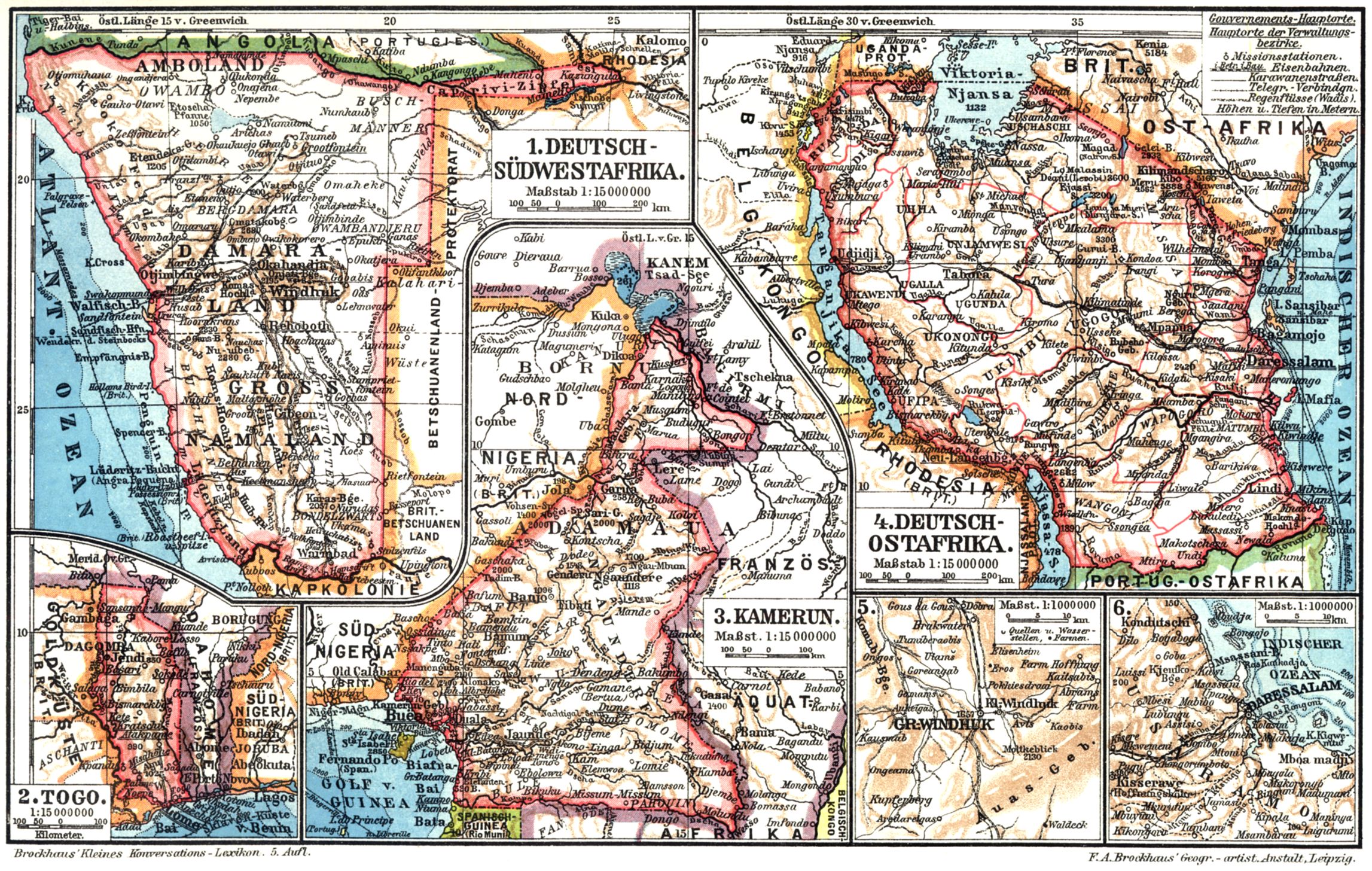
German Colonial Empire and
Ubersee-Deutschland
Die Kolonien des Deutschen Reiches im 19. Jahrhundert
Kiepert's Handkarte der deutschen Kolonien (1895
)
Deutscher Kolonialatlas
(German Colonial Atlas), 1896
Kolonial Afrika
Die Deutschen Kolonien
Deutsche Afrika
(German Africa, Brockhaus, 1911)
Deutsche Kolonien und Erster Weltkrieg
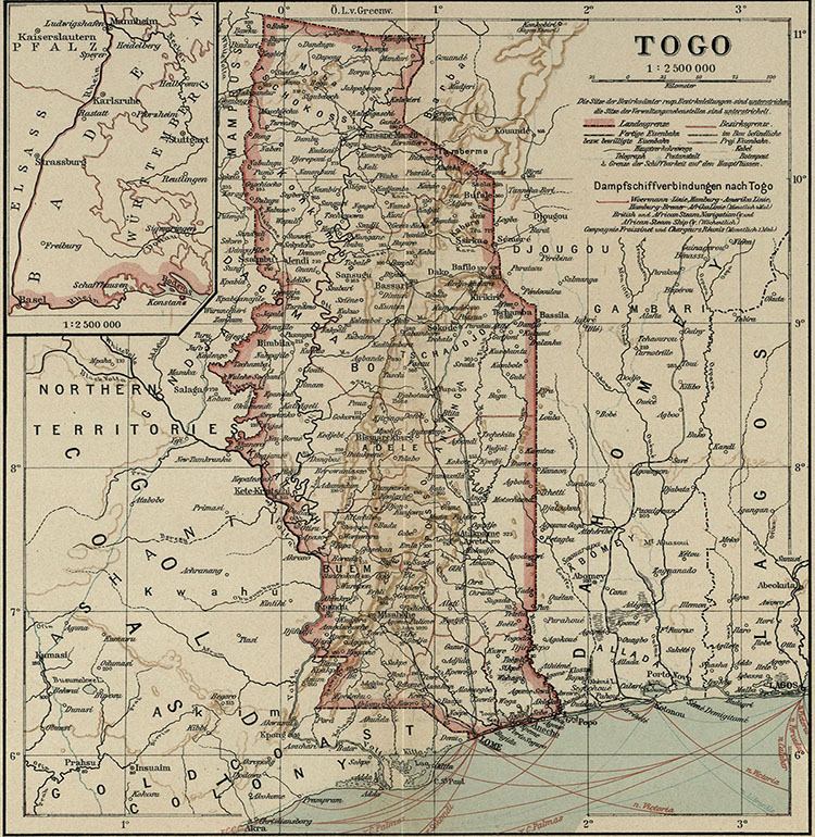
Togo
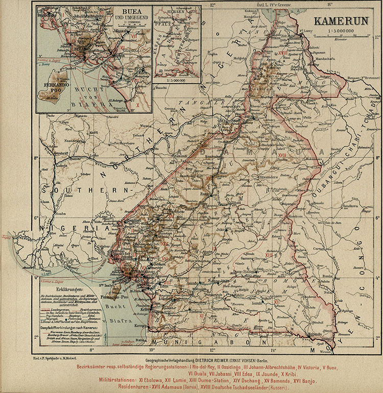
Cameroon
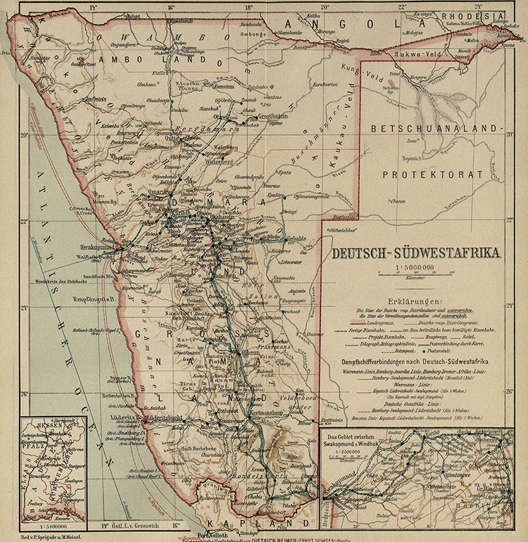
Namibia
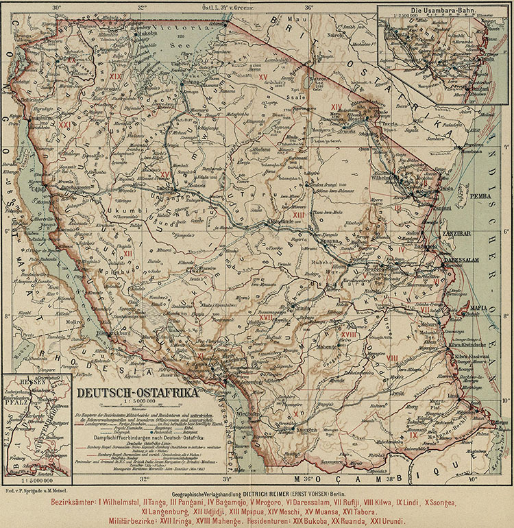
East Africa
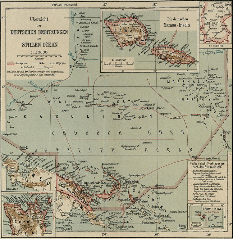
New Guinea
German Central and Eastern Europe before WWII
Area Settled by Germans in Eastern Europe
Auswanderung von Deutschen in das Schwarmeer- und Wolgagebiet (Russland) in 18. und 19. Jh.
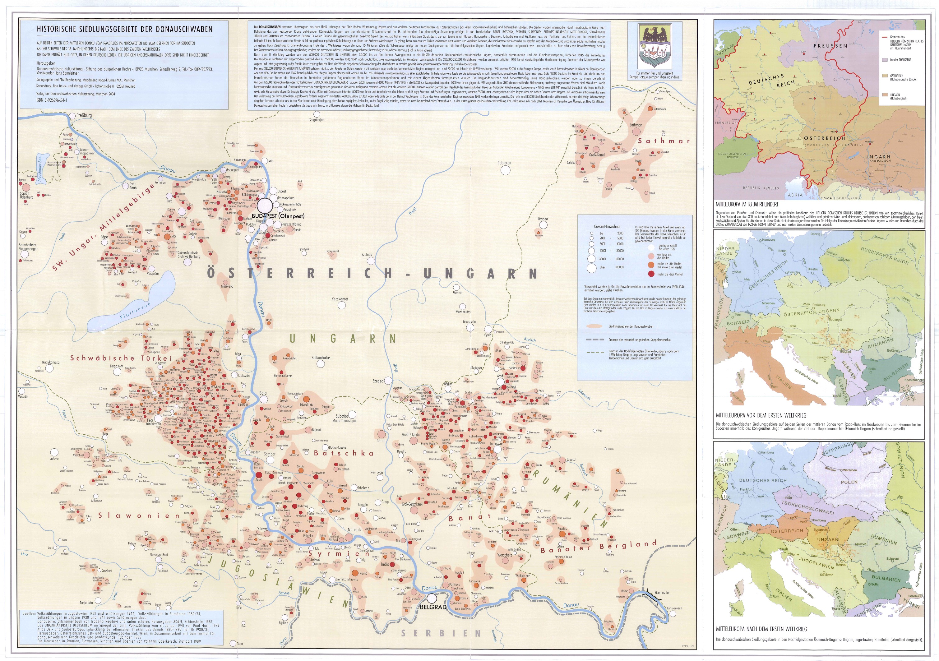
Historische Siedlungsgebiete der Donauschwaben
The Sorb Region: Sorbisches Siedlungsgebiet
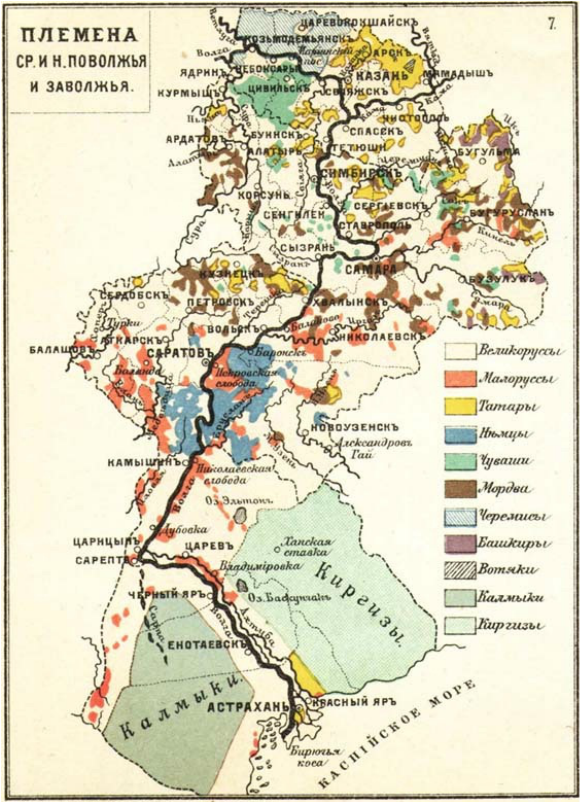
Ethnic Map of the Volga Region, 1901
Ethnic Map of Silesia: Nationalitäten-Karte der Provinz Schlesien, 1906 (1900 Census)
Ethnic and Linguistic Map of Moravia and Silesia (1910 Census)
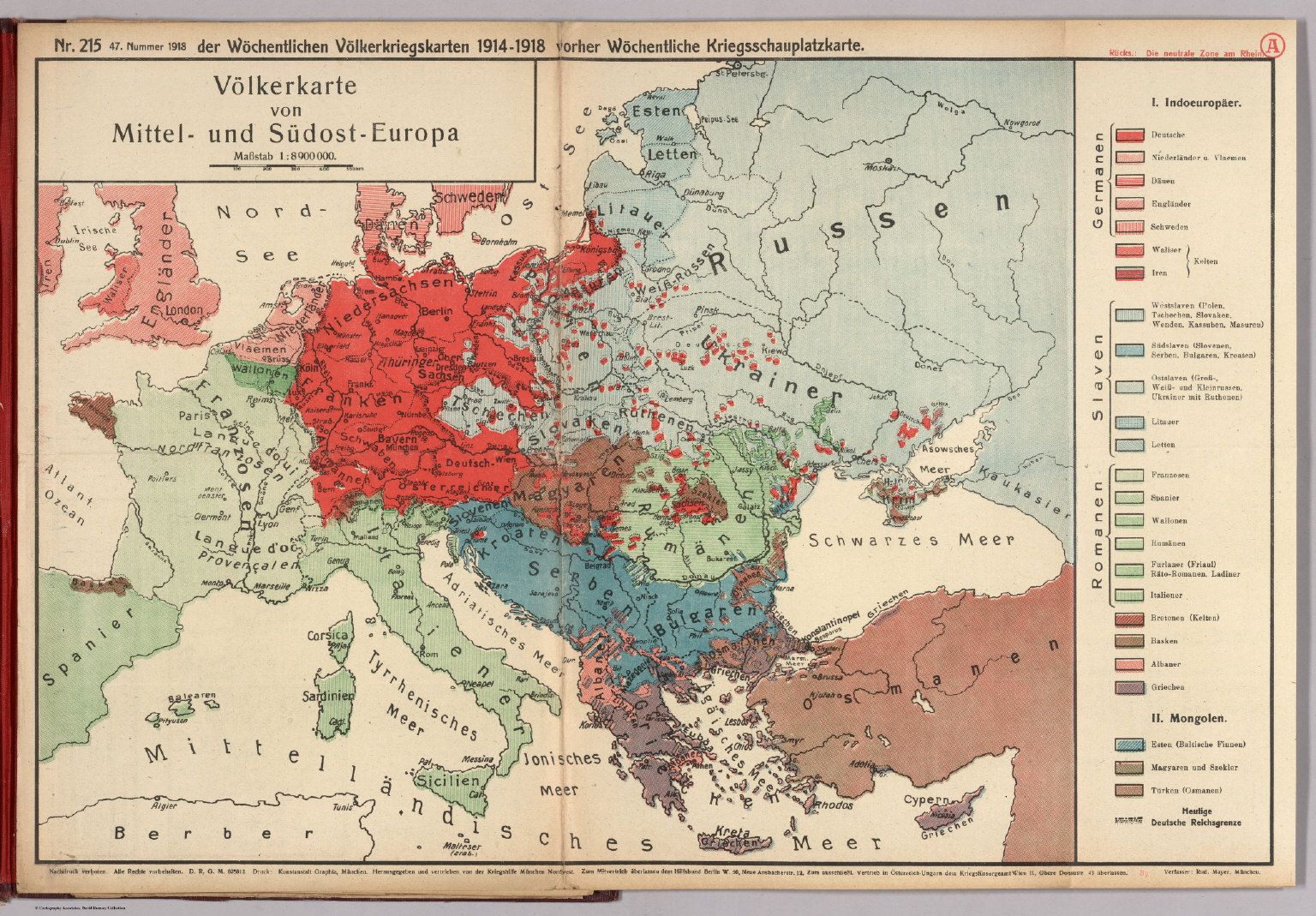
Völkerkarte von Mittel- und Südost-Europa, 1918
Eastern Prussia, 1919-1939
Germany and Central European States
, 1920
(J.G. Bartholomew)
Karte des Autonomen Gebietes des Wolgadeutschen
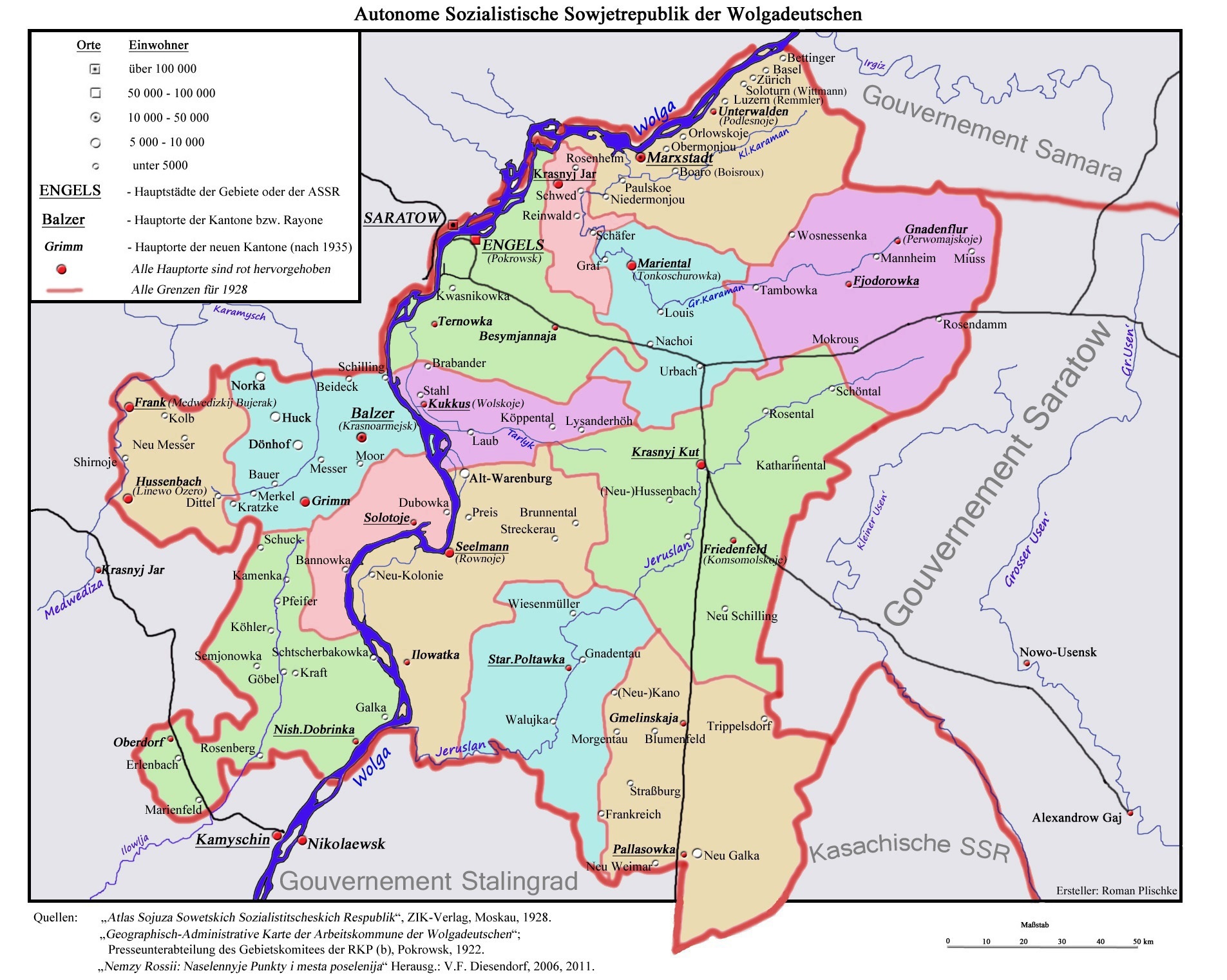
Autonome Sozialistiche Sowjetrepublik der Wolgadeutschen, 1928
Volga German Autonomous Soviet Socialist Republic, 1928 - Physical Map
Volga German Autonomous Soviet Socialist Republic
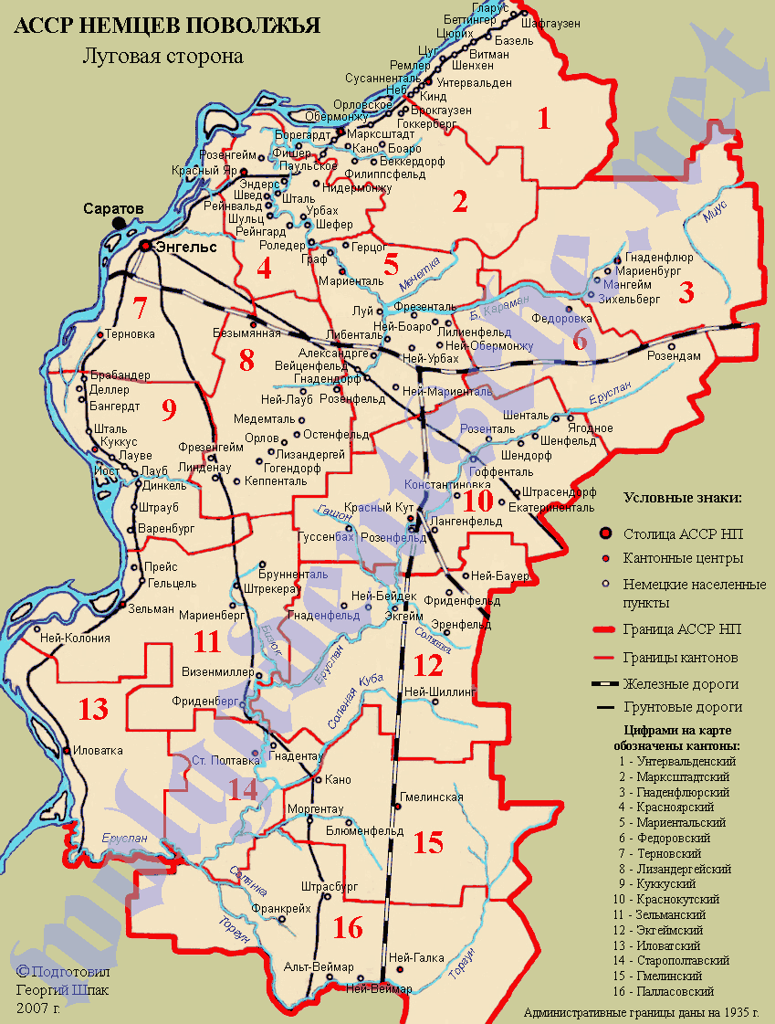
(Georgy Schpak, 2007)
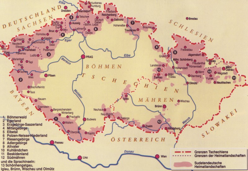
Sudetenland and German Bohemia
Sudetenland and German Bohemia: A Nazi Map of Propaganda
Sudetenland after Munich: Zone of occupation in Czechoslovakia
Sudetenland after Munich: A Nazi Map
Sudetenland
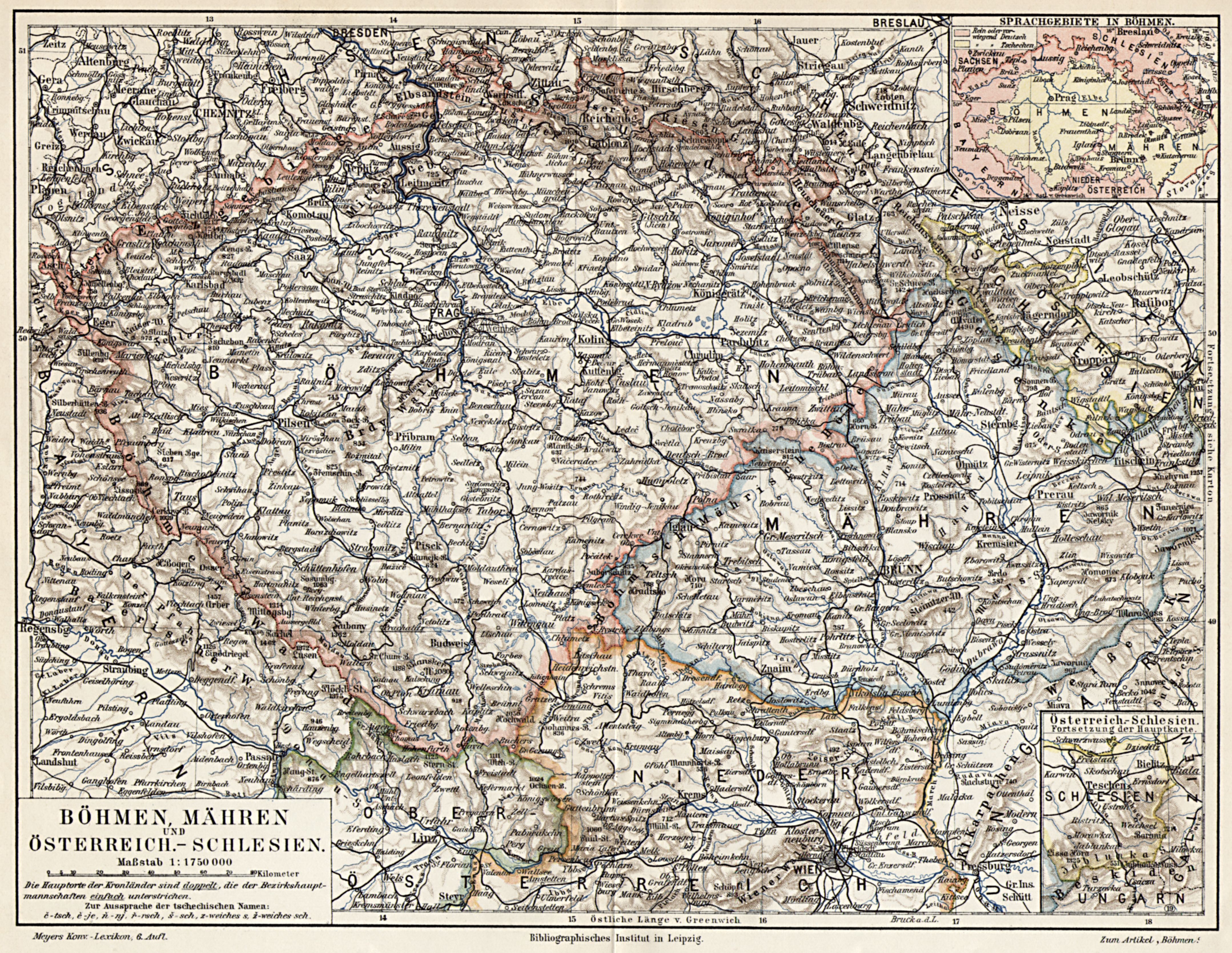
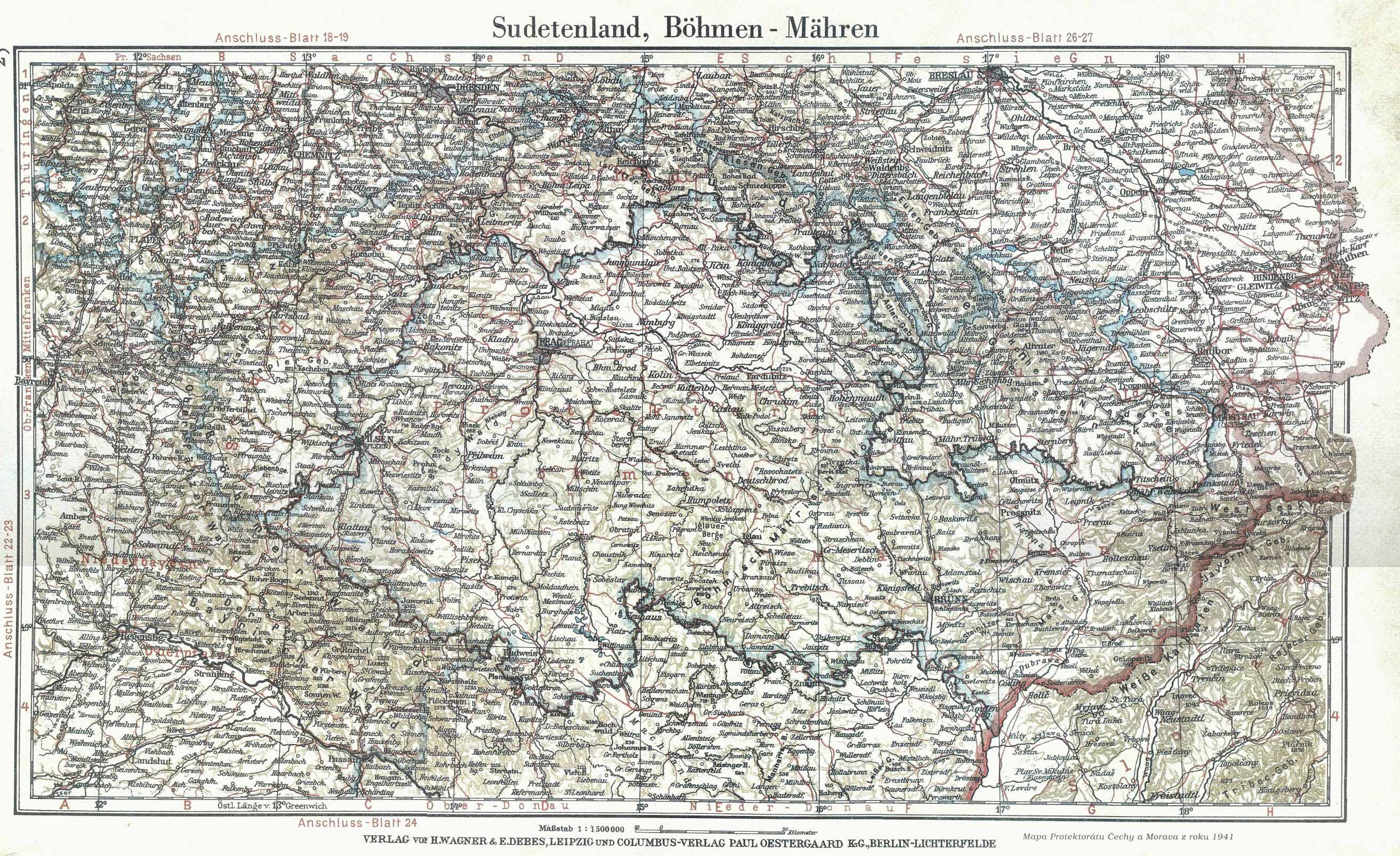
Sudetenland, Bohemia and Moravia
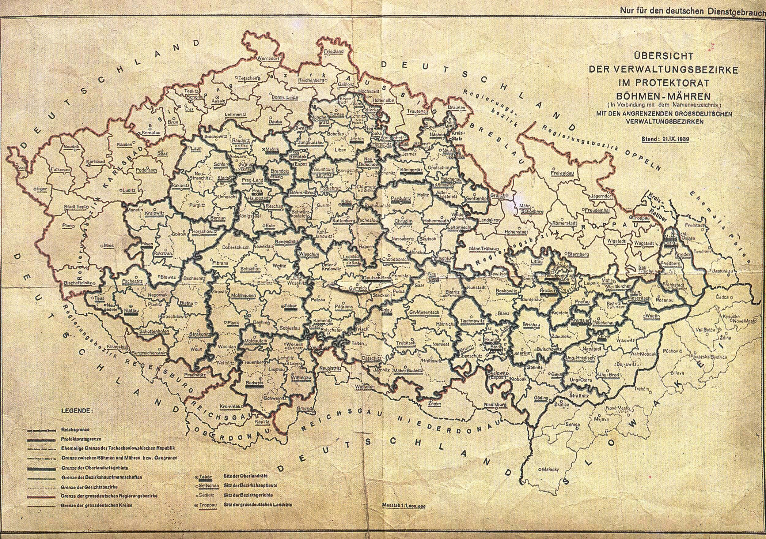
Sudetenland, Bohemia and Moravia: Administrative Division
Sudetenland, Böhmen und Mähren
Bohemia and Moravia
Memel
Protectorate of Bohemia and Moravia, September 1939
Germany: WWI and Interwar Period
An Atlas of the World War I
Historical Maps of the World War I
(University of Alabama)
Germany, 1914
Eastern Germany, 1914
Proposed Berlin to Baghdad Railway, 1914
Germany after the Peace Treaty of 1919
(H. G. Wells)
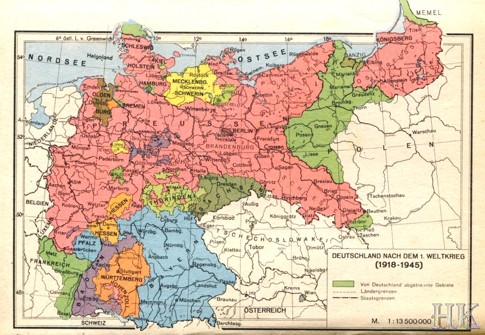
Germany, 1918-1945 (Deutschland nach dem 1. Weltkrieg, 1918-1945)
Germany (Southern section), 1920
(J.G. Bartholomew)
Germany (Western section), 1920
(J.G. Bartholomew)
Germany, 1921
(IEG-Maps)
Germany, 1923
(IEG-Maps)
Germany, 1928: « Deutschlands Verstümmelung »
Germany, 1930
(IEG-Maps)
Germany, 1937
(IEG-Maps)
Germany, 1937
Das Grossdeutsche Reich, 1939
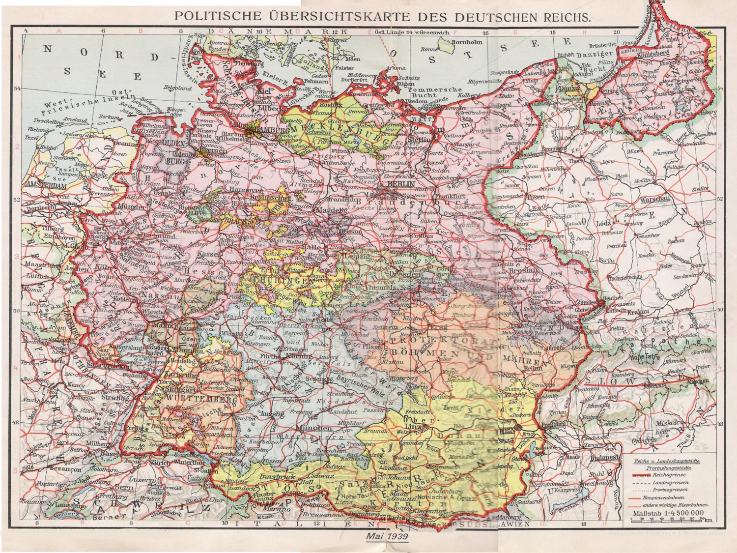
Germany, May 1939
Germany in WWII
German World War II Captured Maps
(Berkeley Library - University of California)
Holocaust and World War II Maps
(Jewish Virtual Library)
Northwestern European Military Situation Maps from WWII
(Library of Congress)
Ostland Atlas
(Maps of the German-Occupied Eastern Europe: the Baltic States and Bielorussia)
World War II: Maps
(Holocaust Encyclopedia)
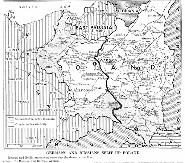
Soviet-German Partition of Poland, 1939
Protectorate of Bohemia and Moravia, September 1939
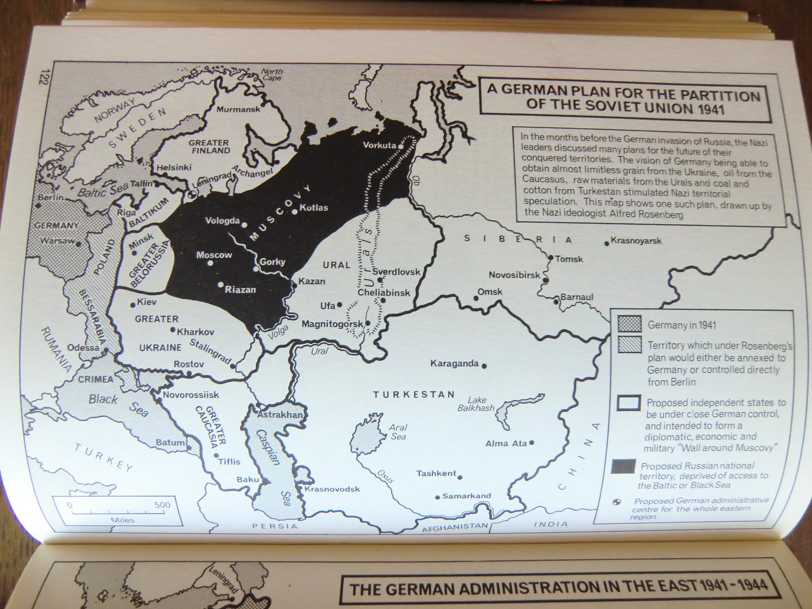
A German Plan for the Partition of the Soviet Union, 1941
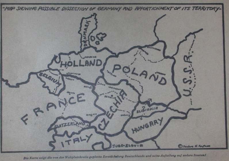
Map Showing Possible Dissection of Germany and Apportionment of Its Territory (Plan Kaufman, 1941)
Deportation of Jews from Germany 1941-1944
(U.S. Holocaust Memorial Museum)
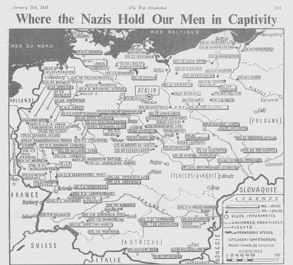
Germany, 1941: Where the Nazis Hold Our Men in Captivity
Sudetenland & Protectorate of Bohemia and Moravia, 1941
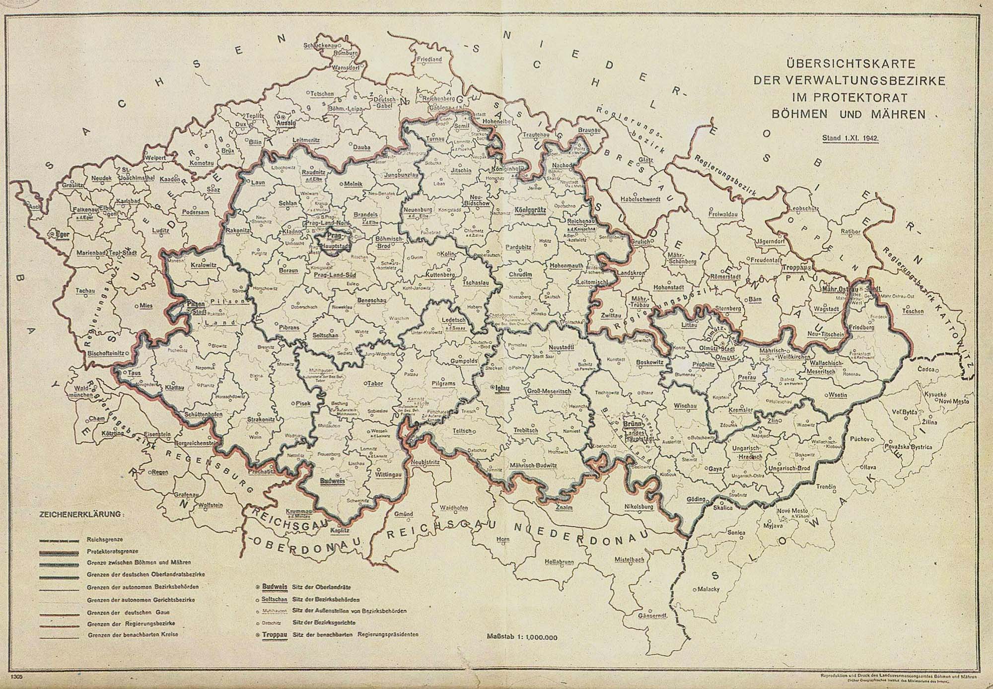
Protectorate of Bohemia and Moravia, 1942
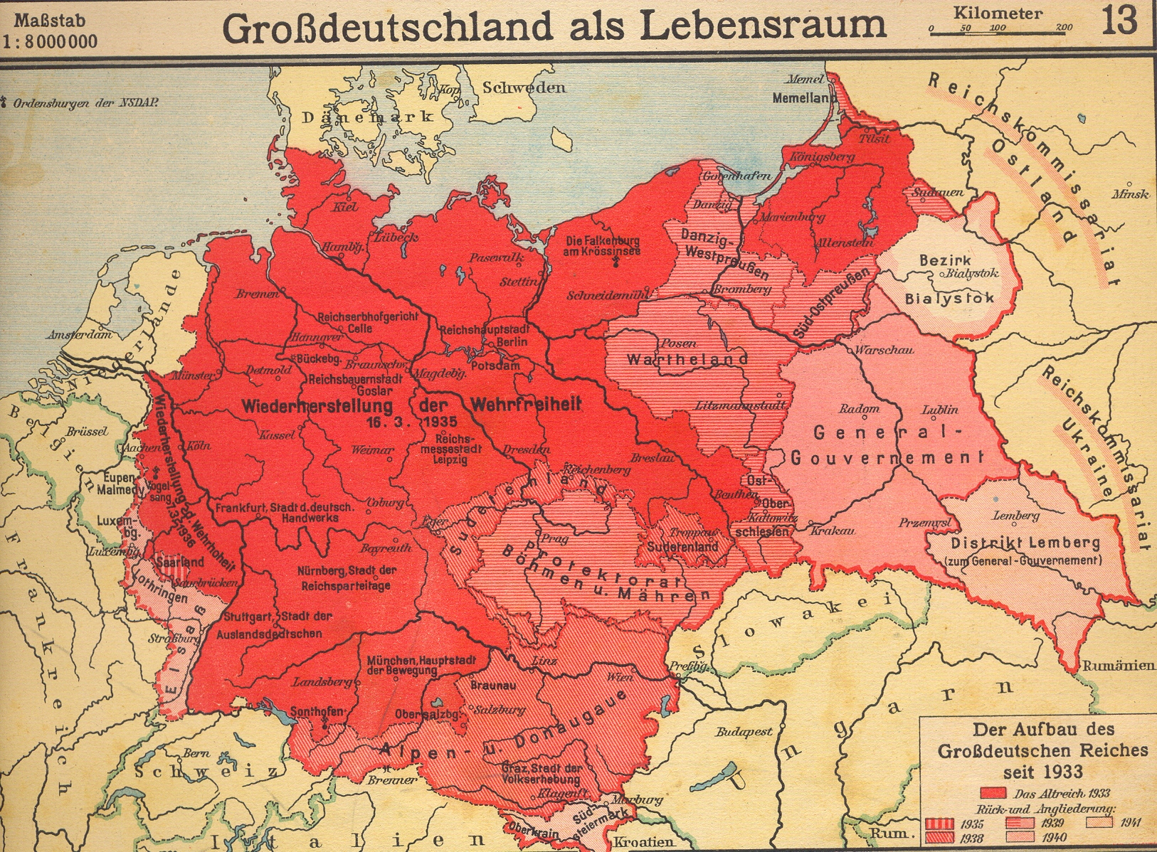
Germany, 1942 (Grossdeutschland als Lebensraum)
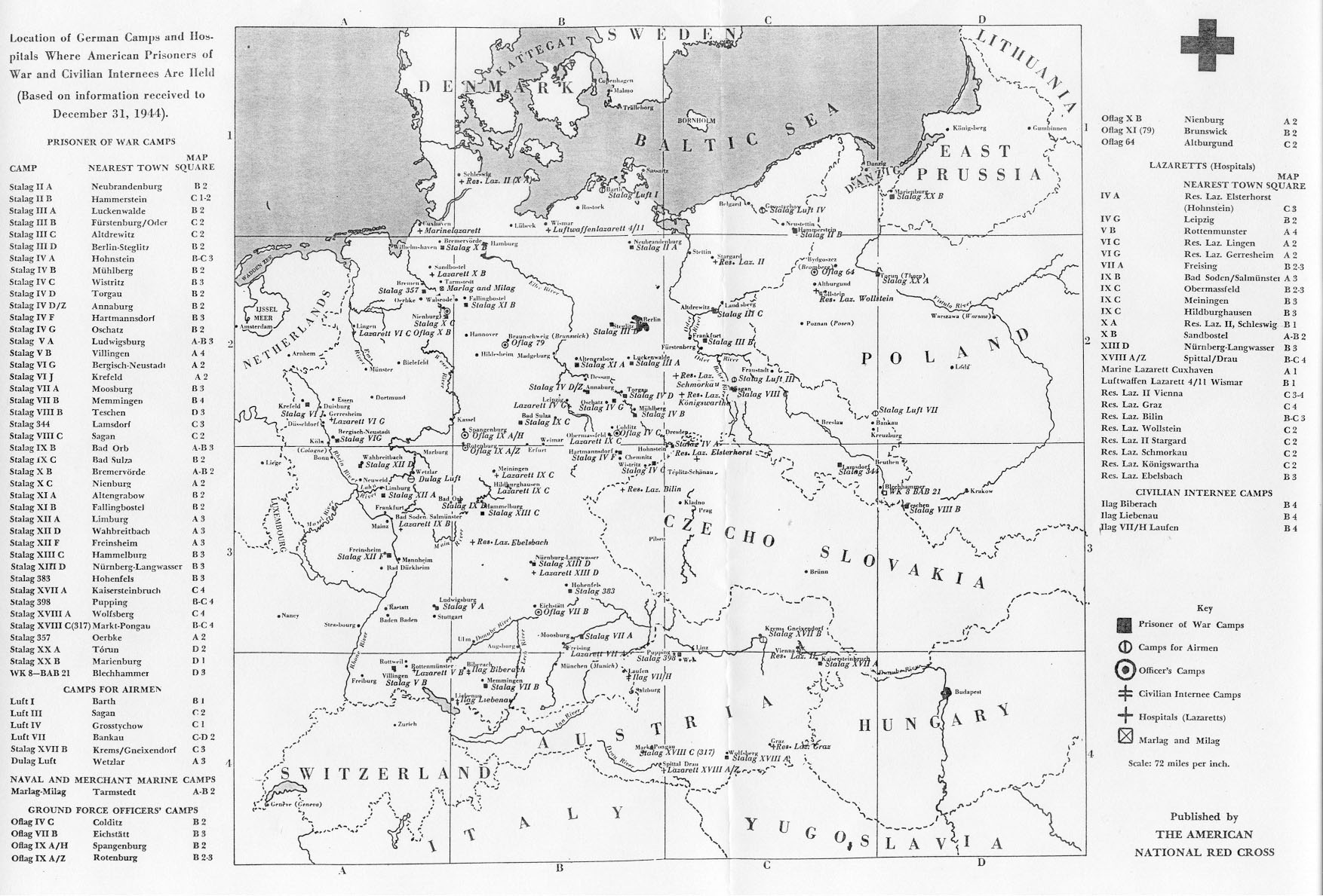
Germany, 1944: Location of German Camps Where American Prisoners Have Been Held
Germany after WWII
Partition of Germany: Tehran and Morgenthau Plans
)
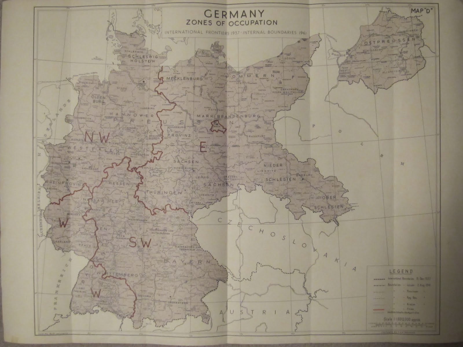
Germany: Zones of Occupation, 1946
The Oder-Neisse Line and Germany’s Postwar Territorial Losses
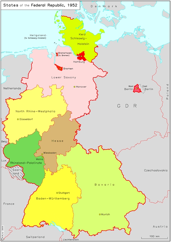
States (Länder) of the Federal Republic of Germany, 1952
Germany, 1990

